 with our Megalithic Portal iPhone app")


<< Text Pages >> Valdecruz Menhir - Standing Stone (Menhir) in Spain in Navarra
Submitted by Klingon on Monday, 22 September 2008 Page Views: 3495
Neolithic and Bronze AgeSite Name: Valdecruz MenhirCountry: Spain
NOTE: This site is 17.319 km away from the location you searched for.
Region: Navarra Type: Standing Stone (Menhir)
Nearest Town: Baztan Nearest Village: P. Santa Margarita
Latitude: 42.115543N Longitude: 1.489556W
Condition:
| 5 | Perfect |
| 4 | Almost Perfect |
| 3 | Reasonable but with some damage |
| 2 | Ruined but still recognisable as an ancient site |
| 1 | Pretty much destroyed, possibly visible as crop marks |
| 0 | No data. |
| -1 | Completely destroyed |
| 5 | Superb |
| 4 | Good |
| 3 | Ordinary |
| 2 | Not Good |
| 1 | Awful |
| 0 | No data. |
| 5 | Can be driven to, probably with disabled access |
| 4 | Short walk on a footpath |
| 3 | Requiring a bit more of a walk |
| 2 | A long walk |
| 1 | In the middle of nowhere, a nightmare to find |
| 0 | No data. |
| 5 | co-ordinates taken by GPS or official recorded co-ordinates |
| 4 | co-ordinates scaled from a detailed map |
| 3 | co-ordinates scaled from a bad map |
| 2 | co-ordinates of the nearest village |
| 1 | co-ordinates of the nearest town |
| 0 | no data |
Be the first person to rate this site - see the 'Contribute!' box in the right hand menu.
Internal Links:
External Links:
Standing Stone (Menhir) in Community of Bardeak - Las Bardena
Have you visited this site? Please add a comment below.
You may be viewing yesterday's version of this page. To see the most up to date information please register for a free account.
Do not use the above information on other web sites or publications without permission of the contributor.
Nearby Images from Flickr

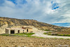
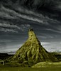
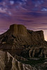

The above images may not be of the site on this page, but were taken nearby. They are loaded from Flickr so please click on them for image credits.
Click here to see more info for this site
Nearby sites
Click here to view sites on an interactive map of the areaKey: Red: member's photo, Blue: 3rd party photo, Yellow: other image, Green: no photo - please go there and take one, Grey: site destroyed
Download sites to:
KML (Google Earth)
GPX (GPS waypoints)
CSV (Garmin/Navman)
CSV (Excel)
To unlock full downloads you need to sign up as a Contributory Member. Otherwise downloads are limited to 50 sites.
Turn off the page maps and other distractions
Nearby sites listing. In the following links * = Image available
2.3km SE 140° Tres Montes Dolmen* Burial Chamber or Dolmen
49.0km NNW 334° Kandaraitz Cista Cist
49.6km NNW 334° Kandaraitz Dolmen Burial Chamber or Dolmen
49.9km N 3° Santacris Castro or Chafurdão
52.8km NNW 332° Biorrada Menhir Standing Stone (Menhir)
53.5km NNW 333° Jugondo Dolmen Burial Chamber or Dolmen
53.7km NNW 329° Museo Arqueológico Las Eretas* Ancient Village or Settlement
53.7km NNW 332° Las Cabras 3 Cista Cist
53.8km NNW 332° Las Cabras 2 Cista Cist
55.0km NNW 335° Genzelaia Túmulo 1-3 Round Barrow(s)
55.0km NNW 335° Genzelaia Menhir Standing Stone (Menhir)
55.1km NNW 334° Genzelaia Cabezón Túmulo Round Barrow(s)
55.4km NNW 339° San Bartolomé Dolmen Burial Chamber or Dolmen
56.6km NNW 341° Soplahogueras Menhir Standing Stone (Menhir)
57.6km NNW 340° Karakidoia Dolmen Burial Chamber or Dolmen
59.0km NNW 341° Andiuz Dolmen Burial Chamber or Dolmen
60.2km NNW 340° La Mina de Farangortea Dolmen* Burial Chamber or Dolmen
60.2km NNW 340° La Mina Menhir* Standing Stone (Menhir)
60.5km NNW 339° Legastiaga Menhir Standing Stone (Menhir)
60.6km NNW 339° Farangortea Dolmen* Burial Chamber or Dolmen
60.7km NNW 340° Legastiaga Menhir Standing Stone (Menhir)
60.8km NNW 339° Farangortea Dolmen Burial Chamber or Dolmen
61.9km NNW 330° Andelos* Ancient Village or Settlement
62.6km N 352° Arriurdin Menhir Standing Stone (Menhir)
62.6km NNE 33° Arroyo Vizcarra necropolis* Stone Circle
View more nearby sites and additional images

")
 We would like to know more about this location. Please feel free to add a brief description and any relevant information in your own language.
 Wir möchten mehr über diese Stätte erfahren. Bitte zögern Sie nicht, eine kurze Beschreibung und relevante Informationen in Deutsch hinzuzufügen.
 Nous aimerions en savoir encore un peu sur les lieux. S'il vous plaît n'hesitez pas à ajouter une courte description et tous les renseignements pertinents dans votre propre langue.
 Quisieramos informarnos un poco más de las lugares. No dude en añadir una breve descripción y otros datos relevantes en su propio idioma.