<< Our Photo Pages >> Ladywell (Bradford on Avon) - Holy Well or Sacred Spring in England in Wiltshire
Submitted by kernunos on Sunday, 24 April 2005 Page Views: 20128
Springs and Holy WellsSite Name: Ladywell (Bradford on Avon)Country: England County: Wiltshire Type: Holy Well or Sacred Spring
Nearest Town: Bradford on Avon
Map Ref: ST823608
Latitude: 51.346003N Longitude: 2.25552W
Condition:
| 5 | Perfect |
| 4 | Almost Perfect |
| 3 | Reasonable but with some damage |
| 2 | Ruined but still recognisable as an ancient site |
| 1 | Pretty much destroyed, possibly visible as crop marks |
| 0 | No data. |
| -1 | Completely destroyed |
| 5 | Superb |
| 4 | Good |
| 3 | Ordinary |
| 2 | Not Good |
| 1 | Awful |
| 0 | No data. |
| 5 | Can be driven to, probably with disabled access |
| 4 | Short walk on a footpath |
| 3 | Requiring a bit more of a walk |
| 2 | A long walk |
| 1 | In the middle of nowhere, a nightmare to find |
| 0 | No data. |
| 5 | co-ordinates taken by GPS or official recorded co-ordinates |
| 4 | co-ordinates scaled from a detailed map |
| 3 | co-ordinates scaled from a bad map |
| 2 | co-ordinates of the nearest village |
| 1 | co-ordinates of the nearest town |
| 0 | no data |
Internal Links:
External Links:
 (PID:24078)")
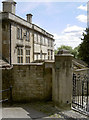
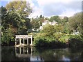
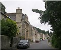
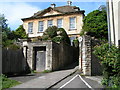
This spring comes from the hill on which stands a delightful, small chapel dedicated to Our Lady, hence the dedication. Now the water flows from a pipe in a stone wall.
The surround is recent and unapologetically Christian with a Chi-Rho symbol. A drinking trough (19th Century?) is located nearby and is presumably associated with this spring.
The water has been by the townsfolk for many centuries and is noted for its purity.
You may be viewing yesterday's version of this page. To see the most up to date information please register for a free account.
 (PID:24080)")
 (PID:24079)")
Do not use the above information on other web sites or publications without permission of the contributor.
Nearby Images from Geograph Britain and Ireland:
©2014(licence)
©2008(licence)
©2008(licence)
©2011(licence)
©2014(licence)
The above images may not be of the site on this page, they are loaded from Geograph.
Please Submit an Image of this site or go out and take one for us!
Click here to see more info for this site
Nearby sites
Key: Red: member's photo, Blue: 3rd party photo, Yellow: other image, Green: no photo - please go there and take one, Grey: site destroyed
Download sites to:
KML (Google Earth)
GPX (GPS waypoints)
CSV (Garmin/Navman)
CSV (Excel)
To unlock full downloads you need to sign up as a Contributory Member. Otherwise downloads are limited to 50 sites.
Turn off the page maps and other distractions
Nearby sites listing. In the following links * = Image available
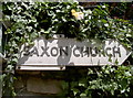
165m NE 46° St Laurence's Church (Bradford on Avon)* Early Christian Sculptured Stone (ST8241960914)
1.8km W 267° Turleigh Trows* Holy Well or Sacred Spring (ST8044960725)
2.3km W 265° Winsley Chambered Tomb (ST800606)
3.4km NW 311° Jug's Grave* Round Barrow(s) (ST79696305)
3.5km NW 305° Conkwell stone circle* Stone Circle (ST79456280)
3.7km WNW 299° Conkwell well* Holy Well or Sacred Spring (ST791626)
4.3km W 276° Shingle Bell* Holy Well or Sacred Spring (ST780613)
5.3km NNW 338° Monk's Conduit (Monkton Farleigh)* Holy Well or Sacred Spring (ST8036265692)
5.4km WSW 253° Beacon Barrow (Somerset) Round Barrow(s) (ST77095920)
5.5km WSW 258° Hill Farm Barrow (Somerset) Round Barrow(s) (ST76855969)
6.3km WSW 257° The Giants Graves Cist (ST761594)
6.4km NW 311° Bathampton Camp* Hillfort (ST77456502)
6.7km NW 311° Bathampton* Standing Stones (ST772652)
7.0km NW 306° Bathampton Round Barrow 2* Round Barrow(s) (ST76616489)
7.5km S 186° The Devil's Bed and Bolster* Chambered Tomb (ST81495333)
7.6km N 9° Hazelbury Manor Menhirs* Modern Stone Circle etc (ST83476830)
7.6km N 1° Becket's Well (Box) Holy Well or Sacred Spring (ST825684)
7.9km N 360° Box Rock Circus* Modern Stone Circle etc (ST823687)
8.1km NW 310° Kensington Meadows Holed Megalith Holed Stone
8.2km WNW 298° Sacred Spring, Bath* Holy Well or Sacred Spring (ST7505364726)
8.4km WNW 300° Bath Postal Museum* Museum (ST7504564998)
9.0km NW 323° Solsbury Hill* Hillfort (ST76876797)
9.4km W 259° Twinhoe Stone Circle (ST730590)
9.5km WSW 248° Stoney Littleton* Chambered Cairn (ST7349257208)
9.6km NNW 344° Three Shires Stones* Modern Stone Circle etc (ST7961070021)
View more nearby sites and additional images


 We would like to know more about this location. Please feel free to add a brief description and any relevant information in your own language.
 Wir möchten mehr über diese Stätte erfahren. Bitte zögern Sie nicht, eine kurze Beschreibung und relevante Informationen in Deutsch hinzuzufügen.
 Nous aimerions en savoir encore un peu sur les lieux. S'il vous plaît n'hesitez pas à ajouter une courte description et tous les renseignements pertinents dans votre propre langue.
 Quisieramos informarnos un poco más de las lugares. No dude en añadir una breve descripción y otros datos relevantes en su propio idioma.