<< Our Photo Pages >> Corick Stone Circle - Stone Circle in Ireland (Northern) in Co. Derry
Submitted by Anonymous on Sunday, 13 October 2002 Page Views: 8898
Neolithic and Bronze AgeSite Name: Corick Stone CircleCountry: Ireland (Northern) County: Co. Derry Type: Stone Circle
Map Ref: H779896
Discoverer Map Number: D13
Latitude: 54.748322N Longitude: 6.791024W
Condition:
| 5 | Perfect |
| 4 | Almost Perfect |
| 3 | Reasonable but with some damage |
| 2 | Ruined but still recognisable as an ancient site |
| 1 | Pretty much destroyed, possibly visible as crop marks |
| 0 | No data. |
| -1 | Completely destroyed |
| 5 | Superb |
| 4 | Good |
| 3 | Ordinary |
| 2 | Not Good |
| 1 | Awful |
| 0 | No data. |
| 5 | Can be driven to, probably with disabled access |
| 4 | Short walk on a footpath |
| 3 | Requiring a bit more of a walk |
| 2 | A long walk |
| 1 | In the middle of nowhere, a nightmare to find |
| 0 | No data. |
| 5 | co-ordinates taken by GPS or official recorded co-ordinates |
| 4 | co-ordinates scaled from a detailed map |
| 3 | co-ordinates scaled from a bad map |
| 2 | co-ordinates of the nearest village |
| 1 | co-ordinates of the nearest town |
| 0 | no data |
Internal Links:
External Links:
")
Have you visited this site? Please contribute a description or any thoughts by adding a comment.
You may be viewing yesterday's version of this page. To see the most up to date information please register for a free account.
Do not use the above information on other web sites or publications without permission of the contributor.
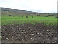
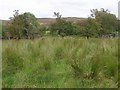
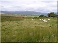
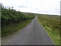
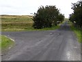
Nearby Images from Geograph Britain and Ireland:
©2007(licence)
©2007(licence)
©2007(licence)
©2007(licence)
©2007(licence)
The above images may not be of the site on this page, they are loaded from Geograph.
Please Submit an Image of this site or go out and take one for us!
Click here to see more info for this site
Nearby sites
Click here to view sites on an interactive map of the areaKey: Red: member's photo, Blue: 3rd party photo, Yellow: other image, Green: no photo - please go there and take one, Grey: site destroyed
Download sites to:
KML (Google Earth)
GPX (GPS waypoints)
CSV (Garmin/Navman)
CSV (Excel)
To unlock full downloads you need to sign up as a Contributory Member. Otherwise downloads are limited to 50 sites.
Turn off the page maps and other distractions
Nearby sites listing. In the following links * = Image available
141m NW 316° Corick Stone Row* Stone Row / Alignment (H778897)
2.0km WSW 240° Ballybriest Court Tomb* Court Tomb (H7617988570)
2.3km WSW 241° Ballybriest Circle Stone Circle (H7594088480)
3.7km S 175° Mobuy Stone Circle (H783859)
3.8km WNW 282° Owenreagh SE Stone Circle (H742903)
4.0km WNW 283° Owenreagh NW [NE] Stone Circle (H740904)
4.0km WNW 283° Owenreagh NW [SW] Stone Circle (H740904)
4.7km SE 140° Letteran Stone Circle (H810860)
7.7km WSW 249° Davagh Lower N Stone Row / Alignment (H707867)
7.8km WSW 249° Davagh Lower S* Stone Circle (H70618673)
7.8km WSW 249° Davagh Lower N Stone Circle (H706867)
8.1km WSW 253° Giant's Grave (Davagh) Chambered Tomb (H7014787081)
10.8km WSW 241° Beaghmore A* Stone Circle
10.8km WSW 241° Beaghmore B* Stone Circle
10.8km N 4° Coolnasillagh Chambered Tomb (C7855000390)
10.8km WSW 241° Beaghmore Multiple Stone Rows / Avenue (H685842)
10.8km WSW 241° Beaghmore C* Stone Circle
10.8km N 4° Coolnasillagh Stone Row / Alignment (C7845000425)
10.8km WSW 241° Beaghmore D* Stone Circle
10.8km WSW 241° Beaghmore E* Stone Circle
10.8km WSW 241° Beaghmore* Stone Circle (H6843984247)
10.9km WSW 241° Beaghmore F* Stone Circle
10.9km WSW 241° Beaghmore G* Stone Circle
10.9km SW 232° Beleevna Beg Stone Row / Alignment (H6935082780)
11.0km SW 234° Beleevnabeg Stone Circle (H6913082960)
View more nearby sites and additional images


 We would like to know more about this location. Please feel free to add a brief description and any relevant information in your own language.
 Wir möchten mehr über diese Stätte erfahren. Bitte zögern Sie nicht, eine kurze Beschreibung und relevante Informationen in Deutsch hinzuzufügen.
 Nous aimerions en savoir encore un peu sur les lieux. S'il vous plaît n'hesitez pas à ajouter une courte description et tous les renseignements pertinents dans votre propre langue.
 Quisieramos informarnos un poco más de las lugares. No dude en añadir una breve descripción y otros datos relevantes en su propio idioma.