<< Our Photo Pages >> Caer Caradoc Round Barrow - Round Barrow(s) in England in Shropshire
Submitted by TheWhiteRider on Monday, 12 June 2006 Page Views: 6101
Neolithic and Bronze AgeSite Name: Caer Caradoc Round BarrowCountry: England County: Shropshire Type: Round Barrow(s)
Nearest Town: Church Stretton Nearest Village: Willstone
Map Ref: SO48059529
Latitude: 52.552960N Longitude: 2.767622W
Condition:
| 5 | Perfect |
| 4 | Almost Perfect |
| 3 | Reasonable but with some damage |
| 2 | Ruined but still recognisable as an ancient site |
| 1 | Pretty much destroyed, possibly visible as crop marks |
| 0 | No data. |
| -1 | Completely destroyed |
| 5 | Superb |
| 4 | Good |
| 3 | Ordinary |
| 2 | Not Good |
| 1 | Awful |
| 0 | No data. |
| 5 | Can be driven to, probably with disabled access |
| 4 | Short walk on a footpath |
| 3 | Requiring a bit more of a walk |
| 2 | A long walk |
| 1 | In the middle of nowhere, a nightmare to find |
| 0 | No data. |
| 5 | co-ordinates taken by GPS or official recorded co-ordinates |
| 4 | co-ordinates scaled from a detailed map |
| 3 | co-ordinates scaled from a bad map |
| 2 | co-ordinates of the nearest village |
| 1 | co-ordinates of the nearest town |
| 0 | no data |
Internal Links:
External Links:
I have visited· I would like to visit
TheWhiteRider Serenstar have visited here
")
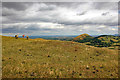
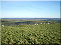
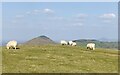
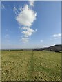
The remains of a Bronze Age round barrow sit at the bottom of Caer Caradoc, a short distance from the end of the causeway. The barrow is low, but quite cleary discernible, in the field opposite the causeway. Marked on the Explorer map as a tumulus.
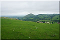
Magnificent views abound from this location, but it can be a challenging walk.
You may be viewing yesterday's version of this page. To see the most up to date information please register for a free account.
")
")
Do not use the above information on other web sites or publications without permission of the contributor.
Nearby Images from Geograph Britain and Ireland:
©2018(licence)
©2008(licence)
©2022(licence)
©2016(licence)
©2022(licence)
The above images may not be of the site on this page, they are loaded from Geograph.
Please Submit an Image of this site or go out and take one for us!
Click here to see more info for this site
Nearby sites
Key: Red: member's photo, Blue: 3rd party photo, Yellow: other image, Green: no photo - please go there and take one, Grey: site destroyed
Download sites to:
KML (Google Earth)
GPX (GPS waypoints)
CSV (Garmin/Navman)
CSV (Excel)
To unlock full downloads you need to sign up as a Contributory Member. Otherwise downloads are limited to 50 sites.
Turn off the page maps and other distractions
Nearby sites listing. In the following links * = Image available
349m W 271° Caer Caradoc (Church Stretton)* Hillfort (SO477953)
1.4km S 191° Hope Bowdler Hill* Cairn (SO47779389)
2.0km WNW 287° Castle Hill (Shropshire)* Hillfort (SO461959)
2.6km NNE 32° The Lawley (Summit)* Hillfort (SO49459745)
3.2km WSW 240° Stretton Sheela* Early Christian Sculptured Stone (SO45239368)
3.6km W 260° Bodbury Ring* Hillfort (SO445947)
4.0km WNW 290° High Park Cross Dyke* Ancient Village or Settlement (SO443967)
4.0km NNE 33° The Lawley (Northern)* Hillfort (SO50289863)
4.2km WSW 255° The Devil's Mouth Cross Dyke* Misc. Earthwork (SO43959425)
4.5km WSW 242° Ashlet Hill Bowl Barrow Round Barrow(s) (SO440932)
5.2km WNW 283° Robin Hood's Butts (Shropshire)* Round Barrow(s) (SO43029655)
5.5km WNW 286° Henley Knap Bowl Barrow* Round Barrow(s) (SO42799685)
5.5km W 261° Long Mynd A* Round Barrow(s) (SO426945)
5.7km W 271° Long Mynd C* Round Barrow(s) (SO423955)
5.8km W 263° Boiling Well (Long Mynd)* Round Barrow(s) (SO423946)
5.8km WNW 284° Wildmoor Bowl Barrow* Round Barrow(s) (SO42409672)
5.9km WSW 240° Cross Dyke Bowl Barrow North* Round Barrow(s) (SO42899244)
5.9km WSW 240° Cross Dyke Bowl Barrow South* Round Barrow(s) (SO42869241)
5.9km W 270° Shooting Box Disc Barrow* Round Barrow(s) (SO421954)
6.0km WSW 244° Barrister's Plain Cross Dyke* Ancient Village or Settlement (SO426927)
6.8km WSW 252° Long Mynd B* Round Barrow(s) (SO41539330)
7.1km WSW 258° Pole Cottage* Round Barrow(s) (SO411939)
7.4km WNW 292° Ratlinghope Hill Bowl Barrow* Round Barrow(s) (SO41179817)
7.6km WNW 285° Ratlinghope Hill Camp* Hillfort (SO407973)
7.7km NE 43° The Frog Well Holy Well or Sacred Spring (SJ53340084)
View more nearby sites and additional images


 We would like to know more about this location. Please feel free to add a brief description and any relevant information in your own language.
 Wir möchten mehr über diese Stätte erfahren. Bitte zögern Sie nicht, eine kurze Beschreibung und relevante Informationen in Deutsch hinzuzufügen.
 Nous aimerions en savoir encore un peu sur les lieux. S'il vous plaît n'hesitez pas à ajouter une courte description et tous les renseignements pertinents dans votre propre langue.
 Quisieramos informarnos un poco más de las lugares. No dude en añadir una breve descripción y otros datos relevantes en su propio idioma.