<< Our Photo Pages >> Brynrhydd Common - Misc. Earthwork in Wales in Powys
Submitted by coldrum on Wednesday, 21 January 2009 Page Views: 3638
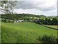
Multi-periodSite Name: Brynrhydd Common Alternative Name: Bryn-RhyddCountry: Wales County: Powys Type: Misc. Earthwork
Map Ref: SO18644145
Latitude: 52.065425N Longitude: 3.188262W
Condition:
| 5 | Perfect |
| 4 | Almost Perfect |
| 3 | Reasonable but with some damage |
| 2 | Ruined but still recognisable as an ancient site |
| 1 | Pretty much destroyed, possibly visible as crop marks |
| 0 | No data. |
| -1 | Completely destroyed |
| 5 | Superb |
| 4 | Good |
| 3 | Ordinary |
| 2 | Not Good |
| 1 | Awful |
| 0 | No data. |
| 5 | Can be driven to, probably with disabled access |
| 4 | Short walk on a footpath |
| 3 | Requiring a bit more of a walk |
| 2 | A long walk |
| 1 | In the middle of nowhere, a nightmare to find |
| 0 | No data. |
| 5 | co-ordinates taken by GPS or official recorded co-ordinates |
| 4 | co-ordinates scaled from a detailed map |
| 3 | co-ordinates scaled from a bad map |
| 2 | co-ordinates of the nearest village |
| 1 | co-ordinates of the nearest town |
| 0 | no data |
Be the first person to rate this site - see the 'Contribute!' box in the right hand menu.
Internal Links:
External Links:
I have visited· I would like to visit
geoffstickland has visited here
")
Possible defended Iron Age enclosure.
For more information see Coflein NPRN 306065.
You may be viewing yesterday's version of this page. To see the most up to date information please register for a free account.
Do not use the above information on other web sites or publications without permission of the contributor.
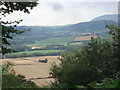
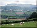
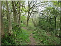
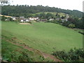
Nearby Images from Geograph Britain and Ireland:
©2007(licence)
©2007(licence)
©2012(licence)
©2007(licence)
©2014(licence)
The above images may not be of the site on this page, they are loaded from Geograph.
Please Submit an Image of this site or go out and take one for us!
Click here to see more info for this site
Nearby sites
Key: Red: member's photo, Blue: 3rd party photo, Yellow: other image, Green: no photo - please go there and take one, Grey: site destroyed
Download sites to:
KML (Google Earth)
GPX (GPS waypoints)
CSV (Garmin/Navman)
CSV (Excel)
To unlock full downloads you need to sign up as a Contributory Member. Otherwise downloads are limited to 50 sites.
Turn off the page maps and other distractions
Nearby sites listing. In the following links * = Image available
649m ENE 66° St Maelog's Cross* Ancient Cross (SO1923941704)
2.2km W 265° Ffynnon Gynydd* Holy Well or Sacred Spring (SO1641241282)
3.1km NE 56° Clyro Court* Chambered Tomb (SO21234315)
3.2km S 189° Coed-y-Polyn Cairn (SO18083832)
3.4km S 186° Little Lodge* Chambered Tomb (SO18223806)
3.8km SSW 208° Bronllys 2* Round Barrow(s) (SO16783811)
3.9km ENE 78° The Walk Well* Holy Well or Sacred Spring (SO225422)
4.0km SSW 195° Gweryfed Park* Hillfort (SO17503759)
4.1km ESE 111° Pen-y-Wyrlod* Chambered Tomb (SO22483987)
4.2km ENE 65° The Monk's Well* Holy Well or Sacred Spring (SO225432)
4.3km SW 214° Spread Eagle Cursus Cursus (SO16203795)
4.3km SSW 212° Spread Eagle Cursus Cursus (SO16283784)
4.9km SSW 211° Pipton* Chambered Tomb (SO16043729)
5.4km NE 36° Crossfoot Farm Standing Stone* Standing Stone (Menhir) (SO21874573)
6.0km W 266° Neuadd-Glan-Gwy* Standing Stone (Menhir) (SO1263641167)
6.0km SSW 196° Croes-llechau (Bronllys) Long Barrow (SO169357)
6.2km ESE 116° Twyn-Y-Beddau* Round Barrow(s) (SO2414838610)
6.3km WSW 251° Boughrood Tumulus* Round Barrow(s) (SO126395)
6.4km SE 124° Maes-Coch Chambered Cairn (SO239378)
6.5km S 185° Ffostil North Chambered Long Barrow* Chambered Tomb (SO17913495)
6.6km WSW 253° Llangoed Maen Hir* Standing Stone (Menhir) (SO123396)
6.6km S 185° Ffostil South Chambered Long Barrow* Chambered Tomb (SO179349)
6.7km SW 235° Bronllys 1 Round Barrow(s) (SO131377)
6.7km SE 127° Pen Y Beacon* Stone Circle (SO23933735)
6.8km W 275° St Steffan Church* Holy Well or Sacred Spring (SO119421)
View more nearby sites and additional images


 We would like to know more about this location. Please feel free to add a brief description and any relevant information in your own language.
 Wir möchten mehr über diese Stätte erfahren. Bitte zögern Sie nicht, eine kurze Beschreibung und relevante Informationen in Deutsch hinzuzufügen.
 Nous aimerions en savoir encore un peu sur les lieux. S'il vous plaît n'hesitez pas à ajouter une courte description et tous les renseignements pertinents dans votre propre langue.
 Quisieramos informarnos un poco más de las lugares. No dude en añadir una breve descripción y otros datos relevantes en su propio idioma.