<< Our Photo Pages >> Drummer Boys Grave Stone - Ancient Mine, Quarry or other Industry in England in Gloucestershire
Submitted by coldrum on Tuesday, 05 January 2010 Page Views: 7143
Multi-periodSite Name: Drummer Boys Grave Stone Alternative Name: Drummer Boys StoneCountry: England County: Gloucestershire Type: Ancient Mine, Quarry or other Industry
Map Ref: SO65470898
Latitude: 51.778413N Longitude: 2.501904W
Condition:
| 5 | Perfect |
| 4 | Almost Perfect |
| 3 | Reasonable but with some damage |
| 2 | Ruined but still recognisable as an ancient site |
| 1 | Pretty much destroyed, possibly visible as crop marks |
| 0 | No data. |
| -1 | Completely destroyed |
| 5 | Superb |
| 4 | Good |
| 3 | Ordinary |
| 2 | Not Good |
| 1 | Awful |
| 0 | No data. |
| 5 | Can be driven to, probably with disabled access |
| 4 | Short walk on a footpath |
| 3 | Requiring a bit more of a walk |
| 2 | A long walk |
| 1 | In the middle of nowhere, a nightmare to find |
| 0 | No data. |
| 5 | co-ordinates taken by GPS or official recorded co-ordinates |
| 4 | co-ordinates scaled from a detailed map |
| 3 | co-ordinates scaled from a bad map |
| 2 | co-ordinates of the nearest village |
| 1 | co-ordinates of the nearest town |
| 0 | no data |
Be the first person to rate this site - see the 'Contribute!' box in the right hand menu.
Internal Links:
External Links:
I have visited· I would like to visit
4clydesdale7 visited on 30th Jul 2011 - their rating: Cond: 3 Amb: 4 Access: 4 The smallest site seen so far
Geojazz have visited here
")
From Pastscape:
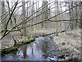
"A large piece of red sandstone conglomerate known locally as the Drummer Boys Grave Stone or Drummer Boys Stone is located 350 yards north of Blackpool Bridge. It contains two artificial hollows - one of which is partly filled with iron which has firmly adhered to the stone. In the bed of the small stream, to the immediate east of the stones are fragments of iron slag. The stone seems to have been used as a mortar stone for crushing ore. The location of the furnace could not be found. "
http://www.pastscape.org.uk/hob.aspx?hob_id=111556
You may be viewing yesterday's version of this page. To see the most up to date information please register for a free account.
")
")
")
Do not use the above information on other web sites or publications without permission of the contributor.
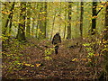
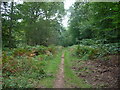
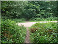
Nearby Images from Geograph Britain and Ireland:
©2019(licence)
©2012(licence)
©2010(licence)
©2012(licence)
©2023(licence)
The above images may not be of the site on this page, they are loaded from Geograph.
Please Submit an Image of this site or go out and take one for us!
Click here to see more info for this site
Nearby sites
Key: Red: member's photo, Blue: 3rd party photo, Yellow: other image, Green: no photo - please go there and take one, Grey: site destroyed
Download sites to:
KML (Google Earth)
GPX (GPS waypoints)
CSV (Garmin/Navman)
CSV (Excel)
To unlock full downloads you need to sign up as a Contributory Member. Otherwise downloads are limited to 50 sites.
Turn off the page maps and other distractions
Nearby sites listing. In the following links * = Image available
633m NNE 15° Patten Stone Marker Stone (SO65640959)
1.7km NNE 23° Soudley Camp* Promontory Fort / Cliff Castle (SO66161058)
1.9km NNE 29° Dean Heritage Centre* Museum (SO664106)
4.7km NW 312° The Speech Stone* Marker Stone (SO62011212)
5.3km NNE 20° Littledean Standing Stone* Marker Stone (SO6731713967)
6.1km E 81° The Awen Stone* Modern Stone Circle etc (SO7149809889)
6.8km NNE 20° Welshbury Hill Ancient Village or Settlement (SO678154)
6.9km NNE 13° St Anthony's Well (Cinderford)* Holy Well or Sacred Spring (SO67051574)
7.0km NNE 19° Welshbury Camp* Hillfort (SO67751555)
7.0km NNE 19° Welshbury Cairn* Cairn (SO67831555)
7.3km W 266° Gattle's Cross* Marker Stone (SO5812608512)
7.4km SSW 211° Lydney Hillfort* Hillfort (SO616027)
7.8km S 185° Lydney Harbour* Modern Stone Circle etc (SO64730126)
7.8km W 264° Clearwell Caves* Ancient Mine, Quarry or other Industry (SO57700822)
8.1km SSW 207° Aylburton Cross* Ancient Cross (SO6172101791)
8.4km SSE 155° Wanswell Holy Well or Sacred Spring (SO68980139)
9.4km WSW 254° Stowe Enclosure* Misc. Earthwork (SO56430643)
10.0km WNW 288° Long Stone, Staunton* Standing Stone (Menhir) (SO55931206)
10.1km W 273° Newland Crosses* Ancient Cross (SO5530809511)
10.6km WSW 244° The Ancient Barrow Well, St. Briavel's* Holy Well or Sacred Spring (SO5593004337)
10.7km WSW 245° St Bride's Well* Holy Well or Sacred Spring (SO5574404515)
10.7km NW 308° Coldwell Rocks Cave or Rock Shelter (SO570156)
11.0km WNW 289° Staunton Cross* Ancient Cross (SO5506412571)
11.3km NW 306° Symonds Yat Fort* Hillfort (SO563157)
11.4km NW 304° Bowler's Hole Cave or Rock Shelter (SO56101545)
View more nearby sites and additional images


 We would like to know more about this location. Please feel free to add a brief description and any relevant information in your own language.
 Wir möchten mehr über diese Stätte erfahren. Bitte zögern Sie nicht, eine kurze Beschreibung und relevante Informationen in Deutsch hinzuzufügen.
 Nous aimerions en savoir encore un peu sur les lieux. S'il vous plaît n'hesitez pas à ajouter une courte description et tous les renseignements pertinents dans votre propre langue.
 Quisieramos informarnos un poco más de las lugares. No dude en añadir una breve descripción y otros datos relevantes en su propio idioma.