<< Text Pages >> Fedw Standing Stone - Standing Stone (Menhir) in Wales in Mid Glamorgan
Submitted by coldrum on Monday, 01 February 2010 Page Views: 4507
Neolithic and Bronze AgeSite Name: Fedw Standing StoneCountry: Wales County: Mid Glamorgan Type: Standing Stone (Menhir)
Map Ref: SO01701191
Latitude: 51.797169N Longitude: 3.426852W
Condition:
| 5 | Perfect |
| 4 | Almost Perfect |
| 3 | Reasonable but with some damage |
| 2 | Ruined but still recognisable as an ancient site |
| 1 | Pretty much destroyed, possibly visible as crop marks |
| 0 | No data. |
| -1 | Completely destroyed |
| 5 | Superb |
| 4 | Good |
| 3 | Ordinary |
| 2 | Not Good |
| 1 | Awful |
| 0 | No data. |
| 5 | Can be driven to, probably with disabled access |
| 4 | Short walk on a footpath |
| 3 | Requiring a bit more of a walk |
| 2 | A long walk |
| 1 | In the middle of nowhere, a nightmare to find |
| 0 | No data. |
| 5 | co-ordinates taken by GPS or official recorded co-ordinates |
| 4 | co-ordinates scaled from a detailed map |
| 3 | co-ordinates scaled from a bad map |
| 2 | co-ordinates of the nearest village |
| 1 | co-ordinates of the nearest town |
| 0 | no data |
Internal Links:
External Links:
Standing Stone in Mid Glamorgan
"Standing stone on Garn Ddu. It is c 1m high tapering to a point at the apex, and is set in a stone-lined socket. No trace of the stone could be found(GGAT). At time of 2003 field visit stone not located."
Source: Coflein.
You may be viewing yesterday's version of this page. To see the most up to date information please register for a free account.
Do not use the above information on other web sites or publications without permission of the contributor.
Nearby Images from Geograph Britain and Ireland:
©2018(licence)
©2018(licence)
©2020(licence)
©2020(licence)
©2007(licence)
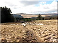
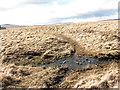
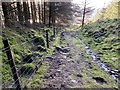
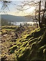
The above images may not be of the site on this page, they are loaded from Geograph.
Please Submit an Image of this site or go out and take one for us!
Click here to see more info for this site
Nearby sites
Key: Red: member's photo, Blue: 3rd party photo, Yellow: other image, Green: no photo - please go there and take one, Grey: site destroyed
Download sites to:
KML (Google Earth)
GPX (GPS waypoints)
CSV (Garmin/Navman)
CSV (Excel)
To unlock full downloads you need to sign up as a Contributory Member. Otherwise downloads are limited to 50 sites.
Turn off the page maps and other distractions
Nearby sites listing. In the following links * = Image available
653m ESE 123° Coedcae'r Gwarthog* Barrow Cemetery (SO02241154)
1.1km NNW 348° Cefn Car Standing Stones* Standing Stones (SO01491299)
1.3km SE 146° Cefn Cil-Sanws* Ring Cairn (SO02421081)
2.1km NNE 17° Nant Gwinau* Stone Row / Alignment (SO02361390)
3.2km WSW 252° Cwm Cadlan 3* Ring Cairn (SN98641101)
3.2km W 264° Twyn Bryn Glas Cairn* Cairn (SN9850011660)
3.3km WSW 252° Cwm Cadlan 1* Round Cairn (SN98551095)
3.5km WSW 252° Cwm Cadlan 2* Ring Cairn (SN98321087)
3.6km E 91° Bryn Glas Cairns (Pontsticill)* Barrow Cemetery (SO05271177)
4.0km W 273° Cadair Fawr Cairn* Cairn (SN9773612218)
4.0km W 270° Blaen Cadlan Uchaf* Cairn (SN9772011990)
4.0km WSW 246° Cefn Sychpant* Round Cairn (SN97951036)
4.1km W 279° Cadair Fawr east cairn* Cairn (SN9760912631)
4.4km NNE 17° Bwlch Gwyn 1 Standing Stone (Menhir) (SO03121612)
4.4km NNE 18° Bwlch Gwyn 2 Standing Stone (Menhir) (SO03151611)
4.5km WNW 288° Cefn Esgair Ring Cairn (SN974134)
4.8km ENE 72° Waun Rydd Cairn 1 Cairn (SO0625513310)
4.9km E 88° Abercriban Ciarn 1 Round Cairn (SO06651201)
5.1km NE 54° Y Gaer (Mid Glamorgan)* Hillfort (SO059148)
5.1km NE 55° Y Gaer Enclosure Hillfort (SO05931478)
5.4km SW 234° Mynydd y Glog* Cairn (SN97270886)
5.5km W 280° Blaen Hepste* Henge (SN9633012960)
5.5km ENE 71° Buarth Y Caerau Hut Circles Ancient Village or Settlement (SO0695213557)
5.7km ENE 76° Pontsticill Inscribed Stone* Early Christian Sculptured Stone (SO0726513176)
5.8km ENE 75° Cwm Criban Cairn (SO0734313320)
View more nearby sites and additional images


 We would like to know more about this location. Please feel free to add a brief description and any relevant information in your own language.
 Wir möchten mehr über diese Stätte erfahren. Bitte zögern Sie nicht, eine kurze Beschreibung und relevante Informationen in Deutsch hinzuzufügen.
 Nous aimerions en savoir encore un peu sur les lieux. S'il vous plaît n'hesitez pas à ajouter une courte description et tous les renseignements pertinents dans votre propre langue.
 Quisieramos informarnos un poco más de las lugares. No dude en añadir una breve descripción y otros datos relevantes en su propio idioma.