<< Our Photo Pages >> Crackstone Long Barrow - Long Barrow in England in Gloucestershire
Submitted by 4clydesdale7 on Saturday, 13 August 2011 Page Views: 6119
Neolithic and Bronze AgeSite Name: Crackstone Long BarrowCountry: England County: Gloucestershire Type: Long Barrow
Nearest Town: Minchinhampton Nearest Village: Crackstone
Map Ref: SO88650030
Latitude: 51.701326N Longitude: 2.165634W
Condition:
| 5 | Perfect |
| 4 | Almost Perfect |
| 3 | Reasonable but with some damage |
| 2 | Ruined but still recognisable as an ancient site |
| 1 | Pretty much destroyed, possibly visible as crop marks |
| 0 | No data. |
| -1 | Completely destroyed |
| 5 | Superb |
| 4 | Good |
| 3 | Ordinary |
| 2 | Not Good |
| 1 | Awful |
| 0 | No data. |
| 5 | Can be driven to, probably with disabled access |
| 4 | Short walk on a footpath |
| 3 | Requiring a bit more of a walk |
| 2 | A long walk |
| 1 | In the middle of nowhere, a nightmare to find |
| 0 | No data. |
| 5 | co-ordinates taken by GPS or official recorded co-ordinates |
| 4 | co-ordinates scaled from a detailed map |
| 3 | co-ordinates scaled from a bad map |
| 2 | co-ordinates of the nearest village |
| 1 | co-ordinates of the nearest town |
| 0 | no data |
Internal Links:
External Links:
I have visited· I would like to visit
4clydesdale7 visited on 12th Aug 2011 - their rating: Cond: 2 Amb: 3 Access: 4 The field has been divided up by the owners of Crackstone Stables (to keep pasture for horses separated) and it has been done in an unsightly way which rather detracts from the scene - quite a puzzle this site
")
The opinion that the area is an ancient quarry is not based on what is on the ground but on the general area - in Vol 50 of the Transactions of BGAS R.J.Burton wrote:-
' There is a crossing of two roads here (Crackstone), at the NE corner of which are a farmyard and buildings (today Crackstone Stables). At the back of these (up the track to Lower Peaches Farm) a field rises (within about 75m) to a ridge which (the field) is hummocky. At first sight like two other fields close by (to the N) where quarrying has been carried on. There is, however, an important difference, for in this case there are only two small depressions utterly inadequate to account for the mounds. The heaps are not thrown up, but rather thrown down on to the natural surface. The probable axis was about N and S and the length, roughly, 160-170ft. The name Crackstone seems to add weight to the suggestion of a disturbed Barrow.'
I can find no record of it ever having been excavated - but evidence in situ seems to suggest it has been at some time. Burton was right to draw comparison with the more northerly 'quarries' - they are definitely below the general field level - as you can see from the photographs the hollows between the mounds do not go below general field level - ie the troughs were not 'dug out' thus the hollows are not 'quarries' -
What did my old Maths master say - QED - but what do you think - BGAS published a contrary opinion in 1960 and Pastscape 212735 seem to sit on the fence.
For another intriguing site see Haresdown Barrow, and of course the well known Long Stone, see the nearby sites list below.
You may be viewing yesterday's version of this page. To see the most up to date information please register for a free account.
")
Do not use the above information on other web sites or publications without permission of the contributor.
Nearby Images from Geograph Britain and Ireland:
©2016(licence)
©2006(licence)
©2009(licence)
©2008(licence)
©2020(licence)
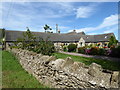
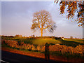
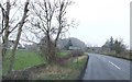
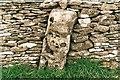
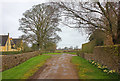
The above images may not be of the site on this page, they are loaded from Geograph.
Please Submit an Image of this site or go out and take one for us!
Click here to see more info for this site
Nearby sites
Key: Red: member's photo, Blue: 3rd party photo, Yellow: other image, Green: no photo - please go there and take one, Grey: site destroyed
Download sites to:
KML (Google Earth)
GPX (GPS waypoints)
CSV (Garmin/Navman)
CSV (Excel)
To unlock full downloads you need to sign up as a Contributory Member. Otherwise downloads are limited to 50 sites.
Turn off the page maps and other distractions
Nearby sites listing. In the following links * = Image available
484m SW 218° Long Stone (Minchinhampton)* Standing Stones (ST88359992)
635m SSW 204° Gatcombe Lodge* Long Barrow (ST88399972)
1.1km NNE 23° Hyde Tumulus 2* Round Barrow(s) (SO89070130)
1.1km WNW 292° The Bulwarks - East 1 and 2 - Minchinhampton* Misc. Earthwork (SO87620072)
1.2km W 260° Bubblewell* Standing Stone (Menhir) (SO875001)
1.3km NNE 19° Hyde Tumulus 1* Round Barrow(s) (SO89060149)
1.4km SSW 198° The Tingle Stone* Long Barrow (ST88239899)
1.5km W 260° The Lang Stone* Standing Stone (Menhir) (SO87170004)
1.6km WNW 284° The Cobstone* Holed Stone (SO87050070)
1.9km S 171° Norn's Tump* Chambered Tomb (ST88949839)
2.1km SSW 201° Avening burial chambers* Burial Chamber or Dolmen (ST87899837)
2.6km SSE 161° Barrow Tumps* Long Barrow (ST89519783)
2.7km SW 223° The Oven* Round Barrow(s) (ST86769832)
2.9km W 272° The Bulwarks (Gloucestershire)* Ancient Village or Settlement (SO857004)
3.0km WSW 238° Oldfield Wood* Chambered Tomb (ST861987)
3.3km WSW 237° Hazlewood Copse Camp* Hillfort (ST85829850)
3.4km W 265° Beaudesert Park Standing Stone* Standing Stone (Menhir) (SO853000)
3.5km WNW 293° Whitefield's Tump* Long Barrow (SO85400170)
3.6km NW 306° The Horestone (Rodborough)* Standing Stone (Menhir) (SO85770241)
3.6km SW 226° Lechmore Tump* Long Barrow (ST86049783)
3.6km WNW 288° Amberley Camp* Misc. Earthwork (SO852014)
3.6km WNW 285° Amberley Cross Bank* Misc. Earthwork (SO85130124)
3.8km NE 44° Ashmead Well* Holy Well or Sacred Spring (SO91270301)
3.8km WNW 304° The Horestone (Sullivan)* Standing Stone (Menhir) (SO85490240)
3.8km SW 223° Lechmore Round Barrow* Round Barrow(s) (ST860975)
View more nearby sites and additional images


 We would like to know more about this location. Please feel free to add a brief description and any relevant information in your own language.
 Wir möchten mehr über diese Stätte erfahren. Bitte zögern Sie nicht, eine kurze Beschreibung und relevante Informationen in Deutsch hinzuzufügen.
 Nous aimerions en savoir encore un peu sur les lieux. S'il vous plaît n'hesitez pas à ajouter une courte description et tous les renseignements pertinents dans votre propre langue.
 Quisieramos informarnos un poco más de las lugares. No dude en añadir una breve descripción y otros datos relevantes en su propio idioma.