<< Our Photo Pages >> Far Hearkening Rock - Natural Stone / Erratic / Other Natural Feature in Wales in Monmouthshire
Submitted by 4clydesdale7 on Sunday, 27 December 2020 Page Views: 8650
Natural PlacesSite Name: Far Hearkening Rock Alternative Name: Far Hearkening StoneCountry: Wales County: Monmouthshire Type: Natural Stone / Erratic / Other Natural Feature
Nearest Town: Coleford Nearest Village: Staunton
Map Ref: SO5410515107
Latitude: 51.832679N Longitude: 2.667439W
Condition:
| 5 | Perfect |
| 4 | Almost Perfect |
| 3 | Reasonable but with some damage |
| 2 | Ruined but still recognisable as an ancient site |
| 1 | Pretty much destroyed, possibly visible as crop marks |
| 0 | No data. |
| -1 | Completely destroyed |
| 5 | Superb |
| 4 | Good |
| 3 | Ordinary |
| 2 | Not Good |
| 1 | Awful |
| 0 | No data. |
| 5 | Can be driven to, probably with disabled access |
| 4 | Short walk on a footpath |
| 3 | Requiring a bit more of a walk |
| 2 | A long walk |
| 1 | In the middle of nowhere, a nightmare to find |
| 0 | No data. |
| 5 | co-ordinates taken by GPS or official recorded co-ordinates |
| 4 | co-ordinates scaled from a detailed map |
| 3 | co-ordinates scaled from a bad map |
| 2 | co-ordinates of the nearest village |
| 1 | co-ordinates of the nearest town |
| 0 | no data |
Internal Links:
External Links:
I have visited· I would like to visit
MegalithicChaton would like to visit
Geojazz visited on 26th Dec 2020 - their rating: Cond: 5 Amb: 5 Access: 2 Approached from the river so it was quite an uphill treck. A little difficult to find as the footpath is indistinct.
4clydesdale7 visited on 14th May 2012 - their rating: Cond: 4 Amb: 4 Access: 3 Unusual type of rock for the area - formed from Dolomite not the predominant Old Red Sandstone/Quartz Conglomerate - superb views over the Wye Valley
Average ratings for this site from all visit loggers: Condition: 4.5 Ambience: 4.5 Access: 2.5
")
Unusually for this area the rock is formed of Dolomite. The rock is the highest of a series of NW facing rocky outcrops and enjoys superb views over the River Wye.
You may be viewing yesterday's version of this page. To see the most up to date information please register for a free account.
")
")
")
Do not use the above information on other web sites or publications without permission of the contributor.
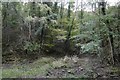
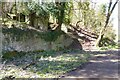
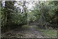
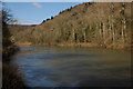
Nearby Images from Geograph Britain and Ireland:

©2010(licence)
©2017(licence)
©2023(licence)
©2017(licence)
©2008(licence)
The above images may not be of the site on this page, they are loaded from Geograph.
Please Submit an Image of this site or go out and take one for us!
Click here to see more info for this site
Nearby sites
Key: Red: member's photo, Blue: 3rd party photo, Yellow: other image, Green: no photo - please go there and take one, Grey: site destroyed
Download sites to:
KML (Google Earth)
GPX (GPS waypoints)
CSV (Garmin/Navman)
CSV (Excel)
To unlock full downloads you need to sign up as a Contributory Member. Otherwise downloads are limited to 50 sites.
Turn off the page maps and other distractions
Nearby sites listing. In the following links * = Image available
530m ENE 68° Cavall's Cave Cave or Rock Shelter (SO546153)
565m ENE 74° Madawg Rockshelter Cave or Rock Shelter (SO54651526)
663m NE 43° King Arthur's Cave* Cave or Rock Shelter (SO54561559)
691m NE 45° King Arthur's North* Cave or Rock Shelter (SO54601559)
899m N 353° Little Doward* Hillfort (SO5416)
916m NNW 347° Little Doward Barrows Round Barrow(s) (SO539160)
916m NNW 347° King Arthur's Hall Cave Cave or Rock Shelter (SO53901600)
1.1km S 174° Staunton Suck Stone (Gloucestershire)* Natural Stone / Erratic / Other Natural Feature (SO54211401)
1.1km S 169° Near Hearkening Rock* Natural Stone / Erratic / Other Natural Feature (SO54311401)
1.2km ESE 121° The Biblins Cave Cave or Rock Shelter (SO55161446)
1.3km E 94° Biblins Cave or Rock Shelter (SO554150)
1.4km E 93° Lord's Wood Cave Cave or Rock Shelter (SO55551503)
1.5km E 82° Merlin's Cave (Herefordshire) Cave or Rock Shelter (SO556153)
1.5km SE 131° Whipping Brook Cave Cave or Rock Shelter (SO55251410)
1.7km ENE 74° Symonds Yat West Cave or Rock Shelter (SO55701555)
2.0km E 80° Bowler's Hole Cave or Rock Shelter (SO56101545)
2.0km ENE 77° Symonds Yat Cave Cave or Rock Shelter (SO56101555)
2.0km ENE 77° Wye Rapids Cave Cave or Rock Shelter (SO56101555)
2.0km ENE 77° Symonds Yat Cave 3 Cave or Rock Shelter (SO56101555)
2.0km ENE 77° Symonds Yat Cave 2 Cave or Rock Shelter (SO56101555)
2.1km ENE 64° Symonds Yat East Rockshelter Cave or Rock Shelter (SO56001600)
2.3km ENE 74° Symonds Yat Fort* Hillfort (SO563157)
2.6km SSE 168° Toads Mouth Stone* Natural Stone / Erratic / Other Natural Feature (SO54621260)
2.6km NE 49° Huntsham Hill Rockshelters Cave or Rock Shelter (SO561168)
2.7km SSE 159° Staunton Cross* Ancient Cross (SO5506412571)
View more nearby sites and additional images


 We would like to know more about this location. Please feel free to add a brief description and any relevant information in your own language.
 Wir möchten mehr über diese Stätte erfahren. Bitte zögern Sie nicht, eine kurze Beschreibung und relevante Informationen in Deutsch hinzuzufügen.
 Nous aimerions en savoir encore un peu sur les lieux. S'il vous plaît n'hesitez pas à ajouter une courte description et tous les renseignements pertinents dans votre propre langue.
 Quisieramos informarnos un poco más de las lugares. No dude en añadir una breve descripción y otros datos relevantes en su propio idioma.