<< Text Pages >> Cwm Fforest - Modern Stone Circle etc in Wales in Powys
Submitted by vicky on Monday, 23 September 2002 Page Views: 5158
Modern SitesSite Name: Cwm FforestCountry: Wales County: Powys Type: Modern Stone Circle etc
Nearest Town: Brecon Nearest Village: Pen-y-genffordd
Map Ref: SO1833029440 Landranger Map Number: 161
Latitude: 51.957424N Longitude: 3.189915W
Condition:
| 5 | Perfect |
| 4 | Almost Perfect |
| 3 | Reasonable but with some damage |
| 2 | Ruined but still recognisable as an ancient site |
| 1 | Pretty much destroyed, possibly visible as crop marks |
| 0 | No data. |
| -1 | Completely destroyed |
| 5 | Superb |
| 4 | Good |
| 3 | Ordinary |
| 2 | Not Good |
| 1 | Awful |
| 0 | No data. |
| 5 | Can be driven to, probably with disabled access |
| 4 | Short walk on a footpath |
| 3 | Requiring a bit more of a walk |
| 2 | A long walk |
| 1 | In the middle of nowhere, a nightmare to find |
| 0 | No data. |
| 5 | co-ordinates taken by GPS or official recorded co-ordinates |
| 4 | co-ordinates scaled from a detailed map |
| 3 | co-ordinates scaled from a bad map |
| 2 | co-ordinates of the nearest village |
| 1 | co-ordinates of the nearest town |
| 0 | no data |
Internal Links:
External Links:
What was once thought to be a Chambered Tomb, now reinterpreted as a corn drying kiln.
'A structure first noted on the edge in a bank of the Afon Rhiangoll at this site in 1924, was long considered to be a chambered tomb. Re-examination reveals this to be a ruined corn-drying kiln. Its rectangular kiln chamber abd the low, slab-roofed flue passage facing into the river gorge below, demonstrate the need for its re-interpretation'.
Coflein site no. 275610.
Note: This site is located on private land - permission should be sought from the nearby farm.
You may be viewing yesterday's version of this page. To see the most up to date information please register for a free account.
Do not use the above information on other web sites or publications without permission of the contributor.
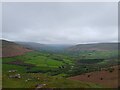
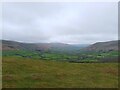
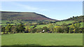
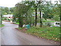
Nearby Images from Geograph Britain and Ireland:
©2023(licence)
©2023(licence)
©2007(licence)
©2011(licence)
©2019(licence)
The above images may not be of the site on this page, they are loaded from Geograph.
Please Submit an Image of this site or go out and take one for us!
Click here to see more info for this site
Nearby sites
Key: Red: member's photo, Blue: 3rd party photo, Yellow: other image, Green: no photo - please go there and take one, Grey: site destroyed
Download sites to:
KML (Google Earth)
GPX (GPS waypoints)
CSV (Garmin/Navman)
CSV (Excel)
To unlock full downloads you need to sign up as a Contributory Member. Otherwise downloads are limited to 50 sites.
Turn off the page maps and other distractions
Nearby sites listing. In the following links * = Image available
408m SSW 201° Ty-Isaf* Chambered Tomb (SO18182906)
787m NW 326° Castell Dinas* Hillfort (SO179301)
1.3km N 7° Bwlch Bach a'r Grib cairns* Cairn (SO18503070)
1.3km E 100° Pen Trumau Ring Cairn (SO196292)
2.4km WSW 244° Mynydd Troed* Chambered Tomb (SO16142842)
2.9km SW 233° Cockit Hill* Promontory Fort / Cliff Castle (SO16032774)
3.8km SSW 206° Mynydd Llangorse 2 Ring Cairn (SO166261)
3.8km SSW 206° Mynydd Llangorse 1 Ring Cairn (SO166261)
3.9km WNW 302° Penywyrlod* Chambered Tomb (SO15053156)
3.9km NNE 15° Wern Frank Wood Cairn Cairn (SO194332)
4.2km NW 317° Talgarth Hillfort (SO155326)
4.6km ESE 112° Maen Llwyd (Powys)* Standing Stone (Menhir) (SO22602762)
5.1km S 187° Coed y Gaer Cairn Cairn (SO1759324348)
5.5km N 355° Ffostil South Chambered Long Barrow* Chambered Tomb (SO179349)
5.5km S 187° Coed y Gaer Hillfort (SO176240)
5.5km N 355° Ffostil North Chambered Long Barrow* Chambered Tomb (SO17913495)
5.6km S 182° Llanfihangel Cwmdu* Ancient Cross (SO18052384)
5.6km SSE 154° Pen Alltmawr Cairns* Cairn (SO2069024330)
5.8km SSW 204° Cefn Moel Stone Row / Alignment (SO15932421)
5.8km SSW 196° Cwmdu Stone Circle (SO166239)
6.0km WSW 244° Llangors Crannog* Crannog (SO12872688)
6.2km ENE 70° Darren Esgob* Stone Circle (SO242315)
6.2km ENE 57° Blaenbwch* Standing Stone (Menhir) (SO23633271)
6.4km SSW 204° Cefn Moel Round Barrow(s) (SO156237)
6.4km NNW 346° Croes-llechau (Bronllys) Long Barrow (SO169357)
View more nearby sites and additional images


 We would like to know more about this location. Please feel free to add a brief description and any relevant information in your own language.
 Wir möchten mehr über diese Stätte erfahren. Bitte zögern Sie nicht, eine kurze Beschreibung und relevante Informationen in Deutsch hinzuzufügen.
 Nous aimerions en savoir encore un peu sur les lieux. S'il vous plaît n'hesitez pas à ajouter une courte description et tous les renseignements pertinents dans votre propre langue.
 Quisieramos informarnos un poco más de las lugares. No dude en añadir una breve descripción y otros datos relevantes en su propio idioma.