<< Our Photo Pages >> Bowl Hill Circle - Natural Stone / Erratic / Other Natural Feature in England in Gloucestershire
Submitted by Andy B on Thursday, 09 March 2023 Page Views: 2349
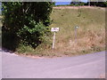
Natural PlacesSite Name: Bowl Hill CircleCountry: England County: Gloucestershire Type: Natural Stone / Erratic / Other Natural Feature
Nearest Town: Stroud Nearest Village: Woodchester
Map Ref: SO8476403248
Latitude: 51.727739N Longitude: 2.221994W
Condition:
| 5 | Perfect |
| 4 | Almost Perfect |
| 3 | Reasonable but with some damage |
| 2 | Ruined but still recognisable as an ancient site |
| 1 | Pretty much destroyed, possibly visible as crop marks |
| 0 | No data. |
| -1 | Completely destroyed |
| 5 | Superb |
| 4 | Good |
| 3 | Ordinary |
| 2 | Not Good |
| 1 | Awful |
| 0 | No data. |
| 5 | Can be driven to, probably with disabled access |
| 4 | Short walk on a footpath |
| 3 | Requiring a bit more of a walk |
| 2 | A long walk |
| 1 | In the middle of nowhere, a nightmare to find |
| 0 | No data. |
| 5 | co-ordinates taken by GPS or official recorded co-ordinates |
| 4 | co-ordinates scaled from a detailed map |
| 3 | co-ordinates scaled from a bad map |
| 2 | co-ordinates of the nearest village |
| 1 | co-ordinates of the nearest town |
| 0 | no data |
Internal Links:
External Links:
")
In 1987 the Gloucestershire Earth Mysteries group began a project to investigate the nature of a curious circular mark on the steep slopes of Bowl Hill at Rodborough in Stroud. A local exponent of Arthurian matters proposed that this circle marked the spot of King Arthur’s burial place based on writings from The Four Ancient Books of Wales and Geoffrey of Monmouth’s History of the Kings of Britain. There is a legend that seven kings, Chieftains or warriors are buried on a hillside somewhere between London and Amberley.
This vague reference point was deduced by the GEM group to be Bowl Hill as the hamlet of Little London lies underneath the hill and the village of Amberley is a short distance away to the south.
However, there is another interesting facet to this story. In the bottom of the valley beneath Bowl Hill sits the village of Woodchester. This rather inconspicuous little place was once the site of a Roman villa and one of the finest Roman mosaics in Europe is buried in situ beneath the turf in the old churchyard. The mosaic depicted the common Orpheus theme, in this particular case he is portrayed charming the birds and the beasts. The central motif of the mosaic is an octagonal shape, broken at the bottom in which Orpheus stands. The circle on Bowl Hill has been referred to as an Omega ring as it has a break at the bottom. The site of the mosaic is by chance (or maybe not) the best place from which to view the ring and this has led some to believe that the mosaic and the circle are connected.
The story pieced together by the GEM researchers is very tantalising. Could there possibly be a lost and forgotten hill figure on this Gloucestershire slope? The fact that the Roman mosaic seems connected with the ring doesn’t necessarily mean the Romans made it (the Romans are always cited as being involved with the making of hill figures but there is very little evidence for this), some involved with the research think it could have been copied by the Romans inspiring the mosaic with its octagonal centre.
The only professional eye cast over the shape came when the help of a botanist was enlisted but the results of his preliminary survey were inconclusive, although a fungal cause for the ring was ruled out. So it would seem that until the interest of local archaeologists can be aroused or perhaps someone else with a bit of clout and the necessary finances, the two pieces of this puzzle remain buried under the Gloucestershire turf.
You may be viewing yesterday's version of this page. To see the most up to date information please register for a free account.
")
Do not use the above information on other web sites or publications without permission of the contributor.
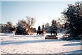
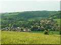
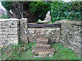
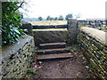
Nearby Images from Geograph Britain and Ireland:
©2005(licence)
©2008(licence)
©2021(licence)
©2021(licence)
©2005(licence)
The above images may not be of the site on this page, they are loaded from Geograph.
Please Submit an Image of this site or go out and take one for us!
Click here to see more info for this site
Nearby sites
Key: Red: member's photo, Blue: 3rd party photo, Yellow: other image, Green: no photo - please go there and take one, Grey: site destroyed
Download sites to:
KML (Google Earth)
GPX (GPS waypoints)
CSV (Garmin/Navman)
CSV (Excel)
To unlock full downloads you need to sign up as a Contributory Member. Otherwise downloads are limited to 50 sites.
Turn off the page maps and other distractions
Nearby sites listing. In the following links * = Image available
285m E 91° Rodborough Camp* Ancient Village or Settlement (SO85050324)
825m W 261° Woodchester Roman Villa* Ancient Village or Settlement (SO8394503128)
1.1km SE 139° The Horestone (Sullivan)* Standing Stone (Menhir) (SO85490240)
1.3km SE 130° The Horestone (Rodborough)* Standing Stone (Menhir) (SO85770241)
1.7km SSE 158° Whitefield's Tump* Long Barrow (SO85400170)
1.9km SSE 167° Amberley Camp* Misc. Earthwork (SO852014)
2.0km S 170° Amberley Cross Bank* Misc. Earthwork (SO85130124)
2.1km W 266° The Toots (King's Stanley)* Long Barrow (SO82700310)
2.9km WSW 239° Bown Hill Long Barrow* Long Barrow (SO82290179)
2.9km WSW 241° Bown Hill Bowl Barrow* Round Barrow(s) (SO82240184)
3.0km SSE 162° The Bulwarks (Gloucestershire)* Ancient Village or Settlement (SO857004)
3.2km WSW 249° Kings Stanley Dyke* Misc. Earthwork (SO818021)
3.3km S 170° Beaudesert Park Standing Stone* Standing Stone (Menhir) (SO853000)
3.4km SE 138° The Cobstone* Holed Stone (SO87050070)
3.8km SE 131° The Bulwarks - East 1 and 2 - Minchinhampton* Misc. Earthwork (SO87620072)
3.9km WSW 251° Woodchester Beaker Barrow* Round Barrow(s) (SO81100198)
4.0km SE 143° The Lang Stone* Standing Stone (Menhir) (SO87170004)
4.2km SE 139° Bubblewell* Standing Stone (Menhir) (SO875001)
4.3km NNW 331° Randwick Barrows* Round Barrow(s) (SO82670699)
4.3km NNW 328° Randwick Long Barrow* Long Barrow (SO82500690)
4.3km NNW 331° Randwick Cross Dyke* Misc. Earthwork (SO82690707)
4.6km ESE 112° Hyde Tumulus 1* Round Barrow(s) (SO89060149)
4.7km SW 215° Lutheredge Earthworks* Misc. Earthwork (ST82089943)
4.7km ESE 114° Hyde Tumulus 2* Round Barrow(s) (SO89070130)
4.7km SSE 163° Oldfield Wood* Chambered Tomb (ST861987)
View more nearby sites and additional images


 We would like to know more about this location. Please feel free to add a brief description and any relevant information in your own language.
 Wir möchten mehr über diese Stätte erfahren. Bitte zögern Sie nicht, eine kurze Beschreibung und relevante Informationen in Deutsch hinzuzufügen.
 Nous aimerions en savoir encore un peu sur les lieux. S'il vous plaît n'hesitez pas à ajouter une courte description et tous les renseignements pertinents dans votre propre langue.
 Quisieramos informarnos un poco más de las lugares. No dude en añadir una breve descripción y otros datos relevantes en su propio idioma.