<< Our Photo Pages >> Grey Wethers. - Stone Circle in England in Devon
Submitted by Bladup on Friday, 12 December 2014 Page Views: 30535
Neolithic and Bronze AgeSite Name: Grey Wethers. Alternative Name: Gray Wethers, Greywethers, Turner G2Country: England County: Devon Type: Stone Circle
Nearest Town: Okehampton Nearest Village: Chagford
Map Ref: SX63878313 Landranger Map Number: 191
Latitude: 50.631928N Longitude: 3.926201W
Condition:
| 5 | Perfect |
| 4 | Almost Perfect |
| 3 | Reasonable but with some damage |
| 2 | Ruined but still recognisable as an ancient site |
| 1 | Pretty much destroyed, possibly visible as crop marks |
| 0 | No data. |
| -1 | Completely destroyed |
| 5 | Superb |
| 4 | Good |
| 3 | Ordinary |
| 2 | Not Good |
| 1 | Awful |
| 0 | No data. |
| 5 | Can be driven to, probably with disabled access |
| 4 | Short walk on a footpath |
| 3 | Requiring a bit more of a walk |
| 2 | A long walk |
| 1 | In the middle of nowhere, a nightmare to find |
| 0 | No data. |
| 5 | co-ordinates taken by GPS or official recorded co-ordinates |
| 4 | co-ordinates scaled from a detailed map |
| 3 | co-ordinates scaled from a bad map |
| 2 | co-ordinates of the nearest village |
| 1 | co-ordinates of the nearest town |
| 0 | no data |
Internal Links:
External Links:
I have visited· I would like to visit
JMcG whese001 hevveh ForestDaughter Hayden would like to visit
Catrinm visited on 27th May 2024 - their rating: Cond: 4 Amb: 4 Access: 2
wildtalents couldn't find on 3rd Jul 2023 I found Fernworthy S.C. easily enough but just couldn't seem to find Greywethers. A young woman in a Renault was also driving around lost (or perhaps taking driving lessons!) and we coincided three times during my meanders around the reservoir and adjacent area. It was fun waving and grinning as kept passing one another.
Next time I'll try harder but the incessant rain and cold was a powerful disincentive to exploring more fully on foot. Some of the paths through the forest were barred and gated and I suspect if I'd guessed the right one, parked then walked, it would have been a cinch.
Phillwhite visited on 18th Jun 2021 - their rating: Cond: 4 Amb: 4 Access: 2 Like most of the Dartmoor circle, it's a bit of a trek but worth it. Via Fernworth is the best route.
lauraaurora visited on 2nd Aug 2020 - their rating: Cond: 5 Amb: 4 Access: 3
Catrinm visited on 5th May 2018 - their rating: Cond: 4 Amb: 4 Access: 2 It is indeed a long tedious walkout you can see the Fernworthy rows along the way
Reava visited on 13th Mar 2018 - their rating: Cond: 4 Access: 2
Reava visited on 27th May 2013 - their rating: Cond: 4 Amb: 4 Access: 3
jeffrep visited on 20th May 2011 - their rating: Cond: 4 Amb: 5 Access: 2 A long, long, long, long but wonderful walk across the open moor from Fernworthy Reservoir. And see Fernworthy Stone Circle on the way.
graemefield visited on 6th Jul 2008 - their rating: Cond: 4 Amb: 5 Access: 2
BolshieBoris visited on 1st Jul 1997 - their rating: Cond: 4 Amb: 4 Access: 2
cazzyjane visited - their rating: Cond: 5 Amb: 5 Access: 2
Bladup MikeGreen AngieLake hamish TheCaptain X-Ice Bolstered have visited here
Average ratings for this site from all visit loggers: Condition: 4.2 Ambience: 4.33 Access: 2.2

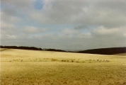
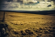
Standing 4.6m (15 feet) from one another, the north circle is 32.7m (107 feet) in diameter while the other is a mere 20cm (8 inches) larger. Now well restored, they were erected below the crest of north-facing slope, along a pass between two hills. Of course JJ didn't bother to walk, but flew over instead! (see aerial photo below)
Access: Continue along the main forest track west from Fernworthy stone circle for a kilometre or so, until you reach a gate onto the open moor. From here, turn south and head up to the saddle of the land between the forest on your left, and Sittaford Tor on your right at just over a kilometre distance.
Update October 2019: This stone circle is featured on the Prehistoric Dartmoor Walks (PDW) website - see their entries for the Grey Wethers (S) Stone Circle and the Grey Wethers Double Stone Circle. PDW tells us: "This site is one of the most impressive on Dartmoor. The circles were restored in 1909 by Burnard. At the time only 9 stones remained standing in the north circle and 7 in the south circle. It is thought that the reconstruction is fairly accurate. The circles are separated by a few meters and are almost identical. Both circles have 30 stones".
The two stone circles at this location are recorded as Pastscape Monument No. 443916 and on the Devon and Dartmoor HER as MDV6759 (The Grey Wethers southern stone circle).
Both stone circles were recorded as Historic England List ID 1018707 (Two stone circles known as The Grey Wethers, three round cairns, two ring cairns and an oval enclosure in Great Stannon Newtake).
You may be viewing yesterday's version of this page. To see the most up to date information please register for a free account.


These are just the first 25 photos of Grey Wethers.. If you log in with a free user account you will be able to see our entire collection.
Do not use the above information on other web sites or publications without permission of the contributor.
Click here to see more info for this site
Nearby sites
Key: Red: member's photo, Blue: 3rd party photo, Yellow: other image, Green: no photo - please go there and take one, Grey: site destroyed
Download sites to:
KML (Google Earth)
GPX (GPS waypoints)
CSV (Garmin/Navman)
CSV (Excel)
To unlock full downloads you need to sign up as a Contributory Member. Otherwise downloads are limited to 50 sites.
Turn off the page maps and other distractions
Nearby sites listing. In the following links * = Image available
286m SSE 149° Sittaford Tor pound* Misc. Earthwork (SX64018288)
358m SE 143° South Teignhead* Cairn (SX64088284)
559m SSE 147° White Ridge Standing Stone* Standing Stone (Menhir) (SX6416282653)
559m SSE 146° White Ridge pound* Ring Cairn (SX6416882656)
591m SSE 163° Sittaford Marsh Hut Circles* Ancient Village or Settlement (SX6402982560)
630m SW 219° Sittaford Tor Cairn* Cairn (SX6346182650)
915m WSW 248° Sittaford Stone Circle* Stone Circle (SX63018281)
1.1km NE 54° Fernworthy settlement* Ancient Village or Settlement (SX6481183777)
1.2km NE 54° Hemstone Rocks Platform Cairn Circle* Cairn (SX6485683806)
1.2km NE 52° Hemstone Rocks Ring Cairn and Cist* Cairn (SX6485283850)
1.4km SSE 162° White Ridge SW settlements* Ancient Village or Settlement (SX64258181)
1.4km NE 45° Froggymead Settlement* Ancient Village or Settlement (SX649841)
1.5km SE 128° White Ridge cairn* Round Cairn (SX65028218)
1.5km SSE 168° White Ridge SW cairn* Round Cairn (SX64158162)
1.7km S 176° Lade Hill Brook Beehive Hut* Ancient Mine, Quarry or other Industry (SX63938145)
1.9km ENE 60° Fernworthy Cairn 4* Cairn (SX65518403)
1.9km ENE 57° Fernworthy Cairn SW* Cairn (SX65478410)
1.9km ENE 58° Fernworthy stone row SE* Stone Row / Alignment (SX65498407)
1.9km ENE 57° Fernworthy* Multiple Stone Rows / Avenue (SX65488410)
1.9km ENE 57° Fernworthy stone row SW* Multiple Stone Rows / Avenue (SX6547984105)
1.9km ENE 58° Fernworthy Cairn SE* Cairn (SX65498409)
1.9km ENE 57° Fernworthy circle* Stone Circle (SX65488411)
1.9km WNW 291° Quintins Man Cairn (SX62098386)
1.9km ENE 59° Fernworthy Cairn E* Cairn (SX65568407)
2.1km NE 53° Fernworthy Cairn N* Cairn (SX65548433)
View more nearby sites and additional images


 We would like to know more about this location. Please feel free to add a brief description and any relevant information in your own language.
 Wir möchten mehr über diese Stätte erfahren. Bitte zögern Sie nicht, eine kurze Beschreibung und relevante Informationen in Deutsch hinzuzufügen.
 Nous aimerions en savoir encore un peu sur les lieux. S'il vous plaît n'hesitez pas à ajouter une courte description et tous les renseignements pertinents dans votre propre langue.
 Quisieramos informarnos un poco más de las lugares. No dude en añadir una breve descripción y otros datos relevantes en su propio idioma.