<< Text Pages >> Twyn-y-Gaer (Monmouthshire) - Hillfort in Wales in Monmouthshire
Submitted by vicky on Wednesday, 03 March 2004 Page Views: 9664
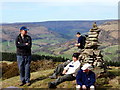
Iron Age and Later PrehistorySite Name: Twyn-y-Gaer (Monmouthshire)Country: Wales County: Monmouthshire Type: Hillfort
Nearest Town: Abergavenny Nearest Village: Crucorney Fawr
Map Ref: SO2938721948 Landranger Map Number: 161
Latitude: 51.891592N Longitude: 3.027499W
Condition:
| 5 | Perfect |
| 4 | Almost Perfect |
| 3 | Reasonable but with some damage |
| 2 | Ruined but still recognisable as an ancient site |
| 1 | Pretty much destroyed, possibly visible as crop marks |
| 0 | No data. |
| -1 | Completely destroyed |
| 5 | Superb |
| 4 | Good |
| 3 | Ordinary |
| 2 | Not Good |
| 1 | Awful |
| 0 | No data. |
| 5 | Can be driven to, probably with disabled access |
| 4 | Short walk on a footpath |
| 3 | Requiring a bit more of a walk |
| 2 | A long walk |
| 1 | In the middle of nowhere, a nightmare to find |
| 0 | No data. |
| 5 | co-ordinates taken by GPS or official recorded co-ordinates |
| 4 | co-ordinates scaled from a detailed map |
| 3 | co-ordinates scaled from a bad map |
| 2 | co-ordinates of the nearest village |
| 1 | co-ordinates of the nearest town |
| 0 | no data |
Internal Links:
External Links:
I have visited· I would like to visit
eyesopen has visited here
Have you visited this site? Please add a comment below.
You may be viewing yesterday's version of this page. To see the most up to date information please register for a free account.
Do not use the above information on other web sites or publications without permission of the contributor.
Nearby Images from Geograph Britain and Ireland:
©2010(licence)
©2008(licence)
©2012(licence)
©2012(licence)
©2015(licence)
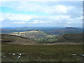
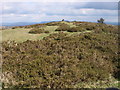
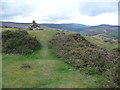
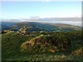
The above images may not be of the site on this page, they are loaded from Geograph.
Please Submit an Image of this site or go out and take one for us!
Click here to see more info for this site
Nearby sites
Key: Red: member's photo, Blue: 3rd party photo, Yellow: other image, Green: no photo - please go there and take one, Grey: site destroyed
Download sites to:
KML (Google Earth)
GPX (GPS waypoints)
CSV (Garmin/Navman)
CSV (Excel)
To unlock full downloads you need to sign up as a Contributory Member. Otherwise downloads are limited to 50 sites.
Turn off the page maps and other distractions
Nearby sites listing. In the following links * = Image available
1.5km NNE 19° St Martin's Church (Cwmyoy)* Ancient Cross (SO29902340)
1.6km WNW 287° Partrishow Churchyard Cross* Ancient Cross (SO2788822434)
1.6km WNW 287° Ffynnon Ishow* Holy Well or Sacred Spring (SO2784322428)
2.6km S 188° Blaenawey Well (Bettws)* Holy Well or Sacred Spring (SO290194)
2.9km ENE 68° Pen-Twyn Hillfort (SO321230)
3.3km NNW 335° Llanthony Barrow Cemetery (SO2825)
3.7km WNW 293° Disgwylfa, Cairn I* Cairn (SO2597023440)
3.7km NNW 339° Garn Wen (Monmouthshire)* Stone Circle (SO28072545)
4.9km SSE 155° Trillech Stone Row / Alignment (SO314175)
5.2km SE 134° Ysgyryd Fawr* Hillfort (SO331183)
5.7km S 177° Twyn yr Allt* Ancient Village or Settlement (SO296163)
5.8km NW 307° Nant Yr Ychen Round Cairn* Cairn (SO2476025470)
5.9km SSE 162° St Teilo's Church (Llantilio Pertholey)* Ancient Cross (SO31141633)
6.4km NNE 30° St. Clodock's Well* Holy Well or Sacred Spring (SO32692738)
6.4km NNE 29° Clodock Inscribed Stone* Carving (SO32642751)
6.5km WSW 240° Coed Ynys Faen* Standing Stones (SO237188)
6.8km N 3° Wiral Cairn* Cairn (SO2985028710)
6.8km SW 232° Golden Grove* Standing Stone (Menhir) (SO2396217829)
6.9km WSW 259° Crug Hywel* Hillfort (SO226207)
7.4km WSW 242° Llangenny Camp* Hillfort (SO228186)
7.5km N 359° Crucorney Fawr 2 Round Cairn (SO293294)
7.7km W 272° Pen Cerrig-calch* Cairn (SO21702236)
7.8km S 174° Abergavenny Priory Cross* Ancient Cross (SO3009514184)
7.9km N 356° Crucorney Fawr 1 Round Cairn (SO290298)
8.0km SW 229° Cwrt-y-Gollen* Standing Stone (Menhir) (SO2324116860)
View more nearby sites and additional images


 We would like to know more about this location. Please feel free to add a brief description and any relevant information in your own language.
 Wir möchten mehr über diese Stätte erfahren. Bitte zögern Sie nicht, eine kurze Beschreibung und relevante Informationen in Deutsch hinzuzufügen.
 Nous aimerions en savoir encore un peu sur les lieux. S'il vous plaît n'hesitez pas à ajouter une courte description et tous les renseignements pertinents dans votre propre langue.
 Quisieramos informarnos un poco más de las lugares. No dude en añadir una breve descripción y otros datos relevantes en su propio idioma.