<< Our Photo Pages >> Woodhouses - Hillfort in England in Cheshire
Submitted by Andy B on Monday, 18 March 2024 Page Views: 15355
Iron Age and Later PrehistorySite Name: WoodhousesCountry: England County: Cheshire Type: Hillfort
Nearest Town: Helsby Nearest Village: Alvanley
Map Ref: SJ511757 Landranger Map Number: 117
Latitude: 53.276014N Longitude: 2.73478W
Condition:
| 5 | Perfect |
| 4 | Almost Perfect |
| 3 | Reasonable but with some damage |
| 2 | Ruined but still recognisable as an ancient site |
| 1 | Pretty much destroyed, possibly visible as crop marks |
| 0 | No data. |
| -1 | Completely destroyed |
| 5 | Superb |
| 4 | Good |
| 3 | Ordinary |
| 2 | Not Good |
| 1 | Awful |
| 0 | No data. |
| 5 | Can be driven to, probably with disabled access |
| 4 | Short walk on a footpath |
| 3 | Requiring a bit more of a walk |
| 2 | A long walk |
| 1 | In the middle of nowhere, a nightmare to find |
| 0 | No data. |
| 5 | co-ordinates taken by GPS or official recorded co-ordinates |
| 4 | co-ordinates scaled from a detailed map |
| 3 | co-ordinates scaled from a bad map |
| 2 | co-ordinates of the nearest village |
| 1 | co-ordinates of the nearest town |
| 0 | no data |
Internal Links:
External Links:
")
Excavations in 1951 showed that the rampart was originally 4m high and revetted with stone on both sides.
References: D.M.Longley “Prehistory” in C.R.Elrington (ed) “The Victoria History of the County of Chester, volume 1, Oxford University Press (1987)
Page originally by Vicky.
Note: A couple of radio features from 2021 you may not have heard, with Dr Seren Griffiths, details in the comments
You may be viewing yesterday's version of this page. To see the most up to date information please register for a free account.
")
Do not use the above information on other web sites or publications without permission of the contributor.
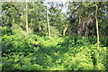
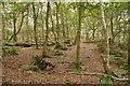
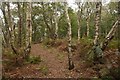
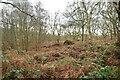
Nearby Images from Geograph Britain and Ireland:
©2015(licence)
©2019(licence)
©2019(licence)
©2021(licence)
©2015(licence)
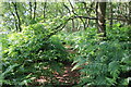
The above images may not be of the site on this page, they are loaded from Geograph.
Please Submit an Image of this site or go out and take one for us!
Click here to see more info for this site
Nearby sites
Key: Red: member's photo, Blue: 3rd party photo, Yellow: other image, Green: no photo - please go there and take one, Grey: site destroyed
Download sites to:
KML (Google Earth)
GPX (GPS waypoints)
CSV (Garmin/Navman)
CSV (Excel)
To unlock full downloads you need to sign up as a Contributory Member. Otherwise downloads are limited to 50 sites.
Turn off the page maps and other distractions
Nearby sites listing. In the following links * = Image available
1.8km NNE 18° Synagogue Well Holy Well or Sacred Spring (SJ51687742)
1.8km W 260° Helsby Hill* Hillfort (SJ493754)
3.0km ENE 68° Bradley Earthworks* Hillfort (SJ539768)
3.3km SE 133° Castle Cob* Round Barrow(s) (SJ535734)
4.1km SE 138° Glead Hill Cob Round Barrow(s) (SJ538726)
7.0km W 260° St Mary (Thornton Le Moors)* Ancient Cross (SJ44157455)
7.3km SSE 160° Delamere Stone Circle (SJ536688)
7.3km SE 126° Gallowsclough Cob* Round Barrow(s) (SJ570713)
7.6km SE 146° Castle Ditch Eddisbury* Hillfort (SJ553694)
7.8km SW 223° St Plegmund's Well* Holy Well or Sacred Spring (SJ457701)
8.4km SSE 165° Kelsborrow Castle* Hillfort (SJ5315567509)
9.5km SSE 157° Whistlebitch Well* Holy Well or Sacred Spring (SJ548669)
10.1km SSE 148° Seven Lows Round Barrow(s) (SJ56336703)
10.2km SE 140° Oakmere* Ancient Village or Settlement (SJ576678)
10.3km SSE 146° Seven Lows* Round Barrow(s) (SJ567671)
10.4km SSE 155° High Billinge* Round Barrow(s) (SJ5548066242)
11.2km ENE 71° Whitley Village Round Barrow(s) (SJ617793)
11.9km SE 132° Long Stone Cross* Ancient Cross (SJ599677)
11.9km S 186° Brookhouse Farm Ancient Village or Settlement (SJ497639)
12.1km N 2° St Luke's Church (Farnworth) Ancient Cross (SJ5171287749)
13.1km SSE 161° Salterswell* Holy Well or Sacred Spring (SJ552632)
13.3km NW 319° Camp Hill (Woolton) Hillfort (SJ424858)
13.6km SW 225° Billy Hobby's Well* Holy Well or Sacred Spring (SJ4127766202)
14.0km SW 226° St John the Baptist Church, Chester* Ancient Cross (SJ40916613)
14.0km SW 226° Roman Amphitheatre (Chester)* Ancient Temple (SJ40836616)
View more nearby sites and additional images


 We would like to know more about this location. Please feel free to add a brief description and any relevant information in your own language.
 Wir möchten mehr über diese Stätte erfahren. Bitte zögern Sie nicht, eine kurze Beschreibung und relevante Informationen in Deutsch hinzuzufügen.
 Nous aimerions en savoir encore un peu sur les lieux. S'il vous plaît n'hesitez pas à ajouter une courte description et tous les renseignements pertinents dans votre propre langue.
 Quisieramos informarnos un poco más de las lugares. No dude en añadir una breve descripción y otros datos relevantes en su propio idioma.