<< Our Photo Pages >> Castle Ditches (Wiltshire) - Hillfort in England in Wiltshire

Submitted by JimChampion on Tuesday, 30 December 2003  Page Views: 15069

Iron Age and Later PrehistorySite Name: Castle Ditches (Wiltshire) Alternative Name: Spelsbury
Country: England County: Wiltshire Type: Hillfort
Nearest Town: Tisbury  Nearest Village: Swallowcliffe
Map Ref: ST963283  Landranger Map Number: 184
Latitude: 51.054031N  Longitude: 2.054165W
Condition:
5Perfect
4Almost Perfect
3Reasonable but with some damage
2Ruined but still recognisable as an ancient site
1Pretty much destroyed, possibly visible as crop marks
0No data.
-1Completely destroyed
4 Ambience:
5Superb
4Good
3Ordinary
2Not Good
1Awful
0No data.
3 Access:
5Can be driven to, probably with disabled access
4Short walk on a footpath
3Requiring a bit more of a walk
2A long walk
1In the middle of nowhere, a nightmare to find
0No data.
3 Accuracy:
5co-ordinates taken by GPS or official recorded co-ordinates
4co-ordinates scaled from a detailed map
3co-ordinates scaled from a bad map
2co-ordinates of the nearest village
1co-ordinates of the nearest town
0no data
3

Internal Links:
External Links:

Castle Ditches (Wiltshire)
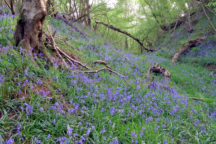
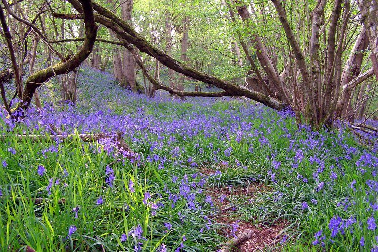
Castle Ditches (Wiltshire) submitted by JimChampion : The approach to the southeast side of Castle Ditches is flat, and the earthwork defences on this side are multiplied. This photo is a view along one of the ditches, from the eastern corner, with the hillfort interior towards the right. The earthworks are all densely wooded and at this time of year the ground is thick with bluebells. (Vote or comment on this photo)
Hillfort in Wiltshire

Have you visited this site? Please add a comment below.
You may be viewing yesterday's version of this page. To see the most up to date information please register for a free account.
Castle Ditches (Wiltshire)
Castle Ditches (Wiltshire) submitted by JimChampion : A profusion of bluebells, growing on the outer earthworks at the eastern corner of Castle Ditches. There are an additional two outer banks at the eastern corner, presumably to provide extra defences on the least-steep approach from the southeast. These may have continued along the southeast edge, beyond the original entrance, but any obvious evidence has been ploughed away in the intervening centu... (1 comment - Vote or comment on this photo)

Castle Ditches (Wiltshire)
Castle Ditches (Wiltshire) submitted by JimChampion : This is the end of the central bank on the southeastern side of the hillfort, where the original entrance cuts through it. It is now overgrown with hazel, birch and beech. (Vote or comment on this photo)

Castle Ditches (Wiltshire)
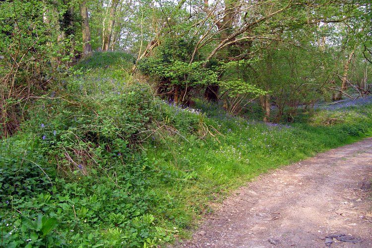
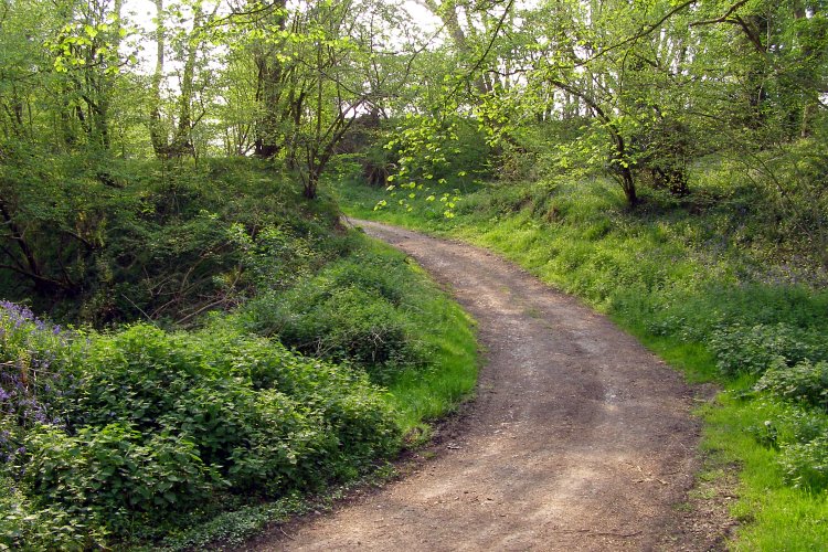
Castle Ditches (Wiltshire) submitted by JimChampion : This track winds its way through the multiple earthwork defences on Castle Ditches' southeast side, headed for the interior of the hillfort. (Vote or comment on this photo)

Castle Ditches (Wiltshire)
Castle Ditches (Wiltshire) submitted by JimChampion : The original entrance to Castle Ditches hillfort winds its way through the many banks and ditches on the southeastern side. This view is on the way out of the hillfort, with the butt end of one of the huge banks to the left. (Vote or comment on this photo)

Castle Ditches (Wiltshire)
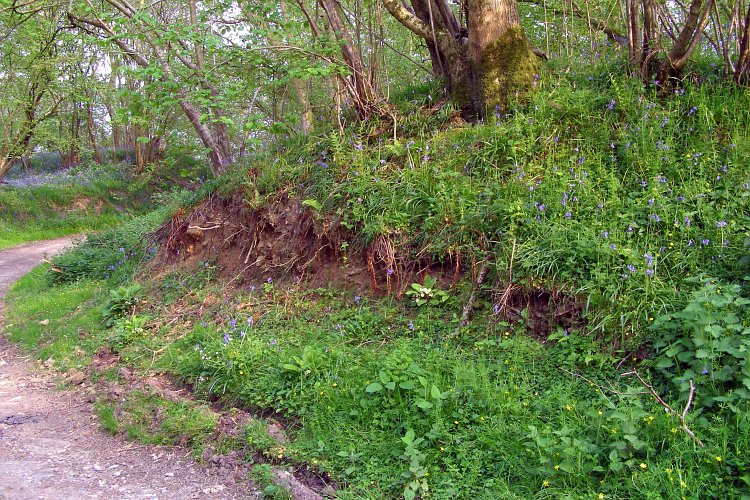
Castle Ditches (Wiltshire) submitted by JimChampion : Bluebells and beech trees growing on the steep inner face of the outer bank, viewed from the track through the original entrance to the hillfort on the souteastern side. There is a deep ditch between the outer bank and the middle bank.

Castle Ditches (Wiltshire)
Castle Ditches (Wiltshire) submitted by JimChampion : Looking southwest along the outer bank and ditch from the original entrance on the southeastern side of the hillfort. Rights of way pass by the hillfort, but the interior is privately owned.

Castle Ditches (Wiltshire)
Castle Ditches (Wiltshire) submitted by JimChampion : View northwest towards Castle Ditches hillfort, with a field of bright yellow blooming rape in the foreground. On this side the hillfort is approached up a long gentle greensand hill from the foot of the chalk escarpment at Buxbury Hill and Swallowcliffe Down. The earthworks are multiplied on this side where it does not have a naturally steep scarps to protect it. The banks and ditches are now hea... (3 comments)

Castle Ditches (Wiltshire)
Castle Ditches (Wiltshire) submitted by JimChampion : Approaching the interior of Castle Ditches hillfort through the original entrance on the southeastern side. Along this side there is an additional inner bank, which can be seen here on the right and left where the track cuts through it. The interior is now used to rear game birds (hence the shelter on the left).

Do not use the above information on other web sites or publications without permission of the contributor.
Click here to see more info for this site

Nearby sites

Click here to view sites on an interactive OS map

Key: Red: member's photo, Blue: 3rd party photo, Yellow: other image, Green: no photo - please go there and take one, Grey: site destroyed

Download sites to:
KML (Google Earth)
GPX (GPS waypoints)
CSV (Garmin/Navman)
CSV (Excel)

To unlock full downloads you need to sign up as a Contributory Member. Otherwise downloads are limited to 50 sites.


Turn off the page maps and other distractions

Nearby sites listing. In the following links * = Image available
 2.0km NW 323° Tisbury Circle* Stone Circle (ST951299)
 2.5km ESE 124° Buxbury Hill* Round Barrow(s) (ST984269)
 2.8km SE 134° Sutton Down long barrow* Long Barrow (ST983264)
 4.3km S 190° Gallows Hill, Wiltshire Round Barrow(s) (ST95542411)
 4.6km SSW 207° White Sheet Hill Long Barrow (ST94242419)
 4.8km NNE 33° Teffont Magna - St. Edwards Church* Ancient Cross (ST98923237)
 5.1km NNE 26° Spring Head Holy Well or Sacred Spring (ST9855732867)
 5.5km E 92° Chiselbury* Hillfort (SU018281)
 6.6km S 190° Winklebury Camp (Wiltshire) Hillfort (ST952218)
 7.1km SSE 164° South Down Ox Drove Tumuli* Round Barrow(s) (ST982215)
 8.0km WSW 247° Castle Rings* Hillfort (ST889251)
 8.0km SE 135° Marleycombe Hill, earthworks* Misc. Earthwork (SU020226)
 8.4km NNW 338° Grim's Ditch 3 (Wiltshire) Misc. Earthwork (ST931361)
 8.6km WNW 285° St Mary the Virgin (East Knoyle)* Ancient Cross (ST880305)
 8.7km SW 223° Chapel Well (Donhead St Mary) Holy Well or Sacred Spring (ST90372196)
 9.2km NNE 31° Bilbury Rings Hillfort (SU01013620)
 9.4km SSE 160° Mistlebury* Hillfort (ST99581948)
 9.7km SSE 150° Bokerley Dyke Misc. Earthwork (SU01241990)
 10.1km SE 135° Vernditch Chase (North)* Long Barrow (SU03402113)
 10.4km S 175° Scrubbity Barrows* Barrow Cemetery (ST97201789)
 10.7km SE 138° Vernditch Chase (South)* Long Barrow (SU035204)
 10.9km N 3° Sherrington Long Barrow* Long Barrow (ST9687239179)
 10.9km N 358° Sherrington Motte Artificial Mound (ST96003923)
 11.3km WNW 289° Puckwell* Holy Well or Sacred Spring (ST856319)
 11.5km SE 136° Martin Down Enclosure* Ancient Village or Settlement (SU043200)
View more nearby sites and additional images

<< Maiden Castle (Cheshire)

Rocky Valley >>

Please add your thoughts on this site

Stonehenge Complete

Stonehenge Complete

Sponsors

Auto-Translation (Google)

Translate from English into:

"Castle Ditches (Wiltshire)" | Login/Create an Account | 1 comment
  
Go back to top of page    Comments are owned by the poster. We aren't responsible for their content.
Re: Castle Ditches (Wiltshire) by JimChampion on Friday, 11 May 2007
(User Info | Send a Message)
From The Ancient History of Wiltshire by Sir Richard Colt Hoare (published 1812) Chapter No. 11 - Station 8: Fovant.


CASTLE DITCHES; but probably its ancient name was SPELSBURY, as a village immediately beneath it, still retains that appellation. It is so surrounded by corn fields and wood, that I perceived no signs of it until I found myself almost within the area of the camp. Its situation is very commanding, and many beautiful points of view are caught from its summit. This earthen work is strengthened by a triple row of ramparts, which are covered on three sides with wood. I can only speak with certainty respecting one entrance, which was towards the south-east; but there is a narrow adit on the opposite side. The area within the entrenchment, contains twenty-three acres and three quarters; the circuit of the outward vallum is seven furlongs, eighty-eight yards; and the height of the ramparts is about forty feet. The entire area of this camp is under tillage, and the greater part of the ramparts is so concealed by thick copse wood, that no adequate idea of their strength and boldness can possibly be formed.
The northern side and western sides of this Station, which are bounded by the river Nadder, have been for many years in a state of successive cultivation In vain therefore we may search for those antiquities which come peculiarly within the scope of our inquiry. From the name of Tisbury, I should have concluded there had been some earthen work or bury in its immediate neighbourhood, but I have never gained intelligence of any that is nearer to it than the strong camp of CASTLE DITCHES which has already been described.


Engraving of the camp's plan on Wiltshire County Council's website.
[ Reply to This ]

Your Name: Anonymous [ Register Now ]
Subject:


Add your comment or contribution to this page. Spam or offensive posts are deleted immediately, don't even bother

<<< What is five plus one as a number? (Please type the answer to this question in the little box on the left)
You can also embed videos and other things. For Youtube please copy and paste the 'embed code'.
For Google Street View please include Street View in the text.
Create a web link like this: <a href="https://www.megalithic.co.uk">This is a link</a>  

Allowed HTML is:
<p> <b> <i> <a> <img> <em> <br> <strong> <blockquote> <tt> <li> <ol> <ul> <object> <param> <embed> <iframe>

We would like to know more about this location. Please feel free to add a brief description and any relevant information in your own language.
Wir möchten mehr über diese Stätte erfahren. Bitte zögern Sie nicht, eine kurze Beschreibung und relevante Informationen in Deutsch hinzuzufügen.
Nous aimerions en savoir encore un peu sur les lieux. S'il vous plaît n'hesitez pas à ajouter une courte description et tous les renseignements pertinents dans votre propre langue.
Quisieramos informarnos un poco más de las lugares. No dude en añadir una breve descripción y otros datos relevantes en su propio idioma.