<< Our Photo Pages >> The King's Standing - Round Barrow(s) in England in West Midlands
Submitted by Baz on Wednesday, 09 May 2007 Page Views: 11036
Neolithic and Bronze AgeSite Name: The King's StandingCountry: England
NOTE: This site is 3.194 km away from the location you searched for.
County: West Midlands Type: Round Barrow(s)
Nearest Town: Sutton Coldfield
Map Ref: SP080956
Latitude: 52.558180N Longitude: 1.88343W
Condition:
| 5 | Perfect |
| 4 | Almost Perfect |
| 3 | Reasonable but with some damage |
| 2 | Ruined but still recognisable as an ancient site |
| 1 | Pretty much destroyed, possibly visible as crop marks |
| 0 | No data. |
| -1 | Completely destroyed |
| 5 | Superb |
| 4 | Good |
| 3 | Ordinary |
| 2 | Not Good |
| 1 | Awful |
| 0 | No data. |
| 5 | Can be driven to, probably with disabled access |
| 4 | Short walk on a footpath |
| 3 | Requiring a bit more of a walk |
| 2 | A long walk |
| 1 | In the middle of nowhere, a nightmare to find |
| 0 | No data. |
| 5 | co-ordinates taken by GPS or official recorded co-ordinates |
| 4 | co-ordinates scaled from a detailed map |
| 3 | co-ordinates scaled from a bad map |
| 2 | co-ordinates of the nearest village |
| 1 | co-ordinates of the nearest town |
| 0 | no data |
Be the first person to rate this site - see the 'Contribute!' box in the right hand menu.
Internal Links:
External Links:
")
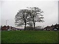
Baz writes "The King`s Standing Barrow, Kingstanding Lane, Kingstanding, Birmingham [is] so called because King Charles I stood on it during the Civil War to address his local recruits, on 19th October 1642."
You may be viewing yesterday's version of this page. To see the most up to date information please register for a free account.
Do not use the above information on other web sites or publications without permission of the contributor.
SteveDut has found this location on Google Street View:
Nearby Images from Geograph Britain and Ireland:
©2018(licence)
©2018(licence)
©2018(licence)
©2020(licence)
©2018(licence)
The above images may not be of the site on this page, they are loaded from Geograph.
Please Submit an Image of this site or go out and take one for us!
Click here to see more info for this site
Nearby sites
Key: Red: member's photo, Blue: 3rd party photo, Yellow: other image, Green: no photo - please go there and take one, Grey: site destroyed
Download sites to:
KML (Google Earth)
GPX (GPS waypoints)
CSV (Garmin/Navman)
CSV (Excel)
To unlock full downloads you need to sign up as a Contributory Member. Otherwise downloads are limited to 50 sites.
Turn off the page maps and other distractions
Nearby sites listing. In the following links * = Image available
1.5km NE 55° Rowton Well* Holy Well or Sacred Spring (SP0927496487)
2.7km ENE 68° Keeper's Well* Holy Well or Sacred Spring (SP1049296613)
3.2km NE 42° Druid's Well (Sutton Park) Holy Well or Sacred Spring (SP1016297991)
7.0km SW 232° St Augustine's Well (Sandwell)* Holy Well or Sacred Spring (SP0248391296)
8.2km SSW 196° War Stone* Natural Stone / Erratic / Other Natural Feature (SP058877)
8.5km NE 54° St Modwen's Well (Canwell) Holy Well or Sacred Spring (SK14890058)
8.8km S 189° Birmingham Museum & Art Gallery Museum (SP066869)
9.2km W 268° Ethelfleda's Hill Fort (Wednesdbury) Hillfort (SO9880095300)
11.2km N 9° Wall Roman sites (Letocetum)* Ancient Village or Settlement (SK0977506660)
12.6km SSW 195° Lapworth Museum Museum (SP047834)
13.0km ESE 117° Beggars Well* Holy Well or Sacred Spring (SP1962989822)
13.6km S 174° Moseley Bog Burnt Mound* Artificial Mound (SP0934382043)
13.8km NW 318° The Great Stones of Landywood* Stone Circle (SJ9872805826)
14.1km SSE 162° Burnt mound in Fox Hollies Park* Artificial Mound (SP1247182177)
15.1km ENE 57° St Ruffin's Well (Tamworth)* Holy Well or Sacred Spring (SK207038)
15.3km NNE 16° St Chad's Well (Lichfield)* Holy Well or Sacred Spring (SK122103)
16.6km NNW 347° Nun's Well (Cannock Wood)* Holy Well or Sacred Spring (SK04151180)
16.8km W 281° St Peter (Wolverhampton)* Ancient Cross (SO9141998765)
17.0km WNW 281° The Bargain Stone* Holed Stone (SO913989)
17.5km NNW 349° Castle Ring (Staffordshire)* Hillfort (SK045128)
17.6km WNW 286° Wulfruna's Well* Holy Well or Sacred Spring (SJ9102600470)
17.7km WNW 282° West Park (Wolverhampton)* Natural Stone / Erratic / Other Natural Feature (SO90609912)
17.9km S 175° Berry Mound* Hillfort (SP095778)
18.5km W 269° Lady Godiva's Cross* Ancient Cross (SO89439528)
20.1km SW 222° St Kenelm's Well* Holy Well or Sacred Spring (SO9444280755)
View more nearby sites and additional images


 We would like to know more about this location. Please feel free to add a brief description and any relevant information in your own language.
 Wir möchten mehr über diese Stätte erfahren. Bitte zögern Sie nicht, eine kurze Beschreibung und relevante Informationen in Deutsch hinzuzufügen.
 Nous aimerions en savoir encore un peu sur les lieux. S'il vous plaît n'hesitez pas à ajouter une courte description et tous les renseignements pertinents dans votre propre langue.
 Quisieramos informarnos un poco más de las lugares. No dude en añadir una breve descripción y otros datos relevantes en su propio idioma.