<< Text Pages >> Saturday Creek - Ancient Village or Settlement in Belize
Submitted by bat400 on Monday, 26 April 2010 Page Views: 5652
Multi-periodSite Name: Saturday CreekCountry: Belize
NOTE: This site is 7.493 km away from the location you searched for.
Type: Ancient Village or Settlement
Nearest Town: Belmopan, Belize
Latitude: 17.316700N Longitude: 88.7667W
Condition:
| 5 | Perfect |
| 4 | Almost Perfect |
| 3 | Reasonable but with some damage |
| 2 | Ruined but still recognisable as an ancient site |
| 1 | Pretty much destroyed, possibly visible as crop marks |
| 0 | No data. |
| -1 | Completely destroyed |
| 5 | Superb |
| 4 | Good |
| 3 | Ordinary |
| 2 | Not Good |
| 1 | Awful |
| 0 | No data. |
| 5 | Can be driven to, probably with disabled access |
| 4 | Short walk on a footpath |
| 3 | Requiring a bit more of a walk |
| 2 | A long walk |
| 1 | In the middle of nowhere, a nightmare to find |
| 0 | No data. |
| 5 | co-ordinates taken by GPS or official recorded co-ordinates |
| 4 | co-ordinates scaled from a detailed map |
| 3 | co-ordinates scaled from a bad map |
| 2 | co-ordinates of the nearest village |
| 1 | co-ordinates of the nearest town |
| 0 | no data |
Be the first person to rate this site - see the 'Contribute!' box in the right hand menu.
Internal Links:
External Links:
Ancient Village or Settlement in Belize.A small Mayan center from the Classic period (250-900AD). The site is being excavated to determine the lifestyle of common people, away from urban centers.
The location given is general for the site.
Note: Classic Mayan culture preserved by common people. Small home "renewal" instead of layered pyramids. Family burials under living space instead of royal tombs.
You may be viewing yesterday's version of this page. To see the most up to date information please register for a free account.
Do not use the above information on other web sites or publications without permission of the contributor.
Nearby Images from Flickr

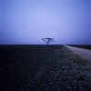
The above images may not be of the site on this page, but were taken nearby. They are loaded from Flickr so please click on them for image credits.
Click here to see more info for this site
Nearby sites
Click here to view sites on an interactive map of the areaKey: Red: member's photo, Blue: 3rd party photo, Yellow: other image, Green: no photo - please go there and take one, Grey: site destroyed
Download sites to:
KML (Google Earth)
GPX (GPS waypoints)
CSV (Garmin/Navman)
CSV (Excel)
To unlock full downloads you need to sign up as a Contributory Member. Otherwise downloads are limited to 50 sites.
Turn off the page maps and other distractions
Nearby sites listing. In the following links * = Image available
15.4km NW 316° Cara Blanca Natural Stone / Erratic / Other Natural Feature
37.8km WSW 240° Cahal Pech Ancient Village or Settlement
39.9km SW 235° Chaa Creek* Ancient Village or Settlement
40.8km W 260° El Pilar* Ancient Village or Settlement
47.1km WSW 238° Xunantunich* Ancient Village or Settlement
49.9km NNE 14° Lamanai Ancient Village or Settlement
51.4km W 276° Cival Ancient Village or Settlement
53.8km W 270° Holmul Ancient Village or Settlement
56.4km WSW 249° Naranjo* Ancient Village or Settlement
62.3km NNW 347° Blue Creek Ancient Village or Settlement
62.5km WNW 291° Xultun Ancient Village or Settlement
62.6km NNW 348° Medicinal Trail Ancient Village or Settlement
66.7km NE 42° Altun Ha Ancient Village or Settlement
69.6km WSW 257° Nakum* Ancient Village or Settlement
71.9km SSW 211° Caracol Ancient Village or Settlement
72.3km WNW 291° San Bartolo* Ancient Village or Settlement
72.6km WSW 248° Yaxha* Ancient Village or Settlement
79.7km WSW 242° Holtun* Ancient Village or Settlement
86.6km S 183° Quebrada de Oro Ancient Village or Settlement
92.2km W 264° Tikal* Ancient Village or Settlement
92.5km W 275° Uaxactun* Ancient Village or Settlement
101.4km WSW 237° Chilonche Ancient Village or Settlement
101.9km N 11° Noh Mul Pyramid* Pyramid / Mastaba
104.9km WSW 249° Ixlú Ancient Village or Settlement
109.3km W 268° El Zotz* Ancient Village or Settlement
View more nearby sites and additional images


 We would like to know more about this location. Please feel free to add a brief description and any relevant information in your own language.
 Wir möchten mehr über diese Stätte erfahren. Bitte zögern Sie nicht, eine kurze Beschreibung und relevante Informationen in Deutsch hinzuzufügen.
 Nous aimerions en savoir encore un peu sur les lieux. S'il vous plaît n'hesitez pas à ajouter une courte description et tous les renseignements pertinents dans votre propre langue.
 Quisieramos informarnos un poco más de las lugares. No dude en añadir una breve descripción y otros datos relevantes en su propio idioma.