<< Other Photo Pages >> Las Caritas de Los Indios - Rock Art in Caribbean Islands
Submitted by KaiHofmann on Tuesday, 01 October 2013 Page Views: 7071
Rock ArtSite Name: Las Caritas de Los IndiosCountry: Caribbean Islands
NOTE: This site is 54.431 km away from the location you searched for.
Type: Rock Art
Nearest Town: La Descubierta
Latitude: 18.560148N Longitude: 71.687707W
Condition:
| 5 | Perfect |
| 4 | Almost Perfect |
| 3 | Reasonable but with some damage |
| 2 | Ruined but still recognisable as an ancient site |
| 1 | Pretty much destroyed, possibly visible as crop marks |
| 0 | No data. |
| -1 | Completely destroyed |
| 5 | Superb |
| 4 | Good |
| 3 | Ordinary |
| 2 | Not Good |
| 1 | Awful |
| 0 | No data. |
| 5 | Can be driven to, probably with disabled access |
| 4 | Short walk on a footpath |
| 3 | Requiring a bit more of a walk |
| 2 | A long walk |
| 1 | In the middle of nowhere, a nightmare to find |
| 0 | No data. |
| 5 | co-ordinates taken by GPS or official recorded co-ordinates |
| 4 | co-ordinates scaled from a detailed map |
| 3 | co-ordinates scaled from a bad map |
| 2 | co-ordinates of the nearest village |
| 1 | co-ordinates of the nearest town |
| 0 | no data |
Be the first person to rate this site - see the 'Contribute!' box in the right hand menu.
Internal Links:
External Links:
Rock Art in Dominicana
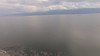
Rock art at the Lago Enriquillo in the Dominican Republic.
You may be viewing yesterday's version of this page. To see the most up to date information please register for a free account.
")
")
")
Do not use the above information on other web sites or publications without permission of the contributor.
Nearby Images from Flickr

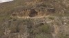
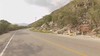
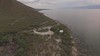
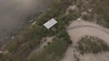
The above images may not be of the site on this page, but were taken nearby. They are loaded from Flickr so please click on them for image credits.
Click here to see more info for this site
Nearby sites
Click here to view sites on an interactive map of the areaKey: Red: member's photo, Blue: 3rd party photo, Yellow: other image, Green: no photo - please go there and take one, Grey: site destroyed
Download sites to:
KML (Google Earth)
GPX (GPS waypoints)
CSV (Garmin/Navman)
CSV (Excel)
To unlock full downloads you need to sign up as a Contributory Member. Otherwise downloads are limited to 50 sites.
Turn off the page maps and other distractions
Nearby sites listing. In the following links * = Image available
171.1km ENE 71° Raul de Monteclaro (Dominican Rep) Rock Art
189.5km E 93° Padre Nuestro Caves (Dominican Republic) Rock Art
498.9km WNW 303° Chorro de Maita Ancient Village or Settlement
518.5km E 92° Caguana* Standing Stones
532.1km E 90° La Cueva del Indio (Puerto Rico)* Rock Art
539.4km E 96° Ponce Plaza (Puerto Rico) Rock Art
767.9km SSE 157° Curaçao Hato Caves Rock Art
842.2km SSW 197° El Pueblito Ancient Village or Settlement
870.3km SSW 196° Ciudad Perdida* Ancient Village or Settlement
1066.6km E 98° Indian Creek Ancient Village or Settlement
1104.7km ESE 104° Trois Rivières Rock Carvings Rock Art
1118.9km NW 317° Bimini Road Natural Stone / Erratic / Other Natural Feature
1158.7km NW 311° Key Largo Rock Mound Ancient Temple
1172.4km S 180° El Porvenir Not Known (by us)
1186.3km NW 314° Miami Circle Rock Art
1186.9km NW 312° Coral Castle* Modern Stone Circle etc
1192.5km NW 314° El Portal Burial Mound* Artificial Mound
1194.4km NW 315° Arch Creek Middens, Florida* Ancient Village or Settlement
1261.2km ESE 116° St Vincent - Borrouallie* Rock Art
1264.0km ESE 117° St Vincent, Buccament* Rock Art
1267.5km NW 319° Jupiter Inlet Mound* Artificial Mound
1273.3km ESE 116° St Vincent, Colonarie* Rock Art
1275.5km ESE 116° St Vincent - Yambou Pass* Rock Art
1282.2km ESE 122° Rock Art near Victoria, Grenada* Rock Art
1282.5km ESE 122° Rock Art near Waltham, Victoria, Grenada* Rock Art
View more nearby sites and additional images


 We would like to know more about this location. Please feel free to add a brief description and any relevant information in your own language.
 Wir möchten mehr über diese Stätte erfahren. Bitte zögern Sie nicht, eine kurze Beschreibung und relevante Informationen in Deutsch hinzuzufügen.
 Nous aimerions en savoir encore un peu sur les lieux. S'il vous plaît n'hesitez pas à ajouter une courte description et tous les renseignements pertinents dans votre propre langue.
 Quisieramos informarnos un poco más de las lugares. No dude en añadir una breve descripción y otros datos relevantes en su propio idioma.