<< Other Photo Pages >> Toolesboro Mound Group - Artificial Mound in United States in Great Lakes Midwest
Submitted by AKFisher on Friday, 22 December 2023 Page Views: 2487
Multi-periodSite Name: Toolesboro Mound Group Alternative Name: Toolesboro Mounds National Historic LandmarkCountry: United States
NOTE: This site is 69.5 km away from the location you searched for.
Region: Great Lakes Midwest Type: Artificial Mound
Nearest Town: Oakville, IA
Latitude: 41.150030N Longitude: 91.05W
Condition:
| 5 | Perfect |
| 4 | Almost Perfect |
| 3 | Reasonable but with some damage |
| 2 | Ruined but still recognisable as an ancient site |
| 1 | Pretty much destroyed, possibly visible as crop marks |
| 0 | No data. |
| -1 | Completely destroyed |
| 5 | Superb |
| 4 | Good |
| 3 | Ordinary |
| 2 | Not Good |
| 1 | Awful |
| 0 | No data. |
| 5 | Can be driven to, probably with disabled access |
| 4 | Short walk on a footpath |
| 3 | Requiring a bit more of a walk |
| 2 | A long walk |
| 1 | In the middle of nowhere, a nightmare to find |
| 0 | No data. |
| 5 | co-ordinates taken by GPS or official recorded co-ordinates |
| 4 | co-ordinates scaled from a detailed map |
| 3 | co-ordinates scaled from a bad map |
| 2 | co-ordinates of the nearest village |
| 1 | co-ordinates of the nearest town |
| 0 | no data |
Internal Links:
External Links:
")
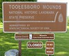
The Toolesboro Mound Group, a National Historic Landmark, is a group of Havana Hopewell culture earthworks on the north bank of the Iowa River near its discharge into the Mississippi. The mounds are owned and displayed to the public by the State Historical Society of Iowa. The mound group is located east of Wapello, Iowa, near the unincorporated community of Toolesboro.
Building the Mounds:
The mouth of the Iowa River was a superb location for people skilled in hunting and the gathering of food. Wild plants living in the rich alluvial soil of the two rivers could be supplemented with fish, shellfish, and waterfowl.
The Hopewell culture was a Native American celebration of the economic surplus, in food and other goods, created by harvesting the natural wealth of the American Midwest. Native Americans, in the Hopewell period, buried their dead in earthen mounds, accompanied by grave goods that displayed their status and possibly their religious and social leadership.
Grave goods discovered in Hopewell mounds include copper from Lake Superior, sea shells from the Gulf of Mexico, mica from the Appalachian Mountains, and obsidian from the region of what is now Yellowstone National Park.
It is believed that the Hopewell Interaction Sphere had extensive trading relationships that enabled them to transfer large quantities of high-status goods across wide sections of the North American continent. The Hopewell of the Toolesboro area would have been able to export blades cut from local flint. Local freshwater pearls were another highly prized item, exported and distributed over a wide area.
The surviving mounds of the Toolesboro Mound Group were built by the Havana Hopewell culture sometime between 200 BCE and 100 CE. The status of the people buried in the mounds indicates that the mounds were raised by people working within an organized community with an established social hierarchy. It is believed that there is likely to have been a Hopewell village located nearby, but as of December 2006 the location of this village had not yet been identified. Archeologists conjecture that the Iowa River, shifting its course frequently during the following two millennia and spreading alluvial silt over its path, may have flooded or buried the site.
After the Hopewell:
Since the original construction, other groups of people have been associated with the site. Close by is an earth work referred to as "the old fort" that was considered to be a part of the Toolesboro Hopewellian mound group. It is considered possible that this was actually constructed about a thousand years later by a different Native American group, the Oneota. To support this, there are two other sites in close vicinity, McKinney and Poison Ivy, that are both Oneota sites.[3]
Preserving the Mounds:
Americans exploring the Mississippi valley found a wide variety of Hopewell mounds up and down the river bluffs. Almost all of them were destroyed, either by careless excavation, grave robbery, or by the agricultural plow. In the late 1800s, the Toolesboro Mound Group was inexpertly excavated by the Davenport Academy of Natural Sciences, which recovered some artifacts.
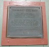
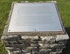
Early records describe as many as 12 mounds near Toolesboro. Subsequent settlement and excavation have reduced that number to seven. The family of George M. Mosier, a local land owner, donated a parcel of land containing the mound group to the state of Iowa. In 1966, the Toolesboro Mound Group was listed as a National Historic Landmark, and in 1969 a small visitor center and parking lot were built near the site. The state has designated the Historical Society of Iowa as custodian of the site.
Of the seven mounds, only two are visible on the grounds of the Educational Center. The remaining five are located in an adjacent woodlot, and are separated by a wire fence from the Educational Center.[4]
The Toolesboro Mound Group is a grave site of the Native Americans of the United States. The Historical Society welcomes visitors to the site, but requests that they not walk on or near the mounds themselves. Source: Wikipedia.
References:
1. "National Register Information System". National Register of Historic Places. National Park Service. January 23, 2007.
2. "Toolesboro Mound Group". National Historic Landmark summary list ing. National Park Service. Retrieved October 8, 2007.
3. Iowahistory.org, teacher's guide.
4. "Iowa Beautiful". (See below link).
5. Park Guides for the Louisa County Conservation Board, Louisa County Conservation Board. Accessed 2009-02-07.
Further reading and information:
Wikipedia: en.wikipedia.org/wiki/Toolesboro_Mound_Group
Iowa History: history.iowa.gov/history/sites/toolesboro-mounds-national-historic-landmark.
Directions:
The site's address is 6568 Toolesboro Road, Wapello, Iowa.[5]
You may be viewing yesterday's version of this page. To see the most up to date information please register for a free account.
")
Do not use the above information on other web sites or publications without permission of the contributor.
Nearby Images from Flickr


The above images may not be of the site on this page, but were taken nearby. They are loaded from Flickr so please click on them for image credits.
Click here to see more info for this site
Nearby sites
Click here to view sites on an interactive map of the areaKey: Red: member's photo, Blue: 3rd party photo, Yellow: other image, Green: no photo - please go there and take one, Grey: site destroyed
Download sites to:
KML (Google Earth)
GPX (GPS waypoints)
CSV (Garmin/Navman)
CSV (Excel)
To unlock full downloads you need to sign up as a Contributory Member. Otherwise downloads are limited to 50 sites.
Turn off the page maps and other distractions
Nearby sites listing. In the following links * = Image available
98.0km NE 44° Albany Mounds* Barrow Cemetery
117.8km NE 41° Thomson Causeway Artificial Mound
118.8km SE 138° Dickson Mounds* Barrow Cemetery
125.5km SE 138° Rockwell* Artificial Mound
136.4km ENE 58° Sinnissippi Mounds* Artificial Mound
140.9km SSW 192° Indian Mounds Park* Artificial Mound
153.2km NNE 13° Dunleith Mounds* Artificial Mound
164.1km SSE 168° Elizabeth Mound Complex* Barrow Cemetery
171.5km SW 232° Thousand Hills Petroglyphs* Rock Art
182.0km SSE 167° Montezuma Mound Group* Artificial Mound
191.2km SE 141° Illinois State Museum* Museum
203.3km N 359° Wyalusing Mounds* Artificial Mound
205.1km NE 52° Beattie Park Mound Group* Misc. Earthwork
205.5km N 357° Pikes Peak State Park Effigy Mounds* Artificial Mound
207.0km WNW 283° Yellow Banks Park* Artificial Mound
215.1km WNW 284° The Palace Ancient Village or Settlement
215.9km N 357° Effigy Mounds National Monument* Artificial Mound
224.2km N 1° Larsen Cave, Crawford Co* Rock Art
224.9km NE 47° Beloit College Mounds* Artificial Mound
233.7km NNE 24° Brighid's Spring at Circle Sanctuary* Holy Well or Sacred Spring
234.5km NNE 24° Circle Sanctuary Nature Preserve* Modern Stone Circle etc
238.3km E 82° Briscoe Mounds* Artificial Mound
245.9km S 170° Pere Marquette State Park* Artificial Mound
249.1km N 6° Tainter Cave Cave or Rock Shelter
251.2km NNE 32° Forest Hill Cemetery* Artificial Mound
View more nearby sites and additional images


 We would like to know more about this location. Please feel free to add a brief description and any relevant information in your own language.
 Wir möchten mehr über diese Stätte erfahren. Bitte zögern Sie nicht, eine kurze Beschreibung und relevante Informationen in Deutsch hinzuzufügen.
 Nous aimerions en savoir encore un peu sur les lieux. S'il vous plaît n'hesitez pas à ajouter une courte description et tous les renseignements pertinents dans votre propre langue.
 Quisieramos informarnos un poco más de las lugares. No dude en añadir una breve descripción y otros datos relevantes en su propio idioma.