<< Our Photo Pages >> Caričin Grad - Ancient Village or Settlement in Serbia
Submitted by Armand on Tuesday, 08 January 2019 Page Views: 3621
Multi-periodSite Name: Caričin Grad Alternative Name: Justiania PrimaCountry: Serbia
NOTE: This site is 91.204 km away from the location you searched for.
Type: Ancient Village or Settlement
Latitude: 42.953247N Longitude: 21.600000E
Condition:
| 5 | Perfect |
| 4 | Almost Perfect |
| 3 | Reasonable but with some damage |
| 2 | Ruined but still recognisable as an ancient site |
| 1 | Pretty much destroyed, possibly visible as crop marks |
| 0 | No data. |
| -1 | Completely destroyed |
| 5 | Superb |
| 4 | Good |
| 3 | Ordinary |
| 2 | Not Good |
| 1 | Awful |
| 0 | No data. |
| 5 | Can be driven to, probably with disabled access |
| 4 | Short walk on a footpath |
| 3 | Requiring a bit more of a walk |
| 2 | A long walk |
| 1 | In the middle of nowhere, a nightmare to find |
| 0 | No data. |
| 5 | co-ordinates taken by GPS or official recorded co-ordinates |
| 4 | co-ordinates scaled from a detailed map |
| 3 | co-ordinates scaled from a bad map |
| 2 | co-ordinates of the nearest village |
| 1 | co-ordinates of the nearest town |
| 0 | no data |
Internal Links:
External Links:
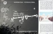
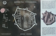
The city was founded by Emperor Justinian I. It existed from the 530s to 615 and was designed as a splendid bishop's seat. The city was a completely new foundation in honour of the nearby village of Tauresium, the birthplace of Justinian. According to Procopius Bederiana, the birthplace of Justinian's uncle and mentor Justin I was nearby. There has been a long debate about the identification of these historical places. The huge correlation between the archaeological site and the description by Procopius as well as finds of seals of the bishop of Iustiniana Prima are strong arguments for an identification of Justiniana Prima with Caričin Grad.
The city planning combined classical and Christian elements: thermae, a forum, and streets with colonnades. Typical Mediterranean features went along with numerous churches.
Justinian himself ordered the foundation of the city by law in 535, establishing the Archbishopric of Justiniana Prima, making it at the same time the capital of the prefecture of Illyricum instead of Thessaloniki (although this is disputed among historians)
https://whc.unesco.org/en/tentativelists/5539/
https://en.wikipedia.org/wiki/Justiniana_Prima
You may be viewing yesterday's version of this page. To see the most up to date information please register for a free account.


Do not use the above information on other web sites or publications without permission of the contributor.
Click here to see more info for this site
Nearby sites
Click here to view sites on an interactive map of the areaKey: Red: member's photo, Blue: 3rd party photo, Yellow: other image, Green: no photo - please go there and take one, Grey: site destroyed
Download sites to:
KML (Google Earth)
GPX (GPS waypoints)
CSV (Garmin/Navman)
CSV (Excel)
To unlock full downloads you need to sign up as a Contributory Member. Otherwise downloads are limited to 50 sites.
Turn off the page maps and other distractions
Nearby sites listing. In the following links * = Image available
34.4km NNW 326° Pločnik* Ancient Village or Settlement
47.1km NNE 30° Narodni muzej Niš* Museum
52.1km SSE 146° Maniste Necropolis* Barrow Cemetery
58.1km NE 43° Balanica Cave Cave or Rock Shelter
73.6km NNW 342° Narodni Muzej Kruševac* Museum
79.8km SSE 165° Kokino* Rock Outcrop
81.9km SSE 159° Cocev Kamen* Cave or Rock Shelter
102.5km N 351° Zavičajni Muzej Paraćin* Museum
103.4km E 101° Sacred Nuraghe Well (Garlo)* Holy Well or Sacred Spring
105.6km S 177° The Sacred Stone of Tekia Standing Stone (Menhir)
115.2km NNE 24° Felix Romuliana* Ancient Palace
119.0km NNE 27° Zaječar museum* Museum
124.8km ESE 104° Krivi Kamik* Hillfort
125.6km SSE 168° Bylazora Ancient Village or Settlement
133.7km NW 319° Mrcajevci Barrow Cemetery
137.6km NNW 340° Grncarica Ancient Village or Settlement
142.5km SE 134° Piyanets Museum Museum
143.5km E 101° National Archaeological Museum of Bulgaria* Museum
158.7km SSE 169° Stobi* Ancient Village or Settlement
160.0km NNE 13° Rudna Glava Ancient Mine, Quarry or other Industry
178.9km ENE 74° Ohoden-Valoga Ancient Village or Settlement
181.4km S 180° The Great Goddess with three faces* Natural Stone / Erratic / Other Natural Feature
181.6km N 11° Lepenski Vir* Ancient Village or Settlement
189.2km SSE 153° Tsarevi Kuli Ancient Village or Settlement
189.6km N 3° Chindiei 2 Cave* Rock Art
View more nearby sites and additional images


 We would like to know more about this location. Please feel free to add a brief description and any relevant information in your own language.
 Wir möchten mehr über diese Stätte erfahren. Bitte zögern Sie nicht, eine kurze Beschreibung und relevante Informationen in Deutsch hinzuzufügen.
 Nous aimerions en savoir encore un peu sur les lieux. S'il vous plaît n'hesitez pas à ajouter une courte description et tous les renseignements pertinents dans votre propre langue.
 Quisieramos informarnos un poco más de las lugares. No dude en añadir una breve descripción y otros datos relevantes en su propio idioma.