<< Other Photo Pages >> Býčí skála - Cave or Rock Shelter in Czech Republic in Moravia
Submitted by KaiHofmann on Sunday, 24 November 2013 Page Views: 3879
Natural PlacesSite Name: Býčí skálaCountry: Czech Republic
NOTE: This site is 6.056 km away from the location you searched for.
Region: Moravia Type: Cave or Rock Shelter
Nearest Town: Brno Nearest Village: Adamov
Latitude: 49.307500N Longitude: 16.694722E
Condition:
| 5 | Perfect |
| 4 | Almost Perfect |
| 3 | Reasonable but with some damage |
| 2 | Ruined but still recognisable as an ancient site |
| 1 | Pretty much destroyed, possibly visible as crop marks |
| 0 | No data. |
| -1 | Completely destroyed |
| 5 | Superb |
| 4 | Good |
| 3 | Ordinary |
| 2 | Not Good |
| 1 | Awful |
| 0 | No data. |
| 5 | Can be driven to, probably with disabled access |
| 4 | Short walk on a footpath |
| 3 | Requiring a bit more of a walk |
| 2 | A long walk |
| 1 | In the middle of nowhere, a nightmare to find |
| 0 | No data. |
| 5 | co-ordinates taken by GPS or official recorded co-ordinates |
| 4 | co-ordinates scaled from a detailed map |
| 3 | co-ordinates scaled from a bad map |
| 2 | co-ordinates of the nearest village |
| 1 | co-ordinates of the nearest town |
| 0 | no data |
Internal Links:
External Links:
I have visited· I would like to visit
fornjotr has visited here
")
One of Czech's largest caves (around 13km) is situated in Moravia northeast of Brno. The archaeologists found traces of human occuppation from the Palaeolothic to the Iron Age and a bronze bull figurine (the name Býčí skála means bull cave in english). In the late 19th century they found remains of 40 skeletons mostly without heads, hands and feet. Archaeologist have some theories about this situation. One is, that the individuals (mostly women) were sacrificed by shamans for the gods of metal in the Hallstatt period.
You may be viewing yesterday's version of this page. To see the most up to date information please register for a free account.
")
")
")
Do not use the above information on other web sites or publications without permission of the contributor.
Nearby Images from Flickr


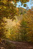
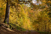


The above images may not be of the site on this page, but were taken nearby. They are loaded from Flickr so please click on them for image credits.
Click here to see more info for this site
Nearby sites
Click here to view sites on an interactive map of the areaKey: Red: member's photo, Blue: 3rd party photo, Yellow: other image, Green: no photo - please go there and take one, Grey: site destroyed
Download sites to:
KML (Google Earth)
GPX (GPS waypoints)
CSV (Garmin/Navman)
CSV (Excel)
To unlock full downloads you need to sign up as a Contributory Member. Otherwise downloads are limited to 50 sites.
Turn off the page maps and other distractions
Nearby sites listing. In the following links * = Image available
2.8km SE 131° Výpustek Cave* Cave or Rock Shelter
14.3km SSW 206° Moravské zemské muzeum* Museum
14.6km SSE 167° Žuráň Mound* Artificial Mound
15.8km SW 216° Anthropos Pavilion* Museum
46.8km S 185° Dolní Věstonice* Ancient Village or Settlement
47.8km S 182° Archeopark Pavlov* Museum
51.6km S 183° Klentnice Stone Circle* Modern Stone Circle etc
53.8km ESE 110° The King's Table* Sculptured Stone
56.5km ESE 113° Archeological Outdoor Museum Modrá* Museum
56.6km ENE 71° Predmosti* Ancient Village or Settlement
62.8km SSE 153° Slavic fortified settlement in Mikulčice* Ancient Village or Settlement
64.4km SSE 152° Church of Saint Margaret of Antioch, Kopčany* Misc. Earthwork
65.0km SSE 148° Menhiry Holic* Standing Stones
69.2km SW 224° Stone stele Hradiste* Standing Stone (Menhir)
69.2km SW 225° U oveček* Rock Outcrop
69.3km SW 224° Great Moravia hillfort - Hradiště* Hillfort
69.5km SW 225° Samaritánka Well* Holy Well or Sacred Spring
71.2km SSE 168° Rabensburg Tumulus (2) Round Barrow(s)
72.5km SW 227° Masovice Prehistoric Settlements Ancient Village or Settlement
73.1km S 169° Rabensburg Tumuli (1) Round Barrow(s)
77.9km SW 223° Heiliger Stein (Mitterretzbach)* Rock Art
78.6km SE 129° Javorníky Menhir Standing Stone (Menhir)
81.2km S 191° MAMUZ Schloss Asparn-Zaya* Museum
81.9km S 186° MAMUZ Museum Mistelbach* Museum
89.3km SW 223° Kalenderstein von Leodagger* Rock Art
View more nearby sites and additional images


 We would like to know more about this location. Please feel free to add a brief description and any relevant information in your own language.
 Wir möchten mehr über diese Stätte erfahren. Bitte zögern Sie nicht, eine kurze Beschreibung und relevante Informationen in Deutsch hinzuzufügen.
 Nous aimerions en savoir encore un peu sur les lieux. S'il vous plaît n'hesitez pas à ajouter une courte description et tous les renseignements pertinents dans votre propre langue.
 Quisieramos informarnos un poco más de las lugares. No dude en añadir una breve descripción y otros datos relevantes en su propio idioma.