 with our Megalithic Portal iPhone app")


<< Text Pages >> St. Thomas's Well (Godstone) - Holy Well or Sacred Spring in England in Surrey
Submitted by HOLYWELL on Tuesday, 01 September 2009 Page Views: 5687
Springs and Holy WellsSite Name: St. Thomas's Well (Godstone)Country: England
NOTE: This site is 1.944 km away from the location you searched for.
County: Surrey Type: Holy Well or Sacred Spring
Nearest Village: Godstone
Map Ref: TQ375537
Latitude: 51.265878N Longitude: 0.030534W
Condition:
| 5 | Perfect |
| 4 | Almost Perfect |
| 3 | Reasonable but with some damage |
| 2 | Ruined but still recognisable as an ancient site |
| 1 | Pretty much destroyed, possibly visible as crop marks |
| 0 | No data. |
| -1 | Completely destroyed |
| 5 | Superb |
| 4 | Good |
| 3 | Ordinary |
| 2 | Not Good |
| 1 | Awful |
| 0 | No data. |
| 5 | Can be driven to, probably with disabled access |
| 4 | Short walk on a footpath |
| 3 | Requiring a bit more of a walk |
| 2 | A long walk |
| 1 | In the middle of nowhere, a nightmare to find |
| 0 | No data. |
| 5 | co-ordinates taken by GPS or official recorded co-ordinates |
| 4 | co-ordinates scaled from a detailed map |
| 3 | co-ordinates scaled from a bad map |
| 2 | co-ordinates of the nearest village |
| 1 | co-ordinates of the nearest town |
| 0 | no data |
Internal Links:
External Links:
Holy Well or Sacred Spring in Surrey
This is one of the wells dedicated to the saint which lay close to the ancient Pilgrim's Way. Little is known of it, but currently it arises from a pipe set into the bank and fills metal agricultural troughs which does not sound very romantic and it isn't! It can be by taking the bridleway that runs north from Barrow Green Lane which goes over the M25, then over a stile and turn right at the top of the field entering a grate and the well is found in the far corner.
You may be viewing yesterday's version of this page. To see the most up to date information please register for a free account.
Do not use the above information on other web sites or publications without permission of the contributor.
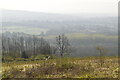
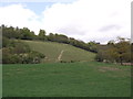
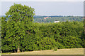
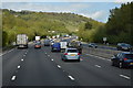
Nearby Images from Geograph Britain and Ireland:
©2022(licence)
©2012(licence)
©2010(licence)
©2015(licence)

©2013(licence)
The above images may not be of the site on this page, they are loaded from Geograph.
Please Submit an Image of this site or go out and take one for us!
Click here to see more info for this site
Nearby sites
Key: Red: member's photo, Blue: 3rd party photo, Yellow: other image, Green: no photo - please go there and take one, Grey: site destroyed
Download sites to:
KML (Google Earth)
GPX (GPS waypoints)
CSV (Garmin/Navman)
CSV (Excel)
To unlock full downloads you need to sign up as a Contributory Member. Otherwise downloads are limited to 50 sites.
Turn off the page maps and other distractions
Nearby sites listing. In the following links * = Image available
2.8km SW 219° Walker Miles Memorial* Modern Stone Circle etc (TQ358515)
2.8km SW 221° St Mary's Well (Godstone)* Holy Well or Sacred Spring (TQ357515)
3.1km SSW 206° Leigh Place Stone* Natural Stone / Erratic / Other Natural Feature (TQ362509)
3.2km SSW 207° Diana's Well Holy Well or Sacred Spring (TQ361508)
3.3km SW 234° Godstone Tumulus* Artificial Mound (TQ349517)
3.6km N 9° Nore Hill Bronze Age Enclosure* Misc. Earthwork (TQ3800057300)
4.5km W 266° War Coppice Camp* Hillfort (TQ3298053260)
4.9km WSW 251° North Park Farm* Ancient Village or Settlement (TQ329520)
5.4km W 265° Spring Bottom* Holy Well or Sacred Spring (TQ321531)
6.9km WNW 288° St Peter and St Paul's Church (Chaldon)* Ancient Cross (TQ3087455694)
6.9km ESE 104° Squerries Park Camp* Hillfort (TQ4428052220)
8.3km ENE 76° Holy Well (Westerham) Holy Well or Sacred Spring (TQ455559)
8.5km WNW 300° Farthing Downs* Barrow Cemetery (TQ300578)
8.6km NW 325° Riddlesdown Newe Ditch* Misc. Earthwork (TQ3230460572)
9.4km S 175° St. Margaret's Well (Lingfield)* Holy Well or Sacred Spring (TQ386444)
10.2km WNW 289° Chipstead Well Holy Well or Sacred Spring (TQ278568)
10.2km NNW 340° Croham Hurst* Round Barrow(s) (TQ338632)
10.3km NNE 24° Warbank Ancient Village or Settlement (TQ414632)
10.4km W 266° Gatton Park, The Millennium Stones* Modern Stone Circle etc (TQ271527)
10.4km WSW 243° Royal Earlswood Stones* Modern Stone Circle etc (TQ283487)
10.8km WSW 252° Whitepost Hill Spring Holy Well or Sacred Spring (TQ273501)
10.8km WSW 253° Waterslade Spring Holy Well or Sacred Spring (TQ272502)
10.9km WSW 249° Redhill Common* Round Barrow(s) (TQ274496)
11.2km NNE 25° Caesar's Well* Holy Well or Sacred Spring (TQ419640)
11.2km NNE 26° Caesar's Camp (Keston)* Hillfort (TQ4220063900)
View more nearby sites and additional images


 We would like to know more about this location. Please feel free to add a brief description and any relevant information in your own language.
 Wir möchten mehr über diese Stätte erfahren. Bitte zögern Sie nicht, eine kurze Beschreibung und relevante Informationen in Deutsch hinzuzufügen.
 Nous aimerions en savoir encore un peu sur les lieux. S'il vous plaît n'hesitez pas à ajouter une courte description et tous les renseignements pertinents dans votre propre langue.
 Quisieramos informarnos un poco más de las lugares. No dude en añadir una breve descripción y otros datos relevantes en su propio idioma.