<< Text Pages >> Bromley Museum - Museum in England in Greater London
Submitted by vicky on Thursday, 02 August 2007 Page Views: 9440
MuseumsSite Name: Bromley MuseumCountry: England
NOTE: This site is 1.736 km away from the location you searched for.
County: Greater London Type: Museum
Nearest Town: Orpington
Map Ref: TQ465665 Landranger Map Number: 177
Latitude: 51.378654N Longitude: 0.103633E
Condition:
| 5 | Perfect |
| 4 | Almost Perfect |
| 3 | Reasonable but with some damage |
| 2 | Ruined but still recognisable as an ancient site |
| 1 | Pretty much destroyed, possibly visible as crop marks |
| 0 | No data. |
| -1 | Completely destroyed |
| 5 | Superb |
| 4 | Good |
| 3 | Ordinary |
| 2 | Not Good |
| 1 | Awful |
| 0 | No data. |
| 5 | Can be driven to, probably with disabled access |
| 4 | Short walk on a footpath |
| 3 | Requiring a bit more of a walk |
| 2 | A long walk |
| 1 | In the middle of nowhere, a nightmare to find |
| 0 | No data. |
| 5 | co-ordinates taken by GPS or official recorded co-ordinates |
| 4 | co-ordinates scaled from a detailed map |
| 3 | co-ordinates scaled from a bad map |
| 2 | co-ordinates of the nearest village |
| 1 | co-ordinates of the nearest town |
| 0 | no data |
Internal Links:
External Links:
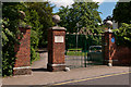
Museum (NOW CLOSED) in Greater London.
There is now a display in Bromley Central Library, which is home to the John Lubbock collection. John Lubbock was an important early archaeologist and friend of Charles Darwin.
Note: Childrens events 7th-10th August. See comment.
You may be viewing yesterday's version of this page. To see the most up to date information please register for a free account.
Do not use the above information on other web sites or publications without permission of the contributor.
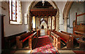
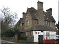
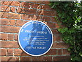
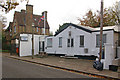
Nearby Images from Geograph Britain and Ireland:
©2011(licence)
©2009(licence)
©2011(licence)
©2009(licence)
©2013(licence)
The above images may not be of the site on this page, they are loaded from Geograph.
Please Submit an Image of this site or go out and take one for us!
Click here to see more info for this site
Nearby sites
Key: Red: member's photo, Blue: 3rd party photo, Yellow: other image, Green: no photo - please go there and take one, Grey: site destroyed
Download sites to:
KML (Google Earth)
GPX (GPS waypoints)
CSV (Garmin/Navman)
CSV (Excel)
To unlock full downloads you need to sign up as a Contributory Member. Otherwise downloads are limited to 50 sites.
Turn off the page maps and other distractions
Nearby sites listing. In the following links * = Image available
1.1km NNE 16° Fordcroft Romano-British Bathhouse* Ancient Village or Settlement (TQ4676767578)
2.7km NNW 343° Hobling Well Holy Well or Sacred Spring (TQ456691)
4.4km NW 315° Chislehurst Caves Cave or Rock Shelter (TQ433695)
4.4km NNW 329° Mound Chislehurst Artificial Mound (TQ441702)
4.8km NE 34° Chalk Wood Denehole Ancient Mine, Quarry or other Industry (TQ491706)
5.0km WSW 240° Caesar's Camp (Keston) Hillfort (TQ422639)
5.2km WSW 243° Caesar's Well* Holy Well or Sacred Spring (TQ419640)
5.8km W 259° Hayes Common 2 Ancient Village or Settlement (TQ408652)
5.9km NE 44° Stonebill Green Deneholes Ancient Mine, Quarry or other Industry (TQ505709)
6.1km WSW 239° Warbank Ancient Village or Settlement (TQ414632)
6.2km NE 37° Joyden's Wood Ancient Village or Settlement (TQ501715)
6.3km WNW 296° St Blaise's well Holy Well or Sacred Spring (TQ40806911)
6.3km W 269° Hussey Well* Holy Well or Sacred Spring (TQ402662)
6.8km W 261° Hayes Common 1* Ancient Village or Settlement (TQ398652)
7.3km NNE 32° Cavey's Springs Deneholes Ancient Mine, Quarry or other Industry (TQ502728)
7.5km E 99° Eynsford Stone* Natural Stone / Erratic / Other Natural Feature (TQ540655)
9.4km ENE 60° Holy well (Hawley) Holy Well or Sacred Spring (TQ545715)
9.4km ENE 74° Sutton At Hone Enclosures Ancient Village or Settlement (TQ555694)
9.6km SE 140° Colet's Well* Holy Well or Sacred Spring (TQ5283459333)
9.9km SE 139° St Thomas a Becket's Well* Holy Well or Sacred Spring (TQ532592)
10.0km SE 135° Stumblebury Round Barrow(s) (TQ53845966)
10.6km S 187° Holy Well (Westerham) Holy Well or Sacred Spring (TQ455559)
10.8km NE 48° Dartford Borough Museum* Museum (TQ5431773920)
10.9km NNW 348° Shrewsbury Tumulus* Round Barrow(s) (TQ439771)
11.4km N 358° Winn's Common Tumulus* Round Barrow(s) (TQ457779)
View more nearby sites and additional images


 We would like to know more about this location. Please feel free to add a brief description and any relevant information in your own language.
 Wir möchten mehr über diese Stätte erfahren. Bitte zögern Sie nicht, eine kurze Beschreibung und relevante Informationen in Deutsch hinzuzufügen.
 Nous aimerions en savoir encore un peu sur les lieux. S'il vous plaît n'hesitez pas à ajouter une courte description et tous les renseignements pertinents dans votre propre langue.
 Quisieramos informarnos un poco más de las lugares. No dude en añadir una breve descripción y otros datos relevantes en su propio idioma.