<< Our Photo Pages >> Queen Anne's Well (Carshalton) - Holy Well or Sacred Spring in England in Surrey
Submitted by DavidCWoods on Sunday, 07 November 2004 Page Views: 17525
Springs and Holy WellsSite Name: Queen Anne's Well (Carshalton) Alternative Name: Anne Boleyn's Well, Notre Dame de Boulogne's WellCountry: England
NOTE: This site is 1.18 km away from the location you searched for.
County: Surrey Type: Holy Well or Sacred Spring
Nearest Town: London Nearest Village: Carshalton
Map Ref: TQ279645
Latitude: 51.365172N Longitude: 0.164187W
Condition:
| 5 | Perfect |
| 4 | Almost Perfect |
| 3 | Reasonable but with some damage |
| 2 | Ruined but still recognisable as an ancient site |
| 1 | Pretty much destroyed, possibly visible as crop marks |
| 0 | No data. |
| -1 | Completely destroyed |
| 5 | Superb |
| 4 | Good |
| 3 | Ordinary |
| 2 | Not Good |
| 1 | Awful |
| 0 | No data. |
| 5 | Can be driven to, probably with disabled access |
| 4 | Short walk on a footpath |
| 3 | Requiring a bit more of a walk |
| 2 | A long walk |
| 1 | In the middle of nowhere, a nightmare to find |
| 0 | No data. |
| 5 | co-ordinates taken by GPS or official recorded co-ordinates |
| 4 | co-ordinates scaled from a detailed map |
| 3 | co-ordinates scaled from a bad map |
| 2 | co-ordinates of the nearest village |
| 1 | co-ordinates of the nearest town |
| 0 | no data |
Internal Links:
External Links:
 (PID:10482)")
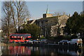
Situated on the corner of High Street and Church Hill in Carshalton, outside All Saints Church, the well is now filled with flowers and has a small notice beside it.
Local legend has it that Anne Boleyn's horse stumbled on a stone while she and Henry VIII were journeying from Nonsuch Palace to see a local nobleman and that the well sprung up on the site.
The problem with this story is that Nonsuch Palace was built in 1538, while Anne was executed in 1536! It is more likely that the name is a corruption of Notre Dame de Boulogne, as the Count of Boulogne was Lord of the Manor of Carshalton in the 12th Century.
holywell wrote: Well is now dry and overgrown but easily found by the church. Said to have arisen from the hoof of Queen Anne Boleyn’s horse. However, more probably St Anne or from "Bolonia" or "Bologne", a local C13th landowner.
You may be viewing yesterday's version of this page. To see the most up to date information please register for a free account.
 (PID:23942)")
Do not use the above information on other web sites or publications without permission of the contributor.
coldrum has found this location on Google Street View:
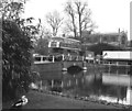
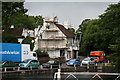
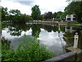
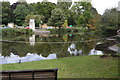
Nearby Images from Geograph Britain and Ireland:
©2007(licence)
©2007(licence)
©2012(licence)
©2018(licence)
©2025(licence)
The above images may not be of the site on this page, they are loaded from Geograph.
Please Submit an Image of this site or go out and take one for us!
Click here to see more info for this site
Nearby sites
Key: Red: member's photo, Blue: 3rd party photo, Yellow: other image, Green: no photo - please go there and take one, Grey: site destroyed
Download sites to:
KML (Google Earth)
GPX (GPS waypoints)
CSV (Garmin/Navman)
CSV (Excel)
To unlock full downloads you need to sign up as a Contributory Member. Otherwise downloads are limited to 50 sites.
Turn off the page maps and other distractions
Nearby sites listing. In the following links * = Image available
4.5km NW 312° Morden Park* Artificial Mound (TQ245674)
4.8km SW 220° Gally Hills Barrow Cemetery (TQ249607)
4.9km NNE 31° Pollards Hill Hillfort (TQ303688)
5.9km SE 133° Riddlesdown Newe Ditch* Misc. Earthwork (TQ3230460572)
5.9km WSW 252° Hatch Furlong Ritual Shafts* Misc. Earthwork (TQ223625)
6.0km ESE 104° Croham Hurst* Round Barrow(s) (TQ338632)
6.2km WSW 255° Ewell Springs (Surrey)* Holy Well or Sacred Spring (TQ219627)
6.3km WSW 255° Bourne Hall Museum* Museum (TQ218627)
7.0km SSE 164° Farthing Downs* Barrow Cemetery (TQ300578)
7.7km S 182° Chipstead Well Holy Well or Sacred Spring (TQ278568)
8.6km NW 322° Caesar's Camp (Wimbledon)* Hillfort (TQ224711)
8.9km NW 323° Caesar's Well (Wimbledon) Holy Well or Sacred Spring (TQ22377151)
9.3km SSE 163° St Peter and St Paul's Church (Chaldon)* Ancient Cross (TQ3087455694)
9.4km SSW 194° St. Margaret's Well (Mugswell)* Holy Well or Sacred Spring (TQ258553)
9.9km NNW 330° Putney Heath Round Barrow(s) (TQ22797295)
10.5km NW 308° King Clump Artificial Mound (TQ195708)
10.7km WNW 298° Kingston Museum* Museum (TQ1830169219)
11.0km WNW 296° King Stone (Kingston-upon-Thames)* Marker Stone (TQ1786769069)
11.2km WSW 248° Ashtead Common Earthwork* Misc. Earthwork (TQ176600)
11.8km NW 312° Richmond Park Long Barrow Artificial Mound (TQ189721)
11.8km S 185° Gatton Park, The Millennium Stones* Modern Stone Circle etc (TQ271527)
11.9km E 88° Hayes Common 1* Ancient Village or Settlement (TQ398652)
12.1km SSE 161° Spring Bottom* Holy Well or Sacred Spring (TQ321531)
12.3km SW 226° Thirty Acre Barn Barrows Round Barrow(s) (TQ192558)
12.3km SSE 157° War Coppice Camp Hillfort (TQ32985326)
View more nearby sites and additional images


 We would like to know more about this location. Please feel free to add a brief description and any relevant information in your own language.
 Wir möchten mehr über diese Stätte erfahren. Bitte zögern Sie nicht, eine kurze Beschreibung und relevante Informationen in Deutsch hinzuzufügen.
 Nous aimerions en savoir encore un peu sur les lieux. S'il vous plaît n'hesitez pas à ajouter une courte description et tous les renseignements pertinents dans votre propre langue.
 Quisieramos informarnos un poco más de las lugares. No dude en añadir una breve descripción y otros datos relevantes en su propio idioma.