


<< Text Pages >> Negen Stones - Standing Stones in England in Surrey
Submitted by Andy B on Friday, 18 February 2005 Page Views: 13534
Neolithic and Bronze AgeSite Name: Negen StonesCountry: England
NOTE: This site is 0.648 km away from the location you searched for.
County: Surrey Type: Standing Stones
Nearest Town: Staines
Map Ref: TQ030714
Latitude: 51.432250N Longitude: 0.519715W
Condition:
| 5 | Perfect |
| 4 | Almost Perfect |
| 3 | Reasonable but with some damage |
| 2 | Ruined but still recognisable as an ancient site |
| 1 | Pretty much destroyed, possibly visible as crop marks |
| 0 | No data. |
| -1 | Completely destroyed |
| 5 | Superb |
| 4 | Good |
| 3 | Ordinary |
| 2 | Not Good |
| 1 | Awful |
| 0 | No data. |
| 5 | Can be driven to, probably with disabled access |
| 4 | Short walk on a footpath |
| 3 | Requiring a bit more of a walk |
| 2 | A long walk |
| 1 | In the middle of nowhere, a nightmare to find |
| 0 | No data. |
| 5 | co-ordinates taken by GPS or official recorded co-ordinates |
| 4 | co-ordinates scaled from a detailed map |
| 3 | co-ordinates scaled from a bad map |
| 2 | co-ordinates of the nearest village |
| 1 | co-ordinates of the nearest town |
| 0 | no data |
Internal Links:
External Links:
Possible lost Standing Stones in Surrey
The name of the town of Staines means "stones" and it is thought to come from a group of nine stones mentioned in a twelfth century charter of Chertsey Abbey which delineated the boundaries of the Abbey lands, and was reported in Up Pontes by Christine Lake. The settlement of Staines is very ancient, with evidence of habitation from Mesolithic times. The charter says this:
"Down to that Eyre that stands in the Thames at Lodders Lake and so along Thames by mid-stream to Glenthuthe (Glanty: M25 roundabout), from Glenhuthe by mid-stream along Thames to the Huthe (Hythe) before Negen Stones". ("Negen stanes" is Saxon for "nine stones").
More at The Old Stones of Staines (archive link).
You may be viewing yesterday's version of this page. To see the most up to date information please register for a free account.
Do not use the above information on other web sites or publications without permission of the contributor.
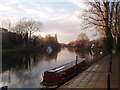
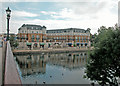
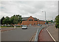
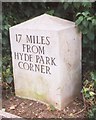
Nearby Images from Geograph Britain and Ireland:
©2005(licence)
©2008(licence)
©2008(licence)
©2019(licence)
©2013(licence)
The above images may not be of the site on this page, they are loaded from Geograph.
Please Submit an Image of this site or go out and take one for us!
Click here to see more info for this site
Nearby sites
Key: Red: member's photo, Blue: 3rd party photo, Yellow: other image, Green: no photo - please go there and take one, Grey: site destroyed
Download sites to:
KML (Google Earth)
GPX (GPS waypoints)
CSV (Garmin/Navman)
CSV (Excel)
To unlock full downloads you need to sign up as a Contributory Member. Otherwise downloads are limited to 50 sites.
Turn off the page maps and other distractions
Nearby sites listing. In the following links * = Image available
1.3km NNW 335° Staines Enclosure* Causewayed Enclosure (TQ024726)
2.4km E 89° Ashford Henge* Henge (TQ054715)
3.7km S 189° The Nun's Well (Surrey)* Holy Well or Sacred Spring (TQ0247767756)
3.8km NE 44° St. Anne's Well (Stanwell)* Holy Well or Sacred Spring (TQ056742)
3.8km S 187° St Ann's Hill* Hillfort (TQ026676)
3.9km NE 37° Stanwell Cursus* Cursus (TQ053746)
4.0km NNW 342° Kingsmead Quarry* Ancient Village or Settlement (TQ01707520)
4.5km SSE 168° Chertsey Museum Museum (TQ040670)
4.7km NNE 26° Heathrow* Cursus (TQ050757)
4.8km NNW 340° Kingsmead Quarry Ancient Village or Settlement (TQ01307588)
5.1km ENE 63° Bedfont Cursus (TQ075738)
5.6km SE 125° Shepperton Henge* Henge (TQ07686832)
6.0km WSW 237° Leptis Magna (Virginia Waters)* Ancient Temple (SU980680)
6.5km NNE 14° Stanwell Cursus* Cursus (TQ044777)
7.1km SW 217° Barrowhills Round Barrow(s) (SU98866567)
7.3km SSW 212° Flutters Hill Barrow* Round Barrow(s) (SU99206516)
7.8km SSW 211° Longcross Barrow* Round Barrow(s) (SU99126466)
8.3km SSW 207° Chobham Common (1)* Misc. Earthwork (SU994639)
9.0km SW 219° Albury Bottom Enclosure* Misc. Earthwork (SU97426430)
9.2km WSW 238° Sunningdale Barrows Round Barrow(s) (SU952664)
10.7km NW 325° Montem mound Artificial Mound (SU9665880045)
11.1km SSE 151° St George's Hill* Hillfort (TQ085618)
11.5km S 174° Jack Temple Healing Centre* Modern Stone Circle etc (TQ045600)
11.7km S 189° Horsell Common W* Barrow Cemetery (TQ01405980)
11.7km S 188° Horsell Common E* Round Barrow(s) (TQ01615977)
View more nearby sites and additional images


 We would like to know more about this location. Please feel free to add a brief description and any relevant information in your own language.
 Wir möchten mehr über diese Stätte erfahren. Bitte zögern Sie nicht, eine kurze Beschreibung und relevante Informationen in Deutsch hinzuzufügen.
 Nous aimerions en savoir encore un peu sur les lieux. S'il vous plaît n'hesitez pas à ajouter une courte description et tous les renseignements pertinents dans votre propre langue.
 Quisieramos informarnos un poco más de las lugares. No dude en añadir una breve descripción y otros datos relevantes en su propio idioma.