<< Other Photo Pages >> Dartford Borough Museum - Museum in England in Kent
Submitted by coldrum on Tuesday, 26 June 2007 Page Views: 5748
MuseumsSite Name: Dartford Borough MuseumCountry: England
NOTE: This site is 1.8 km away from the location you searched for.
County: Kent Type: Museum
Nearest Town: Dartford
Map Ref: TQ5431773920
Latitude: 51.443253N Longitude: 0.219091E
Condition:
| 5 | Perfect |
| 4 | Almost Perfect |
| 3 | Reasonable but with some damage |
| 2 | Ruined but still recognisable as an ancient site |
| 1 | Pretty much destroyed, possibly visible as crop marks |
| 0 | No data. |
| -1 | Completely destroyed |
| 5 | Superb |
| 4 | Good |
| 3 | Ordinary |
| 2 | Not Good |
| 1 | Awful |
| 0 | No data. |
| 5 | Can be driven to, probably with disabled access |
| 4 | Short walk on a footpath |
| 3 | Requiring a bit more of a walk |
| 2 | A long walk |
| 1 | In the middle of nowhere, a nightmare to find |
| 0 | No data. |
| 5 | co-ordinates taken by GPS or official recorded co-ordinates |
| 4 | co-ordinates scaled from a detailed map |
| 3 | co-ordinates scaled from a bad map |
| 2 | co-ordinates of the nearest village |
| 1 | co-ordinates of the nearest town |
| 0 | no data |
Internal Links:
External Links:
Museum in Kent
Collections include Palaeolithic material from the Swanscombe and Dartford areas, collections of Mesolithic and Neolithic finds from the North Kent area and items from the Bronze Age and Iron Age.
Dartford Borough Museum
You may be viewing yesterday's version of this page. To see the most up to date information please register for a free account.
Do not use the above information on other web sites or publications without permission of the contributor.
davidmorgan has found this location on Google Street View:
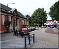
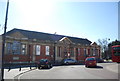
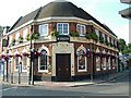
Nearby Images from Geograph Britain and Ireland:
©2012(licence)
©2013(licence)

©2008(licence)
©2008(licence)

©2010(licence)
The above images may not be of the site on this page, they are loaded from Geograph.
Please Submit an Image of this site or go out and take one for us!
Click here to see more info for this site
Nearby sites
Key: Red: member's photo, Blue: 3rd party photo, Yellow: other image, Green: no photo - please go there and take one, Grey: site destroyed
Download sites to:
KML (Google Earth)
GPX (GPS waypoints)
CSV (Garmin/Navman)
CSV (Excel)
To unlock full downloads you need to sign up as a Contributory Member. Otherwise downloads are limited to 50 sites.
Turn off the page maps and other distractions
Nearby sites listing. In the following links * = Image available
2.4km S 177° Holy well (Hawley) Holy Well or Sacred Spring (TQ545715)
4.3km WSW 256° Cavey's Springs Deneholes Ancient Mine, Quarry or other Industry (TQ502728)
4.7km SSE 167° Sutton At Hone Enclosures Ancient Village or Settlement (TQ555694)
4.9km WSW 242° Joyden's Wood Ancient Village or Settlement (TQ501715)
4.9km SW 233° Stonebill Green Deneholes Ancient Mine, Quarry or other Industry (TQ505709)
5.0km E 79° The Monks Well* Holy Well or Sacred Spring (TQ5918474982)
5.5km E 87° Swanscombe Heritage Park* Ancient Mine, Quarry or other Industry (TQ598744)
5.6km E 86° Swanscombe Leisure Centre* Ancient Mine, Quarry or other Industry (TQ59957450)
5.7km ESE 107° Lustrating Pool Holy Well or Sacred Spring (TQ598724)
6.2km WSW 239° Chalk Wood Denehole Ancient Mine, Quarry or other Industry (TQ491706)
6.7km E 91° Bakers Hole* Ancient Mine, Quarry or other Industry (TQ610740)
6.9km E 97° Southfleet Road Ebbsfleet Elephant Butchery Site* Ancient Mine, Quarry or other Industry (TQ6117573260)
7.6km ESE 103° Spring Head Holy Well or Sacred Spring (TQ61767246)
8.4km S 184° Eynsford Stone* Natural Stone / Erratic / Other Natural Feature (TQ540655)
9.5km WNW 297° Winn's Common Tumulus* Round Barrow(s) (TQ457779)
9.9km WSW 243° Hobling Well Holy Well or Sacred Spring (TQ456691)
10.1km SE 124° Chalk Well Holy Well or Sacred Spring (TQ629685)
10.5km ENE 69° Chadwell* Holy Well or Sacred Spring (TQ6478)
10.8km SW 228° Bromley Museum Museum (TQ465665)
10.8km WSW 252° Mound Chislehurst Artificial Mound (TQ441702)
10.9km WNW 289° Shrewsbury Tumulus* Round Barrow(s) (TQ439771)
11.5km ESE 107° Single Well (Iflield) Holy Well or Sacred Spring (TQ65387081)
11.7km NNE 24° St. Cedd's Well (North Ockendon)* Holy Well or Sacred Spring (TQ587848)
11.8km WSW 250° Chislehurst Caves Cave or Rock Shelter (TQ433695)
12.0km NNE 25° Seven Springs (North Ockendon) Holy Well or Sacred Spring (TQ590850)
View more nearby sites and additional images


 We would like to know more about this location. Please feel free to add a brief description and any relevant information in your own language.
 Wir möchten mehr über diese Stätte erfahren. Bitte zögern Sie nicht, eine kurze Beschreibung und relevante Informationen in Deutsch hinzuzufügen.
 Nous aimerions en savoir encore un peu sur les lieux. S'il vous plaît n'hesitez pas à ajouter une courte description et tous les renseignements pertinents dans votre propre langue.
 Quisieramos informarnos un poco más de las lugares. No dude en añadir una breve descripción y otros datos relevantes en su propio idioma.