<< Text Pages >> Prittlewell Spring - Holy Well or Sacred Spring in England in Essex
Submitted by DavidCWoods on Monday, 20 June 2005 Page Views: 7556
Springs and Holy WellsSite Name: Prittlewell SpringCountry: England County: Essex Type: Holy Well or Sacred Spring
Nearest Town: Southend Nearest Village: Prittlewell
Map Ref: TQ875875
Latitude: 51.555218N Longitude: 0.703256E
Condition:
| 5 | Perfect |
| 4 | Almost Perfect |
| 3 | Reasonable but with some damage |
| 2 | Ruined but still recognisable as an ancient site |
| 1 | Pretty much destroyed, possibly visible as crop marks |
| 0 | No data. |
| -1 | Completely destroyed |
| 5 | Superb |
| 4 | Good |
| 3 | Ordinary |
| 2 | Not Good |
| 1 | Awful |
| 0 | No data. |
| 5 | Can be driven to, probably with disabled access |
| 4 | Short walk on a footpath |
| 3 | Requiring a bit more of a walk |
| 2 | A long walk |
| 1 | In the middle of nowhere, a nightmare to find |
| 0 | No data. |
| 5 | co-ordinates taken by GPS or official recorded co-ordinates |
| 4 | co-ordinates scaled from a detailed map |
| 3 | co-ordinates scaled from a bad map |
| 2 | co-ordinates of the nearest village |
| 1 | co-ordinates of the nearest town |
| 0 | no data |
Internal Links:
External Links:
Holy Well or Sacred Spring in Essex. A Clunaic Priory was established nearby in about 1110, colonised from that at Lewes.
I visited in March 2005 and the area around the site is now known as Priory Park. A small manor house, now opened as a museum, occupies the Priory site. They have some old maps and one marks the site of the spring – it is shown as being at one end of the monastic fishing ponds, situated over Prittle Brook from the buildings. The two ponds have now become one, albeit with a large island, presumably formed from part of the old causeway. One of the staff in the museum had told me that the spring was now within the northern pond, and I could certainly see no sign of it, although a large mound occupies the point shown on the map.
The edge of the pond certainly had the remains of some masonary at the edge nearest to the mound, and it may be that the spring is culverted into the pond and that the entry point is concealed under the weeds.
Certainly, a small stream emerges from a pipe in the hillside a few yards further north and flows towards the old Priory.
While watching Tony Robinson's Time Team Special about the "Prittlewell Prince" I was struck by the fact the both here and at Taplow, another of the three sites mentioned, a spring is found in fairly close proximity to the burial site (see also Bapsey Pond). I am not aware of anything at the third site, Sutton Hoo.
You may be viewing yesterday's version of this page. To see the most up to date information please register for a free account.
Do not use the above information on other web sites or publications without permission of the contributor.
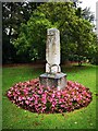
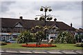
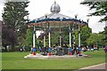
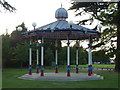
Nearby Images from Geograph Britain and Ireland:
©2020(licence)

©2007(licence)
©2007(licence)
©2011(licence)
©2010(licence)
The above images may not be of the site on this page, they are loaded from Geograph.
Please Submit an Image of this site or go out and take one for us!
Click here to see more info for this site
Nearby sites
Key: Red: member's photo, Blue: 3rd party photo, Yellow: other image, Green: no photo - please go there and take one, Grey: site destroyed
Download sites to:
KML (Google Earth)
GPX (GPS waypoints)
CSV (Garmin/Navman)
CSV (Excel)
To unlock full downloads you need to sign up as a Contributory Member. Otherwise downloads are limited to 50 sites.
Turn off the page maps and other distractions
Nearby sites listing. In the following links * = Image available
5.6km NW 324° Rochford stone* Natural Stone / Erratic / Other Natural Feature (TQ840919)
7.2km NNW 332° Plumberow Mount* Round Barrow(s) (TQ839938)
7.4km W 268° Hadleigh Roundhouse* Ancient Village or Settlement (TQ80058691)
9.3km W 279° Thundersley Natural Stone / Erratic / Other Natural Feature (TQ782886)
14.5km WSW 237° Cliffe Mound Ancient Mine, Quarry or other Industry (TQ7566379139)
14.7km WSW 237° Cliffe Saltings Mound Ancient Mine, Quarry or other Industry (TQ7545279075)
14.8km WSW 238° Cooling Marshes Mound 2 Ancient Mine, Quarry or other Industry (TQ7527879124)
14.9km WSW 238° Cooling Marshes Mound 1 Ancient Mine, Quarry or other Industry (TQ7511779139)
15.0km SW 218° High Halstow Barrow Round Barrow(s) (TQ787753)
15.3km NW 308° The Running Well* Holy Well or Sacred Spring (TQ7510096562)
15.5km SW 227° Bromhey Farm Mound Ancient Mine, Quarry or other Industry (TQ76477661)
15.8km W 260° Corringham Henge (TQ720841)
16.6km SSE 153° Minster Gatehouse Museum* Museum (TQ95567300)
16.6km SSE 153° Well of the Triple Goddess* Holy Well or Sacred Spring (TQ95577300)
16.6km SSE 153° The Abbess's Well* Holy Well or Sacred Spring (TQ9569673029)
16.7km SSE 153° Birth Bracelet Well* Holy Well or Sacred Spring (TQ95667292)
18.3km SSE 148° Kingsborough 1* Causewayed Enclosure (TQ977723)
19.0km SW 229° Cliffe Bronze Age Settlement Ancient Village or Settlement (TQ735746)
20.0km NNW 334° Danbury* Hillfort (TL779051)
20.3km SSE 166° Elmley Barrow Misc. Earthwork (TQ93306801)
20.7km S 189° Holy well at Holywell Farm Holy Well or Sacred Spring (TQ85106695)
20.8km SW 234° Barrow Hill (Kent)* Round Barrow(s) (TQ711746)
20.9km SSW 208° Gillingham Stone circle* Stone Circle (TQ7835668721)
20.9km SW 223° Frindsbury Extra Barrrow Round Barrow(s) (TQ73797166)
21.5km SW 223° Stone House Farm Caves Cave or Rock Shelter (TQ734712)
View more nearby sites and additional images


 We would like to know more about this location. Please feel free to add a brief description and any relevant information in your own language.
 Wir möchten mehr über diese Stätte erfahren. Bitte zögern Sie nicht, eine kurze Beschreibung und relevante Informationen in Deutsch hinzuzufügen.
 Nous aimerions en savoir encore un peu sur les lieux. S'il vous plaît n'hesitez pas à ajouter une courte description et tous les renseignements pertinents dans votre propre langue.
 Quisieramos informarnos un poco más de las lugares. No dude en añadir una breve descripción y otros datos relevantes en su propio idioma.