<< Our Photo Pages >> St Chad's Well (Chadwell Heath) - Holy Well or Sacred Spring in England in Essex
Submitted by HOLYWELL on Wednesday, 27 February 2008 Page Views: 13230
Springs and Holy WellsSite Name: St Chad's Well (Chadwell Heath)Country: England
NOTE: This site is 2.355 km away from the location you searched for.
County: Essex Type: Holy Well or Sacred Spring
Nearest Town: Dagenham Nearest Village: Chadwell Heath
Map Ref: TQ4706389580
Latitude: 51.585891N Longitude: 0.121319E
Condition:
| 5 | Perfect |
| 4 | Almost Perfect |
| 3 | Reasonable but with some damage |
| 2 | Ruined but still recognisable as an ancient site |
| 1 | Pretty much destroyed, possibly visible as crop marks |
| 0 | No data. |
| -1 | Completely destroyed |
| 5 | Superb |
| 4 | Good |
| 3 | Ordinary |
| 2 | Not Good |
| 1 | Awful |
| 0 | No data. |
| 5 | Can be driven to, probably with disabled access |
| 4 | Short walk on a footpath |
| 3 | Requiring a bit more of a walk |
| 2 | A long walk |
| 1 | In the middle of nowhere, a nightmare to find |
| 0 | No data. |
| 5 | co-ordinates taken by GPS or official recorded co-ordinates |
| 4 | co-ordinates scaled from a detailed map |
| 3 | co-ordinates scaled from a bad map |
| 2 | co-ordinates of the nearest village |
| 1 | co-ordinates of the nearest town |
| 0 | no data |
Internal Links:
External Links:
I have visited· I would like to visit
Baruc visited on 1st Jan 2011 - their rating: Cond: -1 Access: 4
 (PID:37033)")
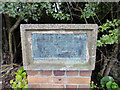
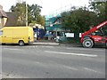
This is the most famed site associated with saxon missionary saint, St. Chad. The site was demolished when a lorry hit it and some of the bricks were reused for a monument. A nearby church reconstructed a replica without water. The real well was famed as an eye water. Water arises nearby are said to be from the same spring source.
You may be viewing yesterday's version of this page. To see the most up to date information please register for a free account.
 (PID:89828)")
 (PID:37032)")
 (PID:89827)")
Do not use the above information on other web sites or publications without permission of the contributor.
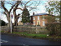
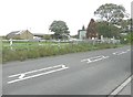
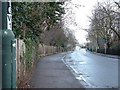
Nearby Images from Geograph Britain and Ireland:
©2012(licence)
©2005(licence)
©2013(licence)
©2007(licence)
©2013(licence)
The above images may not be of the site on this page, they are loaded from Geograph.
Please Submit an Image of this site or go out and take one for us!
Click here to see more info for this site
Nearby sites
Key: Red: member's photo, Blue: 3rd party photo, Yellow: other image, Green: no photo - please go there and take one, Grey: site destroyed
Download sites to:
KML (Google Earth)
GPX (GPS waypoints)
CSV (Garmin/Navman)
CSV (Excel)
To unlock full downloads you need to sign up as a Contributory Member. Otherwise downloads are limited to 50 sites.
Turn off the page maps and other distractions
Nearby sites listing. In the following links * = Image available
3.2km SSE 164° Valence House* Museum (TQ4803386569)
4.7km SSW 207° Holy well (Barking) Holy Well or Sacred Spring (TQ450853)
7.3km W 260° The High Stone of Snaresbrook Marker Stone (TQ3991388103)
7.9km W 281° Gipsy Smith* Modern Stone Circle etc (TQ392909)
8.7km NE 40° Unhenged* Modern Stone Circle etc (TQ5240696410)
9.5km NNW 328° Loughton Camp* Hillfort (TQ418975)
10.2km WNW 303° Pole Hill* Modern Stone Circle etc (TQ383949)
10.8km NNW 328° High Beach* Artificial Mound (TQ410985)
11.3km NNW 345° Ambresbury Banks* Hillfort (TL438004)
11.8km S 188° Winn's Common Tumulus* Round Barrow(s) (TQ457779)
11.8km ENE 67° Weald Park Hillfort Hillfort (TQ578946)
12.5km ESE 114° St. Cedd's Well (North Ockendon)* Holy Well or Sacred Spring (TQ587848)
12.8km ESE 113° Seven Springs (North Ockendon) Holy Well or Sacred Spring (TQ590850)
12.8km NNE 31° Stanford Rivers Stone* Natural Stone / Erratic / Other Natural Feature (TL533008)
12.9km SSW 196° Shrewsbury Tumulus* Round Barrow(s) (TQ439771)
12.9km NNW 341° Upshire Stone* Natural Stone / Erratic / Other Natural Feature (TL424016)
13.2km W 271° St. Eloy's Well* Holy Well or Sacred Spring (TQ338895)
13.8km N 352° Epping Bury puddingstone* Marker Stone (TL44790322)
14.9km SW 215° Greenwich Park Barrows* Barrow Cemetery (TQ3883677128)
15.0km NNE 28° St Andrew’s Church* Museum (TL538030)
15.1km NNW 344° Parvills Puddingstone* Marker Stone (TL424039)
15.3km W 264° Finsbury Park earthworks* Artificial Mound (TQ3186087537)
15.7km ESE 110° Church Field (North Ockendon) Cairn (TQ620845)
15.8km NNW 330° Holyfield Puddingstone* Marker Stone (TL38670303)
15.9km NNW 335° Galley Hill Puddingstone Marker Stone (TL400038)
View more nearby sites and additional images


 We would like to know more about this location. Please feel free to add a brief description and any relevant information in your own language.
 Wir möchten mehr über diese Stätte erfahren. Bitte zögern Sie nicht, eine kurze Beschreibung und relevante Informationen in Deutsch hinzuzufügen.
 Nous aimerions en savoir encore un peu sur les lieux. S'il vous plaît n'hesitez pas à ajouter une courte description et tous les renseignements pertinents dans votre propre langue.
 Quisieramos informarnos un poco más de las lugares. No dude en añadir una breve descripción y otros datos relevantes en su propio idioma.