<< Our Photo Pages >> Waxwell - Holy Well or Sacred Spring in England in Greater London
Submitted by DavidCWoods on Monday, 04 October 2004 Page Views: 10690
Springs and Holy WellsSite Name: Waxwell Alternative Name: Wakeswell, Waecc's SpringCountry: England
NOTE: This site is 3.05 km away from the location you searched for.
County: Greater London Type: Holy Well or Sacred Spring
Nearest Town: Harrow Nearest Village: Pinner
Map Ref: TQ118905
Latitude: 51.602253N Longitude: 0.387124W
Condition:
| 5 | Perfect |
| 4 | Almost Perfect |
| 3 | Reasonable but with some damage |
| 2 | Ruined but still recognisable as an ancient site |
| 1 | Pretty much destroyed, possibly visible as crop marks |
| 0 | No data. |
| -1 | Completely destroyed |
| 5 | Superb |
| 4 | Good |
| 3 | Ordinary |
| 2 | Not Good |
| 1 | Awful |
| 0 | No data. |
| 5 | Can be driven to, probably with disabled access |
| 4 | Short walk on a footpath |
| 3 | Requiring a bit more of a walk |
| 2 | A long walk |
| 1 | In the middle of nowhere, a nightmare to find |
| 0 | No data. |
| 5 | co-ordinates taken by GPS or official recorded co-ordinates |
| 4 | co-ordinates scaled from a detailed map |
| 3 | co-ordinates scaled from a bad map |
| 2 | co-ordinates of the nearest village |
| 1 | co-ordinates of the nearest town |
| 0 | no data |
Internal Links:
External Links:
")
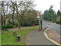
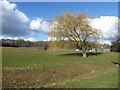
On the junction of Waxwell Road and Uxbridge Road in Pinner. The well has a nice housing, and explanatory notice, but has been sealed and is dry. It is to be found on a wide grass verge in a suburban street, although the village of Pinner is obviously very old and many of the buildings reflect this.
The notice, courtesy of Harrow Heritage Trust, tells us that the name was first recorded in 1274 as Wakeswell, thought to mean "Waecc's Spring". Until the mid 19th C the well was the most important source of water in Pinner village and reputed to have healing properties.
You may be viewing yesterday's version of this page. To see the most up to date information please register for a free account.
")
Do not use the above information on other web sites or publications without permission of the contributor.
coldrum has found this location on Google Street View:
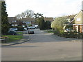
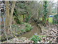
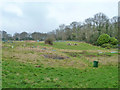
Nearby Images from Geograph Britain and Ireland:
©2020(licence)
©2012(licence)
©2020(licence)
©2020(licence)
©2018(licence)
The above images may not be of the site on this page, they are loaded from Geograph.
Please Submit an Image of this site or go out and take one for us!
Click here to see more info for this site
Nearby sites
Key: Red: member's photo, Blue: 3rd party photo, Yellow: other image, Green: no photo - please go there and take one, Grey: site destroyed
Download sites to:
KML (Google Earth)
GPX (GPS waypoints)
CSV (Garmin/Navman)
CSV (Excel)
To unlock full downloads you need to sign up as a Contributory Member. Otherwise downloads are limited to 50 sites.
Turn off the page maps and other distractions
Nearby sites listing. In the following links * = Image available
2.4km NE 43° Grim's Ditch (Greater London) Ancient Village or Settlement (TQ134923)
3.3km E 86° Weald Stone* Standing Stone (Menhir) (TQ1508890825)
5.2km NE 52° Stanmore common earthwork Misc. Earthwork (TQ15869381)
7.0km NNW 341° Cassiobury Park barrow* Round Barrow(s) (TQ094971)
7.5km SE 146° Horsenden Hill Hillfort (TQ1618684366)
8.8km ESE 107° Kingsbury erratic* Natural Stone / Erratic / Other Natural Feature (TQ2025488084)
11.2km NW 316° Church Hill puddingstones Natural Stone / Erratic / Other Natural Feature (TQ03899840)
11.3km SE 124° St Mary's Well (London)* Holy Well or Sacred Spring (TQ214844)
11.8km SSE 161° Elthorne Park Sarsen* Natural Stone / Erratic / Other Natural Feature (TQ15927947)
12.6km W 260° Bulstrode Camp* Hillfort (SU994880)
12.9km NNW 328° Chipperfield Common Round Barrows* Round Barrow(s) (TL04620126)
14.0km SE 126° Kensal Green* Modern Stone Circle etc (TQ233824)
14.3km N 349° Bedmond Puddingstone Natural Stone / Erratic / Other Natural Feature (TL087045)
14.4km NNW 327° Towerhill (Herts) Puddingstone* Natural Stone / Erratic / Other Natural Feature (TL0363802375)
14.7km N 0° Potterscrouch Puddingstones Natural Stone / Erratic / Other Natural Feature (TL116052)
14.8km SSW 211° Stanwell Cursus* Cursus (TQ044777)
15.3km NNW 336° Kings Langley Cursus Cursus (TL0535804425)
15.5km ESE 108° Chalybeate Well* Holy Well or Sacred Spring (TQ2671986055)
16.0km ESE 106° Hampstead Heath Barrow* Round Barrow(s) (TQ2738286518)
16.2km W 273° The Mount (Beaconsfield)* Round Barrow(s) (SU95549089)
16.3km SSW 206° Heathrow* Cursus (TQ050757)
16.4km N 11° Holy Well (St. Albans)* Holy Well or Sacred Spring (TL14640670)
16.9km SSE 161° Museum of Richmond* Museum (TQ1774374697)
16.9km WSW 242° Stoke Park Bowl Barrow* Round Barrow(s) (SU97038222)
17.0km NE 52° Potters Bar Museum Museum (TL2494101262)
View more nearby sites and additional images


 We would like to know more about this location. Please feel free to add a brief description and any relevant information in your own language.
 Wir möchten mehr über diese Stätte erfahren. Bitte zögern Sie nicht, eine kurze Beschreibung und relevante Informationen in Deutsch hinzuzufügen.
 Nous aimerions en savoir encore un peu sur les lieux. S'il vous plaît n'hesitez pas à ajouter une courte description et tous les renseignements pertinents dans votre propre langue.
 Quisieramos informarnos un poco más de las lugares. No dude en añadir una breve descripción y otros datos relevantes en su propio idioma.