 with our Megalithic Portal iPhone app")


<< Text Pages >> Tyttenhanger Puddingstones - Natural Stone / Erratic / Other Natural Feature in England in Hertfordshire
Submitted by Thorgrim on Thursday, 20 January 2005 Page Views: 8502
Natural PlacesSite Name: Tyttenhanger PuddingstonesCountry: England
NOTE: This site is 6.0 km away from the location you searched for.
County: Hertfordshire Type: Natural Stone / Erratic / Other Natural Feature
Nearest Town: St Albans Nearest Village: Tyttenhanger
Map Ref: TL189060
Latitude: 51.740101N Longitude: 0.279386W
Condition:
| 5 | Perfect |
| 4 | Almost Perfect |
| 3 | Reasonable but with some damage |
| 2 | Ruined but still recognisable as an ancient site |
| 1 | Pretty much destroyed, possibly visible as crop marks |
| 0 | No data. |
| -1 | Completely destroyed |
| 5 | Superb |
| 4 | Good |
| 3 | Ordinary |
| 2 | Not Good |
| 1 | Awful |
| 0 | No data. |
| 5 | Can be driven to, probably with disabled access |
| 4 | Short walk on a footpath |
| 3 | Requiring a bit more of a walk |
| 2 | A long walk |
| 1 | In the middle of nowhere, a nightmare to find |
| 0 | No data. |
| 5 | co-ordinates taken by GPS or official recorded co-ordinates |
| 4 | co-ordinates scaled from a detailed map |
| 3 | co-ordinates scaled from a bad map |
| 2 | co-ordinates of the nearest village |
| 1 | co-ordinates of the nearest town |
| 0 | no data |
Internal Links:
External Links:
I have visited· I would like to visit
willowman1 visited on 22nd Sep 2017 - their rating: Cond: -1 Amb: 3 Access: 5
You may be viewing yesterday's version of this page. To see the most up to date information please register for a free account.
Do not use the above information on other web sites or publications without permission of the contributor.
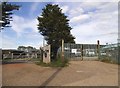
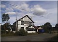
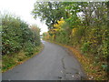
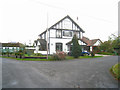
Nearby Images from Geograph Britain and Ireland:
©2015(licence)
©2015(licence)
©2011(licence)
©2011(licence)
©2011(licence)
The above images may not be of the site on this page, they are loaded from Geograph.
Please Submit an Image of this site or go out and take one for us!
Click here to see more info for this site
Nearby sites
Key: Red: member's photo, Blue: 3rd party photo, Yellow: other image, Green: no photo - please go there and take one, Grey: site destroyed
Download sites to:
KML (Google Earth)
GPX (GPS waypoints)
CSV (Garmin/Navman)
CSV (Excel)
To unlock full downloads you need to sign up as a Contributory Member. Otherwise downloads are limited to 50 sites.
Turn off the page maps and other distractions
Nearby sites listing. In the following links * = Image available
4.3km W 281° Holy Well (St. Albans)* Holy Well or Sacred Spring (TL14640670)
4.7km NW 316° Beech Bottom Dyke* Ancient Village or Settlement (TL155093)
5.0km W 281° Verulamium Town Walls* Ancient Village or Settlement (TL1393006840)
5.2km WNW 288° St Albans Puddingstones* Natural Stone / Erratic / Other Natural Feature (TL139075)
5.4km W 281° Verulamium Mosaic & Hypercaust* Ancient Village or Settlement (TL1357006900)
5.4km WNW 285° Verulamium Museum* Museum (TL1364007280)
5.7km WNW 286° Verulamium Puddingstone* Natural Stone / Erratic / Other Natural Feature (TL1340007400)
6.3km NE 55° Mill Green Museum Museum (TL240097)
7.0km WNW 291° Devil's Ditch (Hertfordshire) Ancient Village or Settlement (TL123084)
7.3km N 359° Devil's Dyke (Hertfordshire)* Ancient Village or Settlement (TL186133)
7.3km W 265° Potterscrouch Puddingstones Natural Stone / Erratic / Other Natural Feature (TL116052)
7.4km E 86° Wildhill Puddingstone Natural Stone / Erratic / Other Natural Feature (TL263067)
7.7km SE 130° Potters Bar Museum Museum (TL2494101262)
8.7km ESE 110° Griffin's Hole* Holy Well or Sacred Spring (TL2720403249)
10.3km W 263° Bedmond Puddingstone Natural Stone / Erratic / Other Natural Feature (TL087045)
10.8km WNW 301° The Aubreys* Hillfort (TL095113)
11.0km NNE 26° Welwyn Roman Baths* Ancient Village or Settlement (TL23451602)
11.0km NNE 24° Welwyn Puddingstone* Natural Stone / Erratic / Other Natural Feature (TL231162)
11.1km SSE 158° Barnet Physic Well* Holy Well or Sacred Spring (TQ2332295863)
12.6km SSW 195° Stanmore common earthwork Misc. Earthwork (TQ15869381)
13.0km SW 228° Cassiobury Park barrow* Round Barrow(s) (TQ094971)
13.0km NNE 34° Perry's Grove Boundary Ditch* Misc. Earthwork (TL25851700)
13.6km W 265° Kings Langley Cursus Cursus (TL0535804425)
14.8km SSW 203° Grim's Ditch (Greater London) Ancient Village or Settlement (TQ134923)
15.0km WSW 253° Chipperfield Common Round Barrows* Round Barrow(s) (TL0462001260)
View more nearby sites and additional images


 We would like to know more about this location. Please feel free to add a brief description and any relevant information in your own language.
 Wir möchten mehr über diese Stätte erfahren. Bitte zögern Sie nicht, eine kurze Beschreibung und relevante Informationen in Deutsch hinzuzufügen.
 Nous aimerions en savoir encore un peu sur les lieux. S'il vous plaît n'hesitez pas à ajouter une courte description et tous les renseignements pertinents dans votre propre langue.
 Quisieramos informarnos un poco más de las lugares. No dude en añadir una breve descripción y otros datos relevantes en su propio idioma.