<< Our Photo Pages >> Cool East wedge tomb - Wedge Tomb in Ireland (Republic of) in Co. Kerry
Submitted by GaelicLaird on Monday, 11 January 2021 Page Views: 2755
Neolithic and Bronze AgeSite Name: Cool East wedge tombCountry: Ireland (Republic of)
NOTE: This site is 2.989 km away from the location you searched for.
County: Co. Kerry Type: Wedge Tomb
Nearest Village: Chapeltown
Latitude: 51.911500N Longitude: 10.3612W
Condition:
| 5 | Perfect |
| 4 | Almost Perfect |
| 3 | Reasonable but with some damage |
| 2 | Ruined but still recognisable as an ancient site |
| 1 | Pretty much destroyed, possibly visible as crop marks |
| 0 | No data. |
| -1 | Completely destroyed |
| 5 | Superb |
| 4 | Good |
| 3 | Ordinary |
| 2 | Not Good |
| 1 | Awful |
| 0 | No data. |
| 5 | Can be driven to, probably with disabled access |
| 4 | Short walk on a footpath |
| 3 | Requiring a bit more of a walk |
| 2 | A long walk |
| 1 | In the middle of nowhere, a nightmare to find |
| 0 | No data. |
| 5 | co-ordinates taken by GPS or official recorded co-ordinates |
| 4 | co-ordinates scaled from a detailed map |
| 3 | co-ordinates scaled from a bad map |
| 2 | co-ordinates of the nearest village |
| 1 | co-ordinates of the nearest town |
| 0 | no data |
Internal Links:
External Links:
")
The sides of the tomb are each formed of a single slab, though a small orthostat is set inside the N side-stone at its eastern end. The roof-stone rests on all three stones and on a pad-stone. Leaning against the W end of the structure are three slabs, and another three slabs block its eastern end. None of the slabs appear to be original and they may have been employed to facilitate the use of the tomb as an animal shelter (de Valera and Ó Nuallain 1982, 61-2).
The site commands an extensive view of the Portmagee Channel to the south.
Officially recorded as monument KE078-008. The above description is derived from A. O'Sullivan and J. Sheehan (compilers), 'The Iveragh peninsula: an archaeological survey of South Kerry'. Cork University Press (1996), no. 75.
You may be viewing yesterday's version of this page. To see the most up to date information please register for a free account.
")
")
Do not use the above information on other web sites or publications without permission of the contributor.
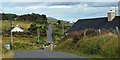
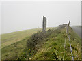
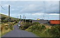
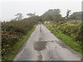
Nearby Images from Geograph Britain and Ireland:
©2019(licence)
©2017(licence)

©2019(licence)
©2019(licence)
©2017(licence)
The above images may not be of the site on this page, they are loaded from Geograph.
Please Submit an Image of this site or go out and take one for us!
Click here to see more info for this site
Nearby sites
Click here to view sites on an interactive map of the areaKey: Red: member's photo, Blue: 3rd party photo, Yellow: other image, Green: no photo - please go there and take one, Grey: site destroyed
Download sites to:
KML (Google Earth)
GPX (GPS waypoints)
CSV (Garmin/Navman)
CSV (Excel)
To unlock full downloads you need to sign up as a Contributory Member. Otherwise downloads are limited to 50 sites.
Turn off the page maps and other distractions
Nearby sites listing. In the following links * = Image available
366m SSW 200° Cool East ogham stone* Standing Stone (Menhir)
1.2km NNE 18° Tinnies Upper Stone Circle (V380770)
2.6km W 267° St Brendan's Well* Holy Well or Sacred Spring
3.5km NE 49° Glanleam standing stone* Standing Stone (Menhir)
6.7km NE 55° Ballycarbery west wedge tomb* Wedge Tomb
6.9km SSE 157° St Buonia's Cross (Killabuonia) Early Christian Sculptured Stone (V4002269422)
7.1km NE 45° Doulus Head Hut Sites* Ancient Village or Settlement
7.6km SSE 152° Leabaleaha Stone Circle (V410690)
8.4km ESE 112° Fermoyle Stone Row / Alignment (V453724)
8.6km NE 55° Cahergal* Stone Fort or Dun (V4484180557)
8.8km NE 52° Leacanabuaile* Stone Fort or Dun (V4463781059)
8.9km NE 54° Kimego Standing Stones (V450808)
9.7km ENE 69° Cahersiveen standing stones* Standing Stones (V4674478981)
10.3km SSE 161° Coom Wedge Tomb* Wedge Tomb
12.6km SSE 163° Kildreelig* Stone Row / Alignment
12.9km E 82° Canburrin Standing Stones
13.0km S 169° Bolus Standing Stones (V396630)
14.4km SE 126° Spuncane Stone Circle (V490670)
15.6km ENE 73° Srugreana Standing Stone (Menhir)
16.6km ENE 66° Ballynahow Beg* Rock Art (V5305682093)
17.5km ESE 104° Doory row Stone Row / Alignment
17.6km SE 128° Eightercua* Stone Row / Alignment (V51206465)
17.7km ESE 104° Doory standing stone Standing Stone (Menhir)
18.0km ESE 112° Dromkeare Stone Row / Alignment
18.1km ESE 109° Dromod* Stone Circle (V545694)
View more nearby sites and additional images


 We would like to know more about this location. Please feel free to add a brief description and any relevant information in your own language.
 Wir möchten mehr über diese Stätte erfahren. Bitte zögern Sie nicht, eine kurze Beschreibung und relevante Informationen in Deutsch hinzuzufügen.
 Nous aimerions en savoir encore un peu sur les lieux. S'il vous plaît n'hesitez pas à ajouter une courte description et tous les renseignements pertinents dans votre propre langue.
 Quisieramos informarnos un poco más de las lugares. No dude en añadir una breve descripción y otros datos relevantes en su propio idioma.