<< Other Photo Pages >> Old Castle of Lieto - Hillfort in Finland
Submitted by Anne T on Thursday, 16 October 2014 Page Views: 3501
Iron Age and Later PrehistorySite Name: Old Castle of Lieto Alternative Name: Liedon Vanhalinna, Lieto Hillfort, Lieto HillCountry: Finland
NOTE: This site is 21.469 km away from the location you searched for.
Type: Hillfort
Nearest Town: Turku
Latitude: 60.486389N Longitude: 22.377222E
Condition:
| 5 | Perfect |
| 4 | Almost Perfect |
| 3 | Reasonable but with some damage |
| 2 | Ruined but still recognisable as an ancient site |
| 1 | Pretty much destroyed, possibly visible as crop marks |
| 0 | No data. |
| -1 | Completely destroyed |
| 5 | Superb |
| 4 | Good |
| 3 | Ordinary |
| 2 | Not Good |
| 1 | Awful |
| 0 | No data. |
| 5 | Can be driven to, probably with disabled access |
| 4 | Short walk on a footpath |
| 3 | Requiring a bit more of a walk |
| 2 | A long walk |
| 1 | In the middle of nowhere, a nightmare to find |
| 0 | No data. |
| 5 | co-ordinates taken by GPS or official recorded co-ordinates |
| 4 | co-ordinates scaled from a detailed map |
| 3 | co-ordinates scaled from a bad map |
| 2 | co-ordinates of the nearest village |
| 1 | co-ordinates of the nearest town |
| 0 | no data |
Internal Links:
External Links:
")
Near the present town of Turku in the southern part of Finland is one of the most important hill-forts in this region known as the Old Castle of Lieto or (in Finnish) Liedon Vanhalinna.
Whilst relatively few of Finland’s hill-forts have been excavated, the Old Castle of Lieto has been shown to have been used in various periods, including the Late Bronze Age, the Middle Iron Age and the Middle Ages up to the end of the 14th century.
This hillfort lies on a steep hillside and is strategically placed between two ancient routes: the Aura river and the Oxen Way of Tavastia.
In 1956 Lieto Hill was donated to the University of Turku which uses the hillfort for archaeological training. Some of the ancient walls and outlines of buildings can be seen and there is a museum displaying some of the finds.
Note: Have you visited this site? Have you any information or photographs to add?
You may be viewing yesterday's version of this page. To see the most up to date information please register for a free account.
")
")
Do not use the above information on other web sites or publications without permission of the contributor.
Nearby Images from Flickr


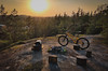

The above images may not be of the site on this page, but were taken nearby. They are loaded from Flickr so please click on them for image credits.
Click here to see more info for this site
Nearby sites
Click here to view sites on an interactive map of the areaKey: Red: member's photo, Blue: 3rd party photo, Yellow: other image, Green: no photo - please go there and take one, Grey: site destroyed
Download sites to:
KML (Google Earth)
GPX (GPS waypoints)
CSV (Garmin/Navman)
CSV (Excel)
To unlock full downloads you need to sign up as a Contributory Member. Otherwise downloads are limited to 50 sites.
Turn off the page maps and other distractions
Nearby sites listing. In the following links * = Image available
11.1km W 271° Altar Raisio* NOT SET
20.4km NW 308° Isotalo, Nousiainen* Cairn
43.5km E 100° Puonti* Cairn
53.3km SE 129° Lupaja* Barrow Cemetery
56.8km NW 320° Laitila* Barrow Cemetery
74.4km NNW 337° Sammallahdenmäki Barrow Cemetery
85.8km N 359° Kokemaki* Barrow Cemetery
120.9km NE 48° Rapola* Hillfort
125.6km ENE 62° Kauriala Uhrikivi Rock Art
126.8km NE 41° Järvensuo I* Ancient Village or Settlement
127.4km W 260° Borgboda Hillfort* Hillfort
129.8km W 261° Johannisberg (Kvarnbo)* Artificial Mound
134.1km W 259° Flyhagen/Knösäkern* Artificial Mound
135.0km WSW 258° Björkens/Söderskog* Artificial Mound
139.2km W 266° Myran* Artificial Mound
139.3km W 265° Smidbacka* Artificial Mound
139.5km W 260° Knösbackarna* Artificial Mound
140.6km ESE 103° Pronssikautinen hauta Lehtisaari (2)* Cairn
140.6km ESE 103° Pronssikautinen hauta Lehtisaari (1)* Cairn
143.0km ESE 102° Pronssikautinen hauta Meilahti (1)* Cairn
144.2km E 101° Käpylä Hiidenkirnu* Natural Stone / Erratic / Other Natural Feature
144.8km ESE 103° National Museum of Finland Museum
145.4km ENE 58° Hovin Manor Stone Rock Art
147.0km E 100° Pihlajamäki Hiidenkirnu Natural Stone / Erratic / Other Natural Feature
147.3km W 260° Kvarnbacken* Artificial Mound
View more nearby sites and additional images


 We would like to know more about this location. Please feel free to add a brief description and any relevant information in your own language.
 Wir möchten mehr über diese Stätte erfahren. Bitte zögern Sie nicht, eine kurze Beschreibung und relevante Informationen in Deutsch hinzuzufügen.
 Nous aimerions en savoir encore un peu sur les lieux. S'il vous plaît n'hesitez pas à ajouter une courte description et tous les renseignements pertinents dans votre propre langue.
 Quisieramos informarnos un poco más de las lugares. No dude en añadir una breve descripción y otros datos relevantes en su propio idioma.