


<< Our Photo Pages >> Gorley Hill - Hillfort in England in Hampshire
Submitted by JimChampion on Sunday, 23 April 2006 Page Views: 10297
Iron Age and Later PrehistorySite Name: Gorley HillCountry: England
NOTE: This site is 1.168 km away from the location you searched for.
County: Hampshire Type: Hillfort
Nearest Town: Fordingbridge Nearest Village: Gorley
Map Ref: SU164113
Latitude: 50.900946N Longitude: 1.768154W
Condition:
| 5 | Perfect |
| 4 | Almost Perfect |
| 3 | Reasonable but with some damage |
| 2 | Ruined but still recognisable as an ancient site |
| 1 | Pretty much destroyed, possibly visible as crop marks |
| 0 | No data. |
| -1 | Completely destroyed |
| 5 | Superb |
| 4 | Good |
| 3 | Ordinary |
| 2 | Not Good |
| 1 | Awful |
| 0 | No data. |
| 5 | Can be driven to, probably with disabled access |
| 4 | Short walk on a footpath |
| 3 | Requiring a bit more of a walk |
| 2 | A long walk |
| 1 | In the middle of nowhere, a nightmare to find |
| 0 | No data. |
| 5 | co-ordinates taken by GPS or official recorded co-ordinates |
| 4 | co-ordinates scaled from a detailed map |
| 3 | co-ordinates scaled from a bad map |
| 2 | co-ordinates of the nearest village |
| 1 | co-ordinates of the nearest town |
| 0 | no data |
Internal Links:
External Links:
I have visited· I would like to visit
davidmorgan JimChampion have visited here
")
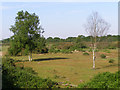
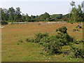
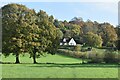
An iron age promontory fort once occupied the southwestern corner of Gorley Common on Gorley Hill - a gravel-capped spur that points southwest into the Avon valley between Fordingbridge and Ringwood. The earthworks were destroyed in the 1950s and 60s when the common's new owners carried out large-scale gravel extraction works, effectively "scalping" the hill. The tall linear earthen banks present on the hill, mostly covered with silver birch trees, are a relic of the quarrying process and not prehistoric in origin.
For some reason the hillfort's northern rampart (with a single entrance) is still shown on the modern 1:25000 Ordnance Survey map, along with the legend 'fort', as it was in the 1940s OS map. There are certainly no remains of this earthwork on the common, just well grazed grass and the occasional gorse brake at a level a few metres below the original plateau. The site is mentioned in the Hampshire Treasures online resource, and Heywood Sumner carried out some excavation at the site which was published in his 1917 book "Ancient Earthworks of the New Forest". [source]
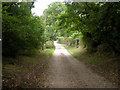
Access The destroyed fort is part of Gorley Common, which has been managed by Hampshire County Council since it purchased the site from the quarry operators in 1995. There is a gravel car park at the northeast corner of the common (grid ref SU168119) at a sharp bend in the Hyde-Ogdens minor road.
You may be viewing yesterday's version of this page. To see the most up to date information please register for a free account.
Do not use the above information on other web sites or publications without permission of the contributor.
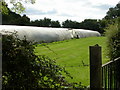
Nearby Images from Geograph Britain and Ireland:
©2006(licence)
©2006(licence)
©2009(licence)
©2009(licence)
©2022(licence)
The above images may not be of the site on this page, they are loaded from Geograph.
Please Submit an Image of this site or go out and take one for us!
Click here to see more info for this site
Nearby sites
Key: Red: member's photo, Blue: 3rd party photo, Yellow: other image, Green: no photo - please go there and take one, Grey: site destroyed
Download sites to:
KML (Google Earth)
GPX (GPS waypoints)
CSV (Garmin/Navman)
CSV (Excel)
To unlock full downloads you need to sign up as a Contributory Member. Otherwise downloads are limited to 50 sites.
Turn off the page maps and other distractions
Nearby sites listing. In the following links * = Image available
1.1km SE 131° Ibsley Common barrows* Barrow Cemetery (SU172106)
1.4km S 170° South Gorley Bowl Barrow Round Barrow(s) (SU16640997)
3.0km S 178° Moyles Court bowl barrow* Round Barrow(s) (SU16510833)
3.9km N 5° Frankenbury* Hillfort (SU167152)
4.2km SE 125° Castle Piece* Hillfort (SU199089)
4.6km NE 52° Ashley Walk mound* Artificial Mound (SU20041413)
5.1km W 262° Sleep Valley Barrow* Round Barrow(s) (SU113106)
5.2km NE 55° Ashley Cross tumuli* Round Barrow(s) (SU20641431)
5.6km WSW 257° Plumley Wood* Barrow Cemetery (SU109100)
6.4km SW 214° Bakers Hanging* Round Barrow(s) (SU128060)
6.5km WSW 238° Ebblake Barrow* Round Barrow(s) (SU109079)
6.5km ENE 69° Hiscocks Hill barrow* Round Barrow(s) (SU22481371)
6.6km NE 49° The Butts (Godshill)* Round Barrow(s) (SU21391565)
6.7km SSW 213° Ashley Heath* Round Barrow(s) (SU128057)
6.8km SSW 209° Watchmoor Wood* Round Barrow(s) (SU131054)
7.0km SW 229° Ashley Heath North* Round Barrow(s) (SU111067)
7.1km W 260° Verwood Stone* Standing Stone (Menhir) (SU09371005)
7.2km W 262° Boveridge Heath* Round Barrow(s) (SU093103)
7.4km ENE 62° Irons Well (Eyeworth)* Holy Well or Sacred Spring (SU22931476)
7.5km WSW 258° Stephen's Castle Tumulus* Round Barrow(s) (SU091097)
7.6km SSE 165° Knaves Ash barrow* Round Barrow(s) (SU18430396)
8.0km SSE 162° Strodgemoor Barrow* Round Barrow(s) (SU18910371)
8.2km SSE 155° Castle Hill (Hampshire)* Hillfort (SU199039)
8.2km SSE 150° St Mary's Well (Hampshire)* Holy Well or Sacred Spring (SU2056304175)
8.2km NE 37° Jacob's Barrow* Round Barrow(s) (SU21321793)
View more nearby sites and additional images


 We would like to know more about this location. Please feel free to add a brief description and any relevant information in your own language.
 Wir möchten mehr über diese Stätte erfahren. Bitte zögern Sie nicht, eine kurze Beschreibung und relevante Informationen in Deutsch hinzuzufügen.
 Nous aimerions en savoir encore un peu sur les lieux. S'il vous plaît n'hesitez pas à ajouter une courte description et tous les renseignements pertinents dans votre propre langue.
 Quisieramos informarnos un poco más de las lugares. No dude en añadir una breve descripción y otros datos relevantes en su propio idioma.