[< Gallery Home | Latest Images | Top 100 | Submit Picture >]
260355 Pictures
|
<< Previous Picture | Next Picture >>
Description
Image from page 681 of "The Victoria history of the county of Devon;" (1906)
Title: The Victoria history of the county of Devon;
Identifier: cu31924028099152
Year: 1906 (1900s)
Authors: Page, William, 1861-1934, ed
Subjects: Natural history
Publisher: London [Constable]
Contributing Library: Cornell University Library
Digitizing Sponsor: MSN
View Book Page: Book Viewer
About This Book: Catalog Entry
View All Images: All Images From Book
Click here to view book online to see this illustration in context in a browseable online version of this book.
Text Appearing Before Image:
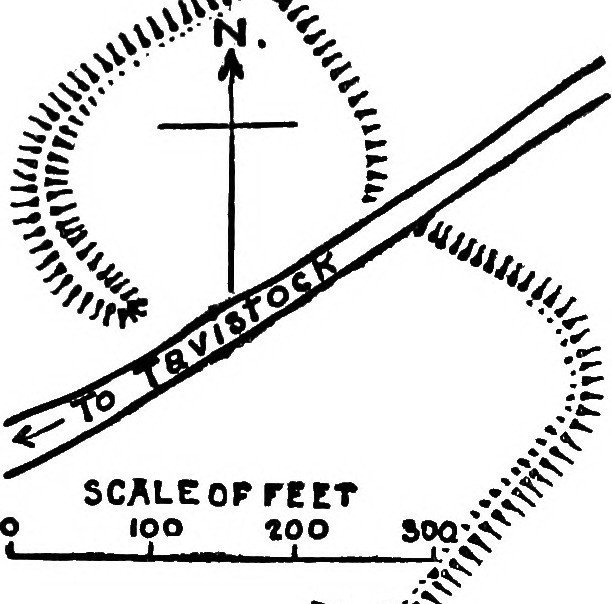
A HISTORY OF DEVONSHIRE town of Tiverton. Situated on high ground, very broken and wild, the camp of no nameable plan is surrounded by a vallum 8 ft. in height, except on the south-west, at which point a wooded steep descends in a valley through which a stream pursues its way to join the River Lowman. x^'''
Text Appearing After Image:
ifi> sfc'^^ir^oo . vviiiuiuiiiii...,, o â= 'iko >* ^c Camp at Tavistock. SCALE OF FEET lOO «oo ' 300 Higher Bury Camp, Tedburn. The southern ^^v^S^»"A^^ii^ The entrance at the north-east is between the incurved ends of the vallum, end, 6o ft. long, turns at an acute angle from the course of the rampart. ToRRiNGTON.âGaze Castle, one mile south of Berry Castle camp in the neighbouring parish of Huntshaw, and in view of the same, is now destroyed and under cultivation ; but 15 ft. of it may be traced through the crops. ^ ^ Ugborough (O.S. cxx, 13).âFully i mile ^-JinjJ south of South Brent and west of Turtley, a »? circular camp is upon a slight rising in a valley. ȣ It is strongest on its southern side, where a 5E rampart rises 3 ft. from within, and has an en- is campment 6 ft. 6 in. with a fosse 3 ft. 6 in. deep. js This agger guarded the entrance at the south-west, sc but in its easterly course it is gradually lost, leaving 3c the remainder of the camp defended only by a 3S ditch 8 ft. wide and 3 ft. deep ; and even that is almost levelled at the north. To the north of it flows the Glaze Brook, a tributary of the River Avon; while on the north and the west, rising from Brent Moor and Ugborough Moor, are the heights of Brent Hill, Ugborough Beacon, and Butterton Hill. I >â -.?. -'A .0, SCALE OF FEET 190 â¢^^'/v % HuNTSHAM Castle, Tiverton. Washfield (O.S. xxxiv, 6).â^The site of a former camp may be traced in a field called ' Castle Close,' between Barehill Wood and Huntland Copse, nearly 2 miles north of Tiverton, Two spear-heads of the * leaf-shaped' type and a short sword were found in the en- trenchment near the ford of the Exe at Worth. WiDECOMBE IN THE Moor (O.S. cviii, 5).âBe- tween 4 and 5 miles north-west of Ashburton are the remains of two entrenchments, both
Note About Images
Please note that these images are extracted from scanned page images that may have been digitally enhanced for readability - coloration and appearance of these illustrations may not perfectly resemble the original work.
Image copyright: Internet Archive Book Images, hosted on Flickr and displayed under the terms of their API.
Title: The Victoria history of the county of Devon;
Identifier: cu31924028099152
Year: 1906 (1900s)
Authors: Page, William, 1861-1934, ed
Subjects: Natural history
Publisher: London [Constable]
Contributing Library: Cornell University Library
Digitizing Sponsor: MSN
View Book Page: Book Viewer
About This Book: Catalog Entry
View All Images: All Images From Book
Click here to view book online to see this illustration in context in a browseable online version of this book.
Text Appearing Before Image:
A HISTORY OF DEVONSHIRE town of Tiverton. Situated on high ground, very broken and wild, the camp of no nameable plan is surrounded by a vallum 8 ft. in height, except on the south-west, at which point a wooded steep descends in a valley through which a stream pursues its way to join the River Lowman. x^'''
Text Appearing After Image:
ifi> sfc'^^ir^oo . vviiiuiuiiiii...,, o â= 'iko >* ^c Camp at Tavistock. SCALE OF FEET lOO «oo ' 300 Higher Bury Camp, Tedburn. The southern ^^v^S^»"A^^ii^ The entrance at the north-east is between the incurved ends of the vallum, end, 6o ft. long, turns at an acute angle from the course of the rampart. ToRRiNGTON.âGaze Castle, one mile south of Berry Castle camp in the neighbouring parish of Huntshaw, and in view of the same, is now destroyed and under cultivation ; but 15 ft. of it may be traced through the crops. ^ ^ Ugborough (O.S. cxx, 13).âFully i mile ^-JinjJ south of South Brent and west of Turtley, a »? circular camp is upon a slight rising in a valley. ȣ It is strongest on its southern side, where a 5E rampart rises 3 ft. from within, and has an en- is campment 6 ft. 6 in. with a fosse 3 ft. 6 in. deep. js This agger guarded the entrance at the south-west, sc but in its easterly course it is gradually lost, leaving 3c the remainder of the camp defended only by a 3S ditch 8 ft. wide and 3 ft. deep ; and even that is almost levelled at the north. To the north of it flows the Glaze Brook, a tributary of the River Avon; while on the north and the west, rising from Brent Moor and Ugborough Moor, are the heights of Brent Hill, Ugborough Beacon, and Butterton Hill. I >â -.?. -'A .0, SCALE OF FEET 190 â¢^^'/v % HuNTSHAM Castle, Tiverton. Washfield (O.S. xxxiv, 6).â^The site of a former camp may be traced in a field called ' Castle Close,' between Barehill Wood and Huntland Copse, nearly 2 miles north of Tiverton, Two spear-heads of the * leaf-shaped' type and a short sword were found in the en- trenchment near the ford of the Exe at Worth. WiDECOMBE IN THE Moor (O.S. cviii, 5).âBe- tween 4 and 5 miles north-west of Ashburton are the remains of two entrenchments, both
Note About Images
Please note that these images are extracted from scanned page images that may have been digitally enhanced for readability - coloration and appearance of these illustrations may not perfectly resemble the original work.
Image copyright: Internet Archive Book Images, hosted on Flickr and displayed under the terms of their API.
No comments. Why don't you go ahead and post one!
To post comments first you must Register!