[< Gallery Home | Latest Images | Top 100 | Submit Picture >]
277688 Pictures
|
<< Previous Picture | Next Picture >>

| Submitted by | SandyG |
| Added | Jan 15 2018 |
| Hits | 250 |
| Votes | 1 |
Description
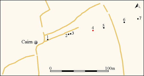
Simplified plan of the Hameldown stone row. Historic field boundaries are also shown. The red circle denotes the position of a hollow which was probably formed when a stone was removed.
Stones plotted by GPS survey by Sandy Gerrard and field boundaries from Google Earth.
Stones plotted by GPS survey by Sandy Gerrard and field boundaries from Google Earth.
No comments. Why don't you go ahead and post one!
To post comments first you must Register!
