Megalithic Portal Map Search
All Countries: France: Rhone:Isère (38)
Narrow down your selection by Type of Site using the filter above.

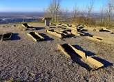
 Camp de Larina Ancient Village or Settlement in Rhone:Isère (38) Camp de Larina Ancient Village or Settlement in Rhone:Isère (38) Posted by holger_rix on Tuesday, 26 April 2016 , Accuracy: 4 (Other Pic) 1 comment |
 Dolmen dit la Pierre à Mata Burial Chamber or Dolmen in Rhone:Isère (38) Dolmen dit la Pierre à Mata Burial Chamber or Dolmen in Rhone:Isère (38) Posted by holger_rix on Monday, 07 March 2016 , Accuracy: 4 (No Pic) No Comments |
 Pierre à Cupule de Chatelans Rock Art in Rhone:Isère (38) Pierre à Cupule de Chatelans Rock Art in Rhone:Isère (38) Posted by holger_rix on Friday, 15 January 2016 , Accuracy: 4 (No Pic) No Comments |
 Ciste de Meyrieu-les-Étangs Burial Chamber or Dolmen in Rhone:Isère (38) Ciste de Meyrieu-les-Étangs Burial Chamber or Dolmen in Rhone:Isère (38) Posted by holger_rix on Thursday, 14 January 2016 , Accuracy: 4 (No Pic) No Comments |
 Le Tombeau du General Burial Chamber or Dolmen in Rhone:Isère (38) Le Tombeau du General Burial Chamber or Dolmen in Rhone:Isère (38) Posted by TheCaptain on Wednesday, 08 September 2010 , Accuracy: 2 (No Pic) No Comments |
 Grotte De La Ture Cave or Rock Shelter in Rhone:Isère (38) Grotte De La Ture Cave or Rock Shelter in Rhone:Isère (38) Posted by AlexHunger on Tuesday, 17 May 2005 (No Pic) No Comments |
 Les Cuves Grotte Cave or Rock Shelter in Rhone:Isère (38) Les Cuves Grotte Cave or Rock Shelter in Rhone:Isère (38) Posted by AlexHunger on Tuesday, 17 May 2005 (No Pic) No Comments |
 Grottes de la Balme Cave or Rock Shelter in Rhone:Isère (38) Grottes de la Balme Cave or Rock Shelter in Rhone:Isère (38) Posted by AlexHunger on Tuesday, 17 May 2005 , Accuracy: 5 (Other Pic) No Comments |

