Contributory members are able to log private notes and comments about each site
Sites Andy B has logged. View this log as a table or view the most recent logs from everyone
Grimsay, Bagh Nam Feadhag
Trip No.17 Entry No.8 Date Added: 24th Sep 2022
Site Type: Ancient Village or Settlement
Country: Scotland (North Uist)
Visited: Saw from a distance

Grimsay, Bagh Nam Feadhag submitted by markj99 on 21st Mar 2021. Grimsay Wheelhouse
(View photo, vote or add a comment)
Log Text: None
Udal (Grenitote)
Trip No.17 Entry No.7 Date Added: 5th Jul 2020
Site Type: Ancient Village or Settlement
Country: Scotland (North Uist)
Visited: Yes

Udal (Grenitote) submitted by Creative Commons on 13th Apr 2012. Wheelhouse at Udal
This is a well-preserved example of an iron age wheelhouse. It was dug partly into the ground. Central stone partitions, like the spokes of a wheel, divided the house into sections.
ScotlandsPlaces says that there is evidence of continuous occupation from Neolithic times to the post-medieval period.
Copyright Rob Burke and licensed for reuse under the Creative Commons Licence.
Site in North Uist Scotland
(View photo, vote or add a comment)
Log Text: None
Drimore, A' Cheardach Bheag
Trip No.17 Entry No.5 Date Added: 5th Jul 2020
Site Type: Ancient Village or Settlement
Country: Scotland (South Uist)
Visited: Saw from a distance

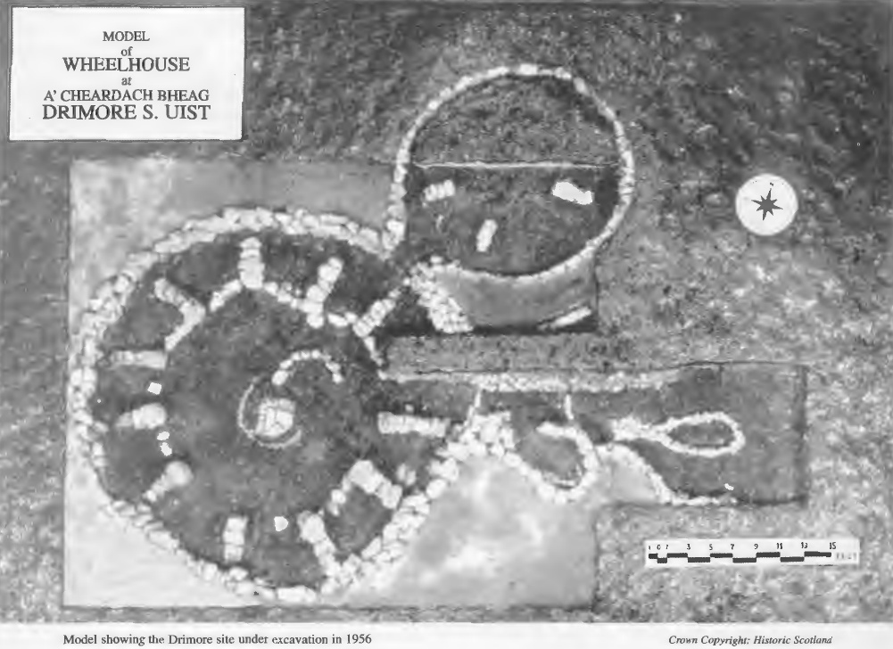
Drimore, A' Cheardach Bheag submitted by dodomad on 5th Jul 2020. Model showing the Drimore site under excavation in 1956
Credit: Historic Scotland
(View photo, vote or add a comment)
Log Text: None
Drimore, A' Cheardach Mhor
Trip No.17 Entry No.4 Date Added: 5th Jul 2020
Site Type: Ancient Village or Settlement
Country: Scotland (South Uist)
Visited: Yes
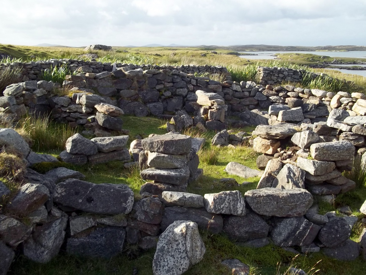
Drimore, A' Cheardach Mhor submitted by SandyG on 4th Feb 2019. The short length of visible walling. View from south east (Scale 1m).
(View photo, vote or add a comment)
Log Text: None
Kilpheder Wheelhouse
Trip No.17 Entry No.3 Date Added: 5th Jul 2020
Site Type: Ancient Village or Settlement
Country: Scotland (South Uist)
Visited: Saw from a distance

Kilpheder Wheelhouse submitted by SandyG on 20th May 2016. Detail of the northern wall. View from the south (26 August 2015).
(View photo, vote or add a comment)
Log Text: None
Bac Mic Connain
Trip No.17 Entry No.1 Date Added: 5th Jul 2020
Site Type: Stone Fort or Dun
Country: Scotland (North Uist)
Visited: Saw from a distance
Log Text: None
Cleithreabhal
Trip No.17 Entry No.2 Date Added: 5th Jul 2020
Site Type: Chambered Cairn
Country: Scotland (North Uist)
Visited: Yes on 13th Sep 2011

Cleithreabhal submitted by Andy B on 13th Sep 2011. Wheeled House on the southern slopes of Cleitreabhal a Dheas.
It's built into the west end of the adjacent Chambered Cairn of which stones have been re-used. Hogha Gearraidh in the background.
Copyright Vanhercke Christiaan and licensed for reuse under the Creative Commons Licence.
Site in North Uist Scotland
(View photo, vote or add a comment)
Log Text: None
Nunney
Trip No.16 Entry No.17 Date Added: 24th Jun 2020
Site Type: Artificial Mound
Country: England (Somerset)
Visited: Yes
Log Text: None
Mells, Newbury Firs
Trip No.16 Entry No.16 Date Added: 24th Jun 2020
Site Type: Artificial Mound
Country: England (Somerset)
Visited: Yes
Log Text: None
Witham Friary 2
Trip No.16 Entry No.15 Date Added: 24th Jun 2020
Site Type: Round Barrow(s)
Country: England (Somerset)
Visited: Yes
Log Text: None
Witham Friary I
Trip No.16 Entry No.14 Date Added: 24th Jun 2020
Site Type: Round Barrow(s)
Country: England (Somerset)
Visited: Yes
Log Text: None
Braysdown Barrow
Trip No.16 Entry No.13 Date Added: 24th Jun 2020
Site Type: Long Barrow
Country: England (Somerset)
Visited: Yes
Log Text: None
Staplemead Round Barrow
Trip No.16 Entry No.12 Date Added: 24th Jun 2020
Site Type: Round Barrow(s)
Country: England (Somerset)
Visited: Yes
Log Text: None
Conquest Field
Trip No.16 Entry No.11 Date Added: 24th Jun 2020
Site Type: Round Barrow(s)
Country: England (Somerset)
Visited: Yes
Log Text: None
Giants Grave, Southmead
Trip No.16 Entry No.5 Date Added: 24th Jun 2020
Site Type: Long Barrow
Country: England (Somerset)
Visited: Yes
Giants Grave, Southmead submitted by hamish on 14th Apr 2005. Only a slight rise is detectable, the farmer told me they do not plough this field.
(View photo, vote or add a comment)
Log Text: None
The Devil's Bed and Bolster
Trip No.16 Entry No.4 Date Added: 24th Jun 2020
Site Type: Chambered Tomb
Country: England (Somerset)
Visited: Yes

The Devil's Bed and Bolster submitted by JimChampion on 18th Apr 2007. In the foreground are the stones that presumably formed part of the end chamber in the tomb. Beyond are the stones at the entrance. The cut logs show that there has been some clearance of woody plants from the remains of the barrow mound. Signs on a nearby fencepost indicate that this barrow is alongside a 'conservation walk' - a phrase usually used for a permissive path around an area of natural/historical interest. Thankfully there weren't too many nettles beneath these trees - I was wearing s...
(View photo, vote or add a comment)
Log Text: None
Elm Barrows, Great Elm
Trip No.16 Entry No.10 Date Added: 24th Jun 2020
Site Type: Round Barrow(s)
Country: England (Somerset)
Visited: Yes
Log Text: None
Jubilee Field
Trip No.16 Entry No.9 Date Added: 24th Jun 2020
Site Type: Round Barrow(s)
Country: England (Somerset)
Visited: Yes
Log Text: None
Rowberrow Field Barrow
Trip No.16 Entry No.8 Date Added: 24th Jun 2020
Site Type: Round Barrow(s)
Country: England (Somerset)
Visited: Yes
Log Text: None
Roundhill Barrow
Trip No.16 Entry No.7 Date Added: 24th Jun 2020
Site Type: Round Barrow(s)
Country: England (Somerset)
Visited: Yes

Roundhill Barrow submitted by Iain_P on 24th May 2017. Here's a simulation (= not very scientific, manipulated Photoshopped image!) showing the barrow without the trees, bushes and knee-deep vegetation. Actually, purely by accident, it fits quite well with the dimensions and description given on the Heritage England listing:
"circular in plan, measuring about 21m in diameter, and survives to a height of approximately 1.7m, with steep sloping sides descending from a level area on the summit which measures 10m across." (List Entry Number: 1013521)
(View photo, vote or add a comment)
Log Text: None
