Contributory members are able to log private notes and comments about each site
Sites Andy B has logged. View this log as a table or view the most recent logs from everyone
Nether Tullicro
Date Added: 4th Apr 2012
Site Type: Standing Stone (Menhir)
Country: Scotland (Perth and Kinross)
Visited: Yes on 14th Jun 2011
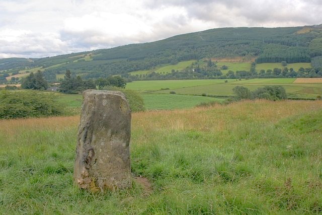
Nether Tullicro submitted by Andy B on 14th Jun 2011. Standing Stone, Nether Tullicro
Neolithic to Bronze Age.
Copyright Mick Garratt and licensed for reuse under the Creative Commons Licence.
(View photo, vote or add a comment)
Log Text: None
Clach a' Phlaigh
Date Added: 4th Apr 2012
Site Type: Standing Stone (Menhir)
Country: Scotland (Perth and Kinross)
Visited: Yes on 14th Jun 2011

Clach a' Phlaigh submitted by Andy B on 14th Jun 2011. Standing stone (Carn na Marbh)
The stone marks the mound under which victims of the 14th century Great Plague were buried
Copyright Elliott Simpson and licensed for reuse under this Creative Commons Licence.
(View photo, vote or add a comment)
Log Text: None
Glassie Standing Stone
Date Added: 4th Apr 2012
Site Type: Standing Stone (Menhir)
Country: Scotland (Perth and Kinross)
Visited: Yes on 14th Jun 2011
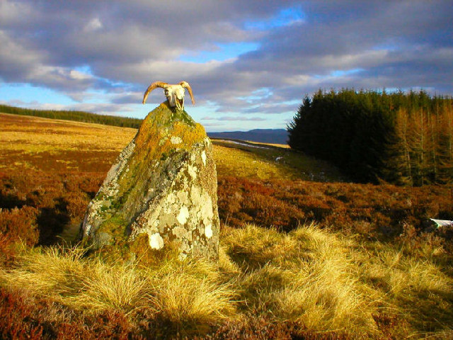
Glassie Standing Stone submitted by Andy B on 14th Jun 2011. Cup-Marked monolith, Boltachan, Glassie, Strathay
This stone bears cup-marks on both its rising edges and the top portion: it is one of several cup and/or ring-marked stones in the immediate vicinity.
Copyright paddy heron and licensed for reuse under this Creative Commons Licence.
(View photo, vote or add a comment)
Log Text: None
Knap Hill
Date Added: 4th Apr 2012
Site Type: Causewayed Enclosure
Country: England (Wiltshire)
Visited: Yes on 13th Jun 2011

Knap Hill submitted by Creative Commons on 13th Jun 2011. Knap Hill and Walkers Hill. Knap Hill on the left, surmounted by a neolithic causewayed enclosure, and Walkers Hill beyond on the right, surmounted by the long barrow of Adam's Grave, with the line of Cross Dyke in the dip to its right. Viewed against evening sun.
Copyright Ian Capper and licensed for reuse under the Creative Commons Licence.
(View photo, vote or add a comment)
Log Text: None
Combe Hill Enclosure
Date Added: 4th Apr 2012
Site Type: Causewayed Enclosure
Country: England (East Sussex)
Visited: Yes on 13th Jun 2011
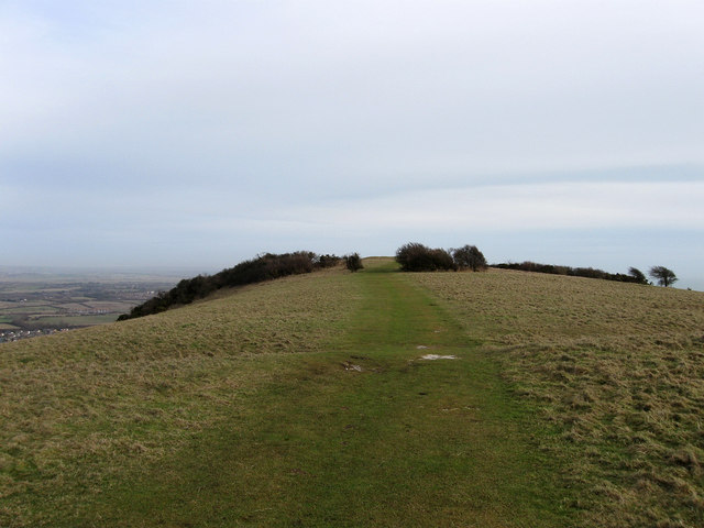
Combe Hill submitted by Creative Commons on 13th Jun 2011. Causewayed Enclosure, Combe Hill
Dating from the Neolithic Age the enclosure contains a ring of two concentric enclosures broken by causeways through them.
Copyright Simon Carey and licensed for reuse under the Creative Commons Licence.
(View photo, vote or add a comment)
Log Text: None
The Combe Tumuli
Date Added: 4th Apr 2012
Site Type: Barrow Cemetery
Country: England (East Sussex)
Visited: Yes on 13th Jun 2011
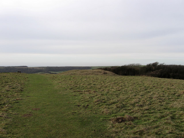
The Combe Tumuli submitted by Andy B on 13th Jun 2011. Tumulus, Combe Hill
On the western side beyond the causewayed enclosure. These date from the Bronze Age.
Copyright Simon Carey and licensed for reuse under the Creative Commons Licence.
(View photo, vote or add a comment)
Log Text: None
Rams Hill
Date Added: 4th Apr 2012
Site Type: Causewayed Enclosure
Country: England (Oxfordshire)
Visited: Yes on 13th Jun 2011
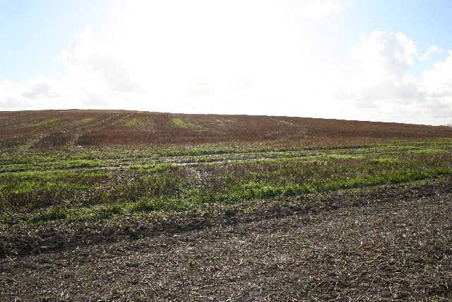
Rams Hill submitted by Andy B on 13th Jun 2011. Rams Hill Fort
Not actually a fort but a 'causewayed camp' between Uffington Castle and Segsbury Camp on The Ridgeway.
Copyright Tom Stringer and licensed for reuse under the Creative Commons Licence.
(View photo, vote or add a comment)
Log Text: None
Dun A'chail
Date Added: 4th Apr 2012
Site Type: Stone Fort or Dun
Country: Scotland (Isle of Islay)
Visited: Yes on 13th Jun 2011
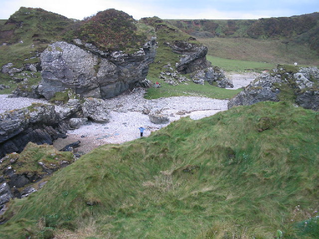
Dun A'chail submitted by Andy B on 13th Jun 2011. Dun a'Chail Iron Age Fort
At Port Alsaig. This small enclosure in the foreground is on the top of a rocky islet in the bay, accessible at low tide across stepping stones and then a short scramble.
Copyright Ian Mitchell and licensed for reuse under the Creative Commons Licence
(View photo, vote or add a comment)
Log Text: None
Gleann Bun An Easa
Date Added: 4th Apr 2012
Site Type: Misc. Earthwork
Country: Scotland (Isle of Islay)
Visited: Yes on 13th Jun 2011
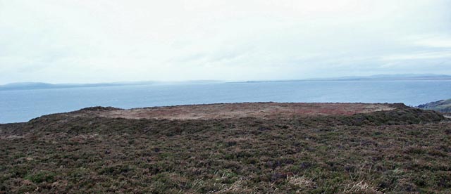
Gleann Bun An Easa submitted by Andy B on 13th Jun 2011. Earthwork, Gleann Bun an Easa, Islay
The earthwork is located on a headland on The Oa. It has a ditch, rampart and traces of causewayed entrance.
Copyright Claire Pegrum and licensed for reuse under the Creative Commons Licence
(View photo, vote or add a comment)
Log Text: None
Ballinaby
Date Added: 4th Apr 2012
Site Type: Stone Row / Alignment
Country: Scotland (Isle of Islay)
Visited: Yes on 13th Jun 2011
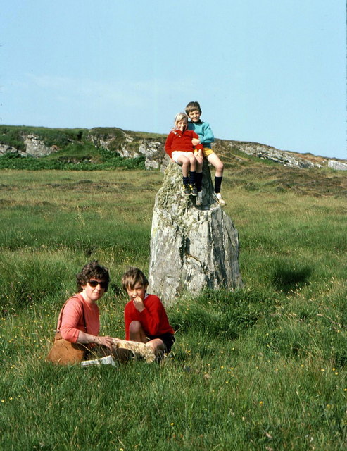
Ballinaby submitted by Creative Commons on 13th Jun 2011. The smaller of the standing stones at Ballinaby
An Carnan is the low hill in the background. The astronomical significance of this stone in conjunction with the very tall stone is explained at Stones of Wonder
Copyright Russel Wills and licensed for reuse under this Creative Commons Licence.
(View photo, vote or add a comment)
Log Text: None
Knocklearoch
Date Added: 4th Apr 2012
Site Type: Standing Stones
Country: Scotland (Isle of Islay)
Visited: Yes on 13th Jun 2011
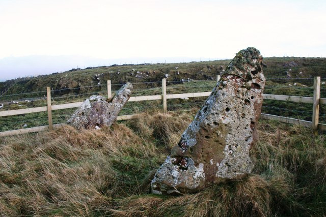
Knocklearoch submitted by Andy B on 13th Jun 2011. Knochlearoch standing stones
Standing Stones in a field directly by the Farm of Knochlearoch.
Copyright Andrew Wood and licensed for reuse under the Creative Commons Licence.
(View photo, vote or add a comment)
Log Text: None
Mullach Dubh
Date Added: 4th Apr 2012
Site Type: Standing Stone (Menhir)
Country: Scotland (Isle of Islay)
Visited: Yes on 13th Jun 2011

Mullach Dubh submitted by Andy B on 13th Jun 2011. Standing stone near Kilmeny, Islay
The limestone stone is about 1.3m high. Part of it has broken off and is embedded in the ground nearby.
Copyright Claire Pegrum and licensed for reuse under this Creative Commons Licence.
(View photo, vote or add a comment)
Log Text: None
Finlaggan
Date Added: 4th Apr 2012
Site Type: Standing Stone (Menhir)
Country: Scotland (Isle of Islay)
Visited: Yes on 13th Jun 2011
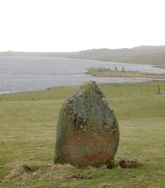
Finlaggan submitted by Andy B on 13th Jun 2011. Standing stone, Finlaggan
This stone overlooks Loch Finlaggan and stands about 2m high. A geophysical survey of the site has suggested that this stone is the only visible remnant of a much larger and more complex stone monument or ceremonial site.
Copyright Gordon Hatton and licensed for reuse under this Creative Commons Licence.
(View photo, vote or add a comment)
Log Text: None
Cragabus
Date Added: 4th Apr 2012
Site Type: Chambered Cairn
Country: Scotland (Isle of Islay)
Visited: Yes on 13th Jun 2011

Cragabus submitted by Creative Commons on 13th Jun 2011. View of chambered cairn looking north towards Old Shieling
Copyright Lesley Smith and licensed for reuse under the Creative Commons Licence.
(View photo, vote or add a comment)
Log Text: None
Lagavulin N
Date Added: 4th Apr 2012
Site Type: Stone Row / Alignment
Country: Scotland (Isle of Islay)
Visited: Yes on 13th Jun 2011

Lagavulin N submitted by Creative Commons on 13th Jun 2011. Standing Stone in Wall, near Lagavulin, Islay
Copyright Becky Williamson and licensed for reuse under the Creative Commons Licence.
(View photo, vote or add a comment)
Log Text: None
Kilbride
Date Added: 4th Apr 2012
Site Type: Standing Stone (Menhir)
Country: Scotland (Isle of Islay)
Visited: Yes on 13th Jun 2011
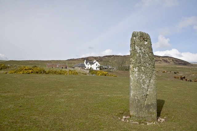
Kilbride submitted by Andy B on 13th Jun 2011. Standing Stone, Kilbride, Islay
With Kilbride Farm in background.
Copyright Becky Williamson and licensed for reuse under this Creative Commons Licence.
(View photo, vote or add a comment)
Log Text: None
Swarth Fell
Date Added: 4th Apr 2012
Site Type: Stone Circle
Country: England (Cumbria)
Visited: Yes on 13th Jun 2011

Swarth Fell submitted by Andy B on 13th Jun 2011. Stone Circle
Above Swarth fell. The circle had proved elusive on previous visits but this appears to be the one marked on the maps.
Copyright Michael Graham and licensed for reuse under this Creative Commons Licence
(View photo, vote or add a comment)
Log Text: None
Knipe Scar
Date Added: 4th Apr 2012
Site Type: Stone Circle
Country: England (Cumbria)
Visited: Yes on 13th Jun 2011

Knipe Scar submitted by Andy B on 13th Jun 2011. Stone Circle
On Knipe Moor.If it was not marked on the map not many would be able to pick it out on the limestone pavement
Copyright Michael Graham and licensed for reuse under the Creative Commons Licence.
(View photo, vote or add a comment)
Log Text: None
Funk Heritage Center
Date Added: 4th Apr 2012
Site Type: Museum
Country: United States (The South)
Visited: Yes on 8th Jun 2011

Funk Heritage Center submitted by Andy B on 8th Jun 2011. The symbols on the 11 feet long boulder have been interpreted alternatively as Creek & Yuchi Indian time portals (stargates,) a star map showing planetary systems, or a land map showing locations of towns & villages.
Credit: Funk Heritage Museum
More photos here
(View photo, vote or add a comment)
Log Text: None
Hasankeyf
Date Added: 4th Apr 2012
Site Type: Ancient Village or Settlement
Country: Turkey
Visited: Yes on 8th Jun 2011

Hasankeyf submitted by Andy B on 8th Jun 2011. A view of the ancient bridge across the Tigris as the river flows through Hasankeyf.
(Courtesy Senol Demir/Flickr Creative Commons)
(View photo, vote or add a comment)
Log Text: None
