Contributory members are able to log private notes and comments about each site
Sites Andy B has logged. View this log as a table or view the most recent logs from everyone
Moel-y-Gaer (Bodfari)
Date Added: 4th Apr 2012
Site Type: Hillfort
Country: Wales (Denbighshire)
Visited: Yes on 30th Aug 2011

Moel-y-Gaer (Bodfari) submitted by Andy B on 30th Aug 2011. Offa's Dyke Path approaching Coed Moel-y-Gaer
Copyright Tim Heaton and licensed for reuse under the Creative Commons Licence.
(View photo, vote or add a comment)
Log Text: None
Moel-y-Gaer (Loggerheads)
Date Added: 11th Jan 2013
Site Type: Hillfort
Country: Wales (Denbighshire)
Visited: Yes on 23rd Oct 2012

Moel-y-Gaer (Loggerheads) submitted by Andy B on 23rd Oct 2012. A piece of vitrified material / flow slag, dimensions c. 15X10x10 cm.
It looks likely that this material was brought to the hillfort as part of a 'founding' event in the building of the ramparts.
Image credit: Bangor University
(View photo, vote or add a comment)
Log Text: None
Great Orme Mine
Trip No.7 Entry No.3 Date Added: 7th Apr 2011
Site Type: Ancient Mine, Quarry or other Industry
Country: Wales (Conwy)
Visited: Would like to visit
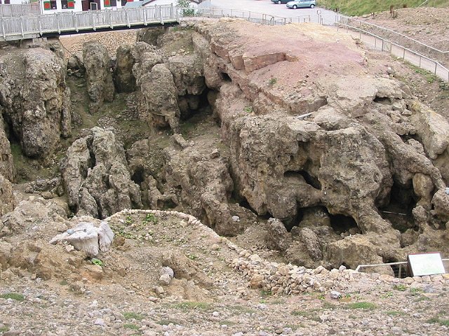
Great Orme Mine submitted by stu on 14th Oct 2002. O.S sheet 17 772831.
The Great Orme Mine. A prehistoric copper mine. Well worth a look around,
nice bronze age artefacts in the entrance to the mine.
(View photo, vote or add a comment)
Log Text: Neil Oliver goes down some tight squeezes in the prehistoric Great Orme Copper mine in Episode One of a History of Celtic Britain
Castell Goetre
Trip No.2 Entry No.1 Date Added: 17th Jan 2011
Site Type: Hillfort
Country: Wales (Ceredigion)
Visited: Yes on 12th Oct 2010
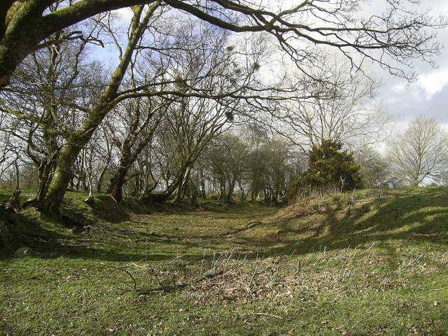
Castell Goetre submitted by Andy B on 12th Oct 2010. Castell Goetre (Possibly from Goed-Tref or 'settlement in the wood') is an Iron Age hill fort on the ridgeway between the Teifi and Dulas valleys. It is located in the northwest of this square and extends into SN6051 to the north.
The fort, now populated by sheep and home to a small reservoir, consists of an oval banked and ditched enclosure with a cross-bank through the centre, possibly part of an earlier phase. From ground level it appears much eroded but in places is still well defined, as ...
(View photo, vote or add a comment)
Log Text: None
Castell Allt-Goch
Trip No.2 Entry No.2 Date Added: 17th Jan 2011
Site Type: Hillfort
Country: Wales (Ceredigion)
Visited: Yes on 12th Oct 2010
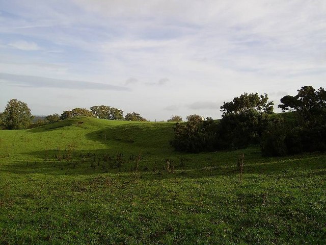
Castell Allt-Goch submitted by Andy B on 12th Oct 2010. This Iron Age hill fort occupies high ground in the south-west of the square and is used as pasture for sheep. A more detailed description is included at
http://www.cambria.org.uk/projects/prehistdefenc/SN54AND55GAZETTEER.pdf
Copyright Dan Gregory and licensed for reuse under the Creative Commons Licence.
(View photo, vote or add a comment)
Log Text: None
Stone near Castell Gwynionydd
Date Added: 12th Jul 2023
Site Type: Standing Stone (Menhir)
Country: Wales (Ceredigion)
Visited: Would like to visit
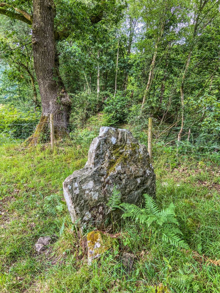
Stone near Castell Gwynionydd submitted by dodomad on 12th Jul 2023. Standing stone next to Castell Gwynionydd, in the Teifi valley NE of Llandysul, Ceredigion. Requires a bit of freelancing to reach. Also close to the iron age hillfort of Pencoed-y-foel.
Contributed by MattM (@MattM51422844 on Twitter)
(View photo, vote or add a comment)
Carn Goch (Carmarthenshire)
Date Added: 17th Sep 2010
Site Type: Hillfort
Country: Wales (Carmarthenshire)
Visited: Yes on 25th Aug 2006

Carn Goch (Carmarthenshire) submitted by Andy B on 25th Aug 2006.
The long cairn at Carn Goch
(View photo, vote or add a comment)
Log Text: None
Sythfaen (Carmarthenshire)
Date Added: 17th Sep 2010
Site Type: Standing Stone (Menhir)
Country: Wales (Carmarthenshire)
Visited: Yes on 25th Aug 2006

Sythfaen (Carmarthenshire) submitted by Andy B on 25th Aug 2006. Stone by the roadside near Carn Goch. Looks relatively modern to me.
(View photo, vote or add a comment)
Log Text: None
Mynydd y Betws
Date Added: 4th Apr 2012
Site Type: Stone Row / Alignment
Country: Wales (Carmarthenshire)
Visited: Yes on 4th Feb 2012
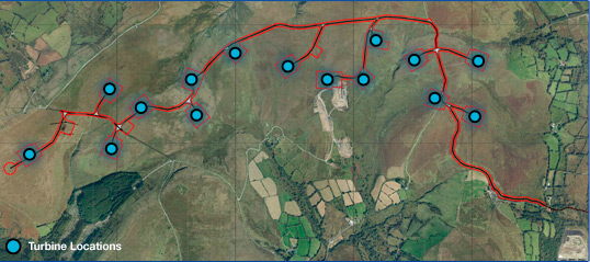
Mynydd y Betws submitted by SandyG on 4th Feb 2012. Located on common land to the east of Ammanford in Carmarthenshire, Mynydd y Betws Wind Farm was granted planning consent in 2009.
The wind farm will consist of 15 turbines with a tip height of 110 meters and an installed capacity of up to 45MW.
Image copyright Cambrian Renewable Energy Limited
(View photo, vote or add a comment)
Log Text: None
Llwydiarth Esgob Stone
Date Added: 11th Jan 2013
Site Type: Rock Art
Country: Wales (Anglesey)
Visited: Yes on 29th Jun 2012
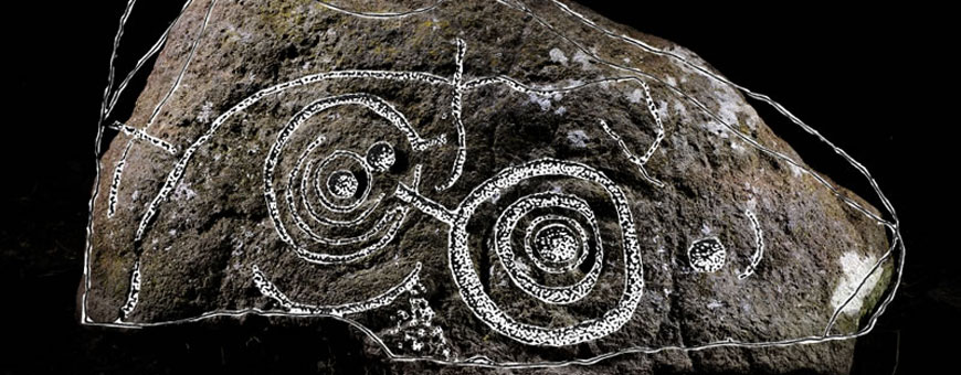
Llwydiarth Esgob Stone submitted by Andy B on 29th Jun 2012. The Llwydiarth Esgob Stone, photo copyright Aerial-Cam.
(View photo, vote or add a comment)
Log Text: None
Bryn Celli Ddu
Date Added: 12th Jun 2015
Site Type: Passage Grave
Country: Wales (Anglesey)
Visited: Yes on 1st Jul 2013

Bryn Celli Ddu submitted by Andy B on 1st Jul 2013. CADW organised an event at the 2013 Summer Solstice. Ancient Arts displaying a fascinating array of replica tools and artefacts for people to handle.
Image Credit: Matt Jones
More photos from the day on Facebook.
(View photo, vote or add a comment)
Log Text: None
Ty-Gwyn
Trip No.20 Entry No.8 Date Added: 24th Feb 2024
Site Type: Standing Stone (Menhir)
Country: Wales (Anglesey)
Visited: Yes
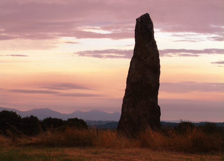
Ty-Gwyn submitted by paulcall on 18th Aug 2006.
Taken early morning on 4 July 2006, giving some idea of the fantastic location of this standing stone
(View photo, vote or add a comment)
Log Text: #8 in our rundown of favourite standing stones (and pairs) in Britain
Penrhos-Feilw
Trip No.20 Entry No.9 Date Added: 24th Feb 2024
Site Type: Standing Stones
Country: Wales (Anglesey)
Visited: Yes
Penrhos-Feilw submitted by DrewParsons on 28th Oct 2010. The lovely pair of standing stones photographed on a fine day in late September 2010. The stones are located behind some houses along a short track from the roadside sign. September 2010.
(View photo, vote or add a comment)
Log Text: #7 in our rundown of favourite standing stones (and pairs) in Britain
Lost Creek
Date Added: 4th Apr 2012
Site Type: Rock Art
Country: United States (The West)
Visited: Yes on 8th Jun 2011
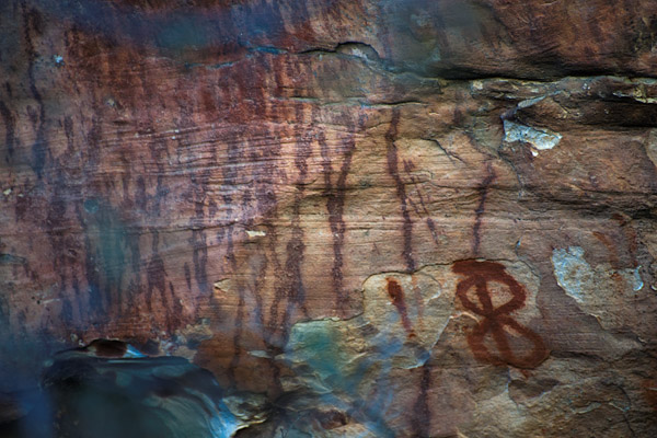
Lost Creek submitted by Andy B on 8th Jun 2011. Rock art, Red Rock Canyon, Nevada prior to the defacement
Creative Commons image by Brian Minami
(View photo, vote or add a comment)
Log Text: None
Bishop Eastern Sierra Petroglyphs
Date Added: 11th Jan 2013
Site Type: Rock Art
Country: United States (The West)
Visited: Yes on 20th Nov 2012
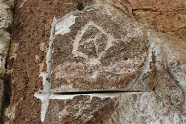
Bishop Eastern Sierra Petroglyphs submitted by Andy B on 20th Nov 2012. An area in the Volcanic Tableland in eastern California where thieves apparently attempted to carve out a petroglyph and then decided to move on without it. They ultimately extracted six slabs with the ancient images, and damaged many of the others in between with their equipment.
Image Credit: Greg Haverstock/Bureau of Land Management
(View photo, vote or add a comment)
Log Text: None
Chimney Rock - Great House
Date Added: 11th Jan 2013
Site Type: Ancient Village or Settlement
Country: United States (The Southwest)
Visited: Yes on 26th Sep 2012

Chimney Rock - Great House submitted by Andy B on 26th Sep 2012. Photo Credit: National Trust for Historic Preservation
(View photo, vote or add a comment)
Log Text: None
Red Rock State Park
Date Added: 13th May 2016
Site Type: Ancient Village or Settlement
Country: United States (The Southwest)
Visited: Yes on 16th Mar 2016
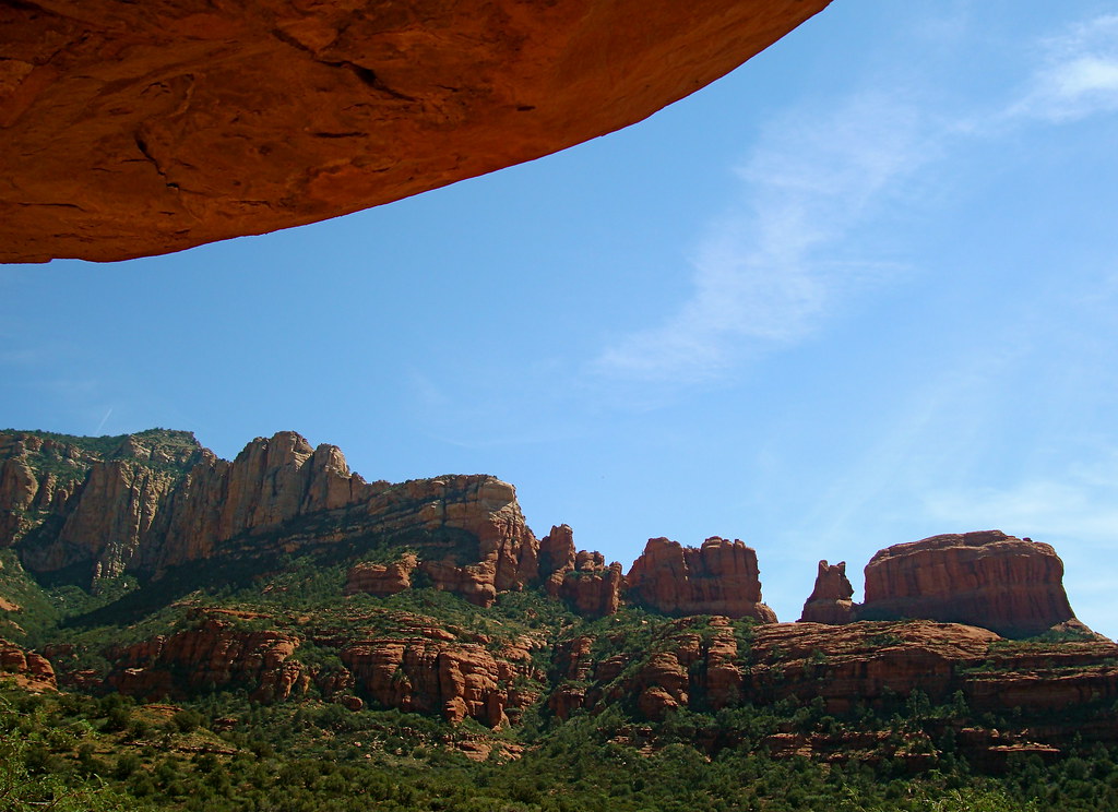
Red Rock State Park submitted by Andy B on 16th Mar 2016. Palatki Heritage Site - Sedona line of mountains that Sinagua reproduced on cave drawing Image copyright: redrock flyer, hosted on Flickr and displayed under the terms of their API.
(View photo, vote or add a comment)
Log Text: None
Kolomoki Mounds Historic Park
Date Added: 4th Apr 2012
Site Type: Artificial Mound
Country: United States (The South)
Visited: Yes on 9th Jan 2011
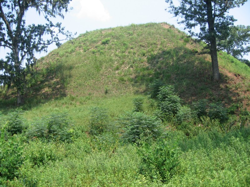
Kolomoki Mounds Historic Park submitted by dodomad on 9th Jan 2011. Temple Mound by Kevin J. Norman
The eight visible mounds of earth in the park were built between 250-950 A.D. by Swift Creek and Weeden Island Indians. American Indians occupied the lands from 350 to 750 A.D. These mounds include Georgia's oldest great temple mound, two burial mounds and four smaller ceremonial mounds. The park's museum is built with part of an excavated mound inside, providing an unusual setting for viewing artifacts and a film about how the mound was built and excavated. ...
(View photo, vote or add a comment)
Log Text: None
Crystal River Archaeological State Park
Date Added: 4th Apr 2012
Site Type: Barrow Cemetery
Country: United States (The South)
Visited: Yes on 9th Jan 2011
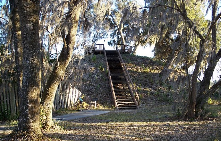
Crystal River Archaeological State Park submitted by Andy B on 9th Jan 2011. The Crystal River archaeological site is made up of a group of shell middens, burial mounds and platform mounds. These features comprise a larger ceremonial complex of plazas and other landscape features. Two large platform mounds on the site are believed to have been used primarily for ceremonial purposes. Thier size, structural uniformity and distinctive flat tops set them apart from the other mounds and middens at the site, denoting their special purpose.
Wikimedia Commons Image
(View photo, vote or add a comment)
Log Text: None
Watson Brake
Date Added: 4th Apr 2012
Site Type: Artificial Mound
Country: United States (The South)
Visited: Yes on 28th May 2011
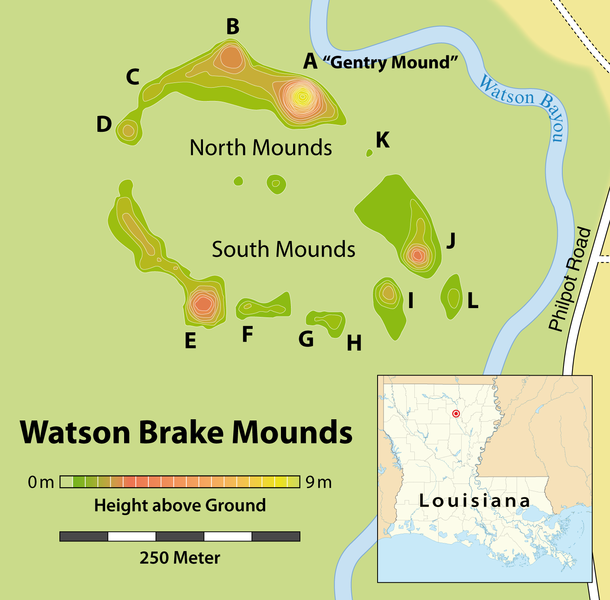
Watson Brake submitted by Andy B on 28th May 2011. Map of the Watson Brake archaeological site, Creative Commons, based on
Joe W. Saunders, Rolfe D. Mandel, et al.: Watson Brake, a Middle Archaic Mound Complex in Northeast Louisiana. In: American Antiquity, Vol. 70, No. 4 (Oktober 2005), pages 631-668 [634]
(View photo, vote or add a comment)
Log Text: None
