Contributory members are able to log private notes and comments about each site
Sites Andy B has logged. View this log as a table or view the most recent logs from everyone
Dray's Ditches
Date Added: 17th Sep 2010
Site Type: Misc. Earthwork
Country: England (Bedfordshire)
Visited: Yes on 1st Sep 2010

Dray's Ditches submitted by Andy B on 1st Sep 2010. The site of Drays Ditches
Copyright John Yaxley and licensed for reuse under the Creative Commons Licence.
http://www.geograph.org.uk/profile/13221
(View photo, vote or add a comment)
Log Text: None
Cleeve Hill Camp
Date Added: 17th Sep 2010
Site Type: Hillfort
Country: England (Somerset)
Visited: Yes on 1st Sep 2010

Cleeve Hill Camp submitted by Andy B on 1st Sep 2010. Cleeve Toot hill fort
This is the information board for Cleeve Toot, a late bronze age or early iron age hill fort close to Bristol. The site has not yet been excavated, and it now in dense woodland at the edge of Cleeve Wood.
Copyright Philip White and licensed for reuse under the Creative Commons Licence.
http://www.geograph.org.uk/profile/7392
(View photo, vote or add a comment)
Log Text: None
Dun An Ruigh Ruadh
Date Added: 17th Sep 2010
Site Type: Stone Fort or Dun
Country: Scotland (Highlands)
Visited: Yes on 1st Sep 2010

Dun An Ruigh Ruadh submitted by Andy B on 1st Sep 2010. Remains of a dun or broch above Loggie
Copyright John Ferguson and licensed for reuse under the Creative Commons Licence.
http://www.geograph.org.uk/profile/28657
(View photo, vote or add a comment)
Log Text: None
Dun Lagaidh
Date Added: 17th Sep 2010
Site Type: Stone Fort or Dun
Country: Scotland (Highlands)
Visited: Yes on 1st Sep 2010

Dun Lagaidh submitted by Creative Commons on 1st Sep 2010. Loch Broom and Ullapool in the background.
Copyright Mike Dunn and licensed for reuse under the Creative Commons Licence.
http://www.geograph.org.uk/profile/27054
(View photo, vote or add a comment)
Log Text: None
Dun Canna
Date Added: 17th Sep 2010
Site Type: Stone Fort or Dun
Country: Scotland (Highlands)
Visited: Yes on 1st Sep 2010

Dun Canna submitted by Creative Commons on 1st Sep 2010. Low Tide at Dun Canna
With Isle Martin to the right and the mainland to the left.
Copyright Mick Garratt and licensed for reuse under the Creative Commons Licence.
http://www.geograph.org.uk/profile/343
(View photo, vote or add a comment)
Log Text: None
Tregeseal East
Date Added: 18th Jan 2011
Site Type: Stone Circle
Country: England (Cornwall)
Visited: Yes on 17th Sep 2010. My rating: Condition 4 Ambience 4 Access 4
Tregeseal East submitted by Andy B on 24th Mar 2010. Photo from June 2009. The cattle were supposed to trample down the bracken but only ate the grass within the circle, destabilising several stones that, after we reported it to the Historic Environment Service in Truro, had to be secured. The HES then organised a manual cutting of surrounding bracken to give the cattle more space away from the circle!
So far this is the only major site to be affected, others not yet being grazed although it is planned to do this at Men-an-Tol and Lanyon Quoit.
...
(View photo, vote or add a comment)
Log Text: None
The Park Fort (Ashdown Forest)
Date Added: 2nd Oct 2010
Site Type: Hillfort
Country: England (East Sussex)
Visited: Couldn't find on 1st Oct 2010
Log Text: Deep in bracken and thick forest, couldn't find it
Careg-Y-Caws
Date Added: 28th Dec 2010
Site Type: Cairn
Country: Wales (Denbighshire)
Visited: Yes on 12th Oct 2010

Careg-Y-Caws submitted by Andy B on 12th Oct 2010. Stone cairn at Pen Bwlch Llandrillo
Looking back up to the Bwerwyn ridge.
Copyright Jeremy Bolwell and licensed for reuse under the Creative Commons Licence.
(View photo, vote or add a comment)
Log Text: None
Castell Goetre
Trip No.2 Entry No.1 Date Added: 17th Jan 2011
Site Type: Hillfort
Country: Wales (Ceredigion)
Visited: Yes on 12th Oct 2010
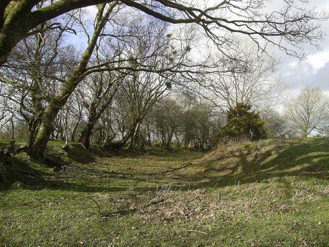
Castell Goetre submitted by Andy B on 12th Oct 2010. Castell Goetre (Possibly from Goed-Tref or 'settlement in the wood') is an Iron Age hill fort on the ridgeway between the Teifi and Dulas valleys. It is located in the northwest of this square and extends into SN6051 to the north.
The fort, now populated by sheep and home to a small reservoir, consists of an oval banked and ditched enclosure with a cross-bank through the centre, possibly part of an earlier phase. From ground level it appears much eroded but in places is still well defined, as ...
(View photo, vote or add a comment)
Log Text: None
Castell Allt-Goch
Trip No.2 Entry No.2 Date Added: 17th Jan 2011
Site Type: Hillfort
Country: Wales (Ceredigion)
Visited: Yes on 12th Oct 2010
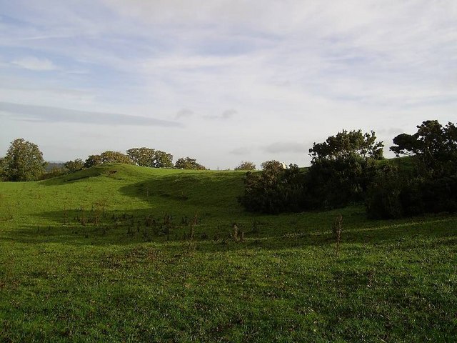
Castell Allt-Goch submitted by Andy B on 12th Oct 2010. This Iron Age hill fort occupies high ground in the south-west of the square and is used as pasture for sheep. A more detailed description is included at
http://www.cambria.org.uk/projects/prehistdefenc/SN54AND55GAZETTEER.pdf
Copyright Dan Gregory and licensed for reuse under the Creative Commons Licence.
(View photo, vote or add a comment)
Log Text: None
Torr Aint
Date Added: 28th Dec 2010
Site Type: Hillfort
Country: Scotland (Isle of Mull)
Visited: Yes on 12th Oct 2010
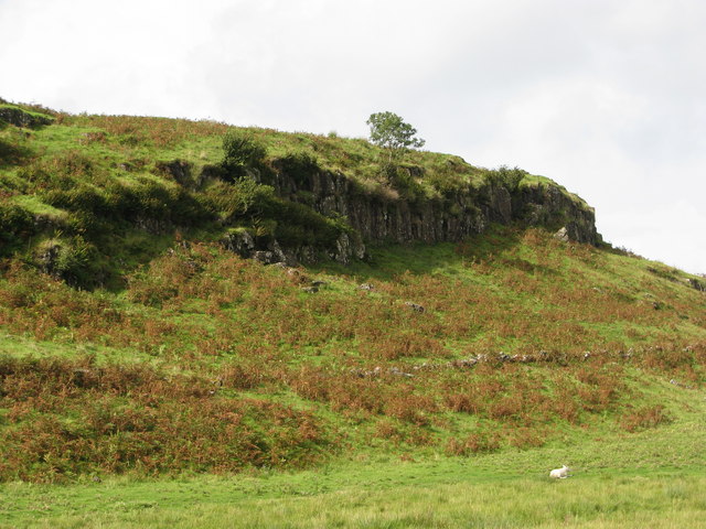
Torr Aint submitted by Andy B on 12th Oct 2010.
Crags at the north end of Torr Aint hillfort
Copyright Sarah Charlesworth and licensed for reuse under this Creative Commons Licence.
(View photo, vote or add a comment)
Log Text: None
Gaer Fach (Merthyr Cynog)
Date Added: 28th Dec 2010
Site Type: Hillfort
Country: Wales (Powys)
Visited: Yes on 12th Oct 2010

Gaer Fach (Merthyr Cynog) submitted by Creative Commons on 12th Oct 2010. View to Gaer Fach
Looking from the bridleway across upper pastures.
Copyright Jonathan Billinger and licensed for reuse under the Creative Commons Licence.
(View photo, vote or add a comment)
Log Text: None
Pen-Y-Castell (Cynffig)
Date Added: 28th Dec 2010
Site Type: Ancient Village or Settlement
Country: Wales (South Glamorgan)
Visited: Yes on 13th Oct 2010

Pen-Y-Castell (Cynffig) submitted by Andy B on 13th Oct 2010. Pen y castell
Looking up to the hill summit from the B4281 at Kenfig Hill. A triangulation point is visible, (although slightly obscured by a bush) to the left of the rightmost tree
Copyright Chris Shaw and licensed for reuse under the Creative Commons Licence.
(View photo, vote or add a comment)
Log Text: None
Garn Fawr (Ogmore Valley)
Date Added: 28th Dec 2010
Site Type: Cairn
Country: Wales (South Glamorgan)
Visited: Yes on 13th Oct 2010
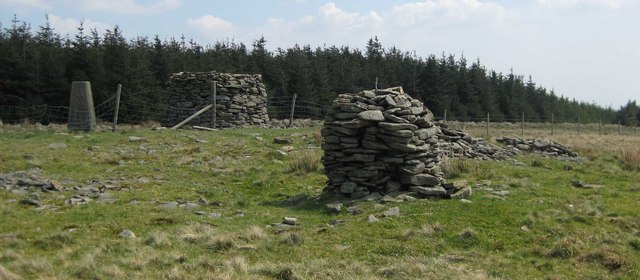
Garn Fawr (Ogmore Valley) submitted by Andy B on 13th Oct 2010. At this trig point are two Cairns, the larger one is a much better construction than the nearest. To the right of the nearest are two piles of stones one larger than the other, it seems possible that these piles have been robbed to make the existing cairns.
Copyright Djinnsplace and licensed for reuse under this Creative Commons Licence.
(View photo, vote or add a comment)
Log Text: None
Coed y Caerau
Date Added: 28th Dec 2010
Site Type: Hillfort
Country: Wales (Powys)
Visited: Yes on 15th Oct 2010

Coed y Caerau submitted by Creative Commons on 15th Oct 2010. Part of the ramparts of a hill fort designed to protect lives and property in less settled times. This area is now largely ungrazed and there is a light covering of ash, oak and hazel.
Copyright Marion Phillips and licensed for reuse under the Creative Commons Licence.
(View photo, vote or add a comment)
Log Text: None
Coed y Caerau
Date Added: 11th Jan 2013
Site Type: Ancient Village or Settlement
Country: Wales (Monmouthshire)
Visited: Yes on 15th Oct 2010

Coed y Caerau submitted by Creative Commons on 15th Oct 2010. Part of the ramparts of a hill fort designed to protect lives and property in less settled times. This area is now largely ungrazed and there is a light covering of ash, oak and hazel.
Copyright Marion Phillips and licensed for reuse under the Creative Commons Licence.
(View photo, vote or add a comment)
Log Text: None
Robin Hood's Well (Burghwallis)
Date Added: 28th Dec 2010
Site Type: Holy Well or Sacred Spring
Country: England (Yorkshire (South))
Visited: Yes on 18th Oct 2010
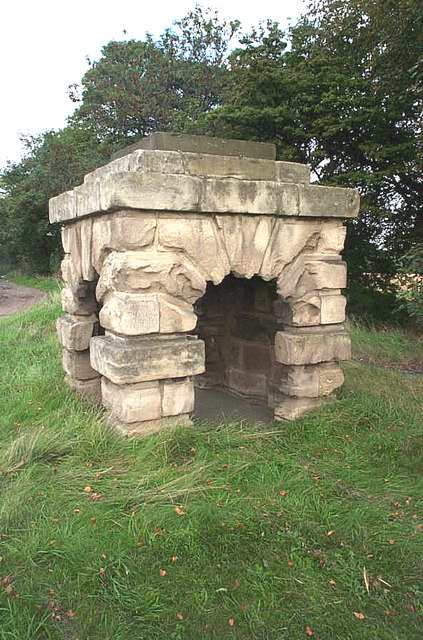
Robin Hood's Well (Burghwallis) submitted by Andy B on 18th Oct 2010. The old well has now been capped with concrete.
(View photo, vote or add a comment)
Log Text: None
Carn-Y-Bugail
Date Added: 28th Dec 2010
Site Type: Cairn
Country: Wales (Powys)
Visited: Yes on 18th Oct 2010

Carn-Y-Bugail submitted by Andy B on 18th Oct 2010. Garn Felen summit trig point in hailstorm
Two ancient cairns are clearly visible on the horizon beyond the John Kyrle High School Duke of Edinburgh Award students.
This limestone mountain has been extensively quarried on its northwest side but much of it retains a great sense of remoteness. From here there are good views of the central ridges of the Brecon Beacons to the north-west and the Bristol Channel may be glimpsed in the opposite direction.
Copyright Nic Howes and licensed f...
(View photo, vote or add a comment)
Log Text: None
Dun Mhadaidh
Date Added: 28th Dec 2010
Site Type: Stone Fort or Dun
Country: Scotland (Isle of Mull)
Visited: Yes on 19th Oct 2010
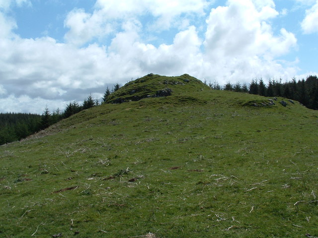
Dun Mhadaidh submitted by Creative Commons on 19th Oct 2010. Site in Isle of Mull Scotland
Copyright Alan Stewart and licensed for reuse under the Creative Commons Licence
(View photo, vote or add a comment)
Log Text: None
Cnoc Na Sroine
Date Added: 28th Dec 2010
Site Type: Stone Fort or Dun
Country: Scotland (Isle of Mull)
Visited: Yes on 19th Oct 2010

Cnoc Na Sroine submitted by Creative Commons on 19th Oct 2010. Site in Isle of Mull Scotland
The flat summit of Cnoc na Sroine was the site of an Iron Age fort or dun, the remains of which can be seen in the photo.
Copyright Eileen Henderson and licensed for reuse under th Creative Commons Licence
(View photo, vote or add a comment)
Log Text: None
