Contributory members are able to log private notes and comments about each site
Sites Andy B has logged. View this log as a table or view the most recent logs from everyone
Priddy Circles
Date Added: 4th Apr 2012
Site Type: Henge
Country: England (Somerset)
Visited: Yes on 17th Jun 2011

Priddy Circles submitted by Andy B on 17th Jun 2011. Map of earthworks at Priddy Rings, Somerset, England. Date: 1911
Source: The Victoria History of the Counties of England, A History Of Somerset, Volume 2.
(View photo, vote or add a comment)
Log Text: None
Tisbury Circle
Date Added: 4th Apr 2012
Site Type: Stone Circle
Country: England (Wiltshire)
Visited: Yes on 18th Jun 2011
Tisbury Circle submitted by Creative Commons on 18th Jun 2011. The Grotto at Wardour Castle, though to contain stones from a megalithic site at Tisbury
Creative commons image by Rod W
(View photo, vote or add a comment)
Log Text: None
Whitesheet Hill
Date Added: 4th Apr 2012
Site Type: Ancient Village or Settlement
Country: England (Wiltshire)
Visited: Yes on 18th Jun 2011

Whitesheet Hill submitted by Creative Commons on 18th Jun 2011. Neolithic camp, White Sheet Hill
Very little of the original site is visible today other than a couple of round barrows and some sections of cross dyke.
Copyright Trish Steel and licensed for reuse under the Creative Commons Licence.
(View photo, vote or add a comment)
Log Text: None
Whitesheet Castle
Date Added: 4th Apr 2012
Site Type: Hillfort
Country: England (Wiltshire)
Visited: Yes on 18th Jun 2011

Whitesheet Castle submitted by Creative Commons on 18th Jun 2011. Cross Dyke, White Sheet Hill
A cross dyke is a linear earthwork comprising of a ditch arranged beside and parallel to banks. They appear to have been used for defensive purposes.
Copyright Trish Steel and licensed for reuse under the Creative Commons Licence.
(View photo, vote or add a comment)
Log Text: None
The Knapp (Bredwardine)
Date Added: 4th Apr 2012
Site Type: Ancient Village or Settlement
Country: England (Herefordshire)
Visited: Yes on 18th Jun 2011
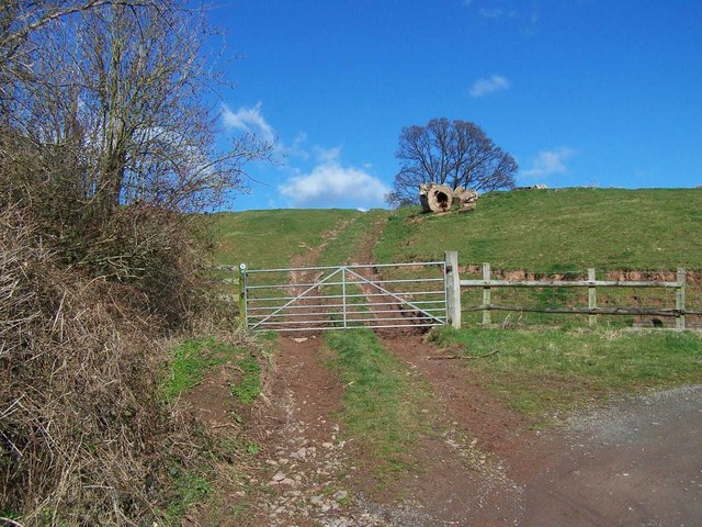
The Knapp (Bredwardine) submitted by Andy B on 18th Jun 2011. Climbing The Knapp
Copyright Geoff Pick and licensed for reuse under this Creative Commons Licence.
(View photo, vote or add a comment)
Log Text: None
Credenhill Camp
Date Added: 4th Apr 2012
Site Type: Hillfort
Country: England (Herefordshire)
Visited: Yes on 18th Jun 2011
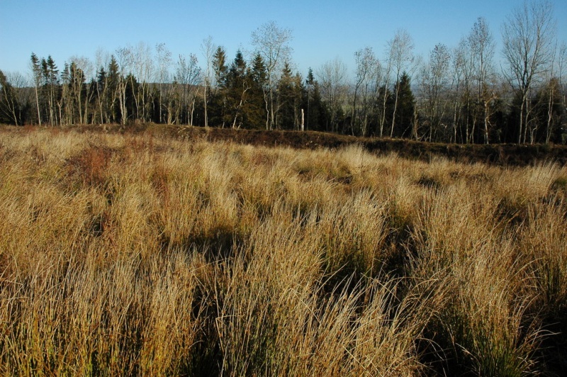
Credenhill Camp submitted by Andy B on 18th Jun 2011. Hill fort on Credenhill
Credenhill is wooded with the exception of the area contained within the high earthworks surrounded the large hill fort which has been cleared.
Copyright Philip Halling and licensed for reuse under this Creative Commons Licence.
(View photo, vote or add a comment)
Log Text: None
Wychbury Camp
Date Added: 4th Apr 2012
Site Type: Hillfort
Country: England (Worcestershire)
Visited: Yes on 18th Jun 2011

Wychbury Camp submitted by Andy B on 18th Jun 2011. Wychbury Hill Fort - Southern Rampart
The hill fort occupies a position on the end of the Clent Hills. It is very much hidden by the trees but would have views to other forts on the Malverns, Clee Hill and Dudley.
Copyright John M and licensed for reuse under this Creative Commons Licence.
(View photo, vote or add a comment)
Log Text: None
Thrumster Mains
Date Added: 4th Apr 2012
Site Type: Broch or Nuraghe
Country: Scotland (Caithness)
Visited: Yes on 18th Jun 2011

Thrumster Mains submitted by Andy B on 18th Jun 2011. Thrumster Or Old Garden Broch
Picture - Bill Fernie, Caithness Heritage Trust
(View photo, vote or add a comment)
Log Text: None
Bryn-Y-Wrach
Date Added: 4th Apr 2012
Site Type: Round Cairn
Country: Wales (South Glamorgan)
Visited: Yes on 19th Jun 2011

Bryn-Y-Wrach submitted by Andy B on 19th Jun 2011. Bryn-Y-Wrach round cairn
Image copyright Gareth from the Garw Valley Heritage project
(View photo, vote or add a comment)
Log Text: None
Carn Galver
Date Added: 4th Apr 2012
Site Type: Ancient Village or Settlement
Country: England (Cornwall)
Visited: Yes on 19th Jun 2011
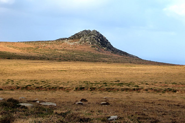
Carn Galver submitted by Creative Commons on 19th Jun 2011. Looking towards Carn Galver
Copyright Tim and licensed for reuse under the Creative Commons Licence.
(View photo, vote or add a comment)
Log Text: None
Carn Galver
Date Added: 4th Apr 2012
Site Type: Round Barrow(s)
Country: England (Cornwall)
Visited: Yes on 19th Jun 2011

Carn Galver submitted by Creative Commons on 19th Jun 2011. Looking towards Carn Galver
Copyright Tim and licensed for reuse under the Creative Commons Licence.
(View photo, vote or add a comment)
Log Text: None
Helman Tor
Date Added: 4th Apr 2012
Site Type: Causewayed Enclosure
Country: England (Cornwall)
Visited: Yes on 19th Jun 2011

Helman Tor submitted by Andy B on 19th Jun 2011. Helman Tor
A view looking justr west of north towards the rocks of Helman Tor. There is something reminiscent of Easter Island about this profile.
Copyright Phil Williams and licensed for reuse under the Creative Commons Licence.
(View photo, vote or add a comment)
Log Text: None
Casterley Camp
Date Added: 4th Apr 2012
Site Type: Hillfort
Country: England (Wiltshire)
Visited: Yes on 22nd Jun 2011

Casterley Camp submitted by Andy B on 22nd Jun 2011. View across Casterley Camp
The outer bank of Casterley Camp is approximately one metre high around most of the perimeter of the hill fort. The foreground of this image shows part of the north westerly section of the ditch and bank. The southern and southeasterly sections of the bank can be seen at the far edge of the field that is now contained within the fort.
Copyright Doug Lee and licensed for reuse under the Creative Commons Licence.
(View photo, vote or add a comment)
Log Text: None
Enfold Bowl Barrow
Date Added: 4th Apr 2012
Site Type: Round Barrow(s)
Country: England (Wiltshire)
Visited: Yes on 22nd Jun 2011
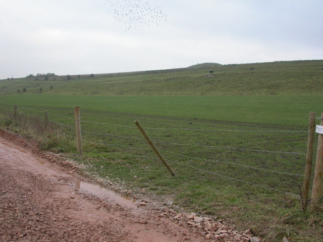
Enfold Bowl Barrow submitted by Andy B on 22nd Jun 2011. Barrow, Water Dean
One of the countless barrows in the Stonehenge area. As seen from the valley bottom.
Copyright Mike Faherty and licensed for reuse under this Creative Commons Licence.
(View photo, vote or add a comment)
Log Text: None
Rybury Camp
Date Added: 4th Apr 2012
Site Type: Hillfort
Country: England (Wiltshire)
Visited: Yes on 22nd Jun 2011
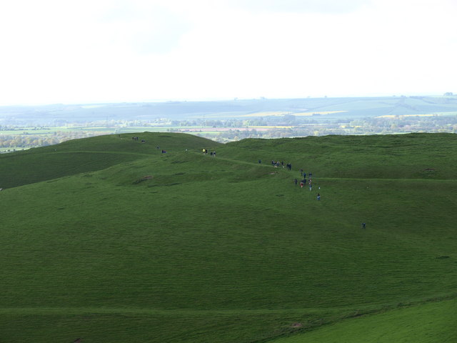
Rybury Camp submitted by Andy B on 22nd Jun 2011. Rybury Hill Fort
The earthworks of Rybury Hill fort evident to the left and right of the walkers
Copyright Dennis Simpson and licensed for reuse under this Creative Commons Licence.
(View photo, vote or add a comment)
Log Text: None
Three Barrows (North Down)
Date Added: 4th Apr 2012
Site Type: Barrow Cemetery
Country: England (Wiltshire)
Visited: Yes on 22nd Jun 2011

Three Barrows (North Down) submitted by Andy B on 22nd Jun 2011. A Barrow on North Down
Copyright Steve Daniels and licensed for reuse under the Creative Commons Licence.
(View photo, vote or add a comment)
Log Text: None
Banks Chambered Tomb
Date Added: 4th Apr 2012
Site Type: Chambered Cairn
Country: Scotland (Orkney)
Visited: Yes on 24th Jun 2011

Banks Chambered Tomb submitted by Andy B on 24th Jun 2011. Drawing the north cell lintel, looking northwest. Photo copyright: ORCA
(View photo, vote or add a comment)
Log Text: None
Boreray
Date Added: 4th Apr 2012
Site Type: Stone Circle
Country: Scotland (Isle of Harris)
Visited: Yes on 26th Jun 2011
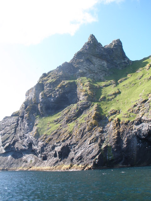
Boreray submitted by Andy B on 26th Jun 2011. Geo an Araich, Boreray
Copyright John Ferguson and licensed for reuse under the Creative Commons Licence.
(View photo, vote or add a comment)
Log Text: None
Ashberry windypit
Date Added: 4th Apr 2012
Site Type: Cave or Rock Shelter
Country: England (Yorkshire (North))
Visited: Yes on 27th Jun 2011

Ashberry windypit submitted by Andy B on 27th Jun 2011. One of the skeletons investigated in the History Cold Case programme. Copyright BBC
(View photo, vote or add a comment)
Log Text: None
Hod Hill
Date Added: 4th Apr 2012
Site Type: Hillfort
Country: England (Dorset)
Visited: Yes on 27th Jun 2011

Hod Hill submitted by Andy B on 27th Jun 2011. WW2 Aerial photo taken 19th June 1945.
From the forthcoming book by Col. Roy M. Stanley II
By kind permission of Col. Stanley
(View photo, vote or add a comment)
Log Text: None
