Contributory members are able to log private notes and comments about each site
Sites Andy B has logged. View this log as a table or view the most recent logs from everyone
Grand Village of Natchez Indians
Date Added: 13th May 2016
Site Type: Ancient Village or Settlement
Country: United States (The South)
Visited: Yes on 3rd Sep 2015

Grand Village of Natchez Indians submitted by Andy B on 3rd Sep 2015. Powwow01 Image copyright: natchezsam (Sam Jones), hosted on Flickr and displayed under the terms of their API.
(View photo, vote or add a comment)
Log Text: None
Pilot Rock (Cherokee)
Date Added: 13th May 2016
Site Type: Natural Stone / Erratic / Other Natural Feature
Country: United States (The Plains)
Visited: Yes on 29th Sep 2015
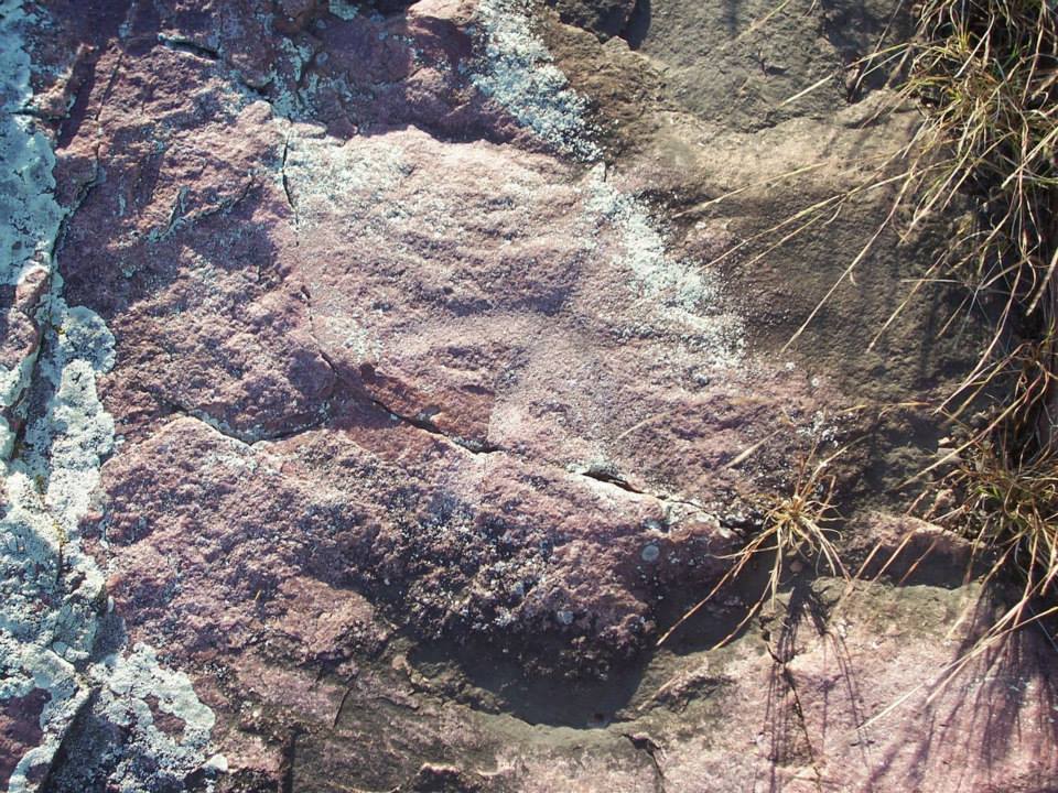
Pilot Rock (Cherokee) submitted by Andy B on 29th Sep 2015. Recently identified Rock Art
Photo credit: Tyler Hahn, used with permission
(View photo, vote or add a comment)
Log Text: None
Derinkuyu Underground City
Date Added: 13th May 2016
Site Type: Ancient Village or Settlement
Country: Turkey
Visited: Yes on 24th Nov 2015
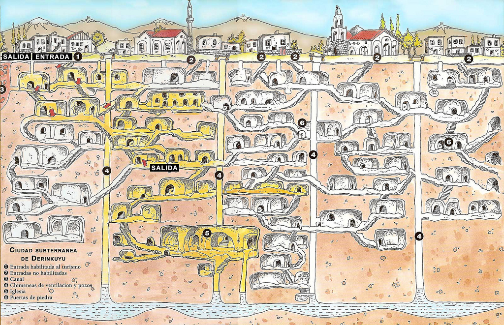
Derinkuyu Underground City submitted by Andy B on 24th Nov 2015. Map of Derinkuyu Underground City Site in Turkey
Image copyright: joyful JOY (Joy), hosted on Flickr and displayed under the terms of their API.
(View photo, vote or add a comment)
Log Text: None
Red Rock State Park
Date Added: 13th May 2016
Site Type: Ancient Village or Settlement
Country: United States (The Southwest)
Visited: Yes on 16th Mar 2016
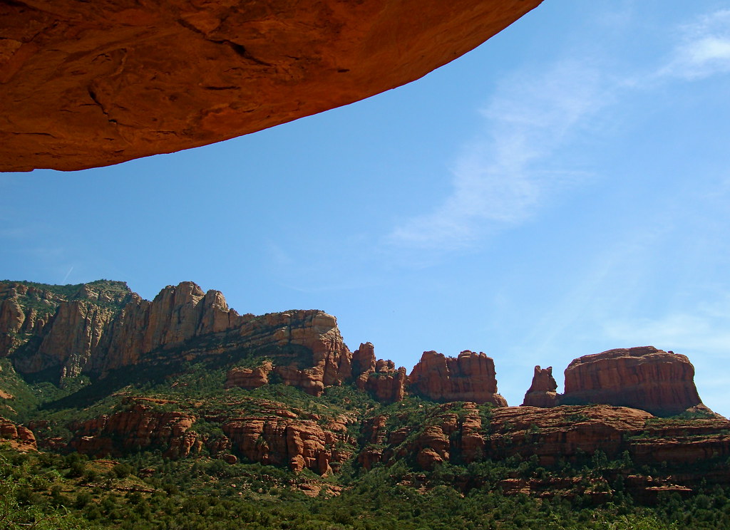
Red Rock State Park submitted by Andy B on 16th Mar 2016. Palatki Heritage Site - Sedona line of mountains that Sinagua reproduced on cave drawing Image copyright: redrock flyer, hosted on Flickr and displayed under the terms of their API.
(View photo, vote or add a comment)
Log Text: None
Walmersley Golf Club stone
Date Added: 13th May 2016
Site Type: Modern Stone Circle etc
Country: England (Greater Manchester)
Visited: Yes on 9th May 2016
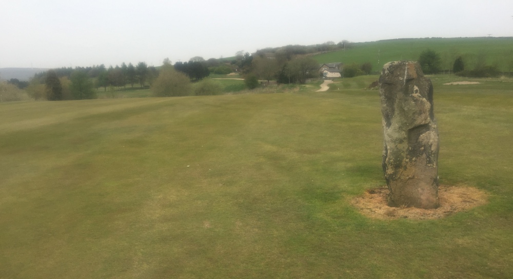
Walmersley Golf Club stone submitted by Andy B on 9th May 2016. A photo sent in by David Bailey who writes: Golfing in the Rochdale area yesterday I happened on the photo attached, and I’m trying to identify it. This is on the 13th hole (long blind par 4) about 300 yards from the large wind turbine.
(View photo, vote or add a comment)
Log Text: None
North Sannox Farm
Trip No.11 Entry No.2 Date Added: 24th Aug 2016
Site Type: Chambered Cairn
Country: Scotland (Isle of Arran)
Visited: Yes on 21st Aug 2016. My rating: Condition 2 Ambience 3 Access 3

North Sannox Farm submitted by Andy B on 7th Mar 2017. There's something brooding and post-apocalyptic about the landscape around this chambered cairn...
Visited August 2016
(View photo, vote or add a comment)
Log Text: All the forest trees have been felled so has a very stark, 'post apocalyptic' vibe over the whole hillside now. However the tomb now at least has a beautiful outlook over the sea which presumably it didn't have when in its deep forest. The logging operations don't seem to have harmed the stones fortunately
Mid Sannox Standing Stone
Trip No.11 Entry No.3 Date Added: 24th Aug 2016
Site Type: Standing Stone (Menhir)
Country: Scotland (Isle of Arran)
Visited: Yes on 21st Aug 2016. My rating: Condition 4 Ambience 3 Access 4

Mid Sannox Standing stone submitted by Bladup on 28th Apr 2013. Mid Sannox Standing stone. Said in some accounts to be the remains of a stone circle demolished in 1836, this stone stands 2.7m high near the road.
(View photo, vote or add a comment)
Log Text: Pity about the fence wire but still lovely
Largybeg Point
Trip No.11 Entry No.4 Date Added: 24th Aug 2016
Site Type: Stone Circle
Country: Scotland (Isle of Arran)
Visited: Yes on 22nd Aug 2016. My rating: Condition 4 Ambience 5 Access 4
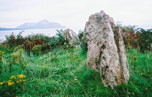
Largybeg Point submitted by Bladup on 27th Apr 2013. Largybeg Point standing stones, Holy island is in the background.
(View photo, vote or add a comment)
Log Text: Superb weather today. Surprised no one has commented on the very obvious and exact alignment with Holy Island. There is a likely looking large cairn nearby.
Machriewaterfoot Standing Stone
Trip No.11 Entry No.6 Date Added: 24th Aug 2016
Site Type: Standing Stone (Menhir)
Country: Scotland (Isle of Arran)
Visited: Yes on 23rd Aug 2016. My rating: Condition 5 Ambience 4 Access 4
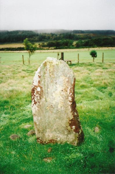
Machriewaterfoot Standing stone submitted by Bladup on 24th Apr 2013. Machriewaterfoot Standing stone.
(View photo, vote or add a comment)
Log Text: Park opposite second tee of golf course. Head over to tee and over to the right. Over a tiny brook and again head to the right. Just off the golf course in a field. There is a very helpful stile for access.
Auchagallon
Trip No.11 Entry No.7 Date Added: 24th Aug 2016
Site Type: Stone Circle
Country: Scotland (Isle of Arran)
Visited: Yes on 23rd Aug 2016. My rating: Condition 4 Ambience 4 Access 4
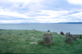
Auchagallon submitted by kelpie on 29th Jul 2002. A circle on a shelf of land overlooking Machrie Bay. NR 89306 34640
(View photo, vote or add a comment)
Log Text: I though this was perhaps a bit boring but the family liked it. I think it's the tiny enclosed off area that spoils the ambience.
Kings Cave
Trip No.11 Entry No.8 Date Added: 24th Aug 2016
Site Type: Cave or Rock Shelter
Country: Scotland (Isle of Arran)
Visited: Yes on 23rd Aug 2016. My rating: Condition 4 Ambience 4 Access 2
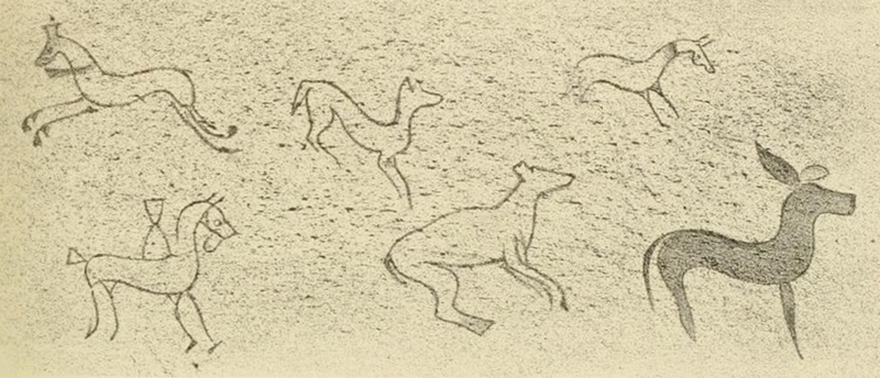
Kings Cave submitted by durhamnature on 14th Mar 2013. Panel from "Sculptured Stones of Scotland" via archive.org
(View photo, vote or add a comment)
Log Text: Pretty strenuous circular walk, down and up the cliff. The northern path is easier so perhaps take that on the way back. Cave impressive and some of the carvings easily visible
Replica Bronze Age Round House at Brodick Castle
Trip No.11 Entry No.9 Date Added: 24th Aug 2016
Site Type: Modern Stone Circle etc
Country: Scotland (Isle of Arran)
Visited: Yes on 24th Aug 2016. My rating: Condition 5 Ambience 5 Access 4
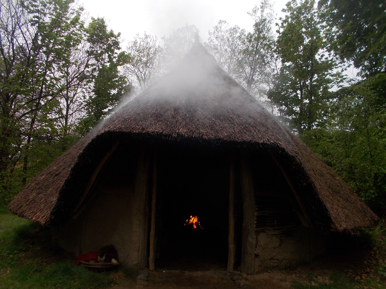
Replica Bronze Age Round House at Brodick Castle submitted by drolaf on 14th May 2023. Brodick replica roundhouse
(View photo, vote or add a comment)
Log Text: Lovely visit, we met the Bronze Age re-enactment chappie who turns out to be a retired Church of Scotland minister strangely enough. He gave a very engaging introduction to the Bronze Age which myself and my older teenage children enjoyed. He's there every Wednesday in the summer with his handleable artefacts and weapons, and rather smokey fire.
Machrie Moor 2
Date Added: 25th Aug 2016
Site Type: Stone Circle
Country: Scotland (Isle of Arran)
Visited: Yes on 25th Aug 2016. My rating: Condition 5 Ambience 5 Access 2

Machrie Moor 2 submitted by DrewParsons on 12th Dec 2009. October 2006
(View photo, vote or add a comment)
Log Text: None
North Sannox Chambered Cairn
Trip No.11 Entry No.1 Date Added: 26th Aug 2016
Site Type: Chambered Cairn
Country: Scotland (Isle of Arran)
Visited: Yes on 25th Aug 2016. My rating: Condition 3 Ambience 4 Access 5

North Sannox Chambered Cairn submitted by nicoladidsbury on 2nd Sep 2004. Grid Ref:015467
A large, partly destroyed, chambered cairn, with one remaining stone standing. The cairn overlooks North Sannox Burn, and lies just below a modern plantation. There are many hut circles and cairns in the plantation, and a hill fort to the North West nearby. The cairn is named "Lag nan Sasunnach" Grave of the Stranger
(View photo, vote or add a comment)
Log Text: Found it on our second visit. Right under my nose a few metres to the left of the toilet block.
Machrie Moor 10
Date Added: 25th Aug 2016
Site Type: Stone Circle
Country: Scotland (Isle of Arran)
Visited: Yes on 25th Aug 2016. My rating: Condition 3 Ambience 4 Access 3

Machrie Moor 10 submitted by AngieLake on 8th Sep 2008. Stones at the SW of the Moss Farm Road (or Machrie Moor 10) circle. The stone on the left resembles the head and shoulders of a hooded person. It faces into the circle, and towards the NE and Midsummer sunrise. There's a dip in the hills at NE, and my ritual movement dowsing headed out of the circle in that direction. Its inner face also seems to have a circular carving.
(View photo, vote or add a comment)
Log Text: None
Moss Farm Stone
Date Added: 25th Aug 2016
Site Type: Standing Stone (Menhir)
Country: Scotland (Isle of Arran)
Visited: Yes on 25th Aug 2016. My rating: Condition 4 Ambience 4 Access 3
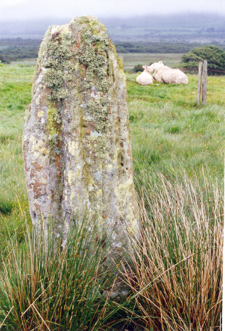
Moss Farm Stone submitted by AngieLake on 8th Sep 2008. Moss Farm Stone, or Machrie Stone, to the left of the road between the Moss Farm Road Cairn circle and the main circles on Machrie Moor.
(View photo, vote or add a comment)
Log Text: None
Moss farm chambered cairn
Date Added: 25th Aug 2016
Site Type: Chambered Cairn
Country: Scotland (Isle of Arran)
Visited: Yes on 25th Aug 2016. My rating: Condition 2 Ambience 4 Access 3

Moss farm chambered cairn submitted by Bladup on 10th Jun 2014. Moss farm chambered cairn.
(View photo, vote or add a comment)
Log Text: None
Machrie Moor 5
Date Added: 25th Aug 2016
Site Type: Stone Circle
Country: Scotland (Isle of Arran)
Visited: Yes on 25th Aug 2016. My rating: Condition 4 Ambience 5 Access 2
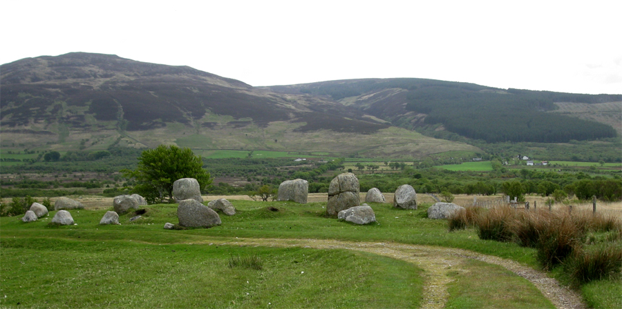
Machrie Moor 5 submitted by jeffrep on 30th Jul 2013. Machrie Moor 5, sometimes called "Fingal's Cauldron Seat," consists of two almost perfectly preserved rings of granite boulders.
The Machrie Moor Stone Circles are located at the end of a 1-1/2 mile track that is off of the A841 (some 200 yards south of the bridge where the main road crosses the Machrie Water) and three miles north of Blackwaterfoot in the western part of the Isle of Arran in North Ayrshire, Scotland.
(View photo, vote or add a comment)
Log Text: None
Tormore 2
Date Added: 25th Aug 2016
Site Type: Chambered Cairn
Country: Scotland (Isle of Arran)
Visited: Yes on 25th Aug 2016. My rating: Condition 2 Ambience 5 Access 2
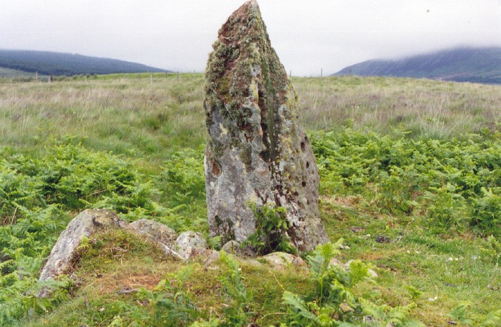
Tormore 2 submitted by AngieLake on 9th Sep 2008. Going by my sketch on the day, this view is looking towards a gap in the hills to the NE.
[Checked this site grid ref on www.danu.co.uk/gallery/info/stones/mosscairn.html. Calling it "Moss Farm Cairn", "grid ref NR 90590 32367", they say that it is: "An excavated cairn circle which lies in a field south of trackway to Machrie Moor just west of Moss Farm."
It was definitely between Moss Farm Road Circle and the main Machrie Moor circles.]
(View photo, vote or add a comment)
Log Text: None
Machrie Moor 4
Date Added: 25th Aug 2016
Site Type: Stone Circle
Country: Scotland (Isle of Arran)
Visited: Yes on 25th Aug 2016. My rating: Condition 4 Ambience 5 Access 2
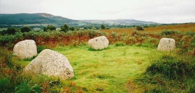
Machrie Moor 4 submitted by Bladup on 9th Jun 2014. Machrie Moor 4.
(View photo, vote or add a comment)
Log Text: None
