Contributory members are able to log private notes and comments about each site
Sites AngieLake has logged. View this log as a table or view the most recent logs from everyone
Bodowyr
Date Added: 26th Sep 2010
Site Type: Passage Grave
Country: Wales (Anglesey)
Visited: Yes on 5th Dec 2004
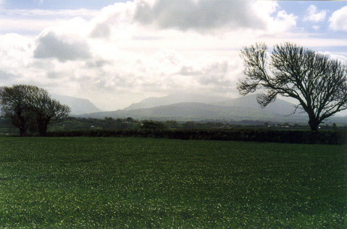
Bodowyr submitted by AngieLake on 5th Dec 2004. This is the gorgeous (and possibly important) view from the 'front' of Bodowyr burial chamber, down the sloping field, and across the Menai Straits towards the noticeable dip in the mountains of North Wales mainland. I would imagine the dip would be the gap between Snowdon (on the right) and Glyder Fawr (left), where the Llanberis Pass runs. Maybe the sun rose in that dip at Midwinter Solstice, as it would seem to be in a southeasterly direction? Its rays would then have illuminated the tomb ...
(View photo, vote or add a comment)
Log Text: None
Boscawen Un
Date Added: 26th Sep 2010
Site Type: Stone Circle
Country: England (Cornwall)
Visited: Yes on 31st Oct 2004

Boscawen Un submitted by AngieLake on 31st Oct 2004. Boscawen Un (or 'Boscanoon', as the local man called it), was looking lovely in March 2004, with no ferns to mar the view of the stones. This pic was cobbled together from two separate ones, so wouldn't win any prizes. However, it does give an overview of the site, showing the late afternoon shadow cast by the giant gnomon in the (off) centre. A few minutes later, and a few hundred yards between here and the main road, I discovered the scarily spooky Creeg Tol.
(View photo, vote or add a comment)
Log Text: None
Boskednan A
Date Added: 26th Sep 2010
Site Type: Cairn
Country: England (Cornwall)
Visited: Yes on 15th Oct 2004
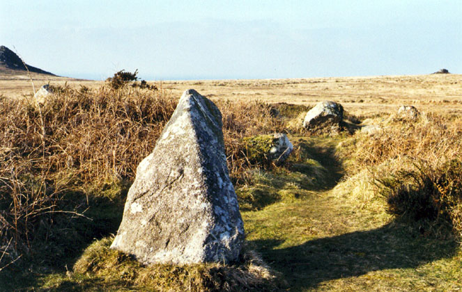
Boskednan A submitted by AngieLake on 15th Oct 2004. This eye-catching stone is in what first appears to be a small circle, near the footpath to Boskednan from Men an Tol. According to the OS map (Explorer 102) it is a 'Tumuli', (near "Carn Galver"). It is on the higher ground (its own little ridge - 227m), and seems to point to the right of Carn Galva, on the left of picture, and more towards the knobby outcrop of granite in the right distance. (The only thing possible on the map is "Little Galver", or further north, "Hannibal's Carn"). Either ...
(View photo, vote or add a comment)
Log Text: None
Boskednan stone circle
Date Added: 26th Sep 2010
Site Type: Stone Circle
Country: England (Cornwall)
Visited: Yes on 15th Oct 2004
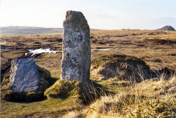
Boskednan stone circle submitted by AngieLake on 15th Oct 2004. The portals at Boskednan as they appeared in March 2004, before the huge stone on the left of picture was re-erected. Carn Galva, which now seems to be framed by these stones, is visible on the right horizon. Between the tall standing stone and the rocky outcrop of Carn Galva, can just be seen the pointed stones of the 'destroyed barrow' (as described by Ian McNeil Cooke in his excellent book "Mermaid to Merrymaid - Journey to the Stones").
(View photo, vote or add a comment)
Log Text: None
Boskenna Cross
Date Added: 26th Sep 2010
Site Type: Ancient Cross
Country: England (Cornwall)
Visited: Yes on 3rd Jun 2007

Boskenna Cross submitted by AngieLake on 3rd Jun 2007. Boskenna Cross in late-aftenoon sunshine in May 07.
(View photo, vote or add a comment)
Log Text: None
Bow Henge
Date Added: 26th Sep 2010
Site Type: Henge
Country: England (Devon)
Visited: Yes on 10th Aug 2009

Bow Henge submitted by AngieLake on 10th Aug 2009. Bow Henge viewed from the air during the drought of 1984. [Excuse quality, but this is an old photocopy from 'Devon's Past - an Aerial View' by Frances Griffith*, which has been tucked away in a file for ages, hence the crease.]
*In 2005 she was Devon County Archaeologist.
Her description:
"The cropmarks here represent the remains of quite a large prehistoric ceremonial structure - some 60m by 70m overall - which would previously have been a prominent feature of the landscape. The cropm...
(View photo, vote or add a comment)
Log Text: None
Bratton Camp
Date Added: 26th Sep 2010
Site Type: Hillfort
Country: England (Wiltshire)
Visited: Yes on 13th Aug 2007

Bratton Camp submitted by AngieLake on 13th Aug 2007. The Westbury White Horse and Bratton Camp's western embankments.
This shows a little more of the panoramic view to the north than Jim's pic did, except it doesn't show the horrid factory!
(View photo, vote or add a comment)
Log Text: None
Bratton Long Barrow
Date Added: 26th Sep 2010
Site Type: Long Barrow
Country: England (Wiltshire)
Visited: Yes on 13th Aug 2007
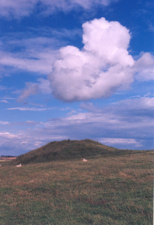
Bratton Long Barrow submitted by AngieLake on 13th Aug 2007. Looking at the barrow from the west end is deceiving, you'd never credit how long it is.
Here you can see how it lies on the northern-facing slope near the top of the hill, inside Bratton Camp fortifications.
8 June 07.
(View photo, vote or add a comment)
Log Text: None
Breage Church Cross
Date Added: 26th Sep 2010
Site Type: Ancient Cross
Country: England (Cornwall)
Visited: Yes on 24th Mar 2008
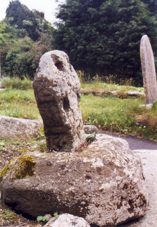
Breage Church Cross submitted by AngieLake on 24th Mar 2008. Breage church cross, looking approx. south.
(View photo, vote or add a comment)
Log Text: None
Brisworthy
Date Added: 26th Sep 2010
Site Type: Stone Circle
Country: England (Devon)
Visited: Yes on 22nd Jul 2010
Brisworthy submitted by AngieLake on 22nd Jul 2010. Taken several years ago now, this visit to Brisworthy by a group of Devon Dowsers members shows the left half of the circle, looking up-slope.
(View photo, vote or add a comment)
Log Text: None
Broad Barrow (Hamel Down)
Date Added: 26th Sep 2010
Site Type: Round Barrow(s)
Country: England (Devon)
Visited: Yes on 22nd Apr 2007
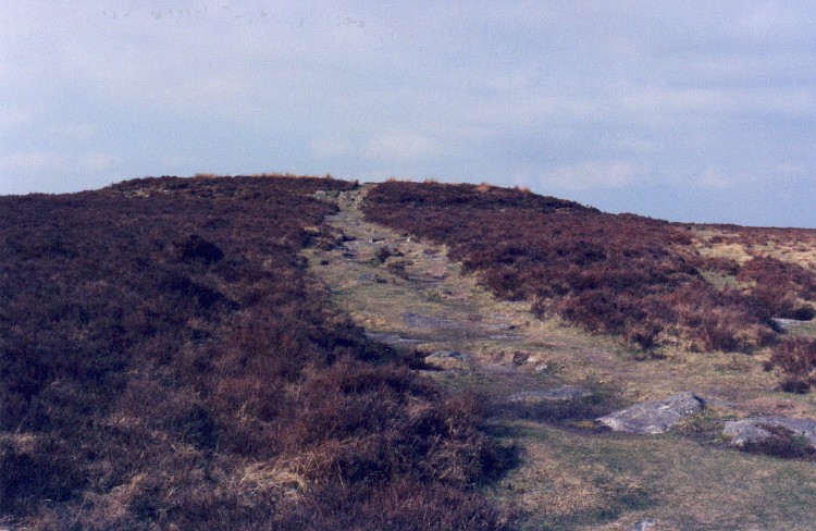
Broad Barrow (Hamel Down) submitted by AngieLake on 22nd Apr 2007. Approaching Broad Barrow from the south. Standing on the highest part of Hamel down (532m) it is the largest barrow on Dartmoor, and The Two Moors Way runs straight through it.
(View photo, vote or add a comment)
Log Text: None
Broadsands Chambered Tomb
Date Added: 26th Sep 2010
Site Type: Chambered Tomb
Country: England (Devon)
Visited: Yes on 14th Jun 2010

Broadsands Chambered Tomb submitted by AngieLake on 14th Jun 2010. Looking across the beach at Broadsands towards the hill on which this chambered tomb is situated. (Slightly to the left of tree covered summit.)
(View photo, vote or add a comment)
Log Text: None
Broadun Ring
Date Added: 26th Sep 2010
Site Type: Ancient Village or Settlement
Country: England (Devon)
Visited: Yes on 20th Apr 2010
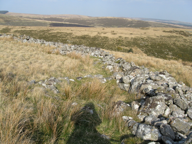
Broadun Ring submitted by AngieLake on 20th Apr 2010. The first hut I came across, built up against the wall in the SE of Broadun Ring enclosure.
(View photo, vote or add a comment)
Log Text: None
Broadun Settlement
Date Added: 26th Sep 2010
Site Type: Ancient Village or Settlement
Country: England (Devon)
Visited: Yes on 20th Apr 2010

Broadun Settlement submitted by AngieLake on 20th Apr 2010. The stile which gives almost immediate access to Broadun Settlement. (And a handy place to sit and get your breath back, while admiring the views!)
(View photo, vote or add a comment)
Log Text: None
Browne’s Hill
Date Added: 26th Sep 2010
Site Type: Portal Tomb
Country: Ireland (Republic of) (Co. Carlow)
Visited: Yes on 22nd Aug 2005

Browne’s Hill submitted by AngieLake on 22nd Aug 2005. Browneshill Dolmen photographed in July 1999. This huge capstone is the heaviest in Europe, weighing about 150 tons according to the site noticeboard. The brown heritage noticeboard at the layby next to the R726 (find it on the right opposite a garage, about 2 miles outside Carlow going east) has the Irish name too: 'Dolman Chnoc an Bhrunaigh' and the English 'Brownshill Dolmen' underneath. (The spellings vary locally). There is gate here and a fenced lane leading to the dolmen, which you can...
(View photo, vote or add a comment)
Log Text: None
Bryn Celli Ddu
Date Added: 26th Sep 2010
Site Type: Passage Grave
Country: Wales (Anglesey)
Visited: Yes on 25th Sep 2004
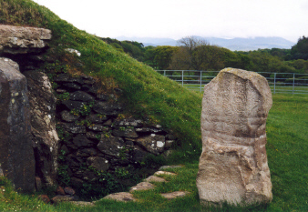
Bryn Celli Ddu submitted by AngieLake on 25th Sep 2004. The replica decorated stone by the 'back door' of Bryn Celli Ddu.
(View photo, vote or add a comment)
Log Text: None
Bryn Gwyn Stones
Date Added: 26th Sep 2010
Site Type: Stone Circle
Country: Wales (Anglesey)
Visited: Yes on 2nd Jul 2006
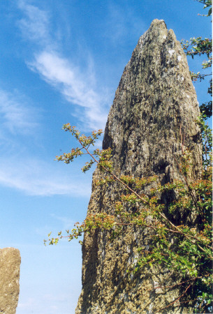
Bryn Gwyn Stones submitted by AngieLake on 2nd Jul 2006. Bryn Gwyn's taller stone is like the tip of a sword - high, and quite broad, but very slender. Its thinner sides align E-W.
(View photo, vote or add a comment)
Log Text: None
Cae'r-hen-Eglwys
Date Added: 26th Sep 2010
Site Type: Standing Stones
Country: Wales (West Glamorgan)
Visited: Yes on 9th Aug 2006

Cae'r-hen-Eglwys submitted by AngieLake on 9th Aug 2006. SEM at Cae'r Hen Eglwys stones, giving a sense of scale. I'd been looking forward to seeing these for ages, so thanks a lot Simon! It would be good to explore the field when the undergrowth has died down.
(View photo, vote or add a comment)
Log Text: None
Cairnholy 1
Date Added: 26th Sep 2010
Site Type: Chambered Cairn
Country: Scotland (Dumfries and Galloway)
Visited: Yes on 17th Aug 2010
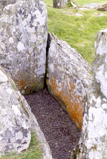
Cairnholy 1 submitted by AngieLake on 17th Aug 2010. The open cist-like chamber at Cairnholy 1 (facade would be at top of photo here).
[2002]
(View photo, vote or add a comment)
Log Text: None
Cairnholy 2
Date Added: 26th Sep 2010
Site Type: Chambered Cairn
Country: Scotland (Dumfries and Galloway)
Visited: Yes on 17th Aug 2010
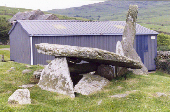
Cairnholy 2 submitted by AngieLake on 17th Aug 2010. It seems sacrilegious to allow a barn of that size to be erected so close to this wonderful monument, but the farmer must have had good reason, and no doubt, permission! Shame though...
[Summer 2002]
(View photo, vote or add a comment)
Log Text: None
