Contributory members are able to log private notes and comments about each site
Sites Anne T has logged. View this log as a table or view the most recent logs from everyone
Inveraray Castle
Trip No.86 Entry No.1 Date Added: 27th Jul 2018
Site Type: Standing Stone (Menhir)
Country: Scotland (Argyll)
Visited: Yes on 16th Jul 2018. My rating: Condition 3 Ambience 4 Access 5
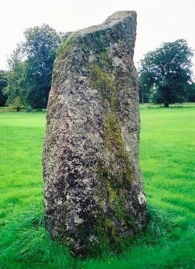
Inveraray Castle submitted by Bladup on 31st Dec 2013. Inveraray Castle standing stone.
(View photo, vote or add a comment)
Log Text: Inveraray Castle Standing Stone: On our way from our daughter’s house to Craignish peninsula (having had the trauma of catching their cat and taking her to the cattery first!) we decided to stop of in Invarary to see our first standing stone of this part of the trip. Mistake.
We arrived the day before the Highland Games at the castle started, so the town was heaving, both with coach tours of largely American tourists, and people attending the games. There was a large funfair on the grass by the harbour, which didn’t aid the flow of traffic through the town.
We managed to turn up the entrance into the castle, only Andrew had to stay in the car whilst I ran out onto the grassy show-ground area to take photographs of the stone. I chuckled to think what the delivery drivers and people putting up the marquees and stands must have thought of this woman running around the stone with a camera must have thought!
St Matthew's Well (Roslin)
Trip No.85 Entry No.4 Date Added: 27th Jul 2018
Site Type: Holy Well or Sacred Spring
Country: Scotland (Midlothian)
Visited: Yes on 15th Jul 2018. My rating: Condition 3 Ambience 3 Access 4
St Matthew's Well (Roslin) submitted by KiwiBetsy on 6th Oct 2006. The water flows into a white (or it probably once was) concrete dome which is brick lined and is very hard to spot in the undergrowth.
(View photo, vote or add a comment)
Log Text: St. Matthew's Well, Roslin: Getting to this well was interesting! Parking in Roslyn Chapel car park at NT 27405 63109, we took the gate from the south east of the car park through the cemetery, then out of the cemetery down a very overgrown lane, with very tall nettles on either side. About 50m from the grid reference for the well, we needed to head off south west into the wood. There were some tracks through here, but obviously not regularly used. We could see a green, mossy mounds/structure through the trees, but couldn’t find a way of getting down to them. In the end, I realised the track had been covered by a heavy, large dead tree branch, which Andrew and I managed to haul away from the path with a little difficulty. Having cleared the track, we used the tree roots as stepping stones at first, then slide the 20m or so down the slope to the well (I told myself it was always easier going up!).
At first we thought there was only one dome here, but looking harder, there was a second one, a few metres up the slope. The front face of the second dome (nearest the river Esk) had a hole in the front, which I poked the camera through to take a photograph. The was a large iron pipe which gushed water into the well chamber. A continuation of this pipe could be seen in a small gully which headed towards the river from the well chambers, although the gloom and all the detitus made it difficult to capture the location.
Heading back to look at the ruins of St. Michael’s church, we looked over the western end of the graveyard, looking south west, and realised we could not only see the well houses, but it also looked as if there were the remains of a wall and steps, as there were cut blocks of stone lying around.
I went back to photograph the 'Spooky Angel' I'd seen when I visited with my friend two years ago (hidden under a bush by the small outbuildings) - she much reminded me of an episode of Dr. Who, where the angels only moved when you didn't look at them.
Glencorse Cup and Ring Marked Stone
Trip No.85 Entry No.3 Date Added: 27th Jul 2018
Site Type: Rock Art
Country: Scotland (Midlothian)
Visited: Yes on 15th Jul 2018. My rating: Condition 3 Ambience 3 Access 5
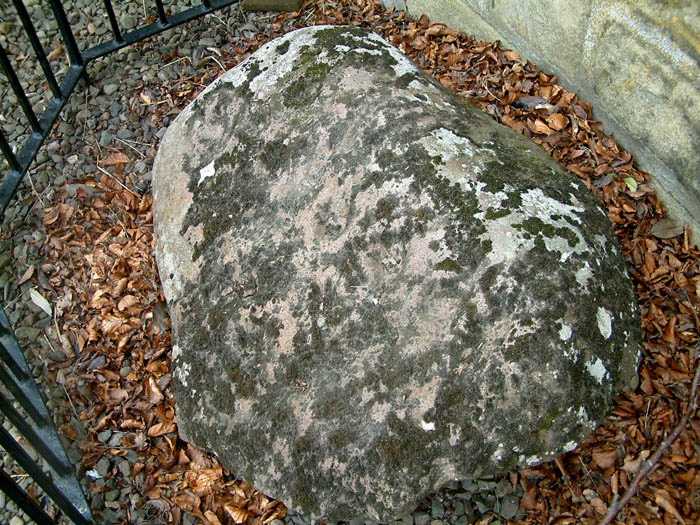
Glencorse Cup and Ring Marked Stone submitted by uisdean on 19th Apr 2007.
Cup and ring marked stone in Glencorse (NT24706259)
(View photo, vote or add a comment)
Log Text: Glencorse Cup and Ring Marked Stone: Just outside the tall, imposing (and locked) Parish Church, which had an amazing old tree in the field opposite, and a long layby; this village is obviously popular with walkers, as there were lots of cars parked around here, and footpaths leading through the woods, away from the church.
This poor cup and ring stone is contained behind railings, so it looked as if the stone had been caged. The lichen and moss growing on it made it a little difficult to pick out the cups (we certainly couldn’t count 22), and we saw a couple of cup and ring motifs. Even trying to view the stone from different angles, to try and highlight the cups, didn’t make it any easier. A brush and a bottle of water would have come in useful.
I was much amused by the ‘reserved’ signs next to the stone, as if the minister and church warden might have had cars with specially shaped bonnets to fit neatly around the ‘railing cage’.
We did try the church door, just in case, but like many of these churches, locked and bolted. This church had the most amazing number of floodlights around it, so it must have been well lit in the dark.
Castle Knowe (Glencorse)
Trip No.85 Entry No.2 Date Added: 27th Jul 2018
Site Type: Ancient Village or Settlement
Country: Scotland (Midlothian)
Visited: Yes on 15th Jul 2018. My rating: Condition 2 Ambience 3 Access 4
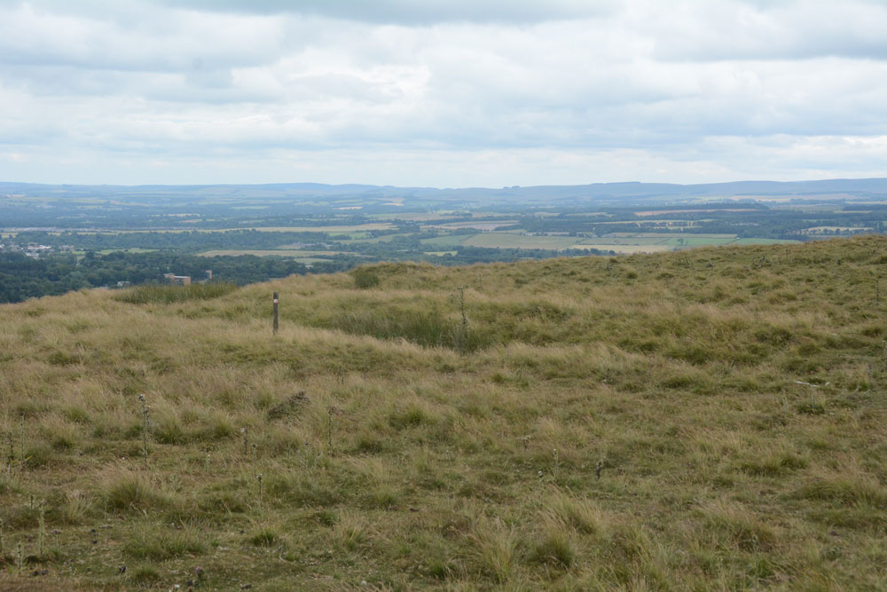
Castle Knowe (Glencorse) submitted by Anne T on 27th Jul 2018. The main line of the low palisade bank/trench to the north eastern side of this palisaded settlement.
(View photo, vote or add a comment)
Log Text: Castle Knowe Palisaded Settlement, Glencorse: From Castle Law hill fort, we continued northwards up the track, turning right up another footpath onto the Castle Knowe Palisaded Settlement. I stopped half way up to get some photos of Castle Law Hill Fort, looking down on it. There were a few other people walking up the track, and whilst they had largely stopped at the fort to look quickly around, no-one paid any attention to this settlement.
There wasn’t a lot to see, apart from some small boundary banks and ditches on the northern and just the north eastern side. There is a modern cairn on top – just a pile of red sandstone rocks, but this was very eye-catching, particularly from the car park and fort below, mostly because of its red colour.
The military earthworks to the north of this settlement look like a much more substantial monument, but are just for military training exercises.
Whilst there were only a couple of the palisade trenches visible on the north and north east side of the settlement, and possibly signs of one of the timber house circles, it was well worth walking further up the hills for the views to the east and north.
Castle Law
Trip No.85 Entry No.1 Date Added: 26th Jul 2018
Site Type: Hillfort
Country: Scotland (Midlothian)
Visited: Yes on 15th Jul 2018. My rating: Condition 3 Ambience 4 Access 4
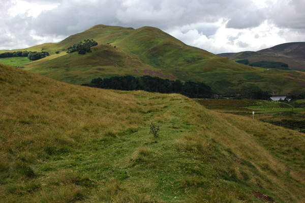
Castle Law submitted by nicoladidsbury on 14th Oct 2007. Castlelaw Hillfort - this photo shows the earth banks and terraces of the hill fort.
(View photo, vote or add a comment)
Log Text: Castle Law Hillfort, Glencorse: First stop of the day, and I was surprised this hill fort was so close to a modern military firing range. Because of its proximity to Edinburgh, there were a few other people parked in the small car park below the fort, but very few walked up onto it; a track carried on up the hill.
The earth house was very unusual, with steps leading down into it, and a narrow, curving passage leading into it. About half way down, a small doorway leads into a circular chamber.
We searched, and found, the cup marked stone towards the eastern wall of the terminus. If other stones had been put on top of this, the cups couldn’t have been seen. It was difficult to capture the cups (and some micro-cups?) in the dim lighting, even using flash and a torch, and had me giggling with our efforts to get a good photograph.
We walked round the inner defences of the fort, admiring the shooting range below, then carried on up the hill to what was left of the palisaded settlement. Walking up the hill to this site gave us an excellent view down on to the hillfort.
Market Cross (Kincardine)
Trip No.84 Entry No.10 Date Added: 26th Jul 2018
Site Type: Ancient Cross
Country: Scotland (Fife)
Visited: Yes on 14th Jul 2018. My rating: Condition 3 Ambience 2 Access 5
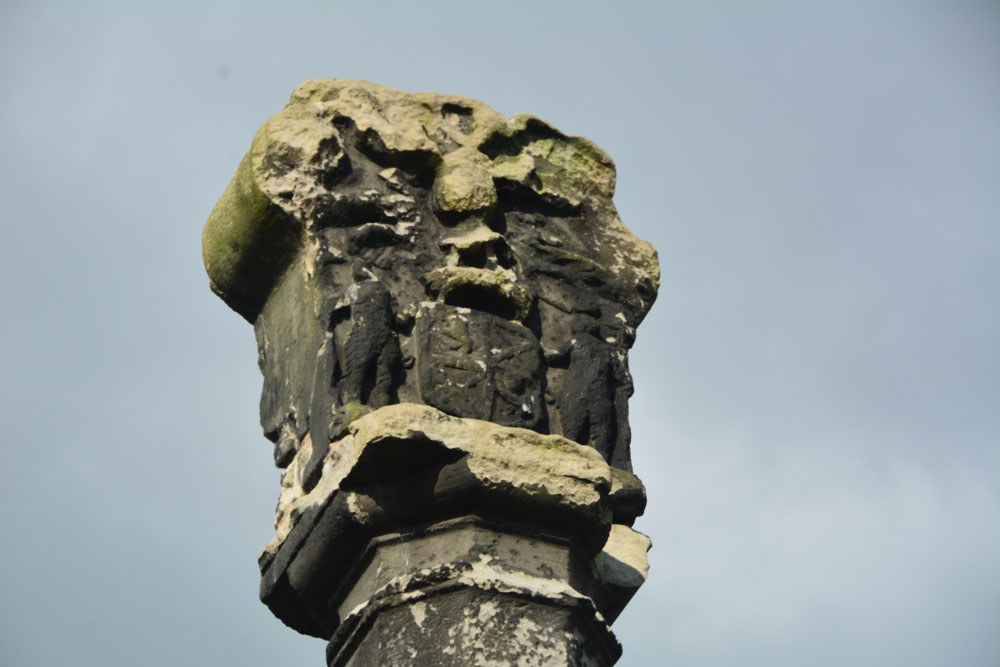
Market Cross (Kincardine) submitted by Anne T on 26th Jul 2018. Apart from the finial, this Mercat Cross in Kincardine was virtually identical in style to the Mercat Cross in Clackmannan, not that far away.
(View photo, vote or add a comment)
Log Text: Mercat Cross, Kincardine: Our last stop of this very hot day, thankfully. This cross was in a very busy stop, next to the main bus stop in the town, with lots of take away shops around the ‘triangle’ of what might have been the village green. Not an impressive site, although the cross (apart from the finial) seems almost identical to the Mercat Cross, Clackmannan. Just one to 'tick off the list' that we've seen it (and photographed it).
Stone of Mannan
Trip No.84 Entry No.9 Date Added: 26th Jul 2018
Site Type: Standing Stone (Menhir)
Country: Scotland (Clackmannanshire)
Visited: Yes on 14th Jul 2018. My rating: Condition 3 Ambience 4 Access 5
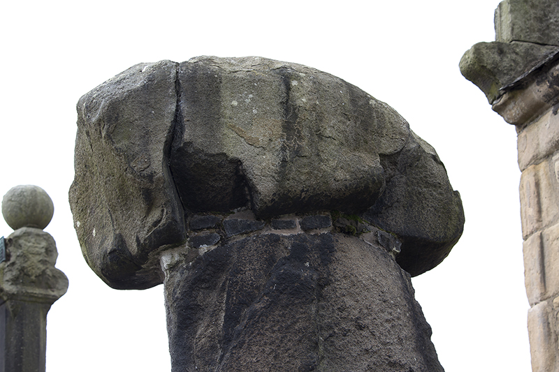
Stone of Mannan submitted by peigimccann on 27th Aug 2017. Stone of Mannan
(View photo, vote or add a comment)
Log Text: Stone of Mannan, Clackmannan: I was surprised to find this only about 20m east of the Mercat Cross (refer to that page for the rest of my visit report). Right next to the market cross and the Tolbooth. See the report above. I was interested to read the plaque on the eastern wall of the Tolbooth: “The Stone or Clack, originally placed at the foot of Lookabootye Brae, was sacred to the pre-Christian deity Mannan and is an unique relic of pagan times. It was raised on the large shaft in 1833”.
Mercat Cross (Clackmannan)
Trip No.84 Entry No.8 Date Added: 26th Jul 2018
Site Type: Ancient Cross
Country: Scotland (Clackmannanshire)
Visited: Yes on 14th Jul 2018. My rating: Condition 3 Ambience 4 Access 5

Mercat Cross (Clackmannan) submitted by peigimccann on 27th Aug 2017. Clackmannan market cross
(View photo, vote or add a comment)
Log Text: The Mercat Cross, Clackmannan: The Mercat Cross, the Stone of Mannan and the Tolbooth are all in the same small area. When we arrived, it was about 6.40pm and the sun was low in the sky, giving deep shadows. Much to the amusement of the people drinking outside the pub behind the Tolbooth, I took a number of photographs of these monuments, then retreated to the car to try and get out of the heat. Was worth seeing, but at this time of day I wanted something to eat, drink and cool shade!
Parkmill Cross (Alloa)
Trip No.84 Entry No.7 Date Added: 26th Jul 2018
Site Type: Ancient Cross
Country: Scotland (Clackmannanshire)
Visited: Couldn't find on 14th Jul 2018. My rating: Condition -1
Log Text: Parkmill Cross, Alloa: Could not find this – the grid reference seemed to be somewhere in a breaker’s yard. Parking in the nearby housing estate just to the south west of this location, we followed the footpath sign to the footpath which ran west-east along the bottom of the field this cross base is supposed to be in, the tall fence and padlocked gates prevented entry. Andrew tried to gain access from the car breakers yard to the north-west, but said it looks as if their site has been extended to cover where this cross might have been.
Castleton (Dollar)
Trip No.84 Entry No.6 Date Added: 26th Jul 2018
Site Type: Standing Stone (Menhir)
Country: Scotland (Clackmannanshire)
Visited: Yes on 14th Jul 2018. My rating: Condition 4 Ambience 4 Access 4
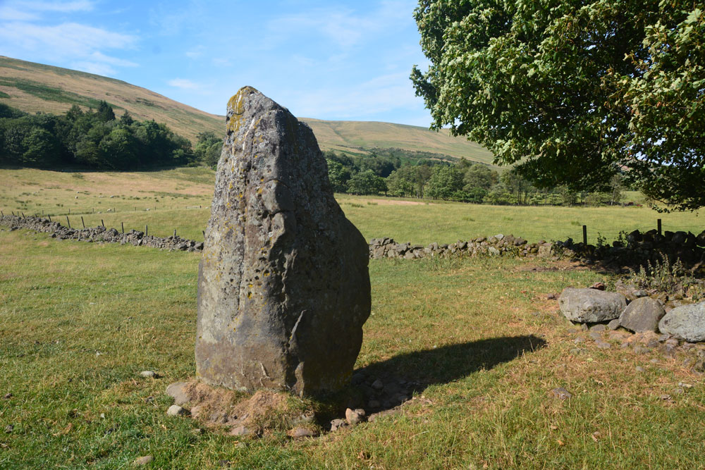
Castleton (Dollar) submitted by Anne T on 26th Jul 2018. Standing stone in Clackmannanshire Scotland. Standing just to the south west of the stone, looking at its location in relation to the surrounding hills and capturing its shadow at this time of the evening.
(View photo, vote or add a comment)
Log Text: Castleton Standing Stone, Pool of Muckhart: To find this stone, we followed the signs to the ‘Japanese’ garden, which had a large car park. The entrance and part of the car park were still in the process of being constructed, but was obviously just about to close for the night, so we parked as close a wall outside the entrance. Scanning the field for a gate, there was one by the farm house, some distance away (and it looked as if there was a small stream we’d have had to cross to reach the stone) or an old, painted red iron gate (very ornate) virtually opposite from where we parked. This had not been used in some time, and our usual gate opening skills didn’t work. We ended up climbing over the gate and walked across the field.
It was by now so hot and sticky, that the sheep had taken shelter under the trees to the east of this stone, in what looked like an old sheep fold, now fallen into ruin. This standing stone had two sides which were eroded, one with what looked like cups, but (having seen similar examples doing the ERA data entry exercise) are probably small holes where pebbles have fallen out, or possible solution holes if the stone had lain on the ground for some considerable time.
A very lovely spot, with gentle rolling hills to the north and north west.
Gray Stone (Dunning)
Trip No.84 Entry No.5 Date Added: 26th Jul 2018
Site Type: Standing Stone (Menhir)
Country: Scotland (Perth and Kinross)
Visited: Yes on 14th Jul 2018. My rating: Condition 3 Ambience 4 Access 4
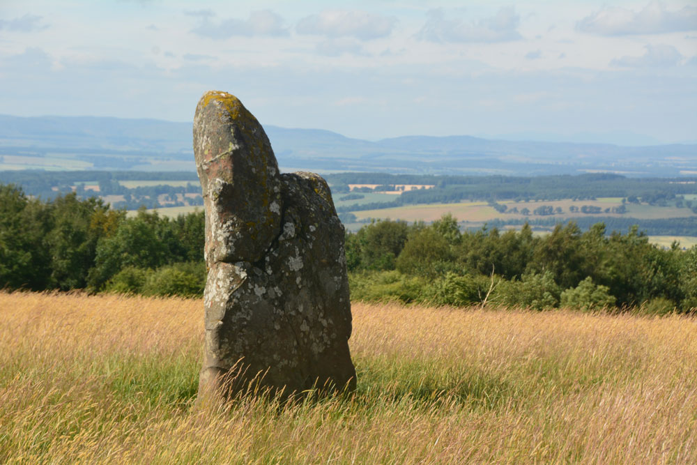
Gray Stone (Dunning) submitted by Anne T on 26th Jul 2018. Getting closer to the stone, approaching it from the gate into the field (south), we started to see the 'shoulder' on its northern side.
(View photo, vote or add a comment)
Log Text: The Gray Stone, Dunning: Thrilled to be seeing my second standing stone of the day (and one we were likely to get close to), we parked at the end of the driveway up to The Knowes farm. The stone is signposted, but the signpost follows the line of the fence and wood to the north west. Undecided whether to follow the sign and walk through the knee high grass or take the farm track which ran directly westwards. Consulting the map, we didn’t come to any firm conclusion, so to avoid having to climb over any fences, we ended up walking up the farm track, ending up at the cottage just before the gate to the big farmhouse to the left. Turning to our right here, in front of the cottage, there is a way across the deep, wide ditch which ran to our right hand side all along the track, then followed another farm track which ran north east to two field gates at NO 02171 11700. Opening the left hand gate, we let ourselves into the field, and the stone was immediately in front of us, about half way along the middle of the field, near to the fence line with the neighbouring wood which is to the stone’s eastern side.
Walking towards the stone (through what looked like a field of wheat, looking back on the photos, but is actually tall, yellow grass which has gone to seed) which is about 7ft tall, we realised it had a ‘shoulder’ to its northern side. Having seen a few other stones like this recently (the Megget Stone springs immediately to mind), I wondered if this had been deliberately cut like this, but looking at the bashes this stone has had, and the cracks and loose pieces on it, it looks as if it has fractured and a piece fallen off.
Whilst the views to the south and east are blocked now by forestry, there was a great vista northwards to Dunning and the hills (which appeared as a blue mist) in the far distance. On its northern side, there is a change in slope down from the stone; to its west and slightly to the south, there is a very slight rise. I wondered if the change in ground level might be because either farming, or perhaps a prevailing wind over time, has caused the ground level to build up here.
A very peaceful and beautiful place.
Forteviot Cross
Trip No.84 Entry No.4 Date Added: 25th Jul 2018
Site Type: Sculptured Stone
Country: Scotland (Perth and Kinross)
Visited: Yes on 14th Jul 2018. My rating: Condition 5 Ambience 4 Access 5
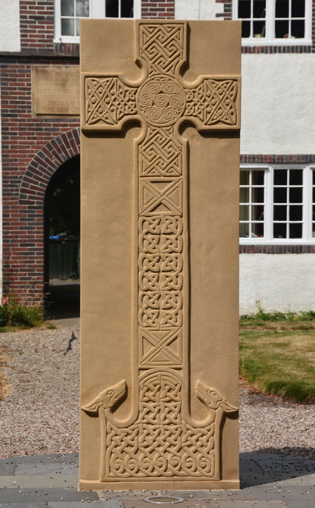
Forteviot Cross submitted by Anne T on 25th Jul 2018. The front of this modern Pictish cross slab, only unveiled in mid-March this year.
(View photo, vote or add a comment)
Log Text: Modern Pictish Cross Slab, Forteviot: Having been spooked by the Maggie Wall Memorial and disappointed at not being able to get into Forteviot parish church (St. Andrews), the lady gardener told us to walk down the road to look at the new cross slab that had just been erected.
Just behind the bus-stop, and in front of a charming courtyard of whitewashed houses, we found out later this cross had been erected only on either 17th or 18th March 2018, so very new.
The lady gardener told us there were some leaflets ‘in the bus stop’ and indeed there were several tucked underneath the bus timetable board. The cross was carved by David McGovern, of Monikierockart for the 2017 Tay Landscape Partnership project. “In the form of a Pictish Cross Slab, the new cross celebrates Forteviot’s status as an early Christian site and its association with King Cinead mac Alpin. The Pictish stone fragments that inspired the cross design can also be visited across the road in St Andrew’s Church (when open).” The leaflet also gives a guide to the patterns on the cross.
St Andrew's Church (Forteviot)
Trip No.84 Entry No.3 Date Added: 25th Jul 2018
Site Type: Class III Pictish Cross Slab
Country: Scotland (Perth and Kinross)
Visited: Visited (still working on) on 14th Jul 2018. My rating: Ambience 3 Access 5
Log Text: St. Andrew's, Forteviot: We drove up to this church to find a lovely local lady garden by the gate into the churchyard. She told us the church would be locked, "but it'll be open on 29th (July)." We explained we were only here for the day, so this was too late. She told us about the recently erected modern cross, just down the road from the church, next to the bus stop. We thanked her kindly and walked down to take a look.
Dunning
Trip No.84 Entry No.2 Date Added: 25th Jul 2018
Site Type: Standing Stone (Menhir)
Country: Scotland (Perth and Kinross)
Visited: Saw from a distance on 14th Jul 2018. My rating: Condition 3 Ambience 3 Access 4

Dunning submitted by Nick on 5th Nov 2002. The stone looking north
(View photo, vote or add a comment)
Log Text: Dunning North Standing Stone: From St Serf’s church, we walked along Kirk Wynd, down alongside the stream, down past some cottages, to where the footpath split. The standing stone was right in front of us, albeit in the middle of a ripening crop of wheat. It seemed very far away, and I was very, very reluctant to trample any of the crop, so we stuck to the footpath. With the camera lens on maximum zoom I tried to capture the different faces of the stone, but as the footpath ran roughly west-east, we couldn’t really get close.
The guide in the church told us there were two standing stones nearby; most people visited the northern (this) stone, but apparently not many people went to the southern stone.
If the field hadn’t been set with a crop, I’d have been tempted to look for the gate, or an alternate route to get closer.
Our next stop was to the very peculiar "Maggie Wall Monument", 1km west of Dunning on the B8062. This is a 20ft tall monument topped by a cross to a witch called Maggie Wall who was apparently burnt in 1657. The stories I've all tracked down say Maggie Wall didn't exist. This monument definitely made me shiver!
Dupplin Cross
Trip No.84 Entry No.1 Date Added: 25th Jul 2018
Site Type: Ancient Cross
Country: Scotland (Perth and Kinross)
Visited: Yes on 14th Jul 2018. My rating: Condition 4 Ambience 4 Access 5
Dupplin Cross submitted by cosmic on 16th May 2007.
Back of the cross with the dedication panel top middle
(View photo, vote or add a comment)
Log Text: Dupplin Cross, St Serf's, Dunning: Our first stop of the day, and a very old, popular, tourist village. We first saw a drinking fountain outside the churchyard, almost at the cross roads.
By the southern door to the church were two hogbacks.
Inside was the Duppline Cross and a smaller cross slab to its north west. There was a guide, already talking to a gentleman about the cross, but when she saw us, she interrupted her talk and came up to us to ask us to join in. Not usually one for ‘tours’ we reluctantly joined her, as I really wanted space and time to drink in this cross on my own, then photograph it; this was not to be, as there was a steady stream of visitors coming into the church. As we went out, another family came in, followed later by a large walking group.
I photographed most of the individual panels around the Dupplin cross and need to sort these out using the diagrams in the 'Official Souvenir Guide' (£1). I was particularly fascinated by the base, which appeared to have carved lines across one corner, and cups (or very worn interlacing) on its base.
Gleneagles A
Trip No.83 Entry No.9 Date Added: 25th Jul 2018
Site Type: Standing Stone (Menhir)
Country: Scotland (Perth and Kinross)
Visited: Yes on 13th Jul 2018. My rating: Condition 3 Ambience 4 Access 5

Gleneagles A submitted by hamish on 23rd Jun 2005. I took this picture, including the phone mast erectors, and ran out of film so couldn't take another one. Maybe another time.
Interesting stone though, there are some markings on the right side.
(View photo, vote or add a comment)
Log Text: Peterhead Farm Standing Stone, Gleneagles: Our last stop of the day. Driving (it was too hot, and we were too lazy to walk) further along the single track road towards the mast and the entrance to Peterhead Farm, we parked near the mast and walked across the road. The nearest gate into the field appeared to be near the farm buildings, so we clambered over the wooden fence at the corner of the road with the farm track.
This standing stone looks as if it sits just below the top of a natural mound. There were quite a few packing stones around the base of the stone, with others scattered around the ground nearby.
Gleneagles B
Trip No.83 Entry No.8 Date Added: 25th Jul 2018
Site Type: Standing Stone (Menhir)
Country: Scotland (Perth and Kinross)
Visited: Yes on 13th Jul 2018. My rating: Condition 3 Ambience 3 Access 4
Gleneagles B submitted by cosmic on 19th Feb 2005. The Incised Mark/s on the North Side
(View photo, vote or add a comment)
Log Text: Peterhead Farm Pictish Symbol Stone: Right next to the A9, so the atmosphere wasn’t brilliant, but ignoring the traffic, looking east, this was a glorious setting.
There was a gate into this field full of sheep, so we let ourselves in and walked over to the stone, which now sits within 30m of a slip road leading to the A9. The Gleneagles roundabout with its golf club ‘sculpture’ provide a strange backdrop.
The views to the east are somewhat different, and facing this way, you could almost believe you were in the country. Whilst the black clouds were gathering to the north and east, there was no rain.
I was fascinated by the two quartz inclusions underneath the symbols.
Dunblane Cathedral
Trip No.83 Entry No.7 Date Added: 25th Jul 2018
Site Type: Class III Pictish Cross Slab
Country: Scotland (Stirling)
Visited: Yes on 13th Jul 2018. My rating: Condition 3 Ambience 4 Access 5
Dunblane Cathedral submitted by Alta-Falisa on 29th Jun 2015. Photo : May 2015.
(View photo, vote or add a comment)
Log Text: Ancient crosses at Dunblane Cathedral: Having been bitten and bitten again by horseflies at Sheriffmuir Stone Row, the weather being very hot and humid, and the Sheriffmuir Inn decidedly shuttered up, we decided to go into Dunblane to find a cup of tea and a late lunch. We managed to find a parking spot just opposite the cathedral, so after tea and a jacket potato at the Beech Tree café, we walked back and went into the cathedral.
This is a really welcoming and peaceful church. The young lady who greeted us and sold us a guide book could hardly be heard for the organist “practising for tomorrow – but you can enjoy the music. You can take photographs, but don’t use the flash around the organist.”
The highlight for me was the two cross marked stones at the western end of the northern aisle. There is a lot of information about the cathedral itself, but not much about the crosses. We marvelled at how worn some of the bases of the columns and other architectural features, as part of the cathedral stood roofless for over 300 years from the late 1500s (says the guide book).
The guide book (page 10) talks about the crosses, saying in the North Aisle: “Here there is a large carved cross – evidence that Dunblane was a religious centre from an early date. Discovered beneath the chapter house floor in 1873, it dates from the 9th century. On the back of the stone are allegorical figures – there are two animals sitting entwined and a horse and rider with an animal, perhaps a wolf, below the horse. Also on display is a fragment from a similar cross-slab found in 1836. It also dates to the 8th or 9th century. The presence of both stones suggests that there may have been an earlier church on this site. Architectural fragments dating from the 1100s and 1200s were found during the construction of the boiler house under the chancel and chapter house in 1836. Some of these fragments are on display in the north aisle. The finely worked chevrons (zigzags) on the arch fragments, and the elaborate column cap hint at the exquisite decoration of the earlier cathedral. Fragments from the 1300s and 1400s are also on display.”
I completely forgot about the four cists around the cathedral, and I didn't have a mobile signal to call up the Portal or the Canmore records, but we will be coming back here at some point in the relatively near future.
The Boat Stone
Trip No.83 Entry No.6 Date Added: 24th Jul 2018
Site Type: Standing Stone (Menhir)
Country: Scotland (Perth and Kinross)
Visited: Yes on 13th Jul 2018. My rating: Condition 3 Ambience 4 Access 4

The Boat Stone submitted by hamish on 23rd Jul 2005. After you have been to Sherriffmuir Stones keep on up the road. Don't try to find Wester Briggs Circle, it's hidden in the heather. Just down the road past the woods on the left is the Boat Stone. You have to clamber over the stone wall with a barbed wire topping to get to this stone. Nearly broke my leg but survived.
(View photo, vote or add a comment)
Log Text: The Boat Stone, Sheriffmuir to Dunblane lane: Marked on the OS map, but not on Canmore, this fallen standing stone is featured on the Portal and The Northern Antiquarian. The road is single track at this point, with not many passing places. The farmer had left the gate into the field wide open, and it was dry, bare soil. We dared to pull the car just inside the gate.
The farmer had heaped a beautifully large pile of maturing manure between the gate and the stone, so I took a slightly wider berth round this than I might have, with the heat and the flies!
This large stone is impressive. It sites on a mound (I walked around it to photograph it and had to step up the mound to get to the top of the stone) and has some lovely quartz inclusions.
Wester Biggs (Dunblane)
Trip No.83 Entry No.5 Date Added: 24th Jul 2018
Site Type: Stone Circle
Country: Scotland (Perth and Kinross)
Visited: Couldn't find on 13th Jul 2018. My rating: Condition -1 Ambience 4 Access 5

Wester Biggs (Dunblane) submitted by Anne T on 24th Jul 2018. Thinking this stone circle was just by the side of the road, and therefore relatively easy to see, we spent ages with our GPS wandering around trying to spot stones of any description. The heather and vegetation was calf deep, so any small stones would have been difficult to spot. However, 6m away from where our GPS said the circle was, there was only this slight change in vegetation (the shorter, green area). Either the stones are hidden, or they've been sadly removed. View looking NE, towar...
(View photo, vote or add a comment)
Log Text: Wester Biggs Stone Circle, Near Dunblane: Returning from tea and cakes in Dunblane, we resumed our search for megalithic sites. Next stop, hopefully, a not-before-photographed stone circle, right by the side of the road.
Finding the telephone mast and driving a couple of hundred yards further on, we parked at NN 86368 06240 and walked back south along the road, armed with the Canmore listing on my phone and the GPS.
Despite an intensive search of the land east of the road around this point, we were unable to locate any stones amongst the tall heather. However, there was a circle of gras/vergetation which was different from any heather at almost exactly the grid reference given by Canmore, so I photographed ‘the spot’. Andrew thinks the stones may have been removed. Always possible, but I think we need to return when the shrubbery has died back.
