Contributory members are able to log private notes and comments about each site
Sites Anne T has logged. View this log as a table or view the most recent logs from everyone
St Mary's Motte (Beaumont)
Trip No.40 Entry No.8 Date Added: 25th Aug 2017
Site Type: Misc. Earthwork
Country: England (Cumbria)
Visited: Yes on 20th Aug 2017. My rating: Condition 3 Ambience 4 Access 5

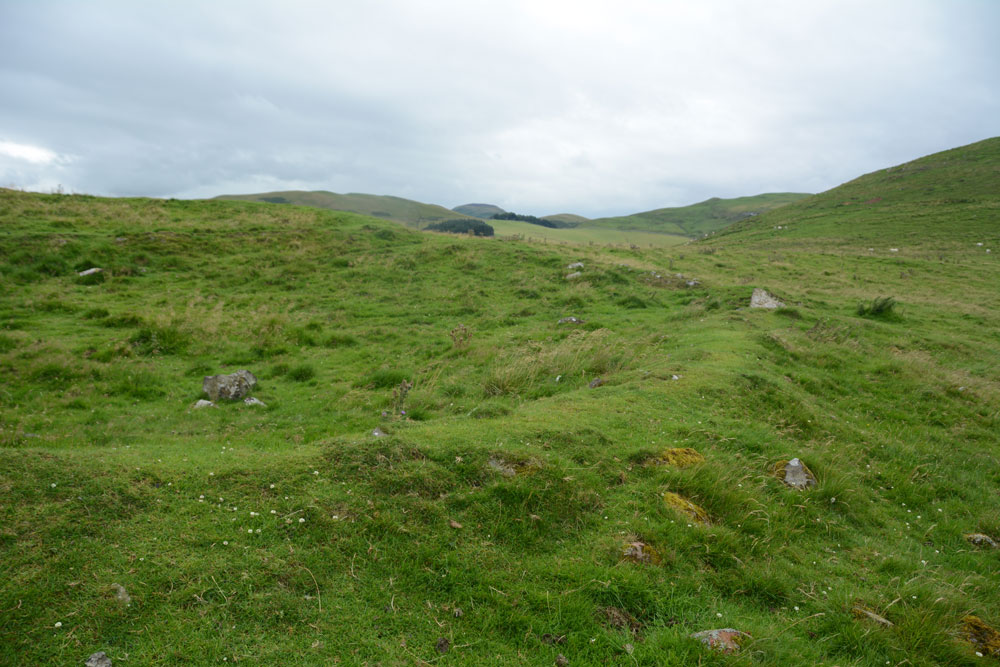
St Mary's Motte (Beaumont) submitted by Anne T on 22nd Aug 2017. Looking at the southern section of the motte, which has been partly cut by the modern road through the village. Pastscape says that the site may originally have been a Saxon or Danish settlement, then the site of turret 70a on Hadrian's Wall, then a Norman motte, finally being replaced by the church in the 12th century.
(View photo, vote or add a comment)
Log Text: St. Mary's Beaumont: Church built on a motte, on a milecastle on a possible Saxon camp: We came to try to see St. Ann’s Well, marked on the OS map as being just off the small triangular village green, but found it was in a private garden surrounded by either a tall hedge or other buildings, so there was no access and no-one around to ask. According to the Old Cumbria Gazetteer, the well is at NY35055942, which is nearer the River Eden, says the well is at NY35055942 (which is different to the OS map) and: “This provided very cold water, useful for helping set the butter. By the time you’d got back up the bank your bucket was only half full.” Dated to 1867 to 1868.
There were lots of walkers trundling along Hadrian’s Wall Path at this point, with a large notice by the interpretation board saying there was a detour due to a large landslip. By this time, my attention had been grabbed by the interpretation board saying this church was built on the line of Hadrian’s Wall and that at one point, a turret (70A) would have stood on the site of the church. The church guide continues: “When the Normans arrived they constructed a motte and baillie as a vantage point to repel invasion from the Scots …. Stones from the wall provided ready building material.”
This is a very pleasant spot. There were so many tractors driving around at this time of the evening we felt out of place! There are farms all along the road through the village. I’d have liked to have seen across to the River Eden, but the farm buildings and houses along its western bank obscured the view. We decided on one final visit, to try and see St. Edward’s Monument (so wet we couldn’t get near last time).
St Andrew's Well (Kirkandrews-on-Eden)
Trip No.40 Entry No.6 Date Added: 22nd Aug 2017
Site Type: Holy Well or Sacred Spring
Country: England (Cumbria)
Visited: Yes on 20th Aug 2017. My rating: Condition 3 Ambience 4 Access 4

St Andrew's Well (Kirkandrews-on-Eden) submitted by Anne T on 22nd Aug 2017. Standing looking at the bank where the spring emerged, with the well pool - a rectangular stone (or brick?) basin - below. There was a steady flow of water, which could be heard from quite a way away.
(View photo, vote or add a comment)
Log Text: St Andrew's Well, Kirkandrews-on-Eden: From Stapleton, we headed to junction 44 of the M6 and stopped for refreshments at Houghton Park Garden Centre, then set off via the A689 (western part of the bypass round Carlisle, turning right at the roundabout where the A689 joins Burgh Road. Kirkandrews is almost 2.5 km to the north west of this point.
In the middle of Kirkandrews-on-Eden the road splits. The left hand fork goes directly to Monkhill, the right hand fork to Beaumont. The old churchyard is somewhat hidden behind bushes, but is approx. 120 metres from the fork in the road. We parked at the wide farm entrance a little further up the road and walked back to the footpath sign.
We followed the footpath for about 50 metres (the old grave stones peer out of the very high grass to your right hand side. As the path starts to descend, we could hear a steady trickle of water and found the well hidden behind weeds that were as tall as I was. Gently moving these aside, so we have a clear view (we thought the weeds might be poisonous) I took photographs. My husband announced this was a very spooky spot (overgrown trees next to a decidedly no longer used grave yard) although I found it strangely tranquil.
There was a channel running down the hillside taking rainwater down to the well pool. The main water came out of the bank to the side at a 90 degree angle to the sandstone basin, then trickled down into a second channel running down the hill.
The basin was much silted up with sandy soil but the flow was strong and clear. Although Pastscape says the well pool is 1.0 metre square, I thought it was rectangular, measuring 1.5 m long b about 80cm wide.
Don’t know what happened to the church, but then just discovered the small mention below – closed in the 1750s with no visible evidence remaining.
St Mary's Church (Walton)
Trip No.40 Entry No.1 Date Added: 22nd Aug 2017
Site Type: Ancient Cross
Country: England (Cumbria)
Visited: Yes on 20th Aug 2017. My rating: Condition 3 Ambience 3 Access 5

St Mary's Church (Walton) submitted by Anne T on 22nd Aug 2017. Standing nearer to the south western corner of the church looking back at the cross shaft. The stone is badly shattered and spalled off on this side.
(View photo, vote or add a comment)
Log Text: St. Mary's, Walton: Went to see a cross head, but found an 11th century market cross instead! This is a very pretty little village, and was on our way back to Stapleton to try to find the Bride’s Well (ran out of time last Thursday). We parked opposite the church on the side of the village green and walked across to the church, letting ourselves in through the rather rusty gate (it took us ages to work out how to open it). I excitedly followed my husband into the church but stopped dead as there was no sign of the cross head at all.
We hunted under pews, up and down the aisles, on window ledges, around the font, inside a chest, and all the places we could think of. The only sign of the cross was a photograph and a brief description on the display boards against the north western wall of the nave, which showed it displayed on top of the font cover. (I’ve since sent an email to the vicar to enquire where it might be located or moved to, but not had a reply yet).
We did however, see a paragraph on the display boards headed AD850 to 1066: “During the latter part of the 9th century to the middle of the 11th century, Walton, as a community, developed. The evidence for this is shown by the relics found in or around the present church. Between the years of 850 to 950, a preaching cross was erected and similarly between 1000 and 1050, a market cross was probably erected.” There is an image of the remains of the market cross in the churchyard. We then went to find this, disappointed not to have found the cross head, but pleased there was something of antiquity to have made this detour worthwhile.
King Edward's Monument
Trip No.40 Entry No.7 Date Added: 22nd Aug 2017
Site Type: Cairn
Country: England (Cumbria)
Visited: Yes on 20th Aug 2017. My rating: Condition 3 Ambience 4 Access 4

King Edward's Monument submitted by Anne T on 22nd Aug 2017. First view of the monument from the parking area at NY 32876 60329
(View photo, vote or add a comment)
Log Text: King Edward's Monument, Burgh-by-Sands: After having visited Beaumont, I was reluctant to go home without seeing something of the Solway, and looking across to Dumfries & Galloway, where we spent 12 years. When we last visited in February 2014 we were unable to get down the lane because it was so waterlogged (we got about one third of the way down and had to abandon the visit, having seen the monument only from afar). This time, the lane looked dry, so we parked by the little triangle of grass and could see the monument on the marshland below.
Appearances were certainly deceptive – parts of the lane were ankle deep in mud, and we picked our way from the track to the marshy grass land next to it, to dry stones and boulders where we could. Eventually we came to the stile over a small stream at NY 32773 60897, which led immediately down to a small wooden bridge and onto another stile. The other side of this stile was deep in water, but thankfully previous walkers had moved ‘stepping stones’ into the water. Once onto Burgh Marshes, the mounds left by ridge and furrow ploughing kept our feet dry until we got to the monument. Parts by the brick wall/metal railings surrounding the monument looked as if it was surrounded by a small moat!
What a place to have waited to cross the Solway. I think I would have preferred to have seen the original cairn rather than this Victorian monstrosity. The chimneys of Chapelcross, the decommissioned nuclear power plant, could be seen across the estuary, together with the flattened hilltop of Burnwark hillfort.
At the time of our visit, the tide was out, but I could imagine the shimmering water of the Solway to the west. A fitting end to a nice afternoon out.
Hall Well (Irthington)
Trip No.40 Entry No.2 Date Added: 24th Aug 2017
Site Type: Holy Well or Sacred Spring
Country: England (Cumbria)
Visited: Yes on 20th Aug 2017. My rating: Condition 2 Ambience 3 Access 5
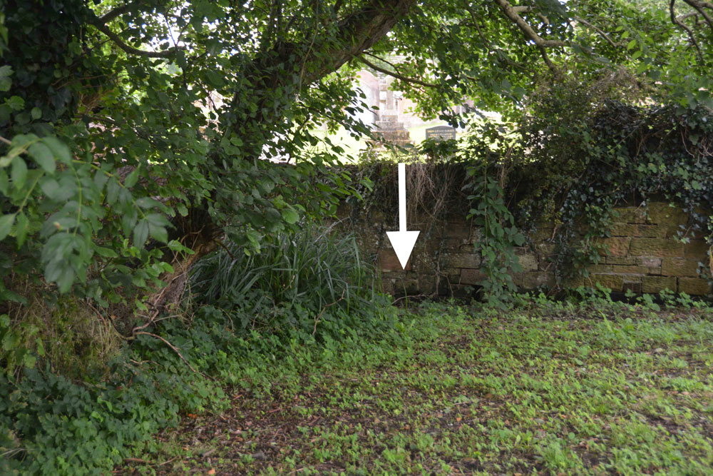
Hall Well (Irthington) submitted by Anne T on 24th Aug 2017. At the southern end of this small grassy area is a boggy area. Just underneath the wooden fence into the neighbouring garden a stream appears from under the bank. This stream has a good flow of water.
(View photo, vote or add a comment)
Log Text: Hall Well, Irthington: From Walton we made our way over to Irthington – not a planned visit, but because I saw the holy well and 2 mottes in close proximity in this village.
This small village (too large to be called a hamlet, but too small to be a good sized village) is obviously old. It’s not that far from Carlisle Airport and stands on the line of Stanegate and is also close to the line of Hadrian’s Wall.
Being armed with the OS map and a GPS, we went in search of the holy well first (passing by the first motte as we’d look for somewhere to park on the way back). According to the OS map the well lies not far outside the south-eastern wall of the church yard. Walking through the churchyard, this area is covered in brambles, nettles and shrubs, but we found some steps leading through the wall and onto the grassy area beyond. At the grid reference above there are some reeds and shrubs sitting in a boggy area. Peering over the fence into the garden of the house sitting immediately to the south, a stream suddenly appears out of the ground and rushes through the garden and is piped under the road, presumably to the modern water pumping station opposite. Nothing exists of any well housing (that we could see) and I’ve emailed the vicar through the ‘A Church Near You’ website.
Just down the road is one of the mottes. Note: the grid reference given by Pastscape indicates the site of the well is around the steps from the churchyard.
Irthington Mill
Trip No.40 Entry No.4 Date Added: 25th Aug 2017
Site Type: Misc. Earthwork
Country: England (Cumbria)
Visited: Yes on 20th Aug 2017. My rating: Condition 2 Ambience 3 Access 5

Irthington Mill submitted by Anne T on 25th Aug 2017. The 'motte' from near the driveway to Irthington Mill house. Fancy having part of your garden growing on such an old feature, especially if it is a motte!
(View photo, vote or add a comment)
Log Text: Irthington Mill 'motte or not?': Having spotted two mottes and a holy well just off the road we were travelling on to Carlisle, I asked to take a detour to find these. Whilst this is marked as a motte on the OS map, and certainly looked like one, I got home to find there is some debate about whether this is a motte or a natural feature (it is not recorded on Historic England’s listings).
Situated between a farm with some very old buildings and Irthington Mill house, with part of the Mill’s garden growing up its western slope, and not far from Irthington Bridge, it seemed to me that this motte was in a much more strategic defensible position near the modern day river crossing. Perhaps the course of the river moved over the years and the site of the motte was changed? This is me not wanting to belive its just a natural feature!
Bride's Well (Stapleton)
Trip No.40 Entry No.5 Date Added: 25th Aug 2017
Site Type: Holy Well or Sacred Spring
Country: England (Cumbria)
Visited: Yes on 20th Aug 2017. My rating: Condition -1 Access 4

Bride's Well (Stapleton) submitted by Anne T on 25th Aug 2017. This was the fallen tree which lies over the position given for Bride's Well at St Mary's Church in Stapleton, so it may possibly be destroyed. The church warden I contacted thinks the well is in a field behind the vicarage and is going to check and get back to me.
(View photo, vote or add a comment)
Log Text: Bride's Well, Stapleton: Now underneath a fallen tree? Having had to run away from this site to collect our cats from the vets after a very brief search for the well last Thursday, we went back armed with the GPS and OS map and found we’d been looking in the wrong direction.
I’d seen a set of stile leading down to the meadow from the eastern side of the church yard so we found these. They led down to the meadow and the burn running north-south through the field, although they were completely overgrown by nettles. Whilst there were only two small steps on the church yard side, there were around 8 going down into the field below.
We walked round and round and the only feature we could see at the exact grid reference given by Pastscape was this fallen tree. Has the well been destroyed? We had a good look round all along the stream in this field.
I sent an email to the Rector when I got home, and received the reply below. She thinks the well might be in the field behind the rectory, which is above the church, and will check and send an update.
Rockcliffe (Cumbria)
Trip No.38 Entry No.3 Date Added: 18th Aug 2017
Site Type: Ancient Cross
Country: England (Cumbria)
Visited: Yes on 17th Aug 2017. My rating: Condition 3 Ambience 4 Access 5

Rockcliffe (Cumbria) submitted by Anne T on 18th Aug 2017. First view of the Rockcliffe Cross from the iron gates by the mounting block. It sits to the right of the path leading to the south porch.
(View photo, vote or add a comment)
Log Text: The Rockcliffe Wheel-headed Cross, Cumbria: From the centre of Carlisle, we followed the signs heading north on the A7, out to the large Asda by the M6. Just before junction 44, a road north west into the industrial estate, clearly signposted to Rockcliffe.
This road leads straight into the village, with the church being on the south western corner of the village where the minor road turns right. There is room to park by the main iron gates to the church, next to the mounting block, in a small triangular piece of road.
Immediately inside the gates, the cross is straight in front of you, just to the right of the path leading to the south porch. Nearby is a modern grave marker in a smaller, but similar shape.
The church sits on a promontory, and as you walk down to the south porch a bend of the River Eden comes into view. On the north side of the church the land drops sharply down to Rockcliffe Beck with some graves on the terrace below. Even I was intrigued enough to walk the narrow path along the northern side of the church because I wanted to see the layout of the churchyard.
Sadly the church was locked, as I’d loved to have seen inside.
St Ninian's Well (Brisco)
Trip No.39 Entry No.2 Date Added: 31st Jul 2019
Site Type: Holy Well or Sacred Spring
Country: England (Cumbria)
Visited: Yes on 17th Aug 2017. My rating: Condition 3 Ambience 3 Access 4

St Ninian's Well (Brisco) submitted by Anne T on 18th Aug 2017. First view of St Ninian's Well as we turned the corner of the dog-leg in the footpath.
(View photo, vote or add a comment)
Log Text: St Ninian's Well, Brisco, Cumbria: From Carlatton Demesne Standing Stone, heading back onto the A69, we took the M6 to junction 42, then the third exit towards Durdar. Brisco (Briscoe according to Pastscape) is the first turn to the right. The village is a line of houses on both sides of the road. We parked where the road widened slightly at Brisco Hall farm and walked back southwards to the footpath, which runs to the north of Well View cottage (they have a sign on the side of the house saying their drive is Elvis Presley Boulevard!), and followed the grassy lane down towards the railway line. Where the path does a right hand turn, there is a small set of stone steps. The footpath then turns north east towards the railway line, going through a gate into a field. The well is in this small enclosed area, tucked away at its south eastern end, mostly hidden by shrubs and brambles.
There is an arched well head that looks Victorian, and Pastscape and Historic England says was erected in the 1830s to 1840s. A step goes down to the well basin, in which, under the water, is a circular structure with a circular hole in its middle. In the corner of the fence facing the well is a small wooden bench, covered by brambles when we visited, but we used sticks to move these away and sit and admire this spot.
From the well, a gate leads through a fence-line down into a field of pasture below (the ground drops by 3-4 feet and there are steps down to the new ground level). This ground is wet and boggy and in line with the well head and pool is a cattle truck. A steady trickle of water comes through the bottom of the trough into a pool which has large boulders pushed around it in a partial circle, now partly destroyed. It looks like this might have been the original well pool. At the bottom of the field, the main west coast railway line runs and we watched several intercity trains and a steam train go by before returning to go into Carlisle for a late lunch then onto our next stop – a wheel-headed cross north west of Carlisle in Rockcliffe.
Carlatton Demesne
Trip No.39 Entry No.1 Date Added: 18th Aug 2017
Site Type: Standing Stone (Menhir)
Country: England (Cumbria)
Visited: Yes on 17th Aug 2017. My rating: Condition 3 Ambience 4 Access 4
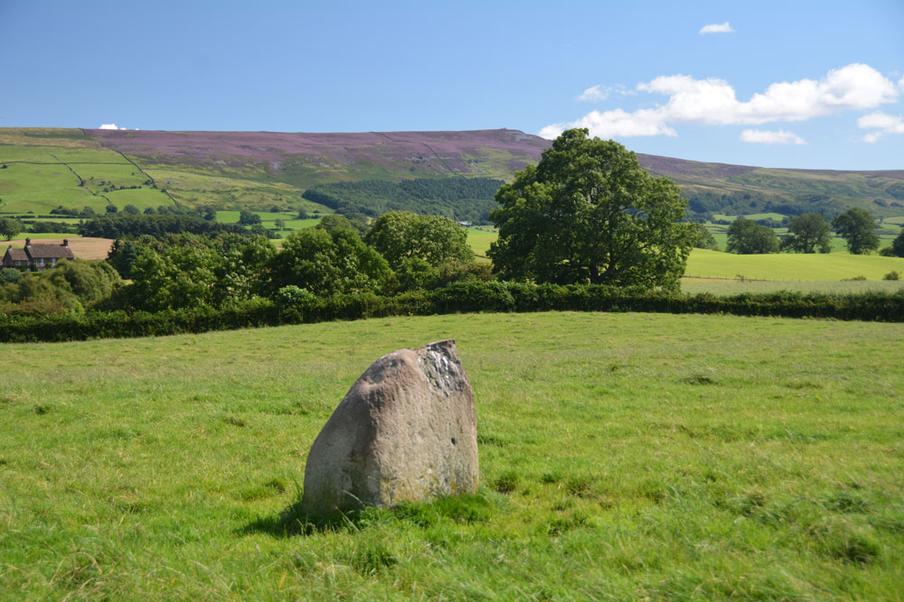
Carlatton Demesne submitted by Anne T on 18th Aug 2017. Standing on the edge of the slight mound on which the stone sits, looking south east towards Castle Carrock Fell.
(View photo, vote or add a comment)
Log Text: Carlatton Demesne Standing Stone: Following the A69 to Carlisle, the only way we could turn left off the A69 to get to Carlatton was to drive north into Brampton and back out again, under the A69. We then followed the B6413 through Castle Carrock, turning off westwards along the minor road past Moor House and Black Dub. The entrance to Carlatton Demesne Farm is around 650 metres further south of the track to Black Dub farm and there is a small hard-cored area just to the south of Carlatton Demesne Farm track, alongside the road.
At first, we walked back towards the small wood to the north-north-east to where we’d seen a gate. The gate was only held up by four pieces of wire and was very rickety, so we abandoned attempts to climb over and walked back up the farm track to where the footpath ran. I heard the farmer start his machinery up in the yard so walked along to have a word with him. It was actually a young farm worker who told me it was OK to walk through the field to look at the standing stone. He told me if we carried along the road towards Penrith, we’d get some pretty spectacular views. In the end, we retraced our steps and didn’t go down that way, but will bear that in mind for future visits.
The countryside is very pretty here, although gaining entry into the field was fun with its very muddy patch by the gate, and having stepped into the pasture, there were hidden, still soft cow pats hidden under the calf length grass. Our stone is number 4 in the list below. It appeared to be sited on top of a small, but pronounced mound with superb views around 360 degrees, with Carrock Fell to the east. It would have been a splendid setting for a stone circle.
Plotting out the points on UK Grid Reference Finder, the NGRs mentioned below form a loose alignment rather than a circle.
Green Humbleton Hillfort
Trip No.37 Entry No.8 Date Added: 8th Aug 2017
Site Type: Hillfort
Country: Scotland (Scottish Borders)
Visited: Saw from a distance on 6th Aug 2017. My rating: Condition 3 Ambience 4 Access 3

Green Humbleton Hillfort submitted by NeilD on 6th Oct 2003. Green Humbleton-2
Northumberland
NT 846277
(View photo, vote or add a comment)
Log Text: Green Humbleton Hillfort: Having been virtually blown off the hillside at Green Humbleton Scooped Settlement on our way up the Pennine Way, we decided we’d visit the Stob Stones first and see if the wind died down on our way back. If the wind was bad on Stob Rig, then what would it be like on the top of this cone-shaped hill? It didn't, so reluctantly we decided to try on a warm, sunny day.
By the time we walked back down the Pennine Way/St Cuthbert’s Way, we were absolutely soaking wet, but at least in the valley below the wind had died down. Rather than the 6-8 cars in the parking area by Bowmont Water, there was only one camper van and our car. A lovely spot for some ‘wild camping’.
Shielknowe Burn Scooped Settlement
Trip No.37 Entry No.4 Date Added: 8th Aug 2017
Site Type: Ancient Village or Settlement
Country: Scotland (Scottish Borders)
Visited: Yes on 6th Aug 2017. My rating: Condition 2 Ambience 3 Access 4
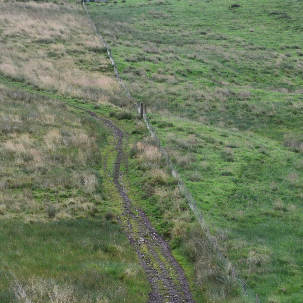
Shielknowe Burn Scooped Settlement submitted by Anne T on 8th Aug 2017. This Scooped Settlement can be seen from Shielknowe Enclosure. Its western most building platform is cut by a modern fence and St. Cuthbert's Way. Photograph taken from the almost ruined Shielknowe Enclosure to the south of Shielknowe Burn.
(View photo, vote or add a comment)
Log Text: Shielknowe Burn Scooped Settlement, Yetholm: This scooped settlement, lying on the northern side of Shielknowe Burn is much easier to see, and is visible from Shielknowe Enclosure, cut by the fence which also cuts the Enclosure. The muddy track from Shielknowe Enclosure runs downhill, crosses the burn, and leads up to join St. Cuthbert’s Way.
Two scooped out areas can be seen, although the farmer had very tightly knotted the twine securing the gate, so whilst Andrew (husband) hopped over the gate, I undid the ‘Gordion Knot’ to get into the settlement. The grass was very tussocky and wet, so walking along the banks of the western most scoop was interesting.
Much more exciting sites to come, so we didn’t spend an awful long time here.
Venchen Farm Cottages (Town Yetholm)
Trip No.37 Entry No.1 Date Added: 7th Aug 2017
Site Type: Standing Stone (Menhir)
Country: Scotland (Scottish Borders)
Visited: Yes on 6th Aug 2017. My rating: Condition 3 Ambience 3 Access 5
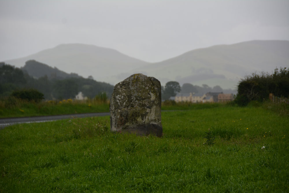
Venchen Farm Cottages (Town Yetholm) submitted by Anne T on 7th Aug 2017. The Venchen Farm Cottages stone, looking south east towards Town Yetholm, over the Bowmont Water Valley. It wasn't raining (much!) when I took this photograph - that's just 'Scotch Mist' in the background.
(View photo, vote or add a comment)
Log Text: Venchen Farm Cottages Standing Stone, Scottish Borders: Having left home to avoid days of damp, rainy weather, we went in search of sunshine and blue skies. The further we travelled up the A68, the more obvious it became that the grey skies got darker the more northerly we got. As we reached Town Yetholm, the heavy raindrops started to fall with the ferocity of hail.
Venchen Farm Cottages are easy enough to find, heading north about 1.6 km north out of the village. This stone looms large out of the grassy verge; at first I thought it was just a village sign. We pulled into a small parking spot just past the stone, nearer to the cottages, by which time it was pelting down even harder and I had the camera covered with kitchen towel and handkerchiefs to keep it dry.
The Canmore notes, which we’d printed off before setting off, said that a hedge had been removed for the stone to be exposed. On UK Grid Reference Finder, the hedge can be seen with the stone tucked away behind it. The grass verge itself didn’t seem to show any signs of disturbance, considering the hedge was only removed in February this year, although the earth around the stone was visible, together with some packing stones and the vegetation along the verge was more weeds than grass.
Difficult to get photographs with the rain, but managed to keep wiping the lens.
Virtue Well (Yetholm)
Trip No.37 Entry No.2 Date Added: 7th Aug 2017
Site Type: Holy Well or Sacred Spring
Country: Scotland (Scottish Borders)
Visited: Yes on 6th Aug 2017. My rating: Condition 2 Ambience 2 Access 4
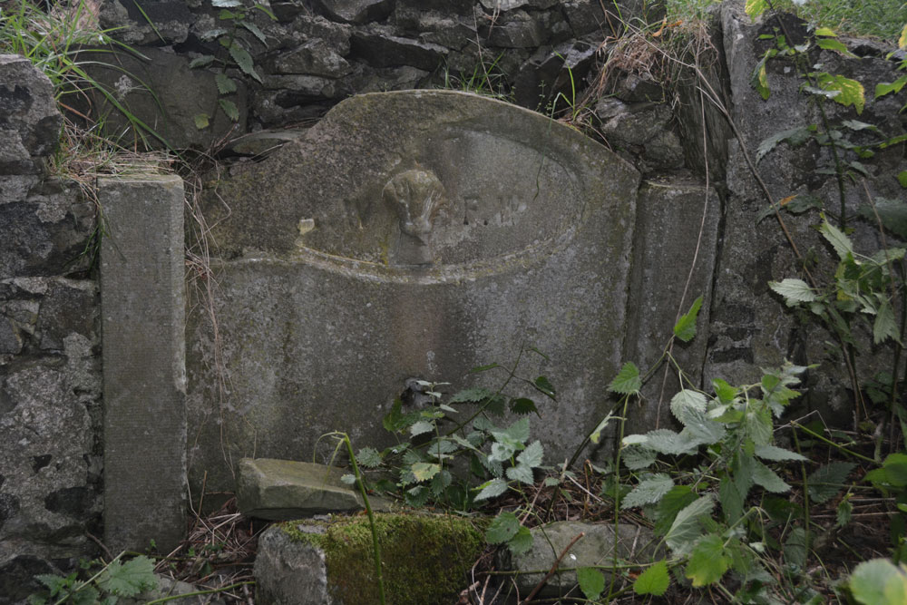
Virtue Well (Yetholm) submitted by Anne T on 7th Aug 2017. Close up of the central panel, showing the basin broken and lying at its base amongst a tumble of stones from the retaining wall.
(View photo, vote or add a comment)
Log Text: Virtue Well, Yetholm: From Venchen Farm Cottages Standing Stone, by the time we drove back down to the west side of the road bridge over Bowmont Water at NT 82132 28576, and parked at a little layby just before the road junction, the rain had eased off a little.
There were two routes up to the well, the first at NT 82128 28603 led up a wet, slippery hill towards a wood, which was rather overgrown. We opted for the footpath proper, starting at NT 82206 28645, with a proper track leading up to Braehouse Farm.
According to UK Grid Reference Finder, the path deviates through the woodland, past the well, but in real life, the track continues straight up to the farm, and we had to tramp through knee high grass through the wood.
Having found this poor little well, I couldn’t but help feel sorry for it. Such a tragedy. It reminded me of the well we’d seen in Middleham – broken up, dry and just part of an old garden wall. At least under the trees we were largely sheltered from the rain.
Stob Stones
Trip No.37 Entry No.6 Date Added: 8th Aug 2017
Site Type: Standing Stones
Country: Scotland (Scottish Borders)
Visited: Yes on 6th Aug 2017. My rating: Condition 3 Ambience 4 Access 3
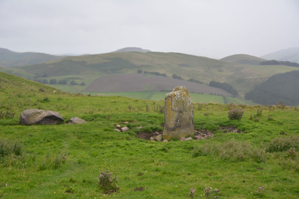
Stob Stones submitted by Anne T on 7th Aug 2017. Whilst the rain lessened for a moment, the hills at the western side of the Bowmont Water Valley came briefly into view!
(View photo, vote or add a comment)
Log Text: Stob Stones, Scottish Borders: From the Green Humbleton Scooped Settlement, by the time we started climbing up towards the Stob Stones, not only was the wind was howling and I was leaning hard into it, but the rain drops were like small pins being driven into my cheeks. I confess to getting a bit fed up and wanting to turn around at this point, but a long-held desire to see these stones kept me going. It was worth it.
Walking over the Stob Rig earthworks (I stopped to photograph these on the way down), the Stob Stones are two standing stones, one now broken and lying prone, sitting on a sort of promontory as the ground to the north and west drops steeply down. Canmore says these stones are at over 1,000 ft above sea level and are situated 230 yards west of the Border. They definitely sit on some kind of mound.
To the west lies the border between England and Scotland, and we walked a 100 metres or so further up the hill, just so we could see the stone wall which makes up the boundary. Tantalisingly, we could see cairns on the adjacent hillside, but being England, different rules for walking (and I was too wet to want to go on).
Stob Rig (Yetholm)
Trip No.37 Entry No.7 Date Added: 8th Aug 2017
Site Type: Misc. Earthwork
Country: Scotland (Scottish Borders)
Visited: Yes on 6th Aug 2017. My rating: Condition 2 Ambience 4 Access 3
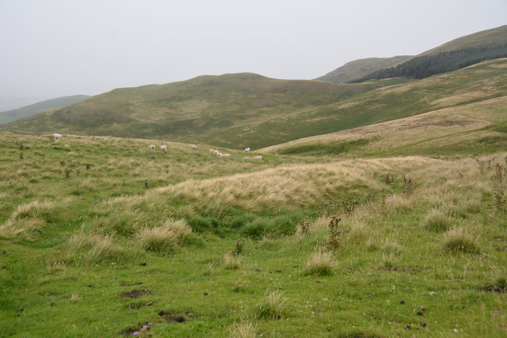
Stob Rig (Yetholm) submitted by Anne T on 7th Aug 2017. This is the eastern most of the banks with a slight ditch on its downhill side. The bank running parallel to it can be seen just on the horizon to the middle-left hand side of the photograph, delineated by the yellow grass growing on the bank.
(View photo, vote or add a comment)
Log Text: Stob Rig Earthworks: On the way up to the Stob Stones from the Pennine Way, there were two really obvious earthworks running in parallel towards the stones and we walked between them to reach the stones. I was keen to try and get out of the wind and the rain (almost impossible in this high, exposed spot) so didn't stop to photograph them.
On the way back down to re-join the Pennine Way, the earthworks were slightly less obvious. With the howling wind and the rain lashed sharply against my cheeks, I was tempted to put the camera safely in the rucksack, but having walked all this way up the hill, I wanted to document them.
In the end, I only managed to photograph the eastern most of the banks; the photos of the western-most had too many raindrops on the camera lens to be of any use.
Ad Gefrin
Trip No.37 Entry No.9 Date Added: 28th Aug 2017
Site Type: Ancient Palace
Country: England (Northumberland)
Visited: Yes on 6th Aug 2017. My rating: Condition 1 Ambience 4 Access 5

Ad Gefrin submitted by PaulH on 13th Mar 2003. Yeavering Bell hill fort
View of Ad Gefrin at NT926305
At the foot of Yeavering Bell is the site of probably the most impaces dating from the seventh century. The palace, Ad Gefrin, (the place of the goats) was one of the homes of King Edwin of Northumbria, whose name was given to another town - 'Edwin's Burgh', now known as Edinburgh.
It was at Ad Gefrin that St Paulinus baptised 3000 Northumbrians in 627 AD, just about twenty-five years prior to St Cuthbert's entry into Melrose Abbey.
(View photo, vote or add a comment)
Log Text: Ad Gefrin, Northumberland (near Yeavering): Trying to dry out from the walk to the Stob Stones, we decided to go back via Wooler and the A687 rather than back down the A68, passing Yeavering Bell on our way. Driving north, I was surprised to find we re-entered England from Scotland, back into Northumberland National Park. As we drove through Kirknewton, this ‘stone bus shelter’ and unusual gate posts caught my eye and we screeched to a halt.
I was amazed that we’d never heard of this site at all, and I read the interpretation board, then walked into the field to look at the other board. In front of me there was nothing but tall, yellow grass, with a faint darker green line where a narrow track ran along the edge of the field.
There was nothing on the interpretation board to tell us where about on the site we were. Seeing that the site spread across the road, I crossed and peered into the field. This, of course, now being England, I couldn’t just let myself into the field and wander around.
There being an excellent 4G signal here, I pulled up the Gefrin website and was really surprised to find this site described as the most evocative archaeological sites in Northumberland and also one of the most remarkable archaeological discoveries of the 20th century.
If I hadn’t been so wet and tired after a long day out, I’d have walked round the fields. As it was, we decided to return home, do some investigation and return to the site another day (adding to our ever growing list of ‘want to see’ sites).
Sheilknowe Burn Enclosure
Trip No.37 Entry No.3 Date Added: 8th Aug 2017
Site Type: Ancient Village or Settlement
Country: Scotland (Scottish Borders)
Visited: Yes on 6th Aug 2017. My rating: Condition 1 Ambience 3 Access 4
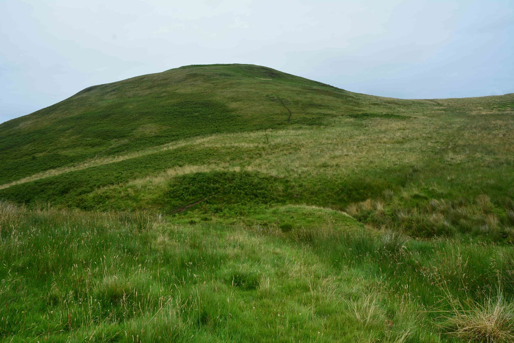
Shielknowe Burn Enclosure submitted by Anne T on 8th Aug 2017. Standing near the fence which cuts across the southern boundary of this horseshoe shaped enclosure, looking towards Shielknowe Burn, part of the land in a small loop of the burn seems to have slipped down. The burn forms the northern most boundary of the settlement. Green Humbleton hillfort is almost in the centre/top of the photograph.
(View photo, vote or add a comment)
Log Text: Shielknowe Enclosure, Yetholm: From the Virtue Well we made our way to Kirk Yetholm, finding the small side road which is actually the Pennine Way, but which can be driven down to a small parking area beside where the Halter Burn and Shielknowe Burn meet. Here a footbridge leads over the Burn, the Pennine Way and St. Cuthbert’s Way meeting at this point.
We tried St. Cuthbert’s Way first of all, running parallel to Shielknowe Burn on it’s eastern side, but after a few hundred yards, came across a rocky outcrop where I would have needed to turn into a mountain goat (OK for my husband, but not for me) so we retreated and walked almost back to the footbridge. There is another mown track which runs on the western side of the stream – boggier but much easier to follow and the sides of the small gorge not quite so precipitous.
It's a good job we had the GPS with us, together with a printed sheet of the Canmore details, otherwise we’d have walked across this settlement without knowing it was there. By finding it’s centre (the south western edge is almost at the corner of the fenced off field containing Shielknowe Burn Scooped Enclosure.
By carefully walking over the area, we could see very slight banks and changes in vegetation, but my goodness, had we not been out with NOWTAG, we would have missed this.
Green Humbleton Settlement
Trip No.37 Entry No.5 Date Added: 8th Aug 2017
Site Type: Ancient Village or Settlement
Country: Scotland (Scottish Borders)
Visited: Yes on 6th Aug 2017. My rating: Condition 2 Ambience 4 Access 3
Green Humbleton Settlement submitted by Anne T on 8th Aug 2017. The western half of the scoop. Green Humbleton Hill can be seen just starting to rise up on the middle/upper right hand side of the image. The hillfort certainly dominated the western view.
(View photo, vote or add a comment)
Log Text: Green Humbleton Scooped Settlement, Yetholm: Now this was a settlement I could get excited about, and what views! If the first two enclosures on the way up here were somewhat dull, this more than made up for it! To the north and east the land dropped steeply away to Humbleton Syke and to the west Green Humbleton hillfort dominated the view.
By the time we got here, the wind was absolutely howling and we had to retreat to the walls of the scoop to get some respite.
There is a very clear oval scoop with a D-shaped enclosure to its north. To the north east of the D-shape there were some stones that Andrew called me over to look at. I did want to be persuaded they formed a cist. What a place to be buried. It could be a well, but there is no mention of either in the Canmore records.
If it hadn’t been so windy, I would have loved to have spent more time here. With the dark clouds looming, we decided to go up to the Stob Stones rather than risk being blown off the top of Green Humbleton hillfort. If the weather was favourable, we’d try on our way back.
Green Castle Ringwork
Trip No.36 Entry No.1 Date Added: 31st Jul 2017
Site Type: Misc. Earthwork
Country: England (Northumberland)
Visited: Yes on 30th Jul 2017. My rating: Condition 2 Ambience 3 Access 5

Green Castle Ringwork submitted by Anne T on 31st Jul 2017. Climbing (sorry, walking!) up the track from the small parking area near the cattle grid to Wooler Common, we got a good view of the mound from the top. It looks distinctly saucer shape, hence the Cup and Saucer name.
(View photo, vote or add a comment)
Log Text: Green Castle Ringwork, Wooler: After having stopped off at the ‘usual café’ in Wooler for refreshments, we headed off towards Wooler Common, from the High Street taking Ramsey Lane which becomes Common Road.
At NT 98195 27735 there is a small parking area, where a footpath leads south westerly up and over the Common. From here, the Ringwork looks like part of a giant rubbish tip, with its south and western sides protruding up over the hedgerow like a giant green triangle. Given that to it’s south east there is a huge area for storing skips, it looks at first sight as if the mound is used for a rubbish dump, but it’s not.
There is no access into the field the ringwork sits in (gates are padlocked, and the only gate that opened (immediately opposite the parking area) led down to a wooded area and small ravine.
We actually got a good view of what looks like a ‘Refresher’ sweet by walking up the path towards The Kettles. From here, even the stones in the south western side, where the mound has been eroded, are visible, together with a short section of ditch.
I didn’t spot the telephone wire snaking across the photograph until I loaded it onto my computer.
