Contributory members are able to log private notes and comments about each site
Sites Anne T has logged on trip number: 94 (View all trips)
View this log as a table or view the most recent logs from everyone
Kirkhaugh Cross
Trip No.94 Entry No.3 Date Added: 1st Sep 2018
Site Type: Ancient Cross
Country: England (Northumberland)
Visited: Yes on 31st Aug 2018. My rating: Condition 3 Ambience 4 Access 4

Kirkhaugh Cross submitted by Anne T on 1st Sep 2018. Our first view of this Saxo-Norman cross, approaching along the path through the churchyard from the west, turning towards the south door of the church. The cross is located some 10m from the church door. This side of the cross (Face A in the Corpus record) is said to have two lightly incised crosses, one top and one bottom, although we could not find these.
(View photo, vote or add a comment)
Log Text: Kirkhaugh Cross, Church of the Holy Paraclete: Having seen one of the wells on the opposite side of the road, we turned our attention to finding the cross. This church is virtually hidden behind the trees, with only a portion of its eastern end and a narrow, tall spire peeping out of the trees at its western end.
I thought at first this cross was a modern grave marker, as it sits up a modern plinth, but closer examination showed this cross has been used as a gate post at least once in its past.
Behind the cross is a grave stone which has grown into the side of a large horse chestnut tree and been cracked. With the River South Tyne babbling away just behind the eastern churchyard wall, this is a lovely spot.
Kirkhaugh Wells
Trip No.94 Entry No.2 Date Added: 1st Sep 2018
Site Type: Holy Well or Sacred Spring
Country: England (Northumberland)
Visited: Yes on 31st Aug 2018. My rating: Condition 3 Ambience 4 Access 5

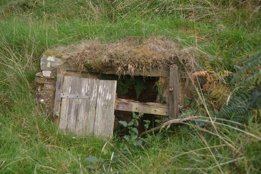
Kirkhaugh Wells submitted by Anne T on 1st Sep 2018. At first glance, this structure looks like a 'doorway into the hillside' but closer inspection through the rotten wooden doors shows a curving, stone well chamber.
(View photo, vote or add a comment)
Log Text: Kirkhaugh Wells, near Church of the Holy Paraclete: After having spent about 2 hours wandering around Epiacum fort, we left to go for a cup of tea in Alston, where we called to the Top Café for tea and crumpets. As suggested by Alastair Robertson, we called into Local Links/Library at the Town Hall to see if they had a copy of his book/report on the fort, but the librarian knew nothing about it (“he wrote a book, but it’s out of print”), and had no further information. We left, walking across to the church of St. Augustine of Canterbury in Alston; I hadn’t taken my camera, and apart from some 13th century gravestones and architectural fragments, the only thing of note was the Derwentwater Clock, set up in the north west corner of the church. Surprisingly, there were instructions to see it working – remove one of the blocks from under the weights on its right hand side, then set the pendulum in motion. Brilliant to see something so old ticking away. To see the hand made cog wheels turning was amazing.
Driving firstly along the A686 following the River South Tyne northwards out of Alston, on the eastern side of the river, we took the minor, very single track road with no passing places, to Kirkhaugh. Just past the farm building is a small triangle of grass; we parked just past this on the grass verge, and made to walk down what looked like the driveway to the Old Rectory, but is actually the only access to the Holy Paraclete Church – Paraclete being another term for ‘Holy Ghost’. The OS map showed ‘Wells’ marked around this point.
As I looked out of the car window, I saw what at first looked like a ‘doorway into the hillside’ but is a disintegrating well house. I walked up the slope to take photographs, and could see inside the well house which is still full of clear water.
The second well, which I saw walking back up the road from the church, is up a hill opposite the farmhouse; now a ruinous brick and concrete structure, it drains into a trough at the bottom of the slope by the road. Presumably it is then piped into the River South Tyne.
Saffron Well (Barhaugh)
Trip No.94 Entry No.4 Date Added: 2nd Sep 2018
Site Type: Holy Well or Sacred Spring
Country: England (Northumberland)
Visited: Yes on 31st Aug 2018. My rating: Condition 2 Ambience 3 Access 4

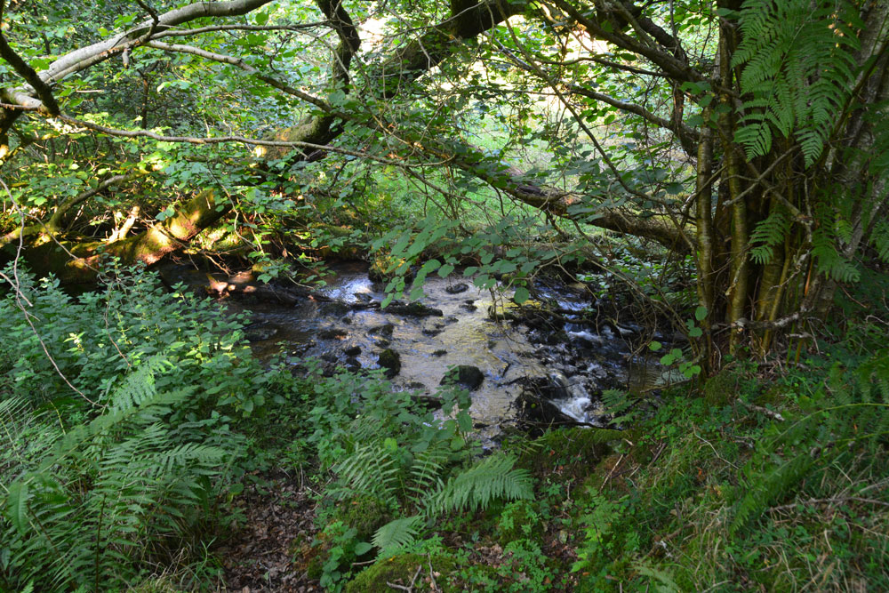
Saffron Well (Barhaugh) submitted by Anne T on 2nd Sep 2018. This well pool is more than a little neglected and overgrown. The waters issue seemingly from nowhere, directly out of the hillside, then running into Barhaugh Burn. Photo taken by Andrew T
(View photo, vote or add a comment)
Log Text: Saffron Well (Barhaugh): After the peace and quiet of Kirkaugh Wells and the Church of the Holy Paraclete, we drove past this even more remote spot. Andrew was brave enough to hop over the stile and descend the very steep, overgrown path down to the river. He reported that a ‘stream just started from nowhere, forming a pool, then running into Barheugh Burn’. Due to the sheer amount of foliage and trees, it was difficult to photograph. Only a very short entry on Pastscape. I've done several internet searches and not been able to find out anything else.
Whitley Castle (Alston)
Trip No.94 Entry No.1 Date Added: 2nd Sep 2018
Site Type: Hillfort
Country: England (Northumberland)
Visited: Yes on 31st Aug 2018. My rating: Condition 3 Ambience 4 Access 4

Whitley Castle (Alston) submitted by Anne T on 2nd Sep 2018. Standing just to the east of the stone wall dividing the site, at its western end, looking over this remarkable series of ramparts. The fort has 'numbered flower pots' scattered around, which link up with a map, so it's easy to find your way around and interpret this site.
(View photo, vote or add a comment)
Log Text: Whitley Castle / Epiacum Fort/Iron Age Hillfort: We were initially going to Kirkheugh to see the old cross there, but were on the wrong side of the river, and passed the fort, named Whitley Castle on the OS map, so stopped in the car park. There was a van and two other cars in the car park, and we could see people on the hillside above, so thought it must have attracted lots of other visitors.
There are new signs around, along with leaflets under the information board. Now called by its Roman name of Epiacum, the way to the fort is well signposted, and by following the numbered tour (spot the numbered flowerpots) we understood where we were.
As we climbed the hill, one of the men at the top had a stepladder – Postman from the Portal? I asked myself. Another had a ranging pole. By the time we reached the top they were sitting having a cup of coffee before continuing. I asked them if they were doing a survey, and realised I was talking to Stewart Ainsworth of Time Team fame. He, Alastair Robertson and colleague (whose name I didn’t ask but whose face was very familiar) were doing a survey in preparation for taking down a ‘modern’ stone wall to open up the fort site. At the moment, to get access to the Vicus and other parts of the site, you have to walk a long way round through different gates. What a multiple ditch system!
For my future reference: Stewart mentioned a 138 page report produced by English Heritage, which I’ve downloaded to both the picture folder and my Megalithic Portal/Useful Information About Sites folder.
Also see https://www.epiacumheritage.org/
