Contributory members are able to log private notes and comments about each site
Sites Anne T has logged on trip number: 104 (View all trips)
View this log as a table or view the most recent logs from everyone
Jemmy's Well (Cambo)
Trip No.104 Entry No.3 Date Added: 25th Oct 2018
Site Type: Holy Well or Sacred Spring
Country: England (Northumberland)
Visited: Yes on 24th Oct 2018. My rating: Condition 3 Ambience 3 Access 4

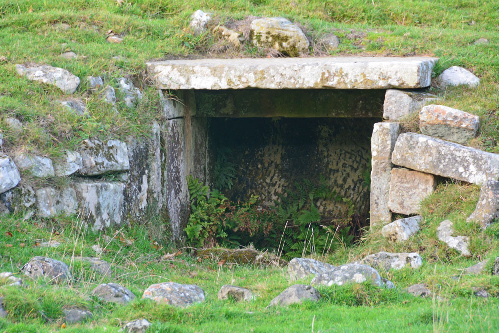
Jemmy's Well (Cambo) submitted by Anne T on 25th Oct 2018. Using the camera lens almost on maximum zoom to try and see the inside of the well house. I will try and get permission to walk across the field and take a closer look in the relatively near future. The half circle of stones outside the well house indicates there used to be a pool at some time in the fairly recent past.
(View photo, vote or add a comment)
Log Text: Jemmy's Well, Cambo: One of three wells in the village of Cambo, but only this one is marked on the modern OS map, and the only mention we found of it was in Binnall and Dodd's 1941 'Holy Wells of Northumberland and Durham' document. The well lies on private land, just south of Cambo School, and the well field had at least half a dozen horses in it; to avoid upsetting the horses, we let ourselves into the field to the south, using the gate near the wood alongside the B6342, then walking north to where a 'bridge/track' has been created over the small stream to the south of the well field.
I found the 1863 OS maps when I got home, and the other two wells are marked, to the south west of Jemmy's Well; where these are the two mentioned by Binnall and Dodds (Hepple's Well and Stinky), I'm not sure, but the are close enough to supply the village.
I'd like to get permission to get into the well field and take a closer look. Whilst the well looked dry at the time of our visit, the semi-circle of stones outside the well house indicated there had been a well pool there at some time in the fairly recent past.
Lady Well (Bavington)
Trip No.104 Entry No.4 Date Added: 25th Oct 2018
Site Type: Holy Well or Sacred Spring
Country: England (Northumberland)
Visited: Yes on 24th Oct 2018. My rating: Condition 2 Ambience 4 Access 4

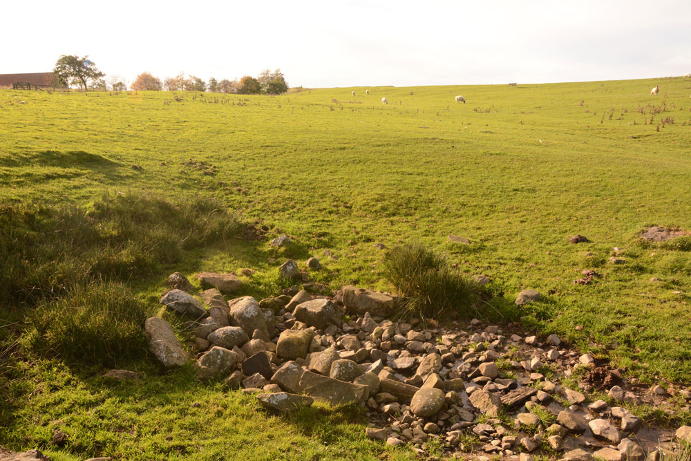
Lady Well (Bavington) submitted by Anne T on 25th Oct 2018. The well from the north east. From the relatively large number of dressed stones at and around the well head, it looks as if there was a well house or structure here at some time. This is the source of the Kirkharle Burn.
(View photo, vote or add a comment)
Log Text: Lady Well, Bavington: This is a lovely spot, and well worth the short walk to and from the road to see this well (or what remains of it).
We parked at NY 99286 80701, just off the B6342, and followed the track northwards towards Ladywell Farm. There was a big boulder with lots of cut marks at it at the top of the track, and I worked out it said ‘Ladywell’ on it, although the marks looked more like runes than letters!
There are no records on Pastscape or HE, although the well is marked on the OS map. Ladywell Farmhouse is recorded as Historic England List ID 1044928, although this is largely 17th and 18th century.
The footpath goes right past the right hand side of the farm, then deviates off slightly north east, through a kissing ate. Walking straight ahead, there was a dip in the ground with some marsh grass around it to our right, so we made a beeline for this. There was a heap of pebbles in the dip, with a stream of water emerging from the ground between the stones – no great rush of water, just a gentle flow. Judging by the dressed stones at the southern end of the pile of pebbles, it looks as through there might have been a well house or pool surround at some point.
Oh the wind, which must have been a steady 30mph plus on our walk there and back! My ears and cheeks burned when I got back into the car after this walk, although it was nice to actually walk to a site and back, even though it was a relatively short distance.
St Andrew's Church (Bothal)
Trip No.104 Entry No.1 Date Added: 25th Oct 2018
Site Type: Ancient Cross
Country: England (Northumberland)
Visited: Yes on 24th Oct 2018. My rating: Condition 3 Ambience 4 Access 5

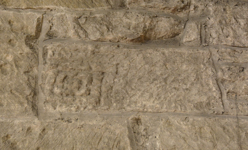
St Andrew's Church (Bothal) submitted by Anne T on 25th Oct 2018. This is AS Corpus Bothal 07, part of a cross shaft built into the north wall of the chancel (towards its western end). Dated to the late tenth to early eleventh century, we initially had difficulty in picking this stone out, but once we'd seen it, could not 'unsee' it. The Corpus describes the pattern as 'formed by concentric punch outlined rectangles with a coiled centre.'
(View photo, vote or add a comment)
Log Text: Anglo Saxon Cross Shaft Fragment, St Andrew's Church, Bothal: I had arranged to collect the key to the church from the Reverend John Parks, who lives in Pegswood. The church in Bothal is very easy to find, and in a very scenic place, with a nearby footpath running down to the River Wansbeck.
The narrow west end of the church faces the road, and is largely hidden by tall, dense trees. My first thought was “how am I going to photograph the outside?” This did prove to be a little bit of a challenge, but in the end, walking into the much larger and spacious churchyard, I managed a couple of shots.
There are a number of entries on HE for St. Andrew’s Church, and whilst we spent about an hour and a half here, I felt I wanted to stay longer to explore all the elements in the guide book and the architectural assessments, but Andrew was getting bored and a cup of tea in Morpeth then holy wells beckoned.
There are several really interesting ‘cut outs’ of the wooden panel in the chancel that give viewing access to a remnant of medieval plasterwork, an old tombstone reused as a lintel, and an old wooden door. The cut outs were quite small, which made photographing these features a little tricky. At one point, I thought I was going to drop the camera down the small window on the south wall of the chancel, in an attempt to photograph the bottom of the lintel above! Photographing the remnant of medieval plasterwork was interesting, as Andrew had to shine the torch (kindly provided by the church in a neat holder next to the grille) whilst I manually focussed the camera. Not a great photo by any means, but I had fun trying!
On the eastern and northern external walls of the church there are musket ball holes.
St Cuthbert's Well (Mitford)
Trip No.104 Entry No.2 Date Added: 24th Oct 2018
Site Type: Holy Well or Sacred Spring
Country: England (Northumberland)
Visited: Yes on 24th Oct 2018. My rating: Condition 3 Ambience 3 Access 5

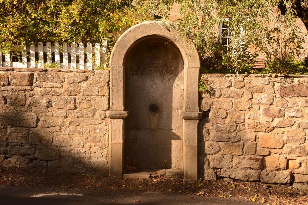
St Cuthbert's Well (Mitford) submitted by Anne T on 24th Oct 2018. The well/fountain housing is built into the wall of the Old Post Office, at the side of the B6343.
(View photo, vote or add a comment)
Log Text: Site of St Cuthbert's Holy Well, Mitford: After having visited Bothal church and spent well over an hour looking around, we stopped off at The Old Chantry tea rooms in Morpeth for a bowl of soup and a cup of tea, then headed off to the small, but very pretty village of Mitford, just over 2.5 km west of Morpeth.
OK, so there is no longer a well here, and the Victorian-era drinking fountain structure that was built in the place where the well was supposed to have been is now dry, it was easy to find. The road is reasonably busy, so I risked getting run over to get a few close up shots. The carving of the impaled dragon's head (I didn't realise what it was until I saw the photos on the larger screen of the computer and read the Historic England description) was pretty gruesome.
We did wander down to the river and walked along a little way. Someone has built what appears to be a very pretty, but very modern, thatched cottage by the side of the footpath along the river.
Note for next time: the pub does special offers on food for pensioners!
