Contributory members are able to log private notes and comments about each site
Sites Anne T has logged on trip number: 131 (View all trips)
View this log as a table or view the most recent logs from everyone
Chagford Druid's Well
Trip No.131 Entry No.1 Date Added: 3rd Jun 2019
Site Type: Holy Well or Sacred Spring
Country: England (Devon)
Visited: Yes on 11th May 2019. My rating: Condition 3 Ambience 4 Access 5
Chagford Druid's Well submitted by cazzyjane on 9th May 2012. Druid's Well, Chagford. Looks like a tiny quoit but has lots of clear water running from it.
(View photo, vote or add a comment)
Log Text: Druid's Well, near Chagford: Our first stop of the day, with bright sunshine and deep shadows. As we approached the well, this was our first of several encounters with a very friendly Granny looking after granddaughter on skittish, but beautiful, horse. Granny was following both round in a car, making sure horse and rider were OK on these narrow lanes. We passed them several times, and met Gran again later in the day outside her farm, when we were driving towards the burial chamber, when we needed to get past a large tractor and trailer going down the narrow, and very potholed lanes.
This well is just outside a property called Wellpark. At first it looks like a grass covered mound, but looking closer there is a well chamber, a large capstone and an exit water channel. On looking at the Pastscape entry, they mention another well recorded on the OS maps, only 9m away, built of an iron post and slate structure, now infilled. We didn't see this, although there was plenty of farm machinery and piles of stones and grit at the sides of the road.
Hunter's Tor Fort
Trip No.131 Entry No.6 Date Added: 4th Jun 2019
Site Type: Hillfort
Country: England (Devon)
Visited: Yes on 12th May 2019. My rating: Condition 2 Ambience 4 Access 3

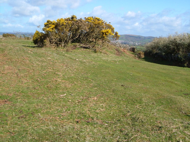
Hunter's Tor Fort submitted by Creative Commons on 8th Feb 2012. The gorse bushes are on the degraded bank of the hilltop fort above the northern end of Lustleigh Cleave. Beyond the wall and gate can be seen Moretonhampstead.
Copyright Derek Harper and licensed for reuse under the Creative Commons Licence
(View photo, vote or add a comment)
Log Text: Hunter's Tor Iron Age Hillfort: A very pleasant walk from the end of the lane at SX 75702 83203, up a public bridlepath, the path cutting through a farmyard higher up the hill. Continuing up the hill, we eventually reached a long stone wall with a gate leading into the fort. At its northern end (SX 76043 82474) there was a large rocky outcrop with a balanced rock.
Most of the ramparts and banks, whilst ruined, are still visible, and there are glorious views over to the west from most of the hillfort.
To its south eastern side, there appear to be rows of stones/banks which might be the remains of old field systems.
Some of the outer banks are cut by a long dry stone wall on its eastern side; looking over these continue in the field behind. We let ourselves out of the gate into the fort at its north eastern side then let ourselves into the gate into the field to take a quick photo of the continuing banks.
There were lots of walkers and mountain bikers walking through the fort. Only one other couple we saw actually appeared to be looking for the features within the fort; others either sat and picnicked by the outcrop, or simply rode through.
Meacombe Cist
Trip No.131 Entry No.5 Date Added: 4th Jun 2019
Site Type: Burial Chamber or Dolmen
Country: England (Devon)
Visited: Yes on 12th May 2019. My rating: Condition 3 Ambience 4 Access 4
Meacombe Cist submitted by hamish on 14th Nov 2004. A fine little chambered tomb, found by chance.
(View photo, vote or add a comment)
Log Text: Meacombe Cist: We'd arrived in Devon in a torrential downpour, although this had cleared in the evening. The sheer amount of rain might have contributed to ripping away the road surface at the edge of the road leading to this burial chamber.
The roads to this burial chamber were atrocious, with very deep potholes and a centre ‘bank’ of earth and grass, which at times tickled the underneath of the car - we debated about turning back at one point. The road was so narrow and parking so difficult that we parked in the next field gate to the north of the cist. Andrew stayed with the car whilst I let myself into the adjacent field, which also looked as if it had archaeology (but are just rocky outcrops, nothing on Pastscape or HE), but didn’t stop as Andrew needed to move the car. Took some quick photos, then ran back.
I was worried about trespassing, but there was a well worn tractor track into an open gate into the next field, then a track from the gate to the burial chamber.
We had hoped to see the enclosure and hut circle to the south west, but no way of stopping, nor could we see any sensible places to stop.
Note: I only found this a 'short walk on the footpath' from the adjacent field.
Shorter Cross
Trip No.131 Entry No.2 Date Added: 3rd Jun 2019
Site Type: Ancient Cross
Country: England (Devon)
Visited: Yes on 12th May 2019. My rating: Condition 3 Ambience 3 Access 5

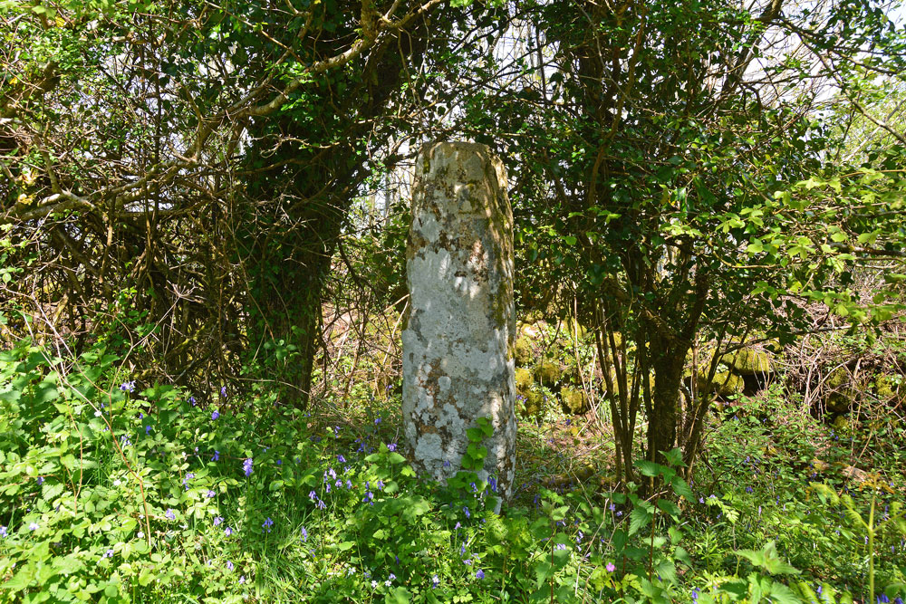
Shorter Cross submitted by Anne T on 3rd Jun 2019. At first glance the standing stone is just another tree-trunk along the side of the minor road - until you look closer. It is remarkably like a standing stone, but very well preserved.
(View photo, vote or add a comment)
Log Text: Shorter Cross, near Druid's Well, Chagford: Not far from Druid’s Well (about 350m as the crow flies), this is a lovely cross, more like a standing stone, with no cross arms.
The cross is well hidden behind/between trees, but we were able to walk into the dip/ditch between the road and the dry stone wall. The crosses on both faces of the stone were clearly visible; on the side nearer the road there was a small, square, equal armed cross inside a larger cross in relief.
Week Down Cross
Trip No.131 Entry No.3 Date Added: 3rd Jun 2019
Site Type: Ancient Cross
Country: England (Devon)
Visited: Yes on 12th May 2019. My rating: Condition 3 Ambience 4 Access 4

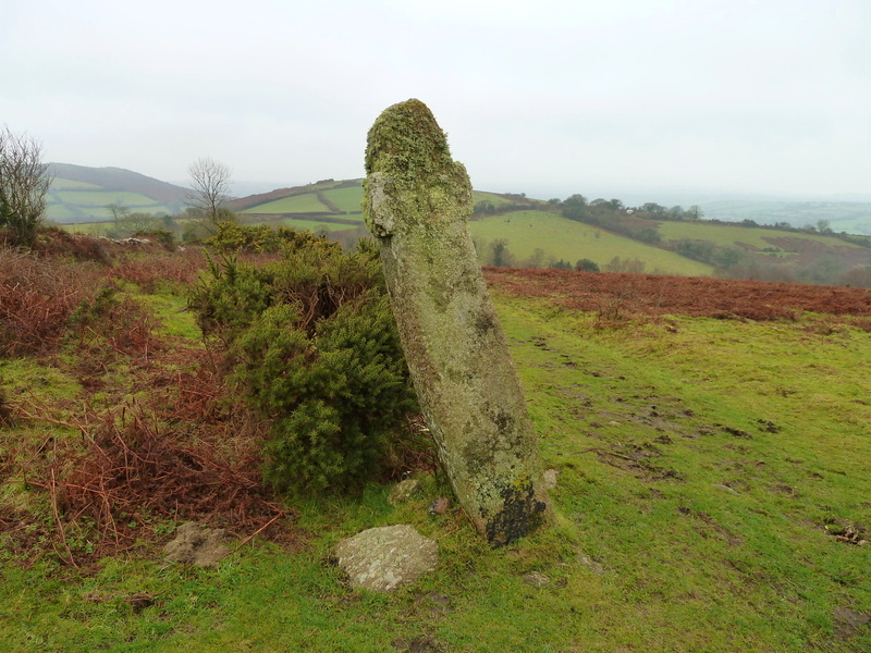
Week Down Cross submitted by Bladup on 3rd Mar 2016. Week Down cross at SX71168653.
(View photo, vote or add a comment)
Log Text: Week Down Cross: We left the car by the Shorter Cross and continued the 250m up the road by foot; in actual fact there is a large grassy area on the moor here, and another car with a disabled passenger pulled onto the grass whilst we were there. Whilst the cross itself is only 9m from the road, there is a bank immediately at the edge of the road to step up to the common.
This cross is in a really lovely location, sitting by the edge of the common/moor, with great views over the moors to Chagford.
I had to be careful about photographing this cross, as to the west there was a camp site with some really brightly coloured tents which took over the photo, so I aligned myself to these were either hidden behind the cross, or behind the gorse bushes!
F H Starkey in his 1983 book “Dartmoor Crosses & Some Ancient Tracks” describes this cross as :”it consists of a tall rectangular shaft of granite, six feet nine inches tall. It has a rounded head and two very short arms have been cut out of the shaft. A Maltese Cross is cut on each face; one of these is in line with the shaft of the cross which is inclined at an angle to the ground, the other is at right-angles to the ground. This rather strange fact led Ormerod (who described the cross in 1874, having know it from at least 1859) to conjecture the crosses had been carved after the cross was erected and had settled down to its out of perpendicular stance Ormerod also tells us that the cross was in danger of falling in 1867 and that it was moved back from the road a little but that its original angle of inclination was repeated when it was re-erected. He says too, that there was a project afoot to move the cross and use it to make a foot-bridge; happily it was spared this fate”.
