Contributory members are able to log private notes and comments about each site
Sites Anne T has logged on trip number: 53 (View all trips)
View this log as a table or view the most recent logs from everyone
Coney Hill (Comrie)
Trip No.53 Entry No.1 Date Added: 10th Oct 2017
Site Type: Misc. Earthwork
Country: Scotland (Perth and Kinross)
Visited: Yes on 28th Sep 2017. My rating: Condition 2 Ambience 2 Access 4

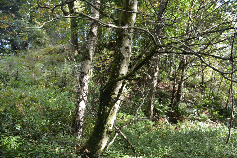
Coney Hill (Comrie) submitted by Anne T on 10th Oct 2017. From the path along the east side of the River Lednock, looking up, the mound of the motte is barely visible through the trees.
(View photo, vote or add a comment)
Log Text: Coney Hill, Comrie: Again, to escape the dreary weather in Armadale, we found ourselves heading a fair way north today, up to Comrie, where there promised to be quite a few sites – standing stones and stone circles in a relatively small area.
Comrie is a really lovely little village, and we stopped for tea and a sandwich at one of the café’s. The menu didn’t appeal to me, so I got a hot Scotch Pie from the next door bakers – one of the best I’d ever tasted.
We didn’t plan on going to this motte, but having walked up the high street and over the bridges, carried on onto the walks which were signposted. There was a large car park next to the golf course.. It had rained here heavily and the paths up to the motte were muddy and slipperty, with a steep drop down to the River Lednock below. The motte was so heavily surrounded by trees that it was difficult to make out by eye, and even more difficult to photograph.
Craigneich Farm
Trip No.53 Entry No.7 Date Added: 11th Oct 2017
Site Type: Standing Stone (Menhir)
Country: Scotland (Perth and Kinross)
Visited: Yes on 11th Oct 2017. My rating: Condition 3 Ambience 3 Access 5

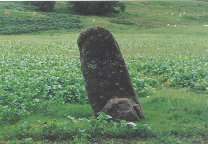
Craigneich Farm submitted by hamish on 26th Jul 2005. This stone is easily seen from the roadside.
(View photo, vote or add a comment)
Log Text: Craigneich Farm Standing Stone, south of Comrie: From the Lawers Standing Stone, we drove south back through Comrie on the B827, to the junction of a minor road at Coilcambus with a phone box on the corner. Turning right (travelling south), we followed the road along to where Machany Water ran close to the road, just before Craigneich Farm. There was a track leading up to the moors on the opposite side of the road, and on this single track road, we needed to pull the car into this entrance for a few minutes while we looked for the stone. We had to climb over wall into field, but the stone wall was low and the wiring broken, so it was easy to access the field.
A somewhat neglected stone, separated from those on the moorland to the south by the road and hedges, it was oddly shaped. By now it was dusk, and I had to use the flash on the camera to get a decent photograph. Worth stopping to have a look.
There were other standing stones which we could see up on the moor to the south, but it was too late in the day to walk up to these and back as it would have been dark by the time we reached the first one.
Dalginross
Trip No.53 Entry No.3 Date Added: 10th Oct 2017
Site Type: Stone Circle
Country: Scotland (Perth and Kinross)
Visited: Yes on 28th Sep 2017. My rating: Condition 3 Ambience 4 Access 5

Dalginross submitted by postman on 13th Aug 2013. Peace and quiet, some cars may have gone past, but I didn't notice them.
(View photo, vote or add a comment)
Log Text: Dalginross Four Poster, Near Comrie: From the Roman Stone and its companions, we headed north towards Comrie. Where the B827 takes a sharp left hand turn through Dalginross and Comrie, take the South Crieff Road towards Easter Dalginross and Muirhead Cemetery, where there is ample parking.
From the layby by the cemetery, we walked back to the road junction with South Crieff Road and the trck to Dalginross Muir Farm; the stone circle is nestled under the trees, with moss covered tree stumps around it.
Quite an enigmatic little stone circle, but I confess that it seemed a little like it had been recently put in here, perhaps as a landscaping feature. I had a bit of a hard time convincing myself it was Bronze Age, but Canmore confirms it is indeed.
Lawers
Trip No.53 Entry No.6 Date Added: 11th Oct 2017
Site Type: Standing Stone (Menhir)
Country: Scotland (Perth and Kinross)
Visited: Saw from a distance on 28th Sep 2017. My rating: Condition 3 Ambience 3 Access 4

Lawers submitted by BigSweetie on 19th May 2004. Perthshire stones photo by Andy Sweet
(View photo, vote or add a comment)
Log Text: Lawers Standing Stone, East of Comrie: From St Fillan’s Chapel, we headed back towards Comrie, this time continuing east along the A85 until we reached the gatehouse at the northern side of the road, just before Comrie Croft Caravan Park.
The landowner had padlocked all the gates, but being within site of the stone, we ended up scrambling over the low stone wall by the small stream running parallel with the eastern side of the field, and separated from the field by a tree lined footpath/track.
On getting level with the stone, I tried (very hard) to photograph it, but was constantly head-butted by a very friendly ginger horse! He was to friendly to contemplate climbing the wooden fence into the field without a bag of apples or pony nuts, so I had to content myself with having my sleeves chewed whilst I tried to photograph the standing stone.
We walked back along the footpath and along the northern side of the field, but the stone was too far away to get a good image of, even with maximum zoom on the camera lens. Having reached the western side of the field, the gates were padlocked. Andrew could squeeze between the wooden rails of the fence, but I was a bit too plump, so clambered unceremoniously over the somewhat higher stone wall at this end of the field.
St Fillan's Chapel (Comrie)
Trip No.53 Entry No.5 Date Added: 11th Oct 2017
Site Type: Ancient Cross
Country: Scotland (Perth and Kinross)
Visited: Yes on 28th Sep 2017. My rating: Condition 2 Ambience 4 Access 4

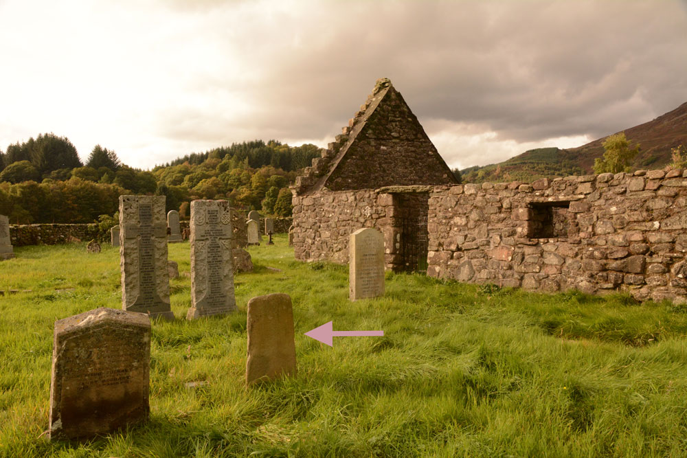
St Fillan's Chapel (Comrie) submitted by Anne T on 11th Oct 2017. The cross slab, lying just to the south of the south wall of the chapel. In 2014 it was found recumbent but, comparing photographs with the Canmore page (24872), it has now been stood upright.
(View photo, vote or add a comment)
Log Text: St. Fillan's Chapel, west of Comrie: From Wester Tullybannocher Stone Circle, we carried on west along the A85, turning left into a road leading down to St. Fillan’s Golf Club and Western Dundurn Farm. Just before the farm buildings, the track splits. The eastern most track is gated off, and the road was very narrow, so we squeezed the car in by the gate intending to run back and move it if it got in the way. There was a herd of cattle in the field, although the churchyard has a dry stone wall around it.
Walking along the track, watched curiously by the golfers on the adjacent course, until I was level with the church ruins (very like Logie Old Kirk), then squidged my way through the wet turf to the far side, where the iron gate to the churchyard was locked, but there was a stone stile into the graveyard.
This is a very, very pretty spot. It is a very old site. Typically, there was no phone signal here so I couldn’t call up the Canmore record. I went round photographing lots of different things. I managed to miss the recumbent cross slab (most of them were overgrown with grass), although there were a couple of other interesting stones and features. Lovely site but disappointing not to have found the cross slab, even though I must have looked at it.
Also known as St Fillian's; Dundurn Burial-ground; Stewarts Of Ardvoirlich Burial-place.
Tullybannocher
Trip No.53 Entry No.4 Date Added: 11th Oct 2017
Site Type: Stone Circle
Country: Scotland (Perth and Kinross)
Visited: Yes on 28th Sep 2017. My rating: Condition 3 Ambience 4 Access 4

Tullybannocher submitted by hamish on 23rd Jul 2005. It's easy to miss this one, I stopped in a field gateway to look at the map glanced round and there it was in that field. It was a four poster by repute but only two remain. Nick thinks there are cupmarks on the stones but not so sure myself.
(View photo, vote or add a comment)
Log Text: Wester Tullybannocher Stone Circle, Comrie: From the Dalginross/Dunmoid Four Poster Stone Circle, we made our way north through Comrie, heading west on the A85, over Dalginross Bridge then turning left. The road goes through a zig-zag then a bend, passing a caravan park on the right hand side at Twenty Shilling Wood. Just after the road turns a right hand bend there is a farm track to your right hand side, with room for a car to pull in before the gate (on opening the gate there is a small area of hard-standing for a couple of cars). We parked just in front of the gate and walked along the farm track to the stones, which were peeping out of knee high grass in the un cultivated part of the field to our left hand side.
We couldn’t spot any cup marks on the western stone, despite walking round the stones several times. Sited on flat pastureland with low hills rising around, and lying just north of the River Earn, this is a lovely spot, although a little spoiled by the heavy traffic on the A85 just to the south of the stones.
