Contributory members are able to log private notes and comments about each site
Sites Anne T has logged on trip number: 1 (View all trips)
View this log as a table or view the most recent logs from everyone
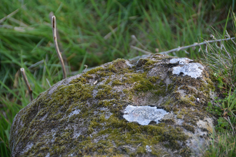
Midstead 3
Trip No.1 Entry No.4 Date Added: 14th May 2016
Site Type: Rock Art
Country: England (Northumberland)
Visited: Yes on 8th May 2016. My rating: Condition 3 Ambience 4 Access 3

Midstead 3 submitted by Anne T on 11th May 2016. Midstead 3 lies approx. 3 metres west of Midstead 2 but is largely buried by turf so difficult to spot unless you are right on top of it. The ERA record (ERA-600) says there are 13 cups of different sizes on this stone. Most must have been buried under the turf.
(View photo, vote or add a comment)
Log Text: Midstead 3, Rock Art near Edlingham, Northumberland: Also see visit report for Jenny's Lantern Hill Fort and Settlement, Midstead 1 and Midstead 2. This stone is about 3 metres to the west of Midstead 2, although the cups are more difficult to spot. Beautiful views over the Aln Valley and to the listening/radar station at Cloudy Crags across the valley.
Midstead 2
Trip No.1 Entry No.3 Date Added: 14th May 2016
Site Type: Rock Art
Country: England (Northumberland)
Visited: Yes on 8th May 2016. My rating: Condition 3 Ambience 4 Access 3

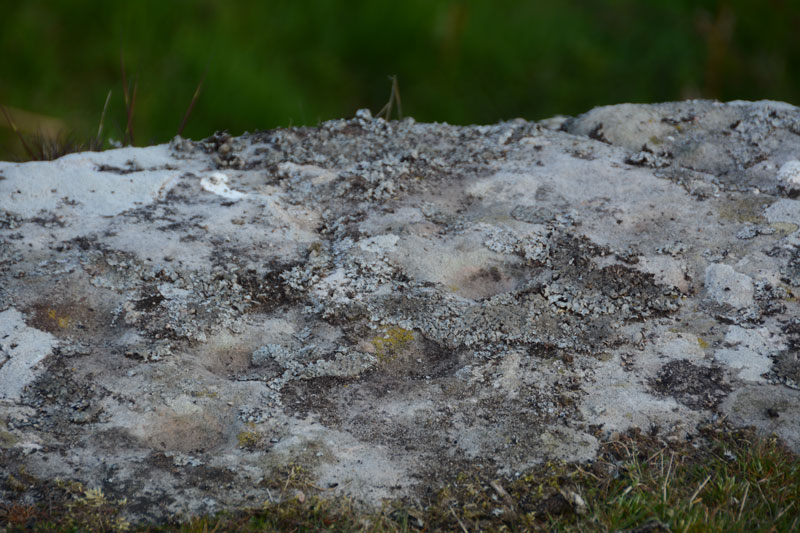
Midstead 2 submitted by Anne T on 11th May 2016. Close up of some of the cup marks on this rock. The ERA-599 record for this stone says there are 35 possible cup marks, but we didn't spot that many. I would have liked to have tried a rubbing of this rock to see how many there were.
(View photo, vote or add a comment)
Log Text: Midstead 2, Rock Art near Edlingham, Northumberland: Having visited Jenny's Lantern Hill Fort and Settlement, we headed back east with the GPS to find the rock art stones we'd failed to find on our visit back in 2014 (our first trip out to find rock art, without a GPS). This rock sits right on the edge of the crag with great views over the Aln Valley below. The cup marks are a little difficult to spot until your eyes adjust to the lumps and bumps on the rock. The cups are inter-disbursed with natural hollows. There are some cup marks on the vertical face of the rock although it was difficult to get too close because of the 'killer' brambles. Note to self: take garden shears/machete on next visit!
Midstead 1
Trip No.1 Entry No.5 Date Added: 14th May 2016
Site Type: Rock Art
Country: England (Northumberland)
Visited: Yes on 8th May 2016. My rating: Condition 3 Ambience 4 Access 4
Midstead 1 submitted by SolarMegalith on 11th May 2013. Cup-and-ring mark with a gutter in the NE corner of Midstead 1 panel (photo taken on May 2013).
(View photo, vote or add a comment)
Log Text: After visiting Jenny's Lantern Hill fort and settlement and Midstead 2 and 3 to the west, we walked eastwards along the top of the crag to find the rock art we'd failed to find on our first trip in 2014. Thank goodness for GPS otherwise we never would have found these. The ground in this rocky field had obviously been very wet at some time in the recent past and been home to some large cattle. Not having rained for some time the ground had hardened, making walking over the tussocks difficult. This stone is the most impressive on the hillside with numerous motifs. Well worth seeing. I'm glad we returned. About 3 metres to the south west of this stone we found another with a cup mark at grid reference NU 12424 15448. Having been sent the HER records for Jenny's Lantern, the Historic England map for this entry (1008839) shows a homestead just above the site of this stone - not marked on the OS maps and not clear on the ground (although not being aware it was there we didn't hunt around).
Lemmington Wood
Trip No.1 Entry No.1 Date Added: 14th May 2016
Site Type: Rock Art
Country: England (Northumberland)
Visited: Yes on 8th May 2016. My rating: Condition 3 Ambience 4 Access 4
Lemmington Wood submitted by SolarMegalith on 28th Feb 2013. Cup-and-ring marks in artificial lighting (photo taken on February 2013).
(View photo, vote or add a comment)
Log Text: Lemmington Wood Rock Art/Rune Stone, Northumberland: We'd been told about this rock by a member of the Tynedale North of the Wall Archaeology Group who is renowned for visiting many and various rock art sites in Northumberland.
From the A1 North, we turned up on the A697 and drove the almost 16 miles to Edlingham (not to be confused with the nearby village of Eglingham to the north). We arrived in this quiet spot to the sound of a cuckoo in the fields nearby – a sound rarely heard up here these days. Just north of Corby’s Crags, an impressive settlement and rock shelter to the right hand side of the road, there is a turn to the left leading to Lemmington Hall. Just as this side road turns off, there is a small parking area and a memorial bench which looks out over to Edlingham Burn and the Aln Valley.
Whilst these are marked as private woods, there are three trails leading from the entrance gate to the wood. Various signposts say “No Bikes” but doesn’t discourage walkers. The ERA record (see below) says there is open access to this stone. These woods have obviously been decimated by the storms over Christmas and New Year and there are fallen trunks and branches everywhere. The trunks blocking the pathways have largely been chain-sawed to allow access.
A GPS is really needed to find this rock, which sits on the top of a slope, which, if the trees hadn’t been there, would have given great views over the valley beyond. The rock is really hidden in a dip and surrounded by conifers so is difficult to spot.
Someone had been there recently and scrapped off the moss in order to see the rock art and runes more clearly. This was good for us, but not so great for the preservation of these features.
According to the HER records (HER 4471), the runes were only found in 1991 by Ian and Irene Hewitt as they prepared the rock for wax rubbing and photography. The runes and rock art are on the edge and upper face of a 6ft outcrop. Described on the England’s Rock Art site ERA 579.
There is clear evidence on the stone of attempts to quarry it, so what else might have been on a more complete rock?
Jenny's Lantern
Trip No.1 Entry No.2 Date Added: 14th May 2016
Site Type: Hillfort
Country: England (Northumberland)
Visited: Yes on 8th May 2016. My rating: Condition 3 Ambience 4 Access 3
Jenny's Lantern submitted by SolarMegalith on 5th May 2013. Rampart and ditch in the southern part of Jenny's Lantern Iron Age hillfort (photo taken on May 2013).
(View photo, vote or add a comment)
Log Text: From the Lemmington Wood rock art/rune stone, we carried along on the minor roads headings towards the tiny village of Bolton, having gone through the somewhat exciting ford over the River Aln between Abberwick and Bolton Mills, then carried on past Jenny's Lantern Hill to Jenny's Lantern. Despite not having rained for a while, this ford was a lot deeper than it looked!
This site was one of the first we visited at the time we (I) signed up for the Portal. Having tried to find the Midstead Rock Art stones without a GPS, but with many stony outcrops on the hill, we failed, meaning to go back but haven’t until now.
Just east of this hillfort is also a Romano-British settlement, which also includes the remains of an Iron Age defended settlement, with a number of visible hut circles, recorded as HER 4379. The whole site is complex and even with the HER and Historic England records, it is quite difficult to unpick on the ground.
The outer banks and ditches are well preserved. From the road, it’s not easy to see the oval fort at all. There is room for a small car in the gateway to a field to the south, at grid reference NU 12433 15229, overlooking the observatory/listening station at Cloudy Crags to the south east. From the gate in the field opposite, follow the track up the hill then head west almost the field, boundary. On the way to the hillfort you will cross the low banks and ditches of a separate Romano-British settlement. Crossing a stone bank, you will see the eastern outer banks and ditches of the hillfort rising up against the skyline.
The actual Jenny’ Lantern, recorded as HER record 20729 (probably an 18th century’ eye-catcher’ folly) stands north east at the brow of the hill.
The hill fort and settlement sit below the brow of the hill, but there are superb views across to the Aln Valley to the south and west. I'd feel safe living here if I lived in days gone by.
